The 3rd and last day of my short Isle of Wight tour started rainy and grey. You can see by the pictures in the time-lapse video below.
I knew the day was going to be like that and was expecting it to be much worse than it actually was. About 1.5 hours into the ride the skies cleared and the rain stopped. Still very cloudy, but at least dry.
I had a non-water proof camera mount on the handlebar and the water proof camera casing was mounted on my helmet. Unfortunately I didn´t notice that somehow the camera was bending to the left as you can see at the beginning of the time-lapse video. Once the rain stopped I moved the camera to the handlebar mount as the open casing also enabled the camera to be charged while recording the trip.
The ride started with a climb straight away. Ventnor is very “hilly” and when I planned my route using Google Maps it suggested a more inland route than I had taken in a previous visit to the island (Sustrans Regional Route 67). So, I didn´t get to see much of the village, but I did ride through it during a nice sunny day in August 2014 and the video below I took during that ride.
The coastal route is nicer, but it has climbs of up to 12% incline in places that were challenging enough for an “empty” bike, let alone a fully loaded one.
Lots of flowers along the way (click to enlarge)
The route traced by Google Maps took me along Wroxall, Newchurch and when I got to a place known as the Garlic Farm, which is exactly what the title indicates, a garlic farm, but you can
visit the farm and know everything about garlic (something like a Garlic Museum), I realised Google was taking me to a direct route to Ryde, which is not what I wanted. My intention was to bypass the
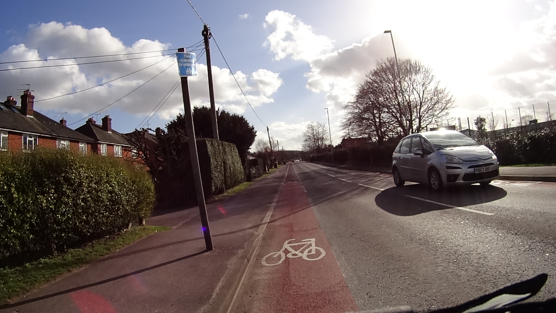
Cycle way, National Cycling Route 23 (click to enlarge)
coastal hills, as I had already done them last year, but to go back to the coast shortly after, so I turned back to Newchurch and entered what is known as the Red Squirrel Trail or Sustrans National Cycle Route 23. I really recommend a ride on this route. It´s a pedestrian shared cycle path, but horses are not allowed and it runs alongside the river Yar. Very peaceful and you´ll find a number of people riding it as well.
I met a nice couple and had a quick chat with them. The man was a native of the Isle, but they both lived in California and were there to visit his family.
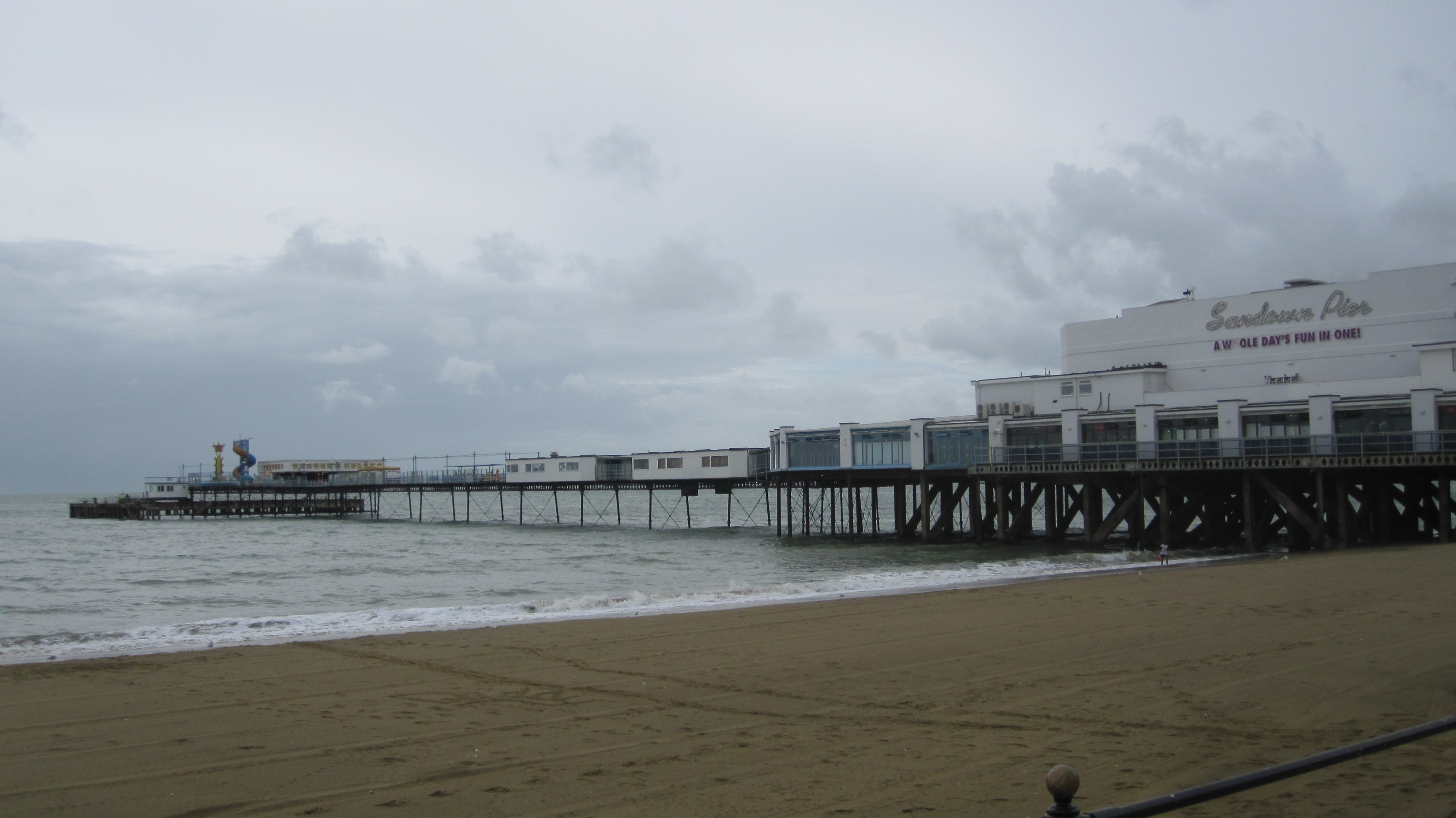
View of Sandown Pier (click to enlarge)
The destination was Sandown and I got a bit lost after the cycle path ended, so you see in the GPS data a bit a back and forth until I found my way.
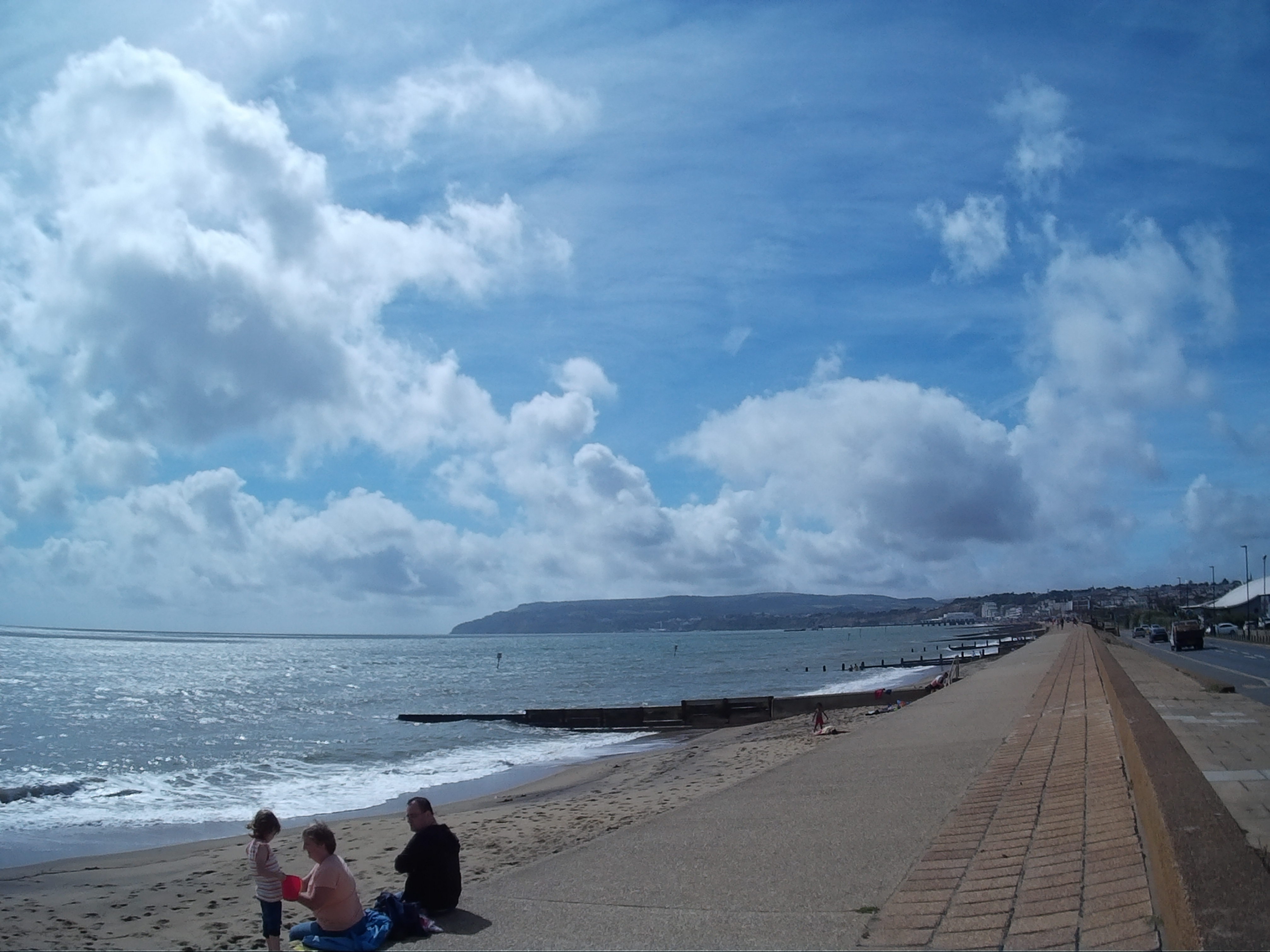
Sandown Beach on a nice day in August 2014 (click to enlarge)
Sandown is a nice part of the Island with great sandy beaches and a fun pier with all sorts of entertainments (game machines, bump cars, etc). If you have children they will love it (it reminds Brighton pier).
Closer look at Sandown Pier (Aug 2014) (click to enlarge)
Riding along the promenade at Sandown beach is fun, but on sunny days you’ll find it full of people and need to be careful.
After Sandown I made my way to
Bembridge Lifeboat Station at the end of the bridge. (click to enlarge)
Bembridge where the new Lifeboat Station is located. At a cost of £7
million it’s a state of the art facility where they can launch sea worthy rescue boats over a ramp in a matter of minutes.
Priory Bay Hotel and Gold Course (click to enlarge)
After Bembridge I crossed Saint Helens and the grounds of the Priory Bay Hotel and Golf camp (very nice to stay if you have the money) in the direction to the village of Seaview. In Seaview you have a clear view of Portsmouth on the other side of the channel.
10x Zoom view of Portsmouth from Seaview. (click to enlarge)
From Seaview it´s a short trip to Ryde alongside the beach. Having done the trip in this direction (counter clockwise), if you ever go to the Isle of Wight to ride I would recommend that you go the other direction (clockwise). From Ryde to Seaview, Bembridge, Sandown, Shanklin, Ventnor and so on. I think it would be a more scenic route.
This post now concludes the series of posts about my 3 days trip to and around the Isle of Wight. If you have any questions, don´t hesitate to ask. Thank you for your visit!
I´ve added a few more pictures and videos below.
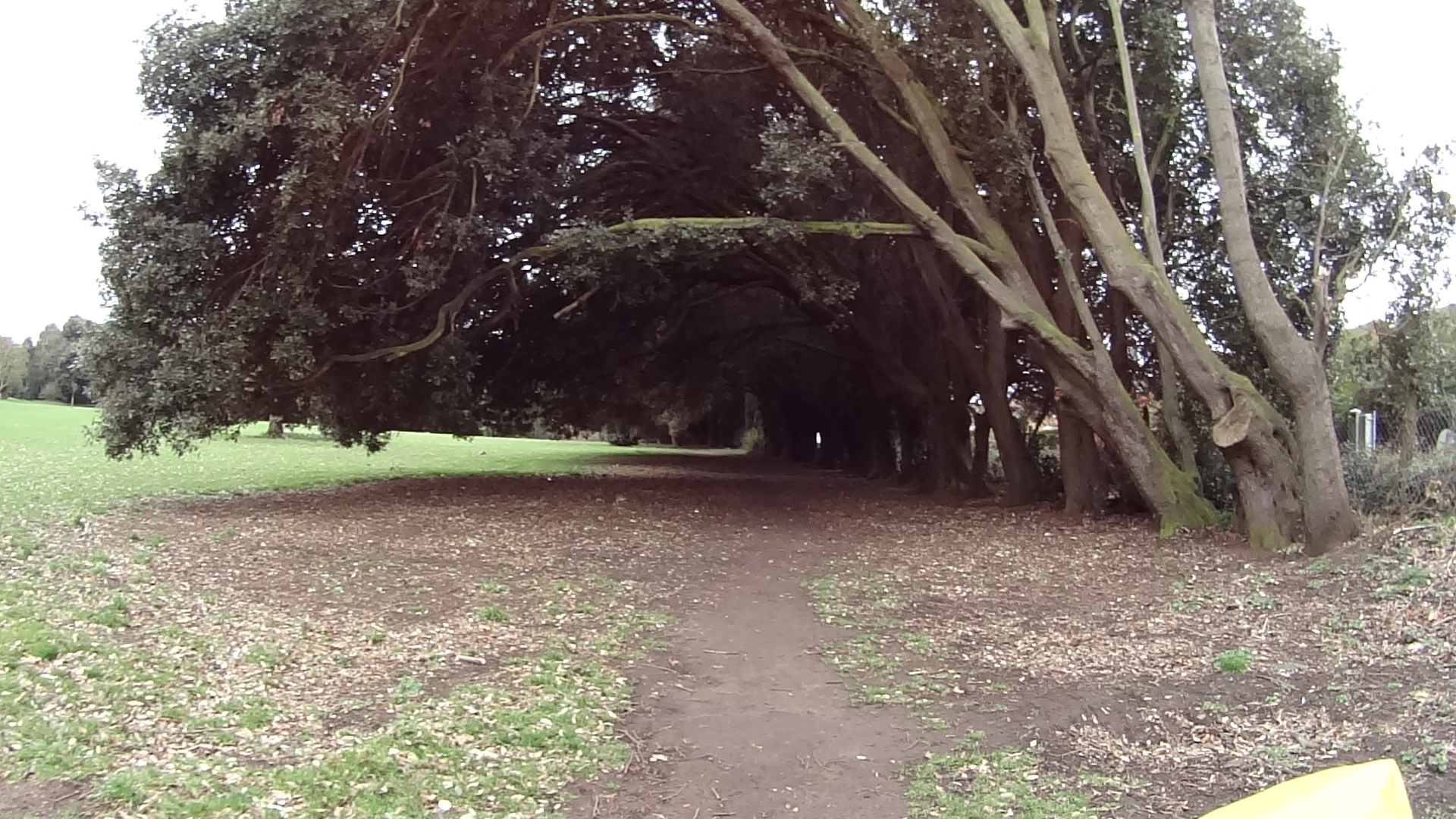
Appley Beach with the Appley Tower on the background (between Seaview and Ryde) (click to enlarge)An interesting picture in every village I rode through. (click to enlarge)Along the Cycling Route 23 (click to enlarge)Bicycle tunnel (click to enlarge)
The video below was taken as I was about the leave the Isle of Wight after a 3 days cycling tour to and around the Island.
Bicycles and Hovercrafts… two very interesting vehicles.
Bicycles are carried free of charge in the Hovercraft and you don’t need to disassemble anything, just remove your bags/luggage from the bike (and item lose item, although I left the water bootles in places and they arrived fine). On the way back my bike´s rear view mirror got broken though. Keep in mind the cargo can only carry 2 bikes at once, but during summer the service runs every 15 minutes.
The next video was shot inside the Hovercraft while “flying” over water to Portsmouth.
This was my 2nd time in the Isle of Wight. I have been here last year with my family and we drove to the Needles Park on the last day of our visit. We could not, however, drive to the Batteries where the big guns used to be. My younger son was already tired and I knew if we walked all the way up hill (it is a considerable walk) I would likely have to carry him.
So in this visit to the Isle of Wight one of my goals was to go the the Needles Battery and see the sea from there.
Full English Breakfast at Kasbah
I left Ryde at about 11 in the morning after a nice full English Breakfast in the B&B I was staying, which I do recommend, by the way. It´s called Kasbah and they are very friendly and welcoming. Rather than a traditional B&B it is more like a small hotel, with nice on-suite rooms, TV and comfortable beds.
During Breakfast I phoned a number of B&Bs and Guesthouses in the Village of Freshwater, which is near the Needles Park. No rooms available. Camping was also not an option as it was too cold, windy and rainy at night and even if I wanted to, most camping grounds where not yet open for the season.
River Medina Marina in Newport.
So I decided to call B&Bs in my next destination, which was Ventnor, a village about 20 miles or 32 Km away – Success, but at a 40% higher price. With accommodation reserved for the night I started my ride letting Google guide me all the way. The first part of the ride, is the route from Ryde to Newport, the island´s biggest town.
I was already familiar with this route because last year I did a 62 Km ride in one day (1/2 way around the Island) which included this ride from Ryde to Newport. Most of the ride is done on roads, but there are stretches of shared cycle ways. The ride follows the National Cycle Route 22.
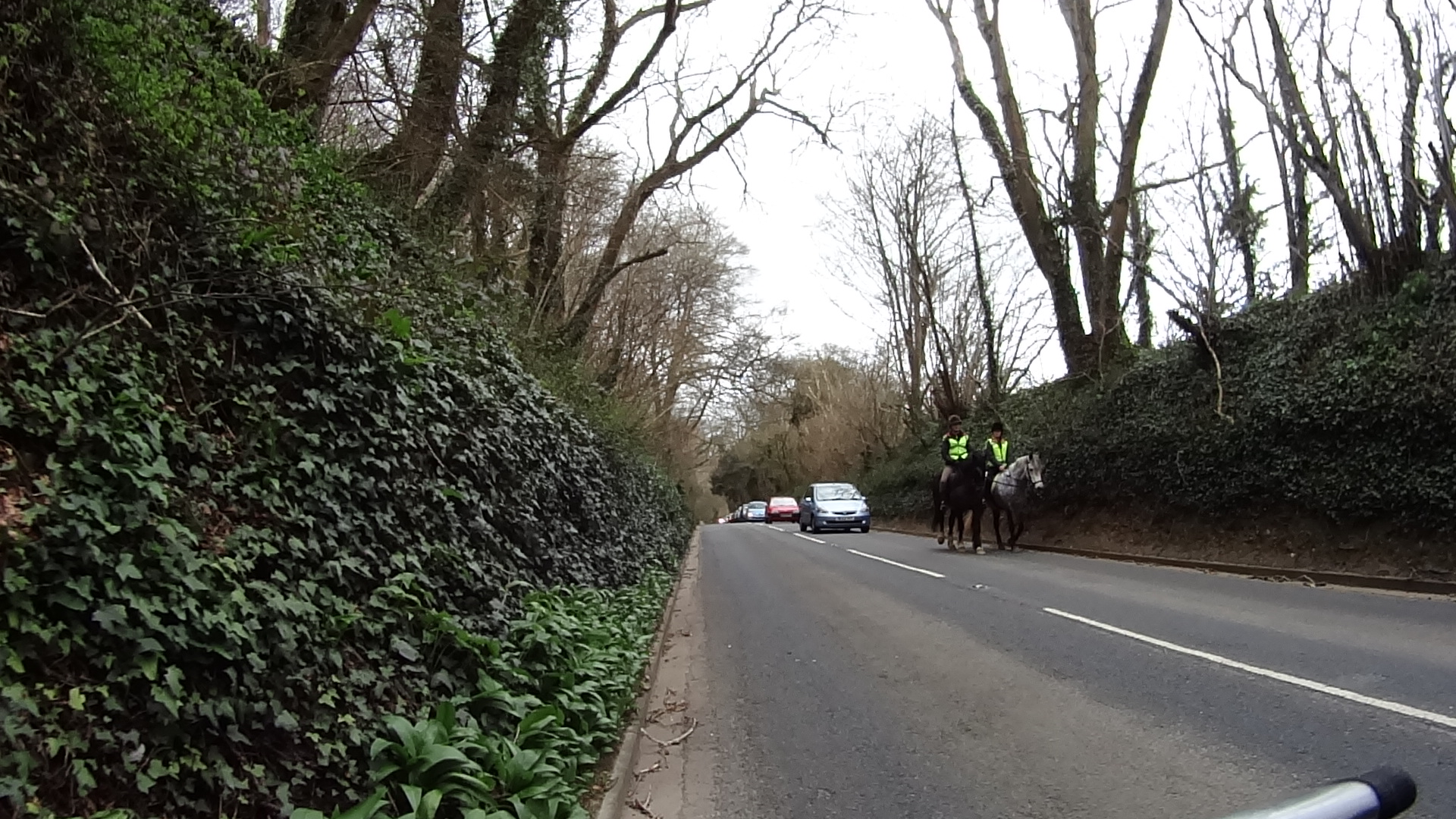
Horse riders on the B3401
To my surprise I even found people riding horses on that road, which must have really pissed the drivers behind them 🙂
Had I found accommodation in Freshwater, I intended to take National Cycle Route 23 and ride to Cowes and Yarmouth and then to the Needles (if not too late in the evening) or stay in Freshwater. Given I had to ride south to Ventnor, I decided for a more direct route to the Needles.
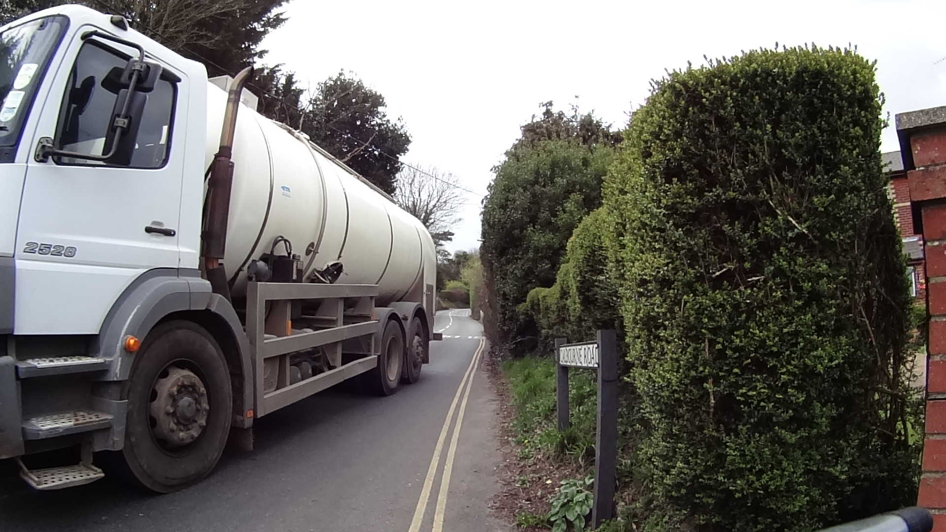
Narrow stretch on a climb of the B3401 (Calbourne Road) with intense traffic.
There are portions of this ride with high traffic of vehicles, mostly cars, vans, buses and small trucks. One particular point on the B3401 is a considerable climb in a very narrow part of the road.
I think that was the only moment in the 2 days of ride in the Isle of Wight that I was concerned for my safety, but that was a very small distance, of perhaps less than a kilometre. The problem is to climb with a heavy bike, slows you down too much, with cars passing inches from you at times.
The rest of the ride was reasonably uneventful with fields and farms often on both sides of the road.
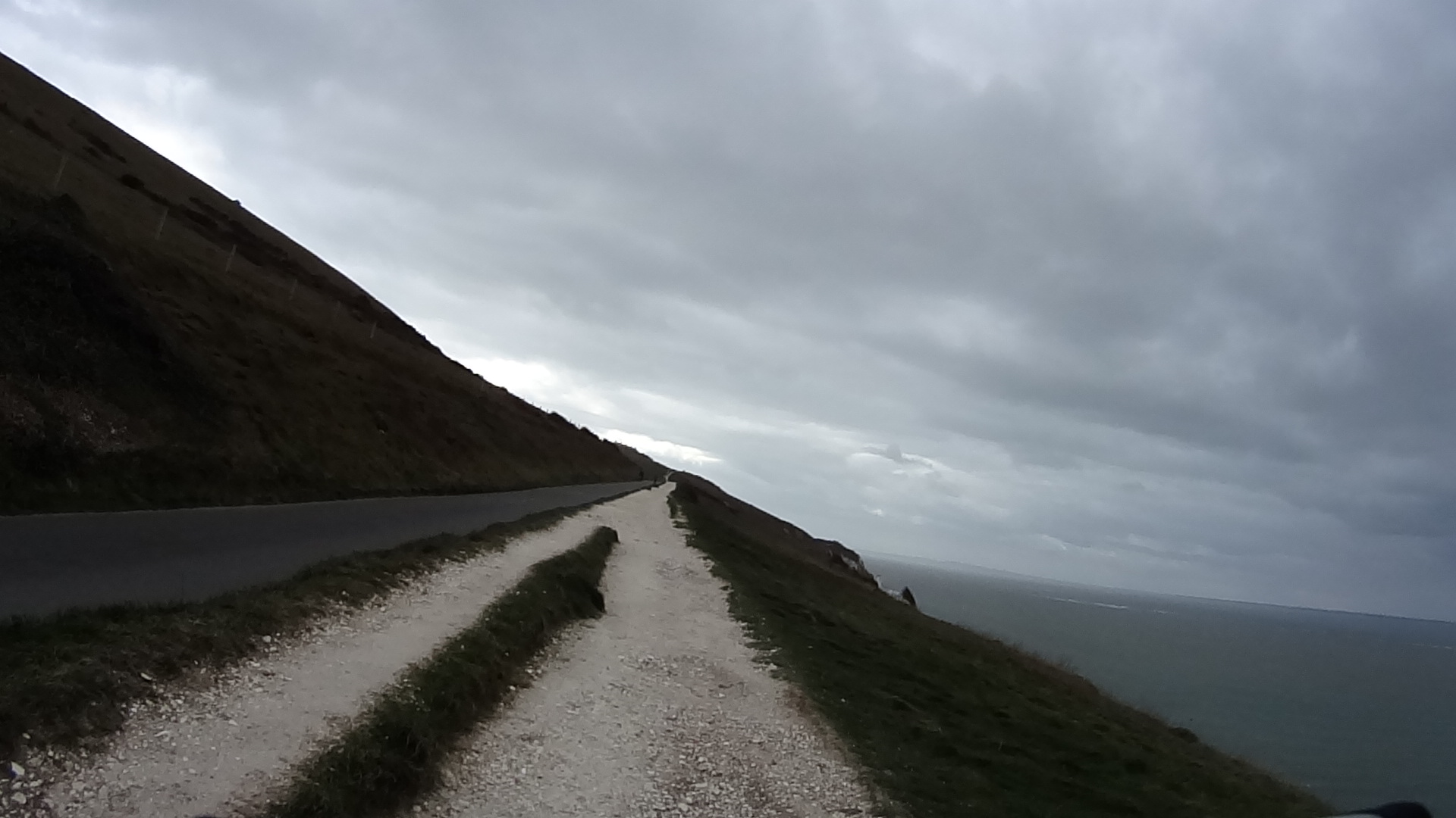
ZigZag climb to the top of the cliff
When I arrived at the Needles Park was already past 3pm in the afternoon, so I went straight up the cliff in the direction of the batteries. I did have to push the bike a part of the way up as the wind, together with the climb was making it very difficult to pedal on a loaded bike.
That would have been an easier way to get up there.
You can walk around the new batteries, but there isn´t much to see, apart from the wonderful sea views.
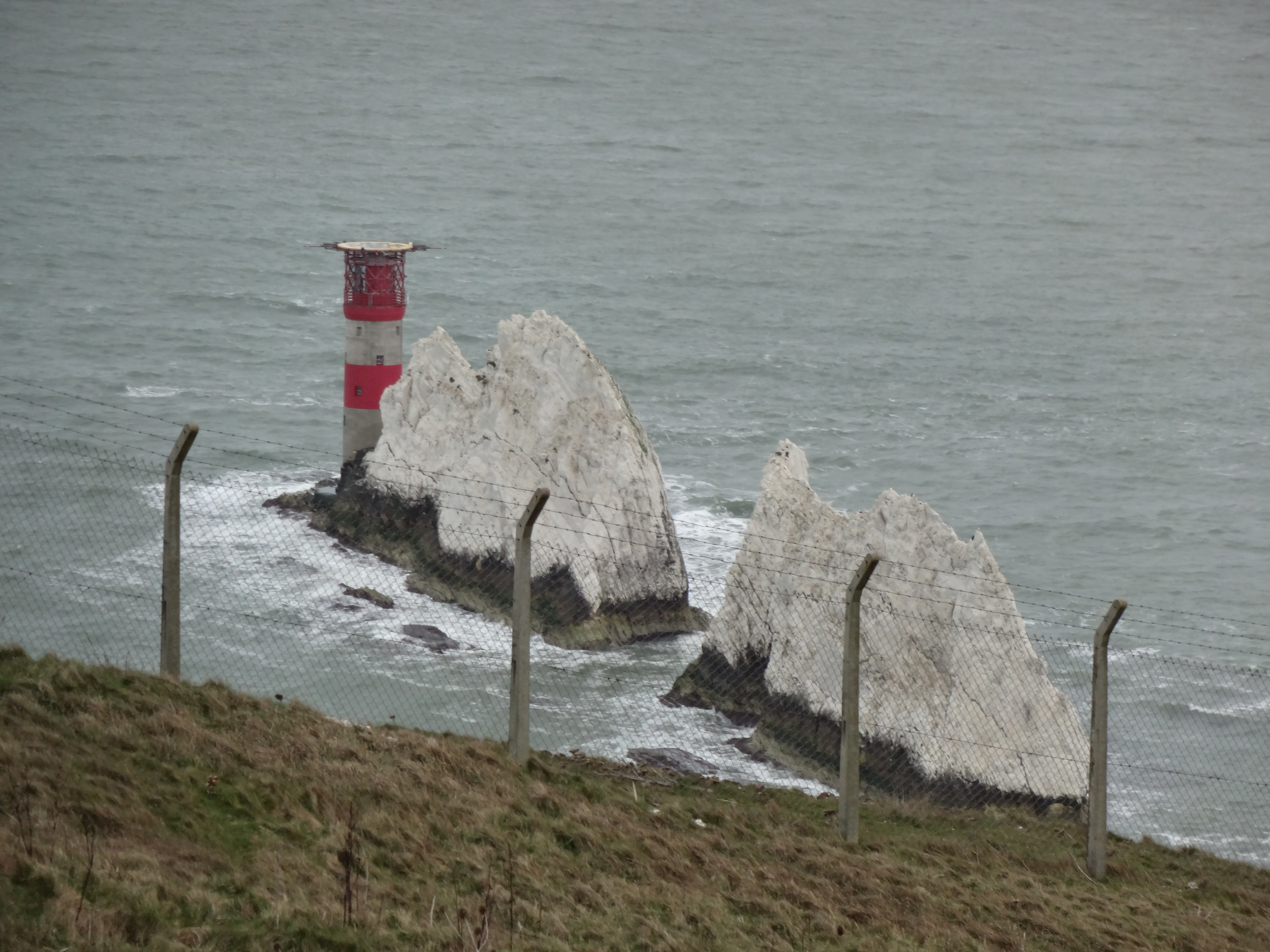
The Needles Rock formation.
To enter the old batteries, which is maintained by English Heritage you need to pay a fee of £6.00, which, given the time I thought wasn´t worth it. So once I had a look around I rode the way down to the park and had a cup of coffee.
Selfie with the Needles Rock formation on the background
There I realized I was without mobile phone signal, so I had to guess the way to Ventnor for a mile until signal was restored and I realized I was going slightly off course.
I wanted to ride to Ventnor on the A3055, also known as Military Road, as this is a coastal road that offer excellent sea views along the way.
(I was told there used to be missile silos in the island during the cold war, but could not find any evidence of that... well, they would have probably hidden the silos anyway, right?)
Mobile phones, mobile houses, mobile everything…
About half way there, Google directed me to take a detour, which I knew was to avoid the A3055 because from that point onwards the traffic increases substantially, but also, probably, to spare me from the climbs I knew I had to do, because I had already ridden this part last year (on an “empty” bike though).
Freshwater Bay Beach
Turns out, when I arrived in the B&B in Ventnor my hosts told me there had been a land slide and the road was blocked from a certain point onwards. Had I continued on the A3055 I would have had to turn back and take the detour anyway, so thank you Google.
Riding through little villages and farm houses, using small country lanes was indeed better and although there were a few climbs, they were much less difficult than those on the A3055.
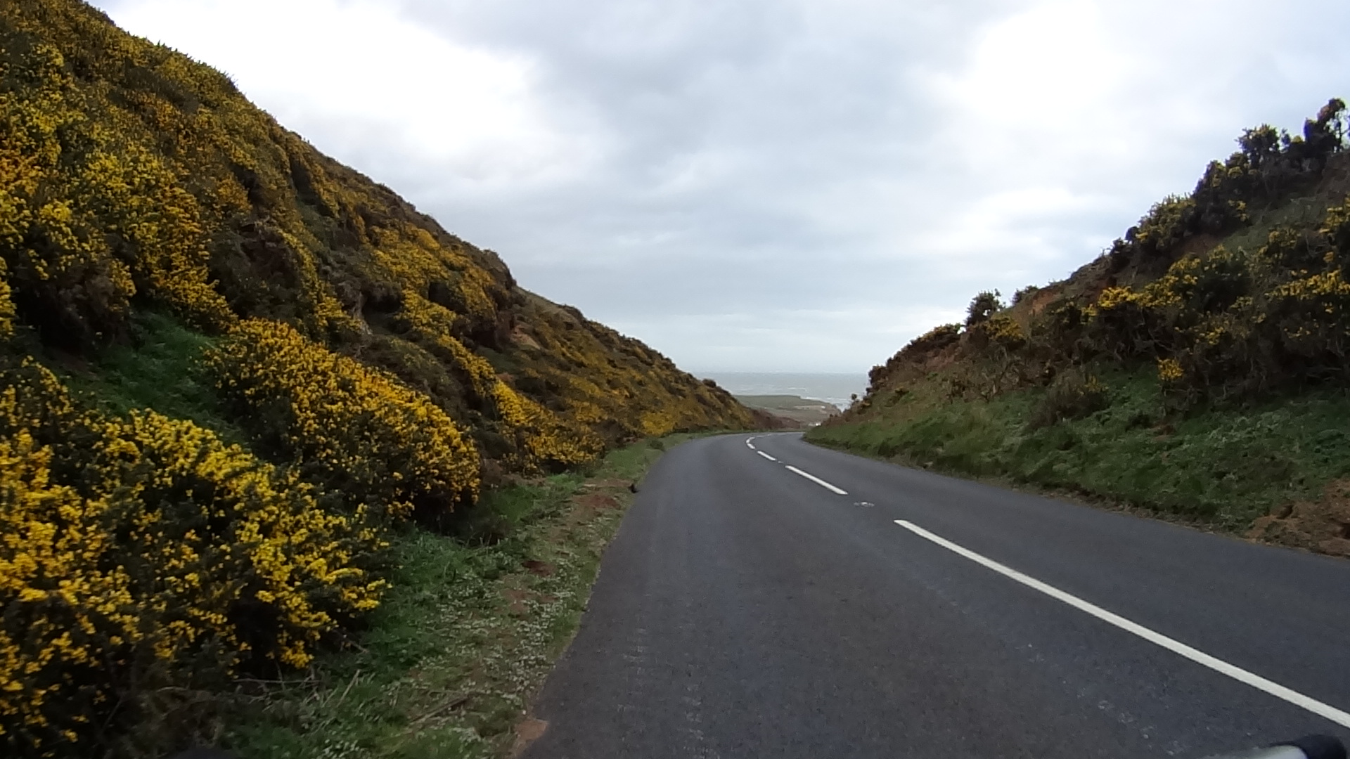
Particularly nice stretch on the A3055. Yellow flowers on both sides and the sea in front.
As I arrived in Ventnor, the time was 6:30pm, the sun had gone completely bringing the temperature down to a chili 5C.
Were the weather friendlier, I would have probably done a much different ride today, but when you are touring one of the things you do is to improvise.
It rained all night that night and weather was predicting heavy rain the next day (which thankfully didn´t actually happen), so I decided to cut my “Tour de Isle of Wight” short and head home the next day.
The video below is more than 8h of riding compressed in less than 8 minutes (5 seconds time-lapse).
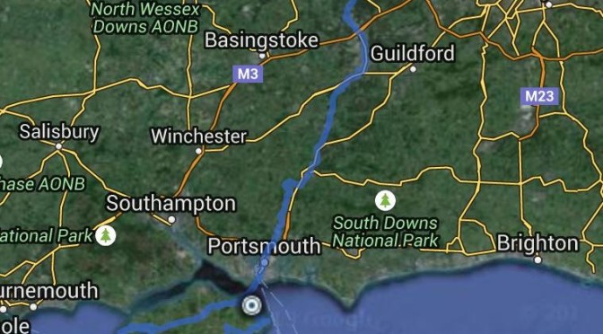
On the 31st of March I rode from Bracknell to Ryde… a “ride to Ryde” 🙂
I was initially planning to have someone drive me to the Hover Port in Porthsmouth, catch the Hovercraft to Ryde and then spend a few days cycling around the Island, but I felt a bit hypocritical and suddenly “Ride to Ryde” started to appeal to me.
Had a look in Google Maps and it suggested a 65 miles or just under 100 Km route. I knew I could easily do that in a day and I was right.
I planned to leave early in the morning, but these plans never seem to work. I packed the panniers the day before, but a number of small things contribute to leaving only at around 11am.
According to Garmin it was a 7h and 53 min ride to Porthsmouth, but I did stop a few times for water and food.
Had just left home. Nice day for a ride.
Weather conditions were not ideal. It was sunny when I left, but in the middle of the afternoon the weather changed and, in addition to the cold wind, I had to face rain and even a 20 min period of hail storm on the bike, which wasn´t much fun. If conditions were better and I was in a hurry I could probably do it under 7 hours even with a few short stops.
I did not weigh the load on the bike, but I estimate it must have been about 20 Kg all together, between contents in both panniers, camping equipment and front bag.
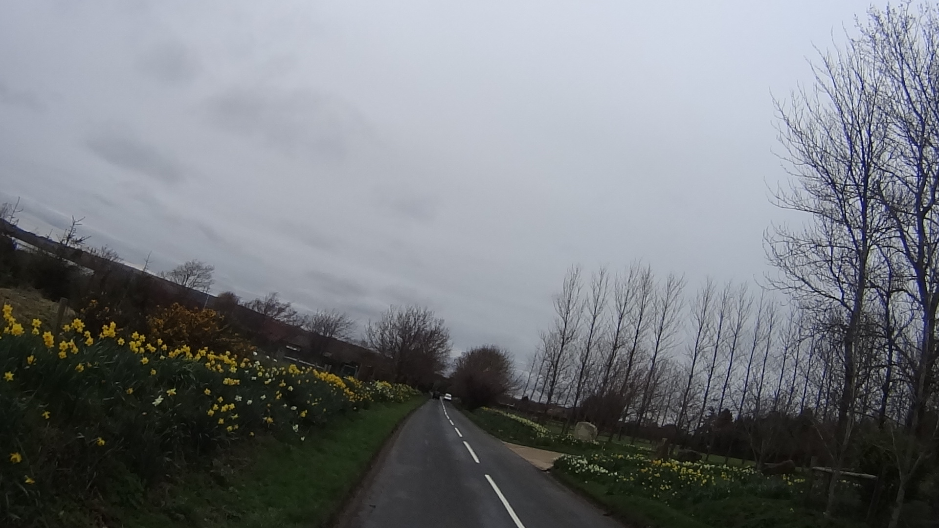
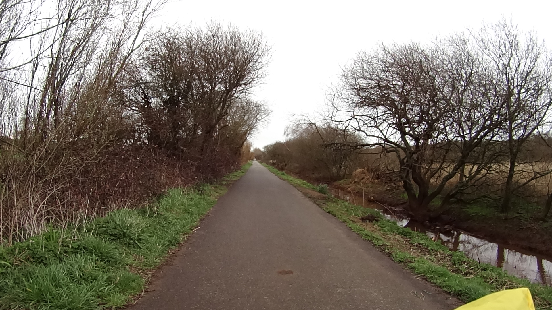
The first part of the ride I was already very familiar with. Down to Crowthorne, then Sandhurst in the direction of Farnborough on the Blackwater Valley Path which is a ride I do recommend for everyone. You ride alongside the Blackwater river and the many lakes and ponds often with vegetation on both sides. Very suitable to families riding together with Children, however, you have to consider it is for the most part not a paved cycled way, so it can get muddy after rain.
Half way there
As I approached Farnham, the Blackwater river turns north ways and as I was riding south I had to leave the cycle path to urban roads, which initially are low traffic, but after Farham Google Maps guided me to the A325 which had an intense traffic of cars and heavy load vehicles. If you are taking this route, please be careful and make sure you have good mirrors in your bike. You will need to be aware of what’s coming behind you because the A325 is not a major A road, so there isn’t much space on its sides and some vehicles approach at very high speed at times. Definitely not a place to take your children for a bike ride.
Traffic remained intense and with no cycle paths until I got close to the A3, which I rode along for just a few miles, eventually crossing it and taking some rural lanes as per Google´s guidance.
As I entered the A3 I realized that I had forgotten to start the camera, so a bit to my disappointment I wouldn´t be able to produce a time lapsed video of the entire ride as I intended.
The video below is from that point all the way to the Porthsmouth´s Hover Port and it does give an idea how the ride was. By then the worst weather conditions had already happen.
One of the issues you get when you start to rely exclusively on technology for navigation is that when there is no phone signal, there is also no access to the internet if you have not cached the map on your phone.
As I was riding on those small lanes, letting tractors and a few vehicles pass (in places there was not even enough space for a car and a bicycle side by side), I lost the signal and realized that I did not know where I was and which path to take in the next crossing. Obviously, per Murphy´s law, I took the wrong path, but thankfully it wasn´t long before I realized I was going the wrong way and the signal eventually returned as I climbed up a little hill. If you zoom up the map above you can see the little “bump” about a mile after I crossed the A3.
Feet are about to become muddy
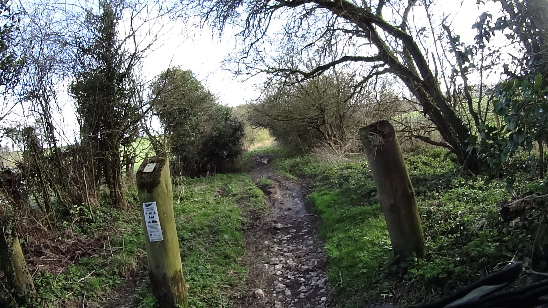
To correct the mistake Google suggested taking some bridal paths that were quite muddy, which is not fun when you are pulling about 20Kg of stuff on the bike. Lucky me, only a few meters were really bad, the rest were dry and rideable.
By then I was starting to get a bit tired and at the point I quickly appear in the video I wasn´t really looking forward to climbing the hill in front of me. I initially pushed the bike on foot, but luckly, the wind, which was strong all day, helped on that climb for a change and I was able to complete most of it riding.
Several Cycleways around Portsmouth
Once the hill was behind there was a long descent and at the end the surroundings started to turn very urban again. I found that the urban areas on the outskirts of Porthsmouth and Porthsmouth itself have quite a good number of cycle lanes with cycling permitted bus lanes as well.
Sunset in Portsmouth
As I approach Porthsmouth in an area called Cosham, the sun was setting and there is a nice cycle lane alongside some of Porthsmouth´s water channels and the scenery was really nice, despite the strong and cold wind.
The rest of the ride towards the Hover Port practically crossed the centre of Porthsmouth, but most of the path is cycleable in safety, with only a few stretches on streets with high traffic. By then night was falling and thankfully I had just missed the Porthsmouth rush hour.
There is a Hovercraft service to Ryde every 15 or 30 minutes so I did not have to wait long to be able to board and had to remove all panniers and bags from the bike, but the bike was loaded safely and everything arrived in Ryde in good order.
Took me a while to find the B&B I was staying, even though it was very close, because by mistake I started Google Maps with the route planned for a car, so it took me a long way around the place and the street of the hotel is single way, contrary to my direction.
It was a challenging ride for me, because of the less than ideal weather conditions. Very windy, it rained for about 1/4 of the way and even had to endure a hail storm on the bike for about 30 min, but it was fun nevertheless.
This is not a ride I would recommend to the uninitiated.
Thanks for reading. Few more pictures…
There is always a light at the end of the tunnel.Hovercraft
Transfer from Portsmouth to Ryde aboard the Hovercraft.