<- Previous Post (Day 3) |
"Faith is not the clinging to a shrine but an endless pilgrimage of the heart.” Abraham Joshua Heschel.
-
- Introduction (this is the same as on previous posts, so skip to next section if you’ve already seen it)
- The statistics and metrics of the day
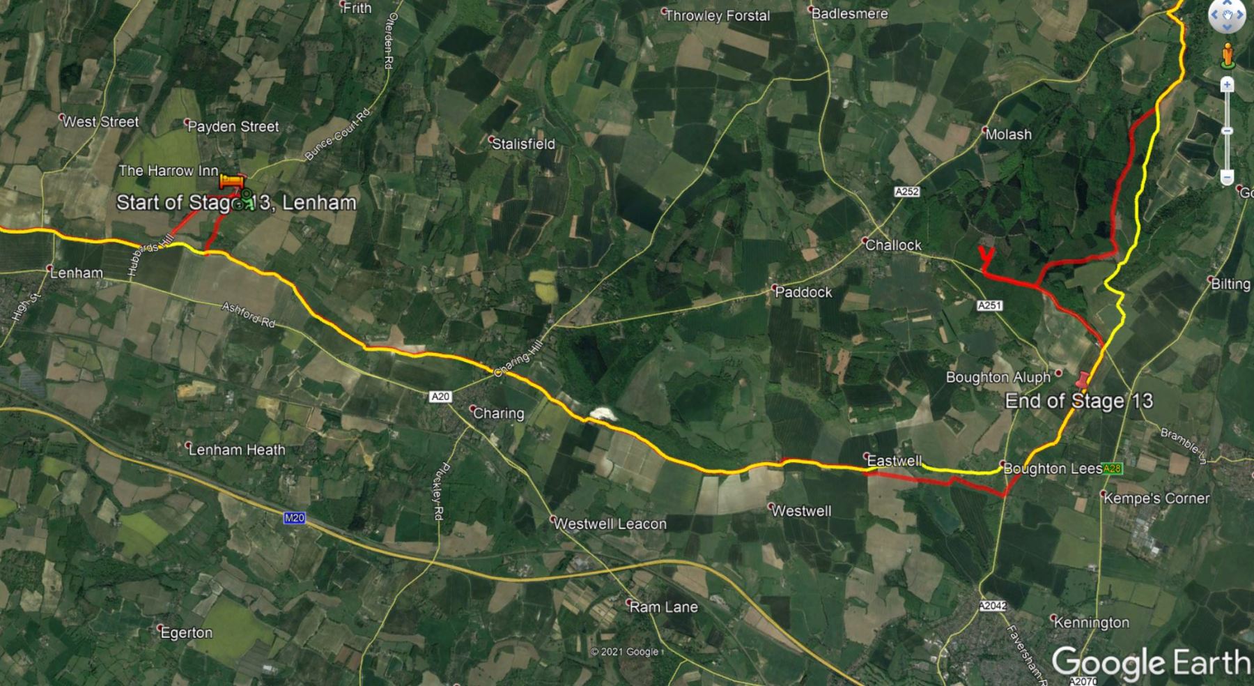
- Stage 13: From From the Harrow Inn Hotel near Lenham to the All Saints’ Church in Boughton Aluph
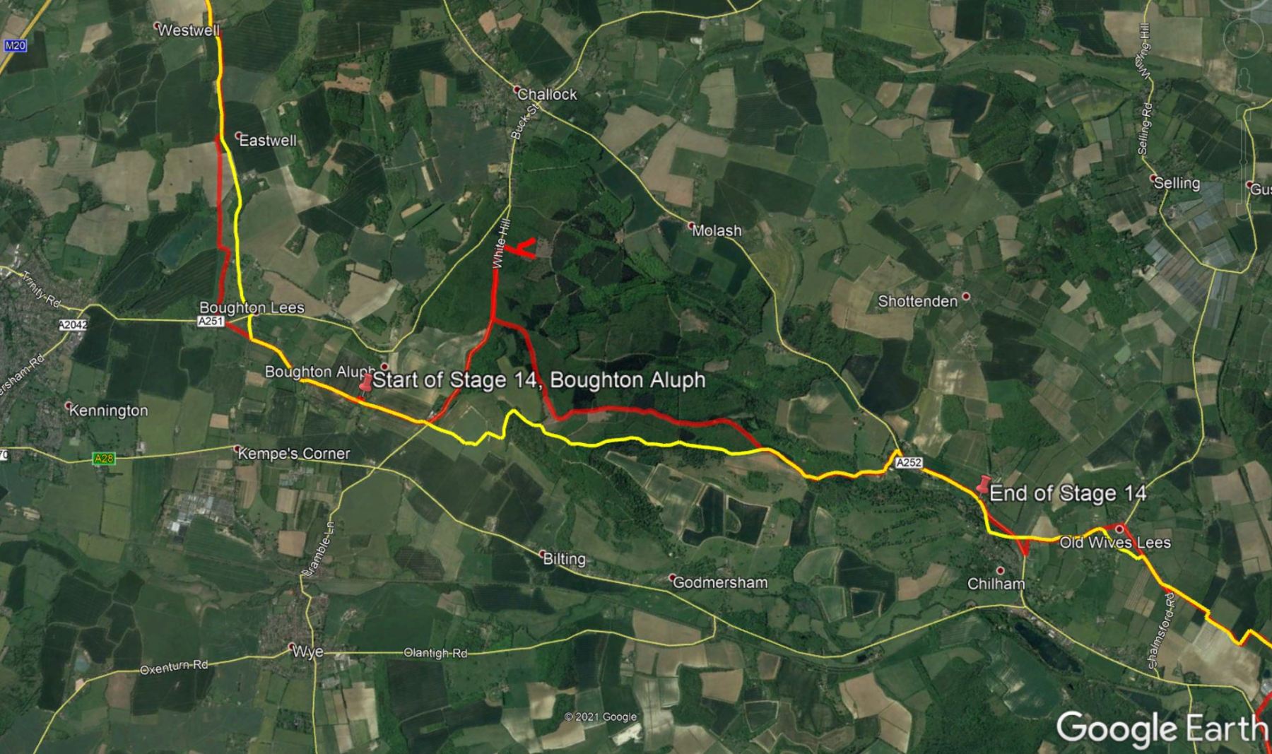
- Stage 14: From the All Saints’ Church in Boughton Aluph to the Village Hall in Chilham
- Stage 15: From Village Hall in Chilham to the Canterbury Cathedral
OK, if this is the first Pilgrim’s Way post of mine that you are reading, I’d recommend you go back a little and read my Introduction to the Pilgrims’ Way blog. There are a few things I explain there that I don’t here and this post might look confusing if you don’t know these things beforehand (e.g. why 15 stages?).
This post is all about the forth day of the pilgrimage – but do take into consideration I was cycling, so if you are walking it is likely you’ll cover much less ground than me! In this one day I covered stages 13, 14 and 15. I describe them separately here. The section below provides the statistics for the full day, but in each video, there are some statistics for each one of the stages such as distance and time.

I reckon that the videos show the route and the difficulties quite well, despite being so speeded-up. You can pause them for more detail or reduce the playback speed in the YouTube interface, if you don’t mind watching it for a longer time (if you do this, don’t forget to mute the video to avoid hearing a slowed-down version of the music!).
Also, bear in mind that this pilgrimage was undertaken during the pandemic and that, although some restrictions had been lifted in the UK in August/September, many places, such as small community churches, were still closed.
Statistics and metrics of the day
All of the details below are in my Pilgrims’ Way Google Sheets Spreadsheet.
- Date: Thursday, 3 September 2020.
- Route: From the Harrow Inn Hotel near Lenham to the Canterbury Cathedral
- Distance: 36.31 km
- Departure time from Harrow Inn Hotel: Around 9:30am.
- Arrival at the Canterbury Cathedral: Around 16:00h.
- Duration of day’s Journey: 6h 04min (but includes several filming stops with the German TV crew). Moving time was considerably shorter = 2h 40 min
- Expenses this day: Total = £63.00
- £30.00 – Food.
- £33.00 – Accommodation in Canterbury (does NOT incl. Breakfast next day)
- Overnight Location: Premier Inn Canterbury City Centre, Kent, England. ✆ +44-333 321 9298
- Type of Accommodation: Hotel
- Walking the Pilgrims’ Way Guide (Leigh Hatts) Stages:
- 13: Lenham to the All Saints’ Church in Boughton Aluph
- 14: All Saints’ Church in Boughton Aluph to the Chilham Village Hall, Chilham.
- 15: Chilham to the Canterbury Cathedral
- Physical and Body Stats: Link to the Garmin Connect Page for this ride
-
- Duration (elapsed time): 6h 04min
- Moving time: 2h 40min
- Average Speed: 13.1 km/h
- Average Moving Speed: 14.2 km/h
-
- Max. Speed: 43.6 km/h
- Total Elevation Gain: 358 m
- Average Heart Rate: 133 bpm
- Max. Heart Rate: 184 bpm
- Calories: 1,482 CAL (Est.)
- The tracking was done by 2 Garmin devices: A Garmin Edge 810 bicycle computer and a Garmin Forerunner 235 watch. There appears to be significant differences between these devices.
-
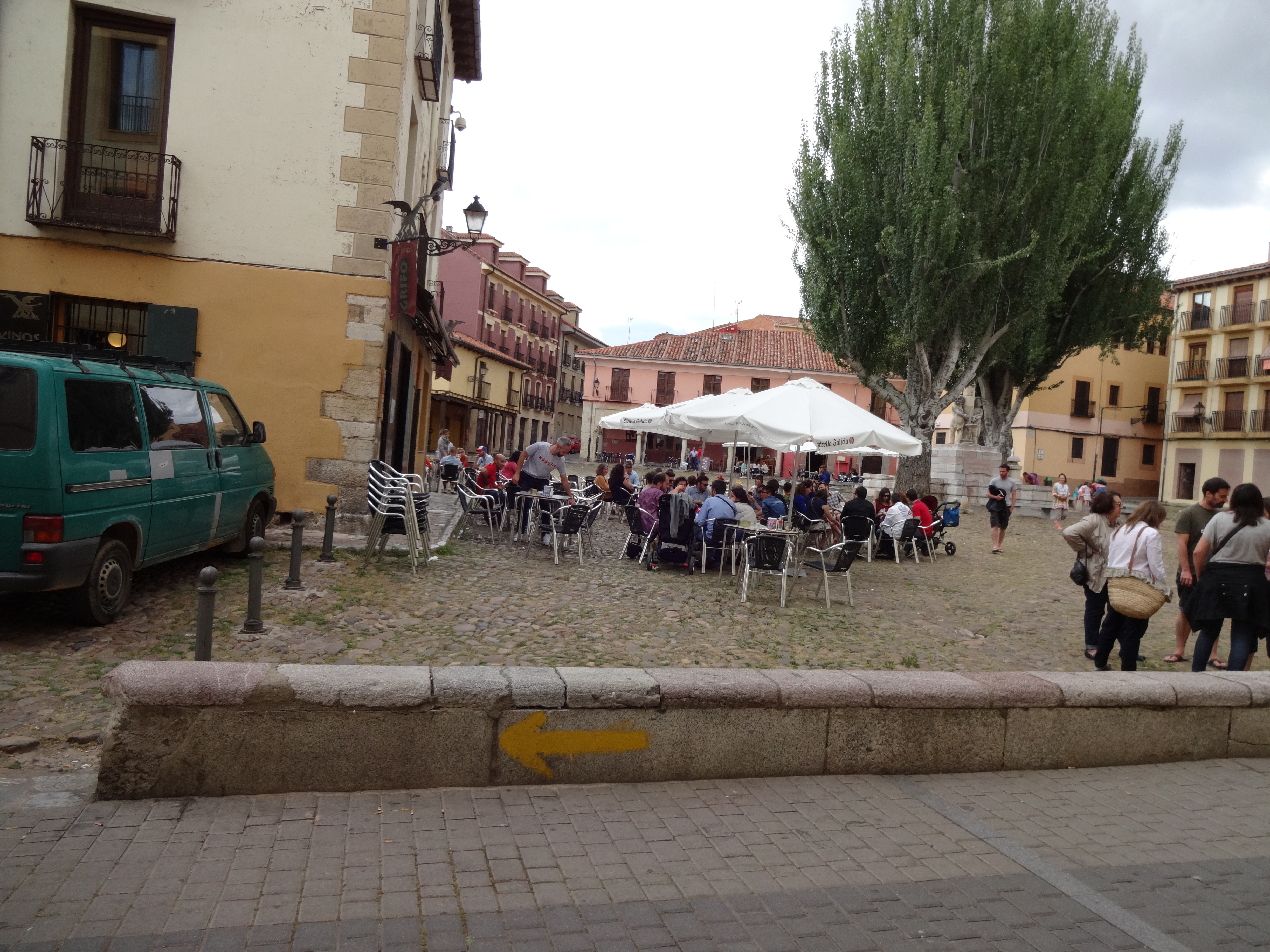
Stage 13: From From the Harrow Inn Hotel near Lenham to the All Saints’ Church in Boughton Aluph
If you haven’t done so already, please watch the video first and then read this blog for more detail! I didn’t want to include all this information in the video voiceover because it would have added too much to the length of the video (which is 6’42″).
The picture below was used in the video and I hope will help you make more sense of the text below.
Before I left the hotel in the morning I had the task of replacing the inner tube of the rear tyre. Thankfully the spare inner tube I was carrying with me worked well, but pumping a fully deflated tyre, with the little bike pump I had, took considerable time and effort.
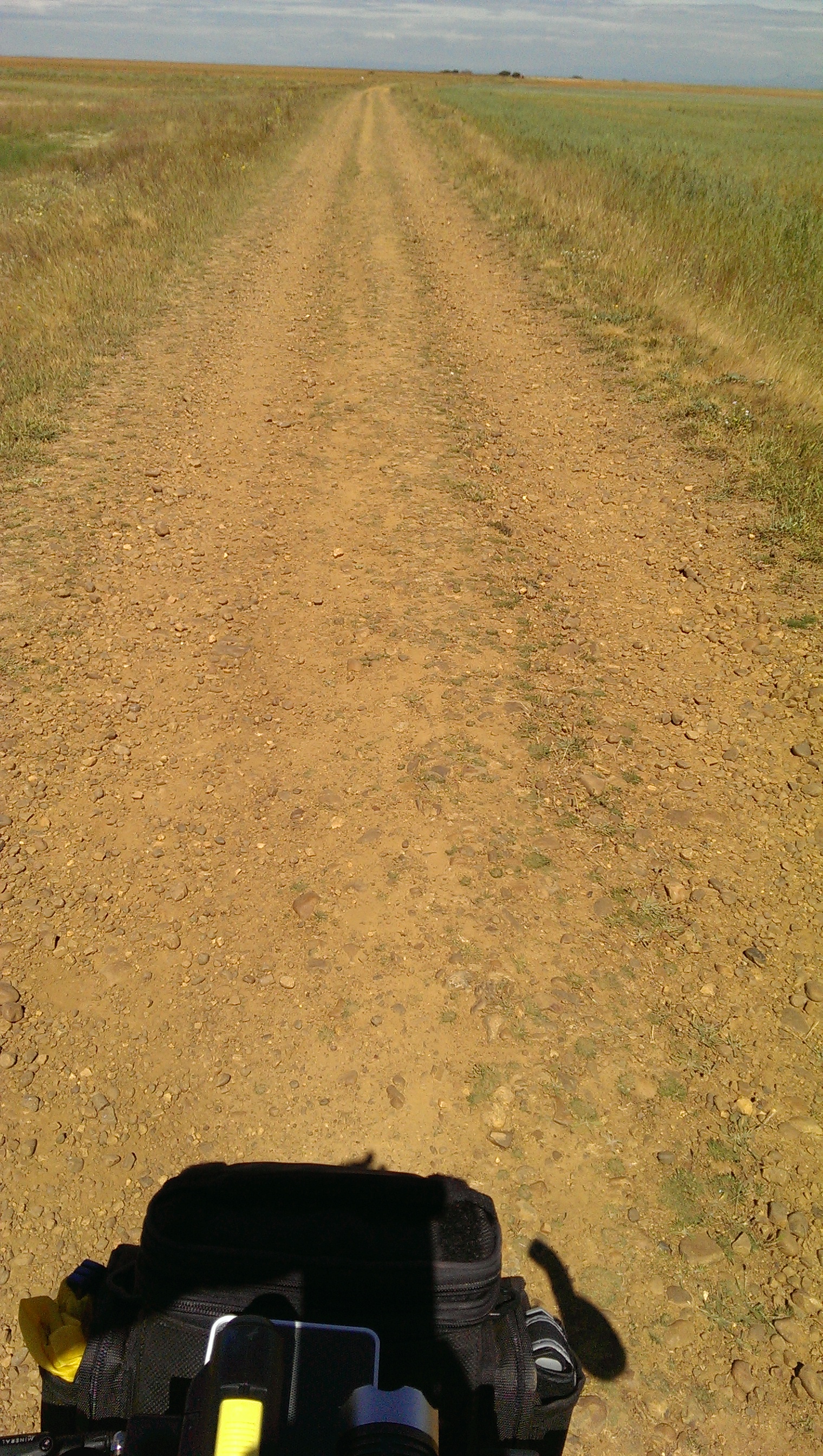
Leaving the Harrow Inn Hotel, I turned right into the Waterditch Rd and then immediatelly right again into Rayners Hill which I had to ride for a few hundred metres to join the dirt track of the Pilgrims’ Way again on the left (which I almost missed). You’ll walk / ride a good few kilometres on these dirt tracks passing farmyard buildings with fields and often a tree line on both sides. The paths are wide, firm and easy to ride despite a bit of gravel on the ground.
It was in one of these paths I met 2 cyclists (a couple) whose intention was to tour from the southeast of the country all the way to Wales in the west, a good few hundred miles away. We’ve spent only a few minutes talking, I gave them a card, but they never got in touch and I don’t recall their names anymore.
You will eventually get to the A252, but will only have to ride / walk on it for 10-15 m in order to cross over to the Pilgrims Way (the road) on the right. The Pilgrims Way is a paved single track with farm fields on both sides at this point. Eventually the asphalt ends and it becomes a dirt track again with a denser tree line between the farm fields. Quite enjoyable to walk / ride on. The asphalted single track returns about 1 or 2 km later (still on cycle route 17).
At the T-Junction between Dunn St and Westwell Ln you’ll need to take a path that has a, sort of, “U” shaped gate (I had to lift my bike vertically to get through it) leading to a path on a farm field that appears to be part of cycle route 17 hence the curiously looking bike sign (as in bikes allowed) post. One would think cycle routes would be unobstructed paths that facilitate the life of cyclists, but that concept does not appear to be valid in the UK. You’ll ride / walk on unpaved single tracks until you get to the edge of a field where the path becomes less pronounced and when I was there the field had just been prepared for planting, so the crossing of the field wasn’t an easy / pleasureable ride. Surprisingly it all still appears to be part of cycle route 17. There is another of such obstacles on the other side of the field, but this one I was able to (barely) transpose without having to lift the bike. Curiously, this entire stretch is in Google Street View and whenever Google took these pictures it looked very different than when I was there.
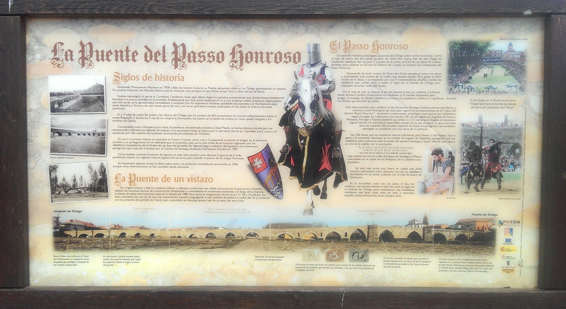
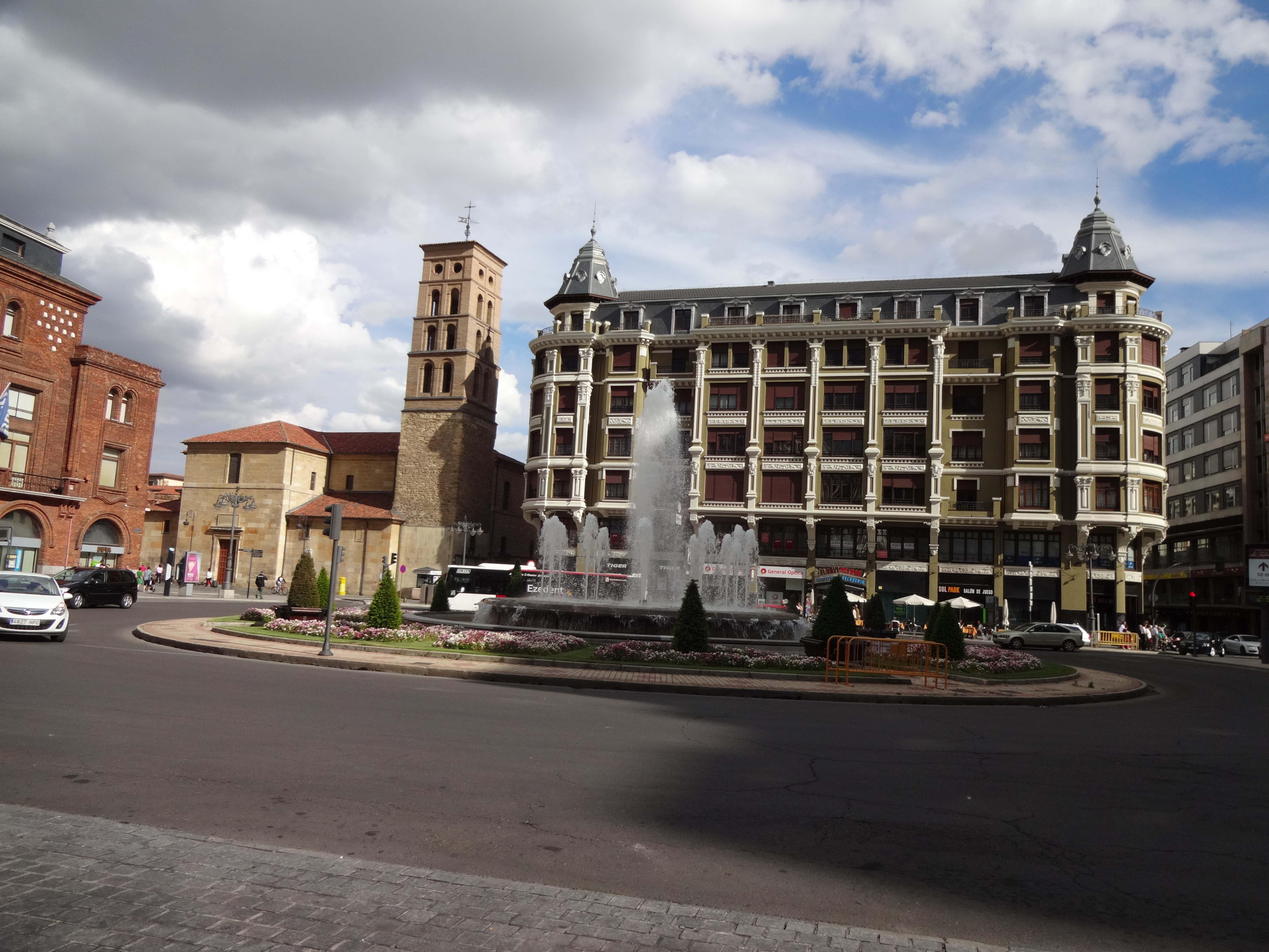
As you re-join the asphalt straight ahead you’ll eventually get to a kissing gate that the original walker’s route instructed to take, but I decided to stick to the road and turn right few metres later. This road doesn’t appear to have a name, but will lead to the A251 and the village of Boughton Lees. The All Saints Church is perhaps 1 or 2 km away from Boughton Lees in a place called Boughton Aluph, which strangely does not appear to be a village at all as the only thing around it is the church and some farm buildings. To get to the church you can stay on the road or, like me, take the narrow shortcut path with barbwire fences on both sides (be careful). After riding a few hundred metres on some farm fields you’ll get to a metal Kissing Gate that leads to the church yard and where the German TV crew was already waiting for me as they wanted to shoot some scenes of me arriving at the church. The All Saints Church has a long pilgrim tradition as medieval pilgrims coming from both Winchester and Southwark would gather there to cross the (then) dangerous King’s Wood forest (which was known to be infested with robbers) together to Chilham. The origins of the church can be traced back to Anglo-Saxon times (1066), but the church itself, more or less as it stands today is from 1329. At the time I was there the church was closed due to Covid restrictions but in normal times it hosts once a year the Stour Music Festival. Its well worth a visit.
The picture gallery below shows the pictures taken by me along this stage. Click on any picture to enlarge.
I hope you enjoy the video and the photos.


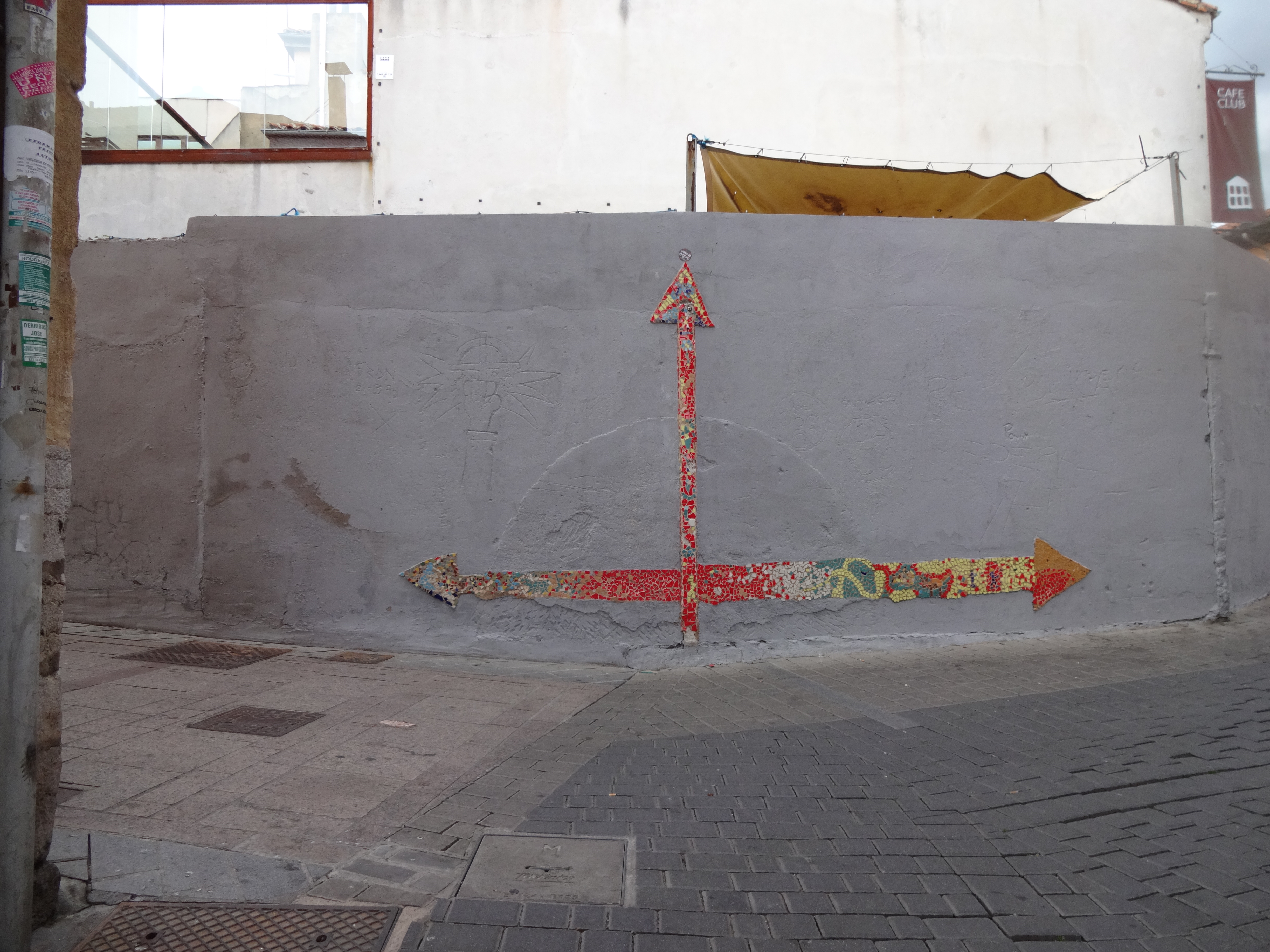
Stage 14: From the All Saints’ Church in Boughton Aluph to the Village Hall in Chilham
If you haven’t done so already, please watch the video first and then read this blog for more detail! I didn’t want to include all this information in the video voiceover because it would have added too much to the length of the video (which is 4’19”).
The picture below was used in the video and I hope will help you make more sense of the text below.
As mentioned in the previous stage, the German TV crew filming the Pilgrims’ Way documentary wanted to add a little acting in the King’s Wood due to the relevance it had in medieval times. As this isn’t really part of the route and the pilgrimage, I have not included it in the video.
As I left the All Saints Church in Boughton Aluph, I crossed a farm field that led me to White Hill Road. The walkers’ route I had obtained on the internet was instructing me to cross the road and follow straight on the farm’s dirt track, but as I had to meet the German TV crew I turned left and climbed White Hill Road to meet them at the King’s Wood Car Park 2 km away. After all the filming I rode back less than a kilometer to enter the King’s Wood at the point I highlight in the video. Hard for me to make a recommendation about a path not taken, but if you are doing it on a bike I would avoid the farm’s dirt track and enter the King’s Wood where I did.
The ride through the wood is very nice and easy with only a few slopes along the way, being the one at the end the more challenging (but easily done). Eventually the path I took joins the path of the walkers’ route. You’ll exit King’s Wood at the A252, not far from Chilham. You’ll ride / walk along the A252 all the way to the Village of Chilham. The walkers’ path will lead you to the St Mary’s Church in Chilham, but by mistake I continued on the A252 and missed the church, hence the reason I end the video of this stage in the Village Hall. After the Village Hall, the next street to the right will take you to the church.
The picture gallery below shows the pictures taken by me along this stage. Click on any picture to enlarge.
I hope you enjoy the video and the photos.


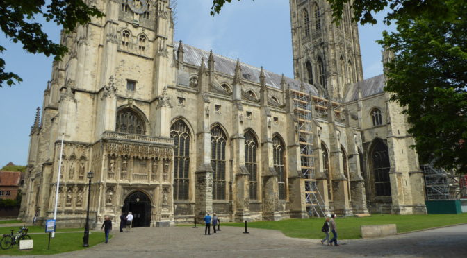
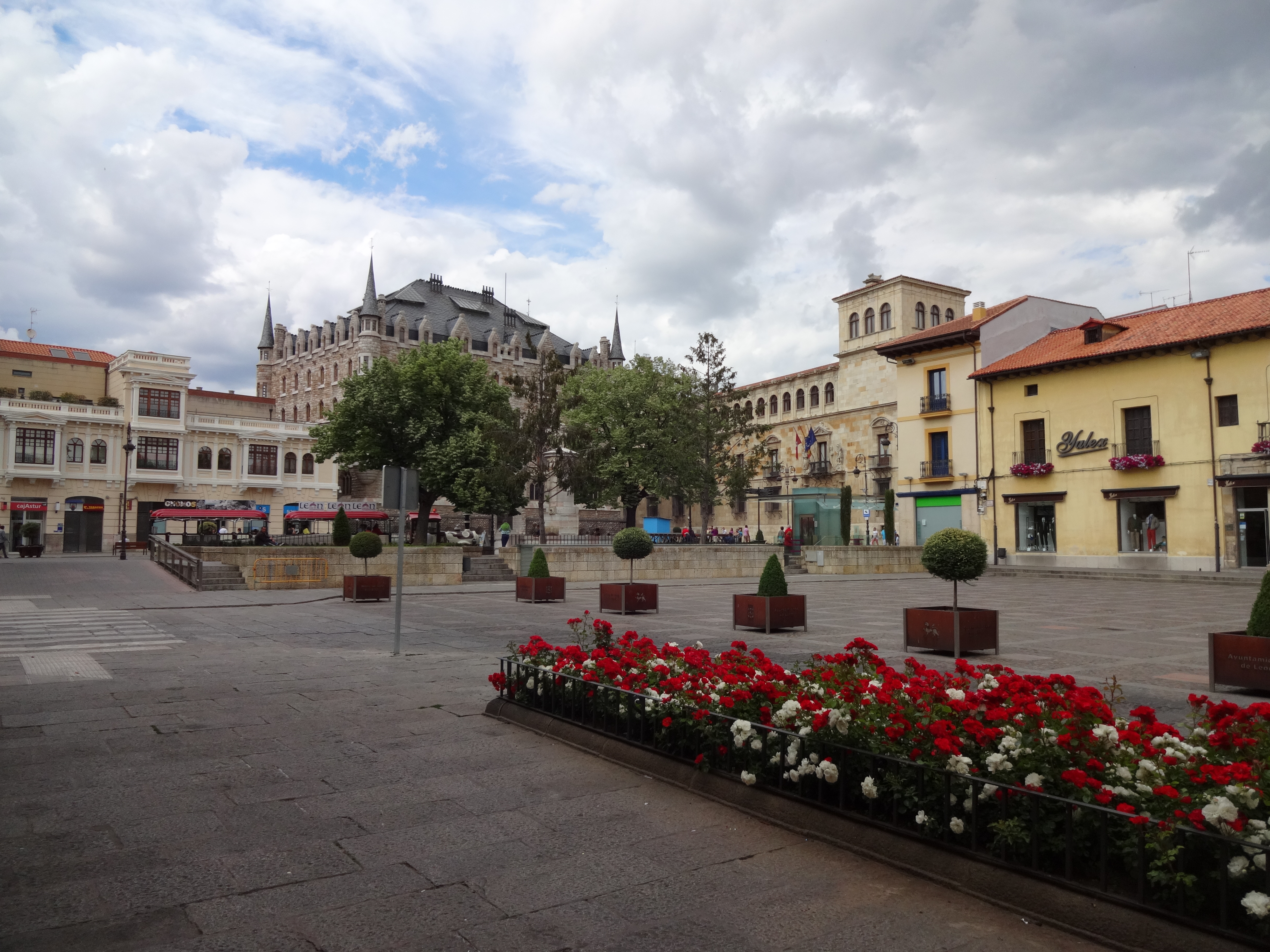
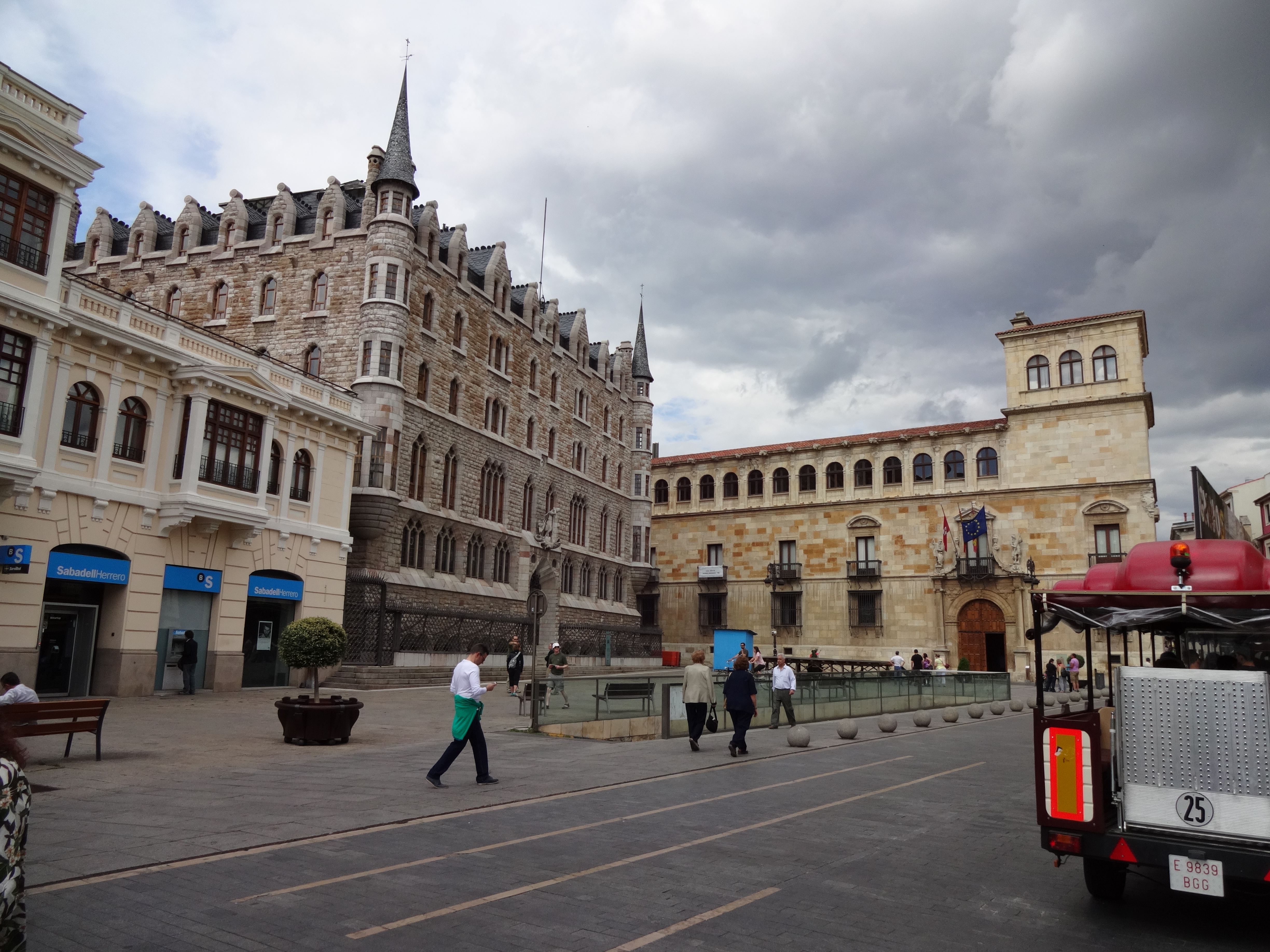
Stage 15: From Village Hall in Chilham to the Canterbury Cathedral.
If you haven’t done so already, please watch the video first and then read this blog for more detail! I didn’t want to include all this information in the video voiceover because it would have added too much to the length of the video (which is 13’09”).
The picture below was used in the video and I hope will help you make more sense of the text below.

If you get to start this stage from the St Mary’s Church in Chilham you will likely be on Church Hill Road. You’ll cross the A252 to take Long Hill and continue all the way to Old Wives Lees, where you’ll turn right on Lower Less Road (the road that was undergoing roadworks in the video). You’ll walk to the “triangle” intersection of Lower Ensden Rd and you should see in front (a little to the right) the path that will take you through some farm fields all the way to the Apple Orchards of Nickle Farm in Chartham. I usually eat an Apple a day (to keep the doctor away) and to me seeing all the Apple trees and their pleasant smeel was a real delight.
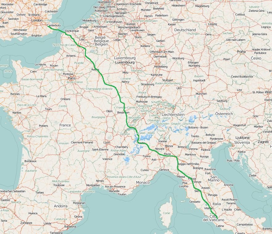
Nickle Farm belongs to FW Mansfield & Son and it is a big business, with many workers, mostly coming from Eastern Europe for the harvest. As I rode through the farm I got a little lost and asked for directions, but communication was a bit difficult. I eventually found the path, but when I saw the pebbles on the track up hill I got demotivated. That forced me to look for an alternative and after talking to another person in the farm he recommeded the path to Canterbury over Chartham village, alongside the Great Stour river, which isn’t really part of the original Pilgrims’ Way route (see where the yellow line and the red line disconnect on the map above).
The original route, on the walkers’ path and the guide will take you to the villeage of Chartham Hatch (yellow line), but I decided to override that. This was MY pilgrimage afterall and, personally, I take a river path over a single track lane any time. Again, it is probably not right for me do make recommendations over a path not taken, but I am glad I did ride to Canterbury alongside the river. The path is beautiful, very flat and very enjoyable, but you’ll have to divide it with a number of other cyclists and walkers (incl. dogs, children, etc). You’ll see magnificent river houses, trees and fields all the way to Canterbury. I think the video is much better at showing you this than I could ever put in words, but if you take the same path as I did you’ll be giving up the historical path of the pilgrimage.
The video includes some drone footage I filmed the NEXT day with Katy and some details about Canterbury with Katy’s voice. I hope you enjoy the bird’s eye view of Canterbury at the distance (at that point the Cathedral is about 3.5 km away).
Upon arriving in Canterbury, as it became the norm over these 4 days, the German TV crew was already waiting for me at the Westgate Towers for a quite intense session of filming. Honestly, I felt a bit like a movie star walking into Canterbury city centre being followed by TV cameras and a filming crew. A sensation that I wasn’t necessarily comfortable with due to all the attention it drew onto me… all for a good cause anyway.
I should consider myself lucky they were there though. I did this pilgrimage during the times of the pandemic and if it wasn’t for the TV crew I am sure a few doors wouldn’t have been open to me. Upon arriving at the cathedral I was warmly greeted by canon Emma Pennington who received us and led us first into the cript of Saint Thomas Becket and then into the high altar where I received my final pilgrim’s blessing and where Katy sang at the end of the video.
In all fairness, I must warn you, the pictures you see in the video are from the next day though as the arrival at the cathedral and all the filming for the TV crew was quite intense. I didn’t really had a lot of time to film for myself, but the experience is the same. If you ever get to watch the documentary, the final footage of me (if included at all) might likely be an aerial / drone footage at the campus of the University of Kent riding into the sunset (quite moving really) onto another challenge.
This stage concludes the pilgrimage. I hope you enjoyed this short series of videos and posts about my Pilgrims’ Way pilgrimage by bike. To me these are memories I’ll take to the grave 🙂
The picture gallery below shows the pictures taken by me along this stage. Click on any picture to enlarge.
I hope you enjoy the video and the photos.


<- Previous Post (Day 3) |
If you have any questions, don’t hesitate to comment or send me a message through the contact form.
Please subscribe to my Blog and/or to my YouTube channel if you don’t want to miss the next one and help me spread the word by liking and sharing my Facebook Page, Instagram and Tweeter feed also.
Thank you for your time!
Do you like these posts? Why, then, don’t you pay me a coffee to help with the blog hosting cost and as a caffeine incentive to keep me going through the long hours of the night? (Suggested amount: £2.00 or USD $3.00 or 2.50€ or whatever you want to give).
You may donate through my Patreon Page or through PayPal directly.
![]()