Category Archives: Mountainbiking

Posts about Mountain Bikes.

Via Beata: Day 04 from Ecton to Warwick (81.36 Km)

This is the 5th post on a series about the Via Beata pilgrimage by bike concluded on the 3rd of August 2021.

This post is natively available in English only. For other languages, please use the Google Translation drop-down option on the right menu (desktop version).
<- Previous Post (Day 3)    |     Next Post (Day 5) ->

The goals of this post are:

  1. Promote the cycling video for this day of the journey.
  2. Provide an overview of the route and allow for the download of a “cleaned-up” version of the GPX track we rode on this day of the journey’s.
  3. Provide the link to the written account for this day of the journey in Katy’s Blog.
  4. Provide the gallery of photographs that Katy and I took on this day of the journey. 
  5. Provide links to useful online resources about this day of the journey.
  6. Provide a communication channel to enable readers and interested parties to ask questions or drop us a message through the blog.

 1. The Video for this day of the journey

The  28m 54s video below was recorded between Ecton to Warwick on the 28th of July 2021.

Back to Top

 2. The route we cycled on this day of the journey

The map below shows a “cleaned-up” version of our route between Lowestoft and East Harling on this day. By “cleaned-up” I mean, where I considered necessary, I edited the “real-life” track to exclude some of the mistakes or issues we encountered along the way, such as navigation errors, closed gates or other impassable obstacles (with a bike), etc. The objective being to prevent you from making these same mistakes or benefiting from the experience we acquired while riding on this route. Keep in mind everything changes… life is dynamic, roads and paths are closed for maintenance or become impassable for a number of reasons, access to certain locations may become restricted, etc. Use it at your own risk.

Download file: Via Beata Day 04 - Ecton to Warwick.gpx

In addition to the raw GPX route shown in the map above, which you may download through the link below the map, I have also created a Google Maps version of the entire route in the EyeCycled Google Account.

To visualise the Google Map of the Via Beata route and main Waypoints please click on the link below (opens in a new tab).

https://www.google.com/maps/d/edit?mid=1mKIjBROBR1o6IiHTRx0Mh6dNUSpa7oc&usp=sharing

Back to Top

 3. Katy’s written account of the day

Please click on the picture below to be taken to her blog post.
Katy's Day04 Blog Post
Katy’s Day04 Blog Post

Back to Top

 4. Photo-Gallery

A picture is worth a thousand words.

These are the pictures we took on this day of the journey. Where possible we provided some context in every picture taken. These pictures are not to be sold or used without prior consent.

Click on the thumbnail to expand picture and read about that moment. The navigation numbers below each gallery refer to the number of viewable pages in the gallery.

Day 04 Photos (Fourth day of the 10 days journey)

Back to Top

 5. Links to useful online resources for this day of the journey.

We are giving you our experiences here for free, but it is up to you if you want to replicate them or not. Each journey is different and you may want to plan a custom one for you. Hopefully some of your journey may match ours, but for any portions that don’t these are useful online resources for this day.

#Resource LinkDescription
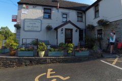
1The World’s End hotel in EctonThis is the Hotel we departed from on this day of the journey. We enjoyed our stay here and have no issues recommending it to you.
2History of the British Canal SystemThis is a Wikipedia article about the British Water Canal System
3Grand Union CanalThe Grand Union canal is the principal navigable waterway between London and the Midlands. It starts in London and one arm runs to Leicester and another ends in Birmingham, with the latter stretching for 137 miles (220 km) with 166 locks from London. We actually rode in parts of both arms on this day.
4River and Canal trustThe River and Canal trust holds the guardianship of 2,000 miles of canals and rivers in England and Wales, together with reservoirs and a wide range of heritage buildings and structures.
5The Heart of England pub and restaurantPlace right by the Grand Union Canal in the village of Weedon Bec where we had lunch. The chicken burger was superb and as we were not driving we could enjoy a worry free pint of beer with it.
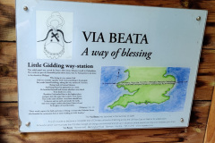
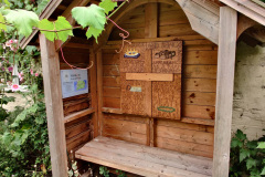
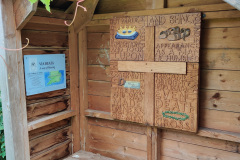
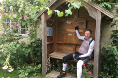
6Way-Station: Make Music in Your Hearts, Leamington Hastings, WarwickshireOne of Katy's favourite Way-Stations
7The Globe Hotel in WarwickThis is the Hotel we stayed at the end of this day's journey. We enjoyed our stay here and have no issues recommending it to you.

Back to Top

 6. How to get in touch with us

The easiest way is to use the form below and send us a message, but you can also leave comments both here as well as in YouTube or our social media accounts. Kepp in mind we do this as a hobby, not as a job, so our responses might be delayed. We aim to provide a response within a week, but it can happen that we are travelling or otherwise unavailable for longer than that. If you didn’t receive a response within 2 weeks, but send us a folloy-up message. 

Warning
Warning
Warning
Warning

Warning.

Back to Top

<- Previous Post (Day 3)    |     Next Post (Day 5) ->

Do you like these posts? Why, then, don’t you pay me a coffee to help with the blog hosting cost and as a caffeine incentive to keep me going through the long hours of the night? (Suggested amount: £2.00 or USD $3.00 or 2.50€ or whatever you want to give).
You may donate through my Patreon Page or through PayPal directly.

Become a Patron


Please rate this post by clicking on the desired star (1 = Awful, 5 = Excellent)
[Total: 0 Average: 0]

Via Beata: Day 03 from St Ives to Ecton (78.23 Km)

This is the 4th post on a series about the Via Beata pilgrimage by bike concluded on the 3rd of August 2021.

This post is natively available in English only. For other languages, please use the Google Translation drop-down option on the right menu (desktop version).
<- Previous Post (Day 2)    |     Next Post (Day 4) ->

The goals of this post are:

  1. Promote the cycling video for this day of the journey.
  2. Provide an overview of the route and allow for the download of a “cleaned-up” version of the GPX track we rode on this day of the journey’s.
  3. Provide the link to the written account for this day of the journey in Katy’s Blog.
  4. Provide the gallery of photographs that Katy and I took on this day of the journey. 
  5. Provide links to useful online resources about this day of the journey.
  6. Provide a communication channel to enable readers and interested parties to ask questions or drop us a message through the blog.

 1. The Video for this day of the journey

The  24m 23s video below was recorded between St Ives and Ecton on the 27th of July 2021.

Back to Top

 2. The route we cycled on this day of the journey

The map below shows a “cleaned-up” version of our route between Lowestoft and East Harling on this day. By “cleaned-up” I mean, where I considered necessary, I edited the “real-life” track to exclude some of the mistakes or issues we encountered along the way, such as navigation errors, closed gates or other impassable obstacles (with a bike), etc. The objective being to prevent you from making these same mistakes or benefiting from the experience we acquired while riding on this route. Keep in mind everything changes… life is dynamic, roads and paths are closed for maintenance or become impassable for a number of reasons, access to certain locations may become restricted, etc. Use it at your own risk.

Download file: W-VB03 - St Ives to Ecton.gpx

In addition to the raw GPX route shown in the map above, which you may download through the link below the map, I have also created a Google Maps version of the entire route in the EyeCycled Google Account.

To visualise the Google Map of the Via Beata route and main Waypoints please click on the link below (opens in a new tab).

https://www.google.com/maps/d/edit?mid=1mKIjBROBR1o6IiHTRx0Mh6dNUSpa7oc&usp=sharing

Back to Top

 3. Katy’s written account of the day

Please click on the picture below to be taken to her blog post.

Katy's Day 03 Blog Post
Katy’s Day 03 Blog Post

Back to Top

 4. Photo-Gallery

A picture is worth a thousand words.

These are the pictures we took on this day of the journey. Where possible we provided some context in every picture taken. These pictures are not to be sold or used without prior consent.

Click on the thumbnail to expand picture and read about that moment. The navigation numbers below each gallery refer to the number of viewable pages in the gallery.

Day 03 Photos (Third day of the 10 days journey)

Back to Top

 5. Links to useful online resources for this day of the journey.

We are giving you our experiences here for free, but it is up to you if you want to replicate them or not. Each journey is different and you may want to plan a custom one for you. Hopefully some of your journey may match ours, but for any portions that don’t these are useful online resources for this day.

#Resource LinkDescription
1Golden Lion Hotel in St IvesThis is the Hotel we departed from on this day of the journey. We enjoyed our stay here and have no issues recommending it to you.
2Houghton MillRead about the Houghton Mill in the village of Houghton in Cambridgeshire. It has been there for over 1,000 years.
3Way-Station: Rest For Your Souls, Little StukeleyThis way-station is located on the grounds of the Beacon Centre, which is a Baptist place of worship in Little Stukeley, Cambridgeshire.
4Ely CathedralEly Cathedral is definitely worth a visit.
5Way-Station: Obedient Unto Death, Little Gidding, CambridgeshireLittle Gidding is a Way-Station but also the fourth and final poem of T. S. Eliot's Four Quartets, a series of poems that discuss time, perspective, humanity, and salvation which is one of Katy's favourite poems.
6Stanwick Lakes Country ParkStanwick Lakes Country Park comprises of 750 acres (304 hectares) of former gravel pits.
Prior to the construction of a bypass road, a Roman villa was excavated between 1984–1992 and several mosaics were found. In 2013, one of the mosaics was returned after being studied and is now on display in the Park's Visitor Centre. There are still extensive archaeological remains in this area, including a mid-late Anglo-Saxon and medieval settlements abandoned before 1450.
7The World’s End hotel in EctonThis is the Hotel we stayed at the end of this day's journey. We enjoyed our stay here and have no issues recommending it to you.

Back to Top

 6. How to get in touch with us

The easiest way is to use the form below and send us a message, but you can also leave comments both here as well as in YouTube or our social media accounts. Kepp in mind we do this as a hobby, not as a job, so our responses might be delayed. We aim to provide a response within a week, but it can happen that we are travelling or otherwise unavailable for longer than that. If you didn’t receive a response within 2 weeks, but send us a folloy-up message. 

Warning
Warning
Warning
Warning

Warning.

Back to Top

<- Previous Post (Day 2)    |     Next Post (Day 4) ->

Do you like these posts? Why, then, don’t you pay me a coffee to help with the blog hosting cost and as a caffeine incentive to keep me going through the long hours of the night? (Suggested amount: £2.00 or USD $3.00 or 2.50€ or whatever you want to give).
You may donate through my Patreon Page or through PayPal directly.

Become a Patron


Please rate this post by clicking on the desired star (1 = Awful, 5 = Excellent)
[Total: 0 Average: 0]

Via Beata: Day 02 from East Harling to St Ives (102.35 Km)

This post is natively available in English only. For other languages, please use the Google Translation drop-down option on the right menu (desktop version).
<- Previous Post (Day 1)    |     Next Post (Day 3) ->

This is the 3rd post on a series about the Via Beata pilgrimage by bike concluded on the 3rd of August 2021.

The goals of this post are:

  1. Promote the cycling video for this day of the journey.
  2. Provide an overview of the route and allow for the download of a “cleaned-up” version of the GPX track we rode on this day of the journey’s.
  3. Provide the link to the written account for this day of the journey in Katy’s Blog.
  4. Provide the gallery of photographs that Katy and I took on this day of the journey. 
  5. Provide links to useful online resources about this day of the journey.
  6. Provide a communication channel to enable readers and interested parties to ask questions or drop us a message through the blog.

 1. The Video for this day of the journey

The  38m 40s video below was recorded between East Harling to St Ives on the 26th of July 2021.

Back to Top

 2. The route we cycled on this day of the journey

The map below shows a “cleaned-up” version of our route between Lowestoft and East Harling on this day. By “cleaned-up” I mean, where I considered necessary, I edited the “real-life” track to exclude some of the mistakes or issues we encountered along the way, such as navigation errors, closed gates or other impassable obstacles (with a bike), etc. The objective being to prevent you from making these same mistakes or benefiting from the experience we acquired while riding on this route. Keep in mind everything changes… life is dynamic, roads and paths are closed for maintenance or become impassable for a number of reasons, access to certain locations may become restricted, etc. Use it at your own risk.

Download file: W-VB02 - East Harling to St Ives.gpx

In addition to the raw GPX route shown in the map above, which you may download through the link below the map, I have also created a Google Maps version of the entire route in the EyeCycled Google Account.

To visualise the Google Map of the Via Beata route and main Waypoints please click on the link below (opens in a new tab).

https://www.google.com/maps/d/edit?mid=1mKIjBROBR1o6IiHTRx0Mh6dNUSpa7oc&usp=sharing

Back to Top

 3. Katy’s written account of the day

Please click on the picture below to be taken to her blog post.

Katy's Day 02 Blog Post
Katy’s Day 02 Blog Post


Back to Top

 4. Photo-Gallery

A picture is worth a thousand words.

These are the pictures we took on this day of the journey. Where possible we provided some context in every picture taken. These pictures are not to be sold or used without prior consent.

Click on the thumbnail to expand picture and read about that moment. The navigation numbers below each gallery refer to the number of viewable pages in the gallery.

Day 02 Photos (Second day of the 10 days journey)

Back to Top

 5. Links to useful online resources for this day of the journey.

We are giving you our experiences here for free, but it is up to you if you want to replicate them or not. Each journey is different and you may want to plan a custom one for you. Hopefully some of your journey may match ours, but for any portions that don’t these are useful online resources for this day.

#Resource LinkDescription
1The Sunset house B&B in East HarlingThis is the B&B we departed from on this day of the journey. We really enjoyed our stay here and have no issues recommending it to you.
2St Andrew church ruins, RoudhamRead about the ruins of the church of St Andrew in the village of Roundham.
3The Thetford Forest18,730 hectares of forest for you to explore. You'll walk or ride through it. It also has a way-station.
4Way-Station: Mustard Tree, Roudham HeathVia Beata Way-Station at the edge of the Thetford Forest.
5Way-Station: Living Water, Harvest Centre, BrandonUnfortunatelly we were unable to visit this way-station. It is located inside the Harvest Centre in Brandon, which gate was locked. The centre appeared to be closed. Possibly due to covid restrictions.
6Golden Lion Hotel in St IvesThis is the Hotel we stayed at the end of this day's journey. We enjoyed our stay here and have no issues recommending it to you.

Back to Top

 6. How to get in touch with us

The easiest way is to use the form below and send us a message, but you can also leave comments both here as well as in YouTube or our social media accounts. Kepp in mind we do this as a hobby, not as a job, so our responses might be delayed. We aim to provide a response within a week, but it can happen that we are travelling or otherwise unavailable for longer than that. If you didn’t receive a response within 2 weeks, but send us a folloy-up message. 

Warning
Warning
Warning
Warning

Warning.

Back to Top

<- Previous Post (Day 1)    |     Next Post (Day 3) ->

Do you like these posts? Why, then, don’t you pay me a coffee to help with the blog hosting cost and as a caffeine incentive to keep me going through the long hours of the night? (Suggested amount: £2.00 or USD $3.00 or 2.50€ or whatever you want to give).
You may donate through my Patreon Page or through PayPal directly.

Become a Patron


Please rate this post by clicking on the desired star (1 = Awful, 5 = Excellent)
[Total: 0 Average: 0]

Via Beata: Day 01 from Lowestoft to East Harling (83.62 Km)

This post is natively available in English only. For other languages, please use the Google Translation drop-down option on the right menu (desktop version).
<- Previous Post (Intro)    |     Next Post (Day 2) ->

This is the 2nd post on a series about the Via Beata pilgrimage by bike concluded on the 3rd of August 2021.

The goals of this post are:

  1. Promote the cycling video for this day of the journey.
  2. Provide an overview of the route and allow for the download of a “cleaned-up” version of the GPX track we rode on this day of the journey’s.
  3. Provide the link to the written account for this day of the journey in Katy’s Blog.
  4. Provide the gallery of photographs that Katy and I took on this day of the journey. 
  5. Provide links to useful online resources about this day of the journey.
  6. Provide a communication channel to enable readers and interested parties to ask questions or drop us a message through the blog.

 1. The Video for this day of the journey

The  38m 40s video below was recorded between Lowestoft and East Harling on the 25th of July 2021.

Back to Top

 2. The route we cycled on this day of the journey

The map below shows a “cleaned-up” version of our route between Lowestoft and East Harling on this day. By “cleaned-up” I mean, where I considered necessary, I edited the “real-life” track to exclude some of the mistakes or issues we encountered along the way, such as navigation errors, closed gates or other impassable obstacles (with a bike), etc. The objective being to prevent you from making these same mistakes or benefiting from the experience we acquired while riding on this route. Keep in mind everything changes… life is dynamic, roads and paths are closed for maintenance or become impassable for a number of reasons, access to certain locations may become restricted, etc. Use it at your own risk.

Download file: E-VB01 - Lowestoft to East Harling.gpx

In addition to the raw GPX route shown in the map above, which you may download through the link below the map, I have also created a Google Maps version of the entire route in the EyeCycled Google Account.

To visualise the Google Map of the Via Beata route and main Waypoints please click on the link below (opens in a new tab).

https://www.google.com/maps/d/edit?mid=1mKIjBROBR1o6IiHTRx0Mh6dNUSpa7oc&usp=sharing

Back to Top

 3. Katy’s written account of the day

Please click on the picture below to be taken to her blog post.

Katy's Day 01 Blog Post
Katy’s Day 01 Blog Post


Back to Top

 4. Photo-Gallery

A picture is worth a thousand words.

These are the pictures we took on this day of the journey. Where possible we provided some context in every picture taken. These pictures are not to be sold or used without prior consent.

Click on the thumbnail to expand picture and read about that moment. The navigation numbers below each gallery refer to the number of viewable pages in the gallery.

Day 01 Photos (First day of the 10 days journey)

Back to Top

 5. Links to useful online resources for this day of the journey.

We are giving you our experiences here for free, but it is up to you if you want to replicate them or not. Each journey is different and you may want to plan a custom one for you. Hopefully some of your journey may match ours, but for any portions that don’t these are useful online resources for this day.

#Resource LinkDescription
1Hotel Victoria in LowestoftThis is the hotel we stayed for 1 night in Lowestoft. We enjoyed our stay here and have no issues recommending it to you.
2Way-Station: The Glory of God Gives It Light, Kirkley, LowestoftThis way-station is entitled "The Glory of God gives it light". It's based on the scripture of Revelations Chapter 21 v. 23, about a vision of the "Heavenly city" that John had while he was a prisoner on the island of Patmos. It is currently located on the grounds of the Church of St Peter & St john in Kirklet.
3Way-Station: Days of Creation, Ringsfield Hall.We actually missed this way-station. We tried to find it, but were unsuccessful. It could well be we cycled way past it and didn't see it. See video for more details.
4Way-Station: Road to Emmaus, DitchinghamLocated near the gate to the Emmaus Centre in Ditchingham – a charity that gives homeless people a place to live provides training for job opportunities.
5Way-Station: Wise and Foolish Builders, Great MoultonThis way-station is entitled "Wise and foolish builders" and is located on the grounds of the Saint Michael and all Angels church in Great Moulton.
6The Emmaus Centre in DitchinghamEmmaus Norfolk & Waveney is a homelessness charity which provides up to 32 people with a home, tailored support, training and work opportunities.
7The Sunset house B&B in East HarlingThis is the B&B we stayed at the end of our 1st day. We really enjoyed our stay here and have no issues recommending it to you.

Back to Top

 6. How to get in touch with us

The easiest way is to use the form below and send us a message, but you can also leave comments both here as well as in YouTube or our social media accounts. Kepp in mind we do this as a hobby, not as a job, so our responses might be delayed. We aim to provide a response within a week, but it can happen that we are travelling or otherwise unavailable for longer than that. If you didn’t receive a response within 2 weeks, but send us a folloy-up message. 

Warning
Warning
Warning
Warning

Warning.

Back to Top

<- Previous Post (Intro)    |     Next Post (Day 2) ->

Do you like these posts? Why, then, don’t you pay me a coffee to help with the blog hosting cost and as a caffeine incentive to keep me going through the long hours of the night? (Suggested amount: £2.00 or USD $3.00 or 2.50€ or whatever you want to give).
You may donate through my Patreon Page or through PayPal directly.

Become a Patron


Please rate this post by clicking on the desired star (1 = Awful, 5 = Excellent)
[Total: 0 Average: 0]

Via Beata: Introduction

This post is natively available in English only. For other languages, please use the Google Translation drop-down option on the right menu (desktop version).
                         |       Next Post (Day 01) ->

This is the 1st post on a series about the Via Beata pilgrimage by bike concluded on the 3rd of August 2021.

The goals of this post are:

  1. Promote the introduction video to the Blog.
  2. Provide an overview of the route and allow for the download of a “cleaned-up” version of the GPX track we rode from Lowestoft to St. David’s.
  3. Explain what the Via Beata is.
  4. Explain how this series will be presented and made publicly available to you.
  5. Provide the galleries of photographs that Katy and I took along the way for each day of the journey. 
  6. Provide links to useful online resources in case you are considering walking on cycling this pilgrimage yourself.
  7. Provide a communication channel to enable readers and interested parties to ask questions or drop us a message through the blog.

 1. The Introduction Video

The  7m 30s video below was recorded at the Ness Point, the UK’s most easterly point, in Lowestoft on the 24th of July 2021.

Back to Top

 2. The route we cycled

The map below shows a “cleaned-up” route from Lowestoft to St Davids. By “cleaned-up” I mean, I edited the “real-life” track to exclude some of the mistakes or issues we encountered along the way, such as navigation errors, closed gates or other impassable obstacles (with a bike), etc. The objective being to prevent you from making these same mistakes or benefiting from the experience we acquired while riding from Lowestoft to St. David’s in 2021. Keep in mind everything changes… life is dynamic, roads and paths are closed for maintanance or become impassable for a number of reasons, access to certain locations may become restricted, etc. Use it at your own risk.

Download file: Via Beata Cleaned-Up.gpx

In addition to the raw GPX route shown in the map above, which you may download through the link below the map, I have also created a Google Maps version of this route in the EyeCycled Google Account.

I know it looks identical to the map above, but this map can be shared with anyone you know who you think might benefit from it without the need to download it.

As the items it the map don’t appear to be clear, I’ve add a little picture below that might help.

Simply Instructions for the map below.

Back to Top

 3. What is the Via Beata?

The name ‘Via Beata’ in Italian means “blessed way” or in as preferred by its British founders ‘a way of blessing’.

The Via Beata was the idea of Steve Eggleton, who lives in Banham, located right on the route. In conversation with Steve, before we started our journey, he mentioned that he literally dreamt of it one night and the idea never left his mind. The dream was of a line connecting the west coast to the east coast at its widest point, from Lowestoft (the UK’s most easterly point) to St. David’s Cathedral in Wales. As Steve is master artisan of wood carvings, his dream included a network of Christian art-works along this route that had the intention to communicate God’s love for people. These art-works are referred to by him as “Way-Stations”, positioned in key points along the way. The number of way-stations is increasing gradually with new way-stations being added to the route every year, which gives this pilgrimage a dynamic nature.

The first way-station was set up in Banham in the Summer of 2009 and then the organizers have worked outwards to the East and to the West with the initial aim of establishing a way-station every ten miles or so and linking them with existing footpaths and rights-of-way. The Via Beata was therefore established as a walkers path.

The Via Beata really isn’t yet an established bike route: like Lands-End-to-John-O’Groats, so there is no one way to do it. But it has piqued Sustrans’ interest and we were lucky enough to have been sent a pdf and GPX files of a possible route that Sustrans had put together from various National Cycle Routes and other bike-friendly paths and roads. Katy, who has discovered this route and worked tirelessly on planning before our start in 2021 dedicated a disconcerting number of hours to tweaking the route, avoiding some of the more obvious possible pratfalls resulting in a planned journey to go in 10 stages: long days towards the start (where it is flat) with the shorter days saved for the Welsh mountains.

I confess, if it wasn’t for Katy’s reaserch and planning I’d have probably never heard of the Via Beata, so all credits must go to her. She wrote a blog explaining her motivations and how close this was to her heart. I encourage you to read her blog here.

As it is often the case, things never go completely as planned, especially when you are in a group of pioneers executing th plan for the 1st time. We had our fair share of issues and problems along the way… from inexisting paths, locked gates, weather related detours, blocked roads and other impassable obstacles with a loaded bike. Yet, we’ve managed to keep our route reasonably close to the planned one and achieved our goal in the planned 10 days of the journey.

The series of videos and blog post that follow are an account of our experiences in these 10 days. For the vast majority it was an extremelly positive experience. Both Katy and I loved this trip and when you really like something it is only natural that you want to share it with other like minded people.

So, the product we are giving you for free here, are our experiences and advice on how to avoid the major pitfalls we had along the way. We’ve spent counteless hours editing the videos so they look consistent and present a view of every meter of the route so that, if you want to follow in our footsteps (or bike tracks rather) you’ll know exactly what to expect. For the few people left in the world who are avid readers, Katy has written detailed accounts of every day of the trip in her blog and I’ll be linking my blog posts to hers as she does a much better job in textually describing our experiences than I ever could hope to. The more technical details, such as the GPX route, the stats (altimetry, distances, speed, heart rate and other telemetry stats) and the videos are more on me than on her, but we did work cooperatively in order to provide you with a reasonable guide.

If you read to this point, I’d like to invite you to donate us a coffee for this work. We don’t sell the information, nor get any money through monetizing or advertisment at the moment, so donations are this blog’s only source of income. If enough money is obtained through your generous donations that will enable us to pay for the renewal of EyeCycled.com, the hosting of the information and as a added motivation for us to keep doing this. We are very thankful for anything you can spare.

Back to Top

 4. How will the Via Beata materials be presented and made available to you?

The Via Beata materials will be available in written format here, in the blog, and as a playlist of videos in the EyeCycled’s YouTube Channel.

The blog posts will follow a similar structure as presented here with 1 major difference: For the written account of each day’s journey, I’ll just provide a link to Katy’s Via Beata Blog posts. She worked hard in publishing these posts on the same days the journeys happened. I was always very impressed by her commitment and dedication. Even after having cycled long distances all day and being very tired, she always found the motivation to stay up in the evenings writing the posts. There is no need to reinvent the wheel. Her blogs are fantastic written accounts of the journey and if it wasn’t for them a lot would have been lost in memory from 2021, when we actually did the journey, to 2025 when these posts and videos are being published in EyeCycled.com.

For those familiar with EyeCycled’s  YouTube channel you will know that videos are mostly the “time-lapse” recordings of the journey, with commentary and a musical background. The difference between these videos and previous ones are, in my humble opinion, the unprecedented level of clarity and stabilization of the footage provided by mechanical and electronic means and the clear 4K resolution footage recorded. Katy and I also worked hard in providing relevant commentary to the footage where we considered it to be useful.

From the time this introduction blog post and video are published, there will be 1 new blog post and video every week until the entire journey is covered. As the journey took 10 days and the playlist is planned to contain 12 videos, incl. today’s one, we expect the entire program will complete in 11 weeks after this publication.

The series of Blog posts and videos were the result of hundreds of hours of hard work. We didn’t do this with the objective of making any money out of it, but if they are useful to you and you’d like to recognise the value of this work, please consider sponsoring EyeCycled.com or providing a one-off donation to keep the blog going.  

Back to Top

 5. Photo-Galleries

A picture is worth a thousand words.

You’ll find below several picture galleries, one for each day of the journey plus an extra one for the days we spent in St Davids after the pilgrimage was complete. These will be repeated on the posts for each specific day. There are 463 pictures between “Day Zero” and “Day 10” of the journey and then another 261 pictures for the remaining 3 days we spent in St Davids. I considered not posting them all at once, but perhaps they might serve as an incentive for you to follow the series of videos and blog posts as they are published. Where possible I provided some context in every picture taken. These pictures are not to be sold or used without prior consent.

Click on the thumbnail to expand picture and read about that moment. The navigation numbers below each gallery refer to the number of viewable pages in the gallery.

Use the links below to jump directly to the desired gallery.

Day Zero  –  Day 01  –  Day 02  –  Day 03  –  Day 04  –  Day 05

Day 06  –  Day 07  –  Day 08  –  Day 09  –  Day 10  –  Day 11+

Day Zero Photos (prior to the start of the Journey)

 Back to the Top of the Gallery

Day 01 Photos (First day of the 10 days journey)

 Back to the Top of the Gallery

Day 02 Photos (Second day of the 10 days journey)

 Back to the Top of the Gallery

Day 03 Photos (Third day of the 10 days journey)

 Back to the Top of the Gallery

Day 04 Photos (Fourth day of the 10 days journey)

 Back to the Top of the Gallery

Day 05 Photos (Fifth day of the 10 days journey)

 Back to the Top of the Gallery

Day 06 Photos (Sixth day of the 10 days journey) 

 Back to the Top of the Gallery

Day 07 Photos (Seventh day of the 10 days journey) 

 Back to the Top of the Gallery

Day 08 Photos (Eighth day of the 10 days journey) 

 Back to the Top of the Gallery

Day 09 Photos (Ninth day of the 10 days journey) 

 Back to the Top of the Gallery

Day 10 Photos (Tenth day of the 10 days journey) 

 Back to the Top of the Gallery

Days 11, 12 and 13 Photos (These are pictures taken of the Cathedral and of our walks during our 3 days stay in St Davids) 

 Back to the Top of the Gallery

Back to Top

 6. Useful online resources for planning your own journey.

We are giving you our experiences here for free, but it is up to you if you want to replicate them or not. Each journey is different and you may want to plan a custom one for you. Hopefully some of your journey may match ours, but for any portions that don’t these are useful online places you can go to aid in your planning.

#Resource LinkDescription
1Official Via Beata WebsiteIf you are walking (or cycling) the Via Beata, this is the main place to go. Keep in mind, however, the Via Beata route is mainly designed for walking and there are a few stiles and kissing gates on the route that are challenging for cyclists.
2Katy's Via Beata BlogsA must read for anyone doing the Via Beata, especially if cycling.
3Via Beata Playlist in YouTube.Currently composed of 12 videos, incl. 1 introduction video, 10 videos of the journey (1 for each day) and a final conclusion video in St Davids after out arrival there.
4Via Beata Page in the British Pilgrimage TrustNot much info there, but proves the Via Beata is recognised as an official pilgrimage route in the UK.
5Unofficial Via Beata Facebook GroupThis group is mantained by us (EyeCycled). It is unofficial, but it may be useful as a forum for the exchange of information between those who have already done the pilgrimage and those who are planning to do it. We've created a similar group for the Pilgrims' Way pilgrimage and that has proven to be a valuable resource for pilgims.
6Via Beata Official Facebook PageThe official Via Beata Facebook page. Keep in mind this is not a group, so exchange of information might be limited to messages only.
7Via Beata Instragram PageFor pictures of new developments, new way-stations and general visual information.
8Via Beata Page in the LDWAThe LDWA - Long Distance Walkers Association has information and paths / routes for many British treks and pilgrimages.

Back to Top

 7. How to get in touch with us

The easiest way is to use the form below and send us a message, but you can also leave comments both here as well as in YouTube or our social media accounts. Keep in mind we do this as a hobby, not as a job, so our responses might be delayed. We aim to provide a response within a week, but it can happen that we are travelling or otherwise unavailable for longer than that. If you didn’t receive a response within 2 weeks, but send us a follow-up message. 

Warning
Warning
Warning
Warning

Warning.

Back to Top

                         |       Next Post (Day 01) ->

Do you like these posts? Why, then, don’t you pay me a coffee to help with the blog hosting cost and as a caffeine incentive to keep me going through the long hours of the night? (Suggested amount: £2.00 or USD $3.00 or 2.50€ or whatever you want to give).
You may donate through my Patreon Page or through PayPal directly.

Become a Patron


Please rate this post by clicking on the desired star (1 = Awful, 5 = Excellent)
[Total: 0 Average: 0]

Pilgrims’ Way Day 2: Farnham to Westerham (4 Stages, 77.81 Km)

<- Previous Post (Day 1)    |     Next Post (Day 3) ->
"Curiosity does, no less than devotion, pilgrims make", Abraham Cowley.

In this post…

    1. Introduction (this is the same as on previous posts, so skip to next section if you’ve already seen it
    2. The statistics and metrics of the day
    3. Stage 04: From the Bishops Table Hotel in Farnham to St.Catherine’s Village in Guildford.
    4. Stage 05: From St. Catherine’s Village in Guildford to the National Trust’s Box Hill Stepping Stones
    5. Stage 06: From the National Trust’s Box Hill Stepping Stones to the Feathers Hotel in Merstham
    6. Stage 07: From the Feathers Hotel in Merstham to the Chalkpit Lane in Oxted

Introduction

OK, if this is the first Pilgrim’s Way post of mine that you are reading, I’d recommend you go back a little and read my Introduction to the Pilgrims’ Way blog. There are a few things I explain there that I don’t here and this post might look confusing if you don’t know these things beforehand (e.g. why 15 stages?).

This post is all about the second day of the pilgrimage – but do take into consideration I was cycling, so if you are walking it is likely you’ll cover much less ground than me! In this one day I covered stages 4, 5, 6 and 7 and I describe them separately here. The section below provides the statistics for the full day, but in each video, there are some statistics for each one of the stages such as distance and time.

YouTube Playback speed
YouTube Playback speed settings.

I reckon that the videos show the route and the difficulties quite well, despite being so speeded-up. You can pause them for more detail or reduce the playback speed in the YouTube interface, if you don’t mind watching it for a longer time (if you do this, don’t forget to mute the video to avoid hearing a slowed-down version of the music!).

Also, bear in mind that this pilgrimage was undertaken during the pandemic and that, although some restrictions had been lifted in the UK in August/September, many places, such as small community churches, were still closed.

Back to Top

Statistics and metrics of the day

All of the details below are in my Pilgrims’ Way  Google Sheets Spreadsheet.

Download file: PW2 - Farnham to Waverley.gpx
  • Date: Tuesday, 1 September 2020
  • Route: From the Bishops Table Hotel, Farnham to the Days Inn Hotel at the M25 Clacket Lane Service Station near Westerham.
  • Distance:  77.81 km
  • Departure time from Winchester: Around 9:30h.
  • Arrival at Farnham: Around 20:30h.
  • Duration of day’s Journey: 11h 04min
  • Expenses this day: Total = £57.57
    • £22.47 for food.
    • £35.10 – Accommodation
  • Overnight Location: Days Inn Hotel at the M25 Clacket Lane Service Station near Westerham, Kent, England. ✆ +44-844-2250772
  • Type of Accommodation: Hotel
  • Walking the Pilgrims’ Way Guide (Leigh Hatts) Stages:
  • Physical and Body Stats: Link to the Garmin Connect Page for this ride
      • Duration (elapsed time): 11h 45min
      • Moving time: 11h 04min
      • Average Speed: 7 km/h
      • Average Moving Speed:  13.4 km/h
      • Max. Speed: 65.1 km/h
      • Total Elevation Gain: 1,253 m
      • Average Heart Rate: N/A
      • Max. Heart Rate: N/A
      • Calories: 2,566 CAL (Est.)

Back to Top


Stage 04: From the Bishops Table Hotel in Farnham to St.Catherine’s Village in Guildford

If you haven’t done so already, please watch the video first and then read this blog for more detail! I didn’t want to include all this information in the video voiceover because it would have added too much to the length of the video (which is 10’31″).

The picture below was used in the video and I hope will help you make more sense of the text below.

PW04-Google-Maps-Farnham-to-Guildford
Map of the 4th stage between Farnham and Guildford. In yellow the downloaded walker’s path. In red the path I took.

Katy left the hotel about 1h before I did. The destinations was Guildford for both of us, but as she had a train to catch and a time to get home for her first professional engagement that day, she took a more direct route to Guildford’s the train station while I continued on the Pilgrims’ Way.

After retrivieng my bike from the hotel’s shed (it does fit 2 bikes easily… more than two might be a bit of the squezze though), I set out on my way. Because of the Covid restrictions the hotel wasn’t offering breakfast to its guests, but I thought I’d find a place to have breakfast along the way. Easier said than done in times of lock-down.

It was a beautiful day and getting out of Farnham is very easy. As you can see in the video immediatelly after crossing the A31 (after the bridge where I took the pictures of the flowers), the Pilgrims’ Way route took me to Darvills Ln which is already way marked as being a part of the North Downs Way. At the end of Darvills Ln I found myself at what appeared to be the gate of a property I reluctantly entered as it was a clear public footpath that led to a small bridge after a little gate. I am not sure what to advise future cycling pilgrims here. If I write my Pilgrims’ Way cycling guide I will try to find an alternative, as after the bridge the bushes on the path get a bit too dense to make it a comfortable ride. I didn’t see any “No Cycling” sign, but it is just a bit of common sense. Regardless, this path will lead you back to the A31 Farnham-bypass road which you’ll have to cross. I don’t recommend you ride on the A31 as traffic is extremelly intense and there are no hardshoulders, but there are low traffic roads inside of Farnham that lead to this point as well.

After crossing the A31 I got a bit lost at Guildford Road as I was supposed to take the underpass (subway passage) to Park Ln but crossed to the other side of the road instead (you’ll see it in the video). I quickly realised my mistake and back-tracked a few meters, taking the underpass and finding myself right in front of the Shepherd & Flock pub, where you should keep to the right. The path leads to, what I suspect, might be a small farm, but I do believe there is still right of passage there. There is a closed gate, but the gate has an open passage to the left to get through. After the gate you’ll find yourself first on Rock House Ln and then on Guildford Road where you’re going to pass the Princess Royal pub on the left (good food, been there before) and continue on the direction to Runfold and Seale (on Seale Ln).

Arriving in Seale I tried to enter St Lawrence’s Chruch, but it was unfortunatelly closed. Right after the church there is a war memorial and I thought it was the perfect and quiet spot to fly the drone and capture some aerial footage of the church and the path ahead / behind. Katy did the voice-over about Guildford, in the distance, and St Lawrence’s Chruch at this point and I personally believe that, in addition to the nice views from above, her explanations are very interesting and spot on. You should watch this part at least, even if the rest of the video might not be that interesting to you 🙂

After Seale you’ll continue on the Puttenham Rd, which eventually becomes Seale Ln again (I know… the English have a distinct pleasure in making everyone confused with their road naming system – or the lack thereof) passing by St John the Baptist Church (where I stopped to take some pictures) towards the Puttenham Golf Club which you’ll enter as the North Downs Way squezzes between it’s fields on the right the small farms on the left. This portion of the Pilgrims’ Way is beautiful, but you should be aware on dry summer periods you may find several patches of sand banks which make cycling challenging (I presume it will be quite muddy in winter too)..

I left the North Downs on an appropriatelly named Sandy Ln, but on hindsight I think I could have continued on the North Downs. Sandy Ln will lead you to the destination of this stage, which is St Catherine’s village, belonging to the town of Guildford. This stage ends at the Ye Olde Ship Inn Pub where pilgrims can rest and have some refreshments (closed at the time of my pilgrimage).

The picture gallery below shows the pictures taken by Katy and me along this stage. Click on any picture to enlarge.

I hope you enjoy the video and the photos.

Back to Top


Stage 05: From St. Catherine’s Village in Guildford to the National Trust’s Box Hill Stepping Stones

If you haven’t done so already, please watch the video first and then read this blog for more detail! I didn’t want to include all this information in the video voiceover because it would have added too much to the length of the video (which is 13’46”).

The picture below was used in the video and I hope will help you make more sense of the text below.

PW05-Google-Maps-Guildford-to-Box-Hill
Map of the 5th stage between Guildford and the Box Hill Stepping Stones. In yellow the downloaded walker’s path. In red the path I took.

As you might have heard in the video of Stage 4 during the drone footage at St Lawrence’s chruch in Seale, when Katy told you about the town, Guildford is one of the largest towns along the Pilgrims’ Way. It has 80 thousand residents and stage 5 starts in St Catherine’s village in the outskirts of the town. The first landmark you reach is the crossing over the river Wey. The pedestrian bridge has a few steps, which means you’ll likely have to push your bike up and down the bridge as you can see in the video above and in the pictures below. Its a really peacefull corner of Guildford that I didn’t know existed until then.

After the bridge you’ll find yourself riding on the fields of Shalford Park to get to the Pilgrims Way, which in this case is the name of the road you take. It was at the corner of Pilgrims Way and the A281 (Shalford Rd) that I took the picture of the Pilgrims Way road sign with my bike to the right. I used that picture at the start of all Pilgrims’ Way videos I made.

You’ll ride (or walk) on Pilgrims Way for only a few hundred metres until you reach Shepherd’s Way, which I missed and had to back-track a few metres. At the end of Shepherd’s Way you will enter the dirt track of the North Downs Way which is really beautiful and will present you with views of forest tracks, rural landscapes, horses and nature in general. If you’re cycling, please be careful as there are deep sand-banks in places where cycling is not possible or very treacherous (many horse riders and dog-walkers along this path as well). After you cross Halftpenny Ln and continue on the North Downs Way, you’ll have a climb through a path of woodland to reach the Church of St Martha-on-the-Hill, which I really recommend that you take your time to appreciate, specially the views. I regret not having flown my drone in this location as this is one of the most interesting chruches along the Pilgrims’ Way (imho) given its somewhat remote location. The altitude will allow you to see very far and perhaps let your inner child enjoy the rope swing hanging from a tree branch, but make sure it can sustain your weight 🙂 (I also regret not having tried it myself).

Unfortunatelly the church was closed due to the covid restricitions at the time, but I know they have a purpose made stamp for Pilgrims’ Way pilgrims, so take the opportunity to get your pilgrim’s passaport stamped as well.

The descent from St Martha’s Hill was very mountain-biking like, which was fun, but be careful as there are patches of sand and lose rocks along the way. Zooming in on this spot you’ll also notice that my track and the walker’s track diverge a little on the descent until they reach Guildford Ln, but you’ll soon enter a single-track which will lead to some farm fields which are perfectly rideable. If you continue on the single-track following the walker’s path you’ll reach a locked gate with a stile I would not recommend overcoming, so I had back-track a few meters and diverge to the A25, which, despite the heavy traffic, has a small pedestrian footpath on the right. My navigation software lead me to another closed gate in what appeared to be private property (it was probably trying to make me re-join the the original Pilgrims’ Way path), so I just continued on the A25 turning right at Upper Street and then Chantry Ln where you’ll cross a Ford and get to a footpath gate clearly marked with a “No Cycling” sign. I was nearly back-tracking or considering pushing my bike when I realised there was another track a few metres up with a cemitery to the right. It doesn’t seem to be on any map, but it was on the downloaded walker’s track. There were no signs that I should not cycle on it, so I took it, and surprisingly that path led me to a road called “Pilgrims Way” again. You’ll find “Pilgrims Way” roads in many different places along the Pilgrims’ Way route, probably remnants of the ancient pilgrims’ track. This is in the village of Shere and you’ll take a few more single-tracks to reach the village of Gomshall.

As I arrived in Gomshall it was already 14:00h and I was really hungry, not having had anything to eat that day. That’s when I rode pass the Compasses Inn and decided to stop for a bite in their beatiful river side beer-garden (this is the River Tillingbourne, the same you crossed over on the Ford in Shere). I had a delicious veggie-burger and I totally recommend it to you.

I left the Compasses Inn after about 45 min and continued following the Walkers’ path only to reach a set of kissing gates too narrow to fit my bike trhough, so I had to back-track once again, riding past the Compasses Inn again on the A25, under the railway bridge until I reached Beggars Ln which is a long climb that forced me to push the bike up through most of it (I blame it on the veggie-burger 😉 but, seriously, it was difficult terrain with sand and deep erosion cracks in places). Once you’re done climbing, the path through the woods becomes flat and leads you to Ranmore Common Rd. This road will lead to the St Barnabas Church where I did take the opportunity to fly my drone again and where Katy did some wonderful commentary on the video. I particularly like the reference she made to the Bishop of Guildford calling it a “cathedral in the woods”.  Well worth watching, if you ask me.

After St Barnabas Church you’ll pass by the vineyard fields of the Denbies Wine State which Katy also references in the video. To me, I felt like I was somwehere in France, having riden my bike through the  vineyards of the Champagne region in France on my way to Rome during my Via Francigena pilgrimage of 2016. Take your time to enjoy the sights.

The final descent will lead you to the A24 which is really tricky and dangerous to cross due to the extreme high-traffic, please be careful. Once you cross it you’ll find yourself at the car park of the Box Hill Stepping Stones, where this stage ends and it is one of the main natural landmarks of the Pilgrims’ Way.

The picture gallery below shows the pictures taken by me along this stage. Click on any picture to enlarge.

I hope you enjoy the video and the photos .

Back to Top


Stage 06: From the National Trust’s Box Hill Stepping Stones to the Feathers Hotel in Merstham.

If you haven’t done so already, please watch the video first and then read this blog for more detail! I didn’t want to include all this information in the video voiceover because it would have added too much to the length of the video (which is 14’53”).

The picture below was used in the video and I hope will help you make more sense of the text below.

PW06-Google-Maps-Box-Hill-to-Mertsham
Map of the 6th stage between the Box Hill Stepping Stones and the Feathers Hotel in Merstham. In yellow the downloaded walker’s path. In red the path I took.

This stage was, without a doubt, one of the most challenging (if not the most) of the entire journey.

As you can see straight from the start of the video (after my little speech at the beginning), the footbridge has steps, but these steps are really a child’s play in relation to the steps up Box Hill (nearly 300 in total). Lack of attention on my part made me miss the right turn my navigation software was telling me to take. I was really tired and not feeling very demotivated at the moment and climbed a lot more steps than I needed to (I probably did about 200 of the 300 steps when I needed to climb only about 100). “Here you do, here you pay” as per a Portuguese Proverb. I could have removed this portion from the video, but I decided to keep it in for your amuzement.

After all the bike pushing ordeal, I reached a kissing gate too narrow for the bike to get through. Ordinarily I would try to find an alternate route, but this was not an ordinary moment. Thankfully as I was removing my panniers to lift the bike over the gate on my own a runner arrived and he was more than happy to give a helping hand. There are good people on this Earth. After that I thought to myself “That’s it! No more bloddy kissing gates“… yeah, right mate… I didn’t quite follow that, I’m afraid.

At least at the beginning I did put in practice my new “no more kiising gates” resolve, as when I got to the Box Hill Rd the walker’s path pointed to a field with a kissing gate, which I promptly declined to take and continued down on Box Hill Rd turning left at Old Reigate Rd and joining the A25 (Reigate Rd) a little later. I did make an attempt to re-join the walker’s path at Chalkpit Ln (you’ll see this name again in other places) when I found it  just to be another dead end (a local resident told me there was no way through, unless I wanted to cross some people’s gardens, which I obviously wouldn’t). Back on the A25 I rode to the next round-about and took the first exit to the left on the B2032 toward Betchworth Station and then re-joined the walker’s path about 1 km later. If you do take the same route, please be careful as these roads are narrow have no cycling/pedestrian paths and traffic is intense.

Once I re-join the walker’s path on a single track, guess what? Another kissing gate! That was how long my resolve of “no more kissing gates” lasted. Thankfully it was one that I could easily overcome with the bike, so I decided to continue on that track. Met a few local cyclists on that path which indicates it is used for cycling as well, however, there are footpaths on which I decided to just push my bike out of respect for the rules. This portion of the Pilgrims’ Way will take you up Reigate Hill, so there was a lot of pushing the bike in places, up to the Inglis Memorial where I arrived just as the sun was setting. Reigate Hill is similar in elevation to Box Hill, just not as steep. Just before the Inglis Memorial I recorded a video explaining the situation and that I was going to abandon the Pilgrims’ Way in favour of an urban route. I recorded another video at the Reigate Hill car park where Komoot re-routed over to Gatton Bottom instead of going through Gatton Park and the Golf Course the get to the final destination of this stage which is, according the the guide, Quality St. I set my stage’s end to be at the Feathers Hotel in Merstham as it stands right at the corner of Merstham High Street and Quality St, so a very good approximation of where I would have ended had I stayed on the walker’s route.

The picture gallery below shows the pictures taken by me along this stage. Click on any picture to enlarge.

I hope you enjoy the video and the photos.

Back to Top


Stage 07: From the Feathers Hotel in Merstham to the Chalkpit Lane in Oxted

If you haven’t done so already, please watch the video first and then read this blog for more detail! I didn’t want to include all this information in the video voiceover because it would have added too much to the length of the video (which is 3’47”).

The picture below was used in the video and I hope will help you make more sense of the text below.

Map of the 7th stage between the Feathers Hotel in Merstham and Chalkpit Ln in Oxted. In yellow the downloaded walker’s path. In red the path I took to the Days Inn Hotel near Westerham, about 5.5 km further.

As stated in the video above I have no footage recorded for this stage (or at least quality footage I could use). As I arrived at the Feathers Hotel in Merstham, it was already getting dark and I still had at least another 20 km to ride to the place I was staying that night, the Days Inn Hotel near Westerham at the M25 Clacket Lane Service Station. So, I stopped recording shortly after, but in order not to have a break in the series I’ve put together this short Google Earth Fly-Along video animation showing the downloaded Walkers’ route compared to the route I took to the hotel that night.

A brief explanation is given by me at the start of the video. I apologise for the gap, but a pilgrimage, like any other outdoor adventure, is full of surprises and the unexpected adds spice to the experience.

According to Leigh Hatts’ “Walking the Pilgrims’ Way” guidebook, this stage is 12.8 Km long for pilgrims walking on the traditional walkers’ path. If I ever get to do this stage on a bike in the future I’ll add it to the series also.

As you would expect, I was pressed for time and it was getting really dark so I didn’t stop to take any pictures along the way.

Back to Top

<- Previous Post (Day 1)    |     Next Post (Day 3) ->

If you have any questions, don’t hesitate to comment or send me a message through the contact form.
Please subscribe to my Blog and/or to my YouTube channel if you don’t want to miss the next one and help me spread the word by liking and sharing my Facebook Page, Instagram and Tweeter feed also.
Thank you for your time!


Do you like these posts? Why, then, don’t you pay me a coffee to help with the blog hosting cost and as a caffeine incentive to keep me going through the long hours of the night? (Suggested amount: £2.00 or USD $3.00 or 2.50€ or whatever you want to give).
You may donate through my Patreon Page or through PayPal directly.

Become a Patron


Please rate this post by clicking on the desired star (1 = Awful, 5 = Excellent)
[Total: 0 Average: 0]

Pilgrims' Way Tag 1: Von der Kathedrale in Winchester nach Farnham (3 Etappen, 59.63 Km)

Noch nicht auf Deutsch verfugbar

Leider ist diese „post“ auf Deutsch nicht verfügbar. Meine Zeit ist sehr begrenzt und die Übersetzung, Erstellung und Veröffentlichung eines Beitrags dieser Art erfordert mehrere Stunden Arbeit.
Wenn Sie Englisch verstehen und bereit sind, mir zu helfen, um den Posten nach Deutsch zu übersetzen, wäre ich sehr dankbar. Ich verspreche es so schnell wie möglich, zu überprüfen und die Übersetzung zu veröffentlichen und seinen Namen als Übersetzer Kreditieren.

Sie können den Text auf Englisch kopieren und in Programmen wie Microsoft Word einzufügen, übersetzen und es zurück an die Adresse senden Paulo@EyeCycled.com

Danke.

Please rate this post by clicking on the desired star (1 = Awful, 5 = Excellent)
[Total: 0 Average: 0]

Einführung zur den "Pilgrims' Way" (Pilgerweg in England)

Noch nicht auf Deutsch verfugbar

Leider ist diese „post“ auf Deutsch nicht verfügbar. Meine Zeit ist sehr begrenzt und die Übersetzung, Erstellung und Veröffentlichung eines Beitrags dieser Art erfordert mehrere Stunden Arbeit.

Wenn Sie Englisch verstehen und bereit sind, mir zu helfen, um den Posten nach Deutsch zu übersetzen, wäre ich sehr dankbar. Ich verspreche es so schnell wie möglich, zu überprüfen und die Übersetzung zu veröffentlichen und seinen Namen als Übersetzer Kreditieren.

Sie können den Text auf Englisch kopieren und in Programmen wie Microsoft Word einzufügen, übersetzen und es zurück an die Adresse senden Paulo@EyeCycled.com

Danke.

Please rate this post by clicking on the desired star (1 = Awful, 5 = Excellent)
[Total: 0 Average: 0]

Swinley Wald RED Mountainbike-Strecke, Bracknell, Grossbritannien

Noch nicht auf Deutsch verfugbar

Please rate this post by clicking on the desired star (1 = Awful, 5 = Excellent)
[Total: 2 Average: 5]

Swinley Wald Mountainbike-Strecke

(Runterscrollen für die Videos)

Schon eine Zeit lang wollte ich ein Video aufnehmen und etwas schreiben über eine der größten Attraktionen Bracknell’s für Radfahrer, die Mountain Biking wegen in der Swinley Wald.

Ich brachte einen jungen Freund zu den wegen gestern, aber ich habe zu viele Stopps gemacht, und ich wollte eine kontinuierliche Aufnahmen der Fahrt machen.

The Green and the Blue Trail begins and ends here.
Die Grüne and Blaue Trails beginnt and end endet hier.

So wie mein Glück ist, als ich in der Swinley Wald ankam begann es zu regnen. Wenn du mein post über gelesen u. Video gesehen hast über meine Bath zwei Tunnel fahrt unter regen du musst ja denken, “diesen Kerl liebt Fahrrad unter regen fahren” … Nein, tue ich nicht! Aber ich lebe in Großbritannien und man kann es nicht hier vermeiden. Es ist ein schönes Land, aber es regnet viel.

Ich glaube ich brauche nicht schreiben, was schon bereits existiert in dem Netz, aber alles auf English, so habe ich etwas übersetz. Alle Kredit geht an die Autoren und die Links stehen zur Verfügung.

Aus der Bracknell Forest Stadtrat Seite:

Der Swinley Wald ist ein Bereich, des Windsor Krongutes zwischen Bracknell Bagshot am Westen von der A322. Es umfasst 1.000 Hektar vor allem Waldkiefer Waldland.

Drei Radwege im Einklang mit den International Mountain Bike Verband Industriestandards stehen zur Verfügung: Die grünen, blauen und roten (*) Radwege beginnen alle von “The Look Out Discovery Centre” und bieten eine Reihe von Herausforderungen für Familien das für Spaß Radfahren sowie die hoch qualifizierte Fahrer.

Weitere Informationen zu den Radwegen wird von auf der Royal Landschaft Webseite zur Verfügung gestellt. Bitte besuchen Sie den “Look Out Discovery Centre” Außenaktivität-Seite für Informationen über wie man dorthin kommt, über Parkgebühren und Fahrradverleih zur Verfügung.

(*) Ein kleiner Teil der roten Markierung ist derzeit aufgrund der Anwesenheit von Boden nistende Vögel umgeleitet.

  • Ich fand heraus, über Google, dass es einen Mountainbike-Gruppe namens Swinley Riders gibt. Sie haben eine Vielzahl von Informationen in ihrer Website zur Verfügung: http://www.swinleyriders.co.uk/
  • Swinley Bike Hub. Bicycle rental.
    Swinley Bike Hub. Fahrrad Vermietung.

    Wenn du zum Besuch bist und nicht ein Fahrrad hast, kanst du eins mieten (Vollfederung und Scheibenbremsen) von der Swinley Bike Hütte. Mietpreise je nach ihrer Website ist £ 15 für 2 Stunden (beinhaltet Helme) und £ 5 für zusätzliche Stunden. 2 Stunden ist ausreichend, wenn du nur der grüne und blaue weg tuen willst. Bitte überprüft ihre Website für Preisänderungen.

  • Wenn du nach eine Karte der Wege suchst, gibt es einen im PDF-Format hier.

OK, genügend info, oder?

Ich habe die grüne und die blaue Trails heute gemacht. Wenn ich Zeit habe, und hoffentlich auch das Wetter besser ist, ich werde versuchen, diesen Beitrag zu aktualisieren, mit der roten Trail auch. Die unten aufgeführten Daten ist aus meinem Garmin Edge 810 und stimmt nicht überein mit der Informationen in einigen der oben genannten Ressourcen.

Grüne Trail:

Sehr leicht – für Anfänger, Familien und kleine Kinder.

Download file: Swinley Forest Green MTB Trail.gpx

  • Entfernung: 0.93 Km
  • Dauer: 3 min 57 sec.
  • Durchschnittsgeschwindigkeit: 11,7 km/h
  • Max. Geschwindigkeit: 23,7 km/h
  • Höhenunterschied: 8m
  • Durchschnittliche Heart Beat: 176 bpm
  • Max. Herzschlag: 186 bpm
  • Kalorien: 65 C

Blaues Trail:

Mittlere Schwierigkeit – Nichts für absolute Anfänger. Einige Steigungen die tatsächlich dein Herz pumpen und dein Atem rauben wird (siehe Diagramme).

Download file: Swinley Forest Blue MTB Trail.gpx

  • Entfernung: 8.65 Km oder 5,37 Meilen
  • Zeit: 44 min 32 sec. (Ich bin etwas aus der Form. Es gelang mir, ihn um 30 Minuten in der Vergangenheit zu tun)
  • Durchschnittsgeschwindigkeit: 11,7 km/h
  • Max. Geschwindigkeit: 31,3 km/h
  • Höhenunterschied: 105 m
  • Durchschnittliche Heart Beat: 178 bpm
  • Max. Herzschlag: 195 bpm
  • Kalorien: 617 C

 Rote Trail:

Noch zu tun!

Please rate this post by clicking on the desired star (1 = Awful, 5 = Excellent)
[Total: 2 Average: 5]