Calling all pilgrims out there… I’ve created two new collections based on hand-drawn images:
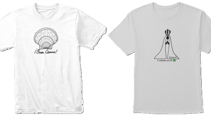
The Scallop Shell collection: The scallop shell, is linked to the Camino de Santiago and Saint James, but it became now a universal pilgrimage symbol, instantly identifying pilgrims on any route.
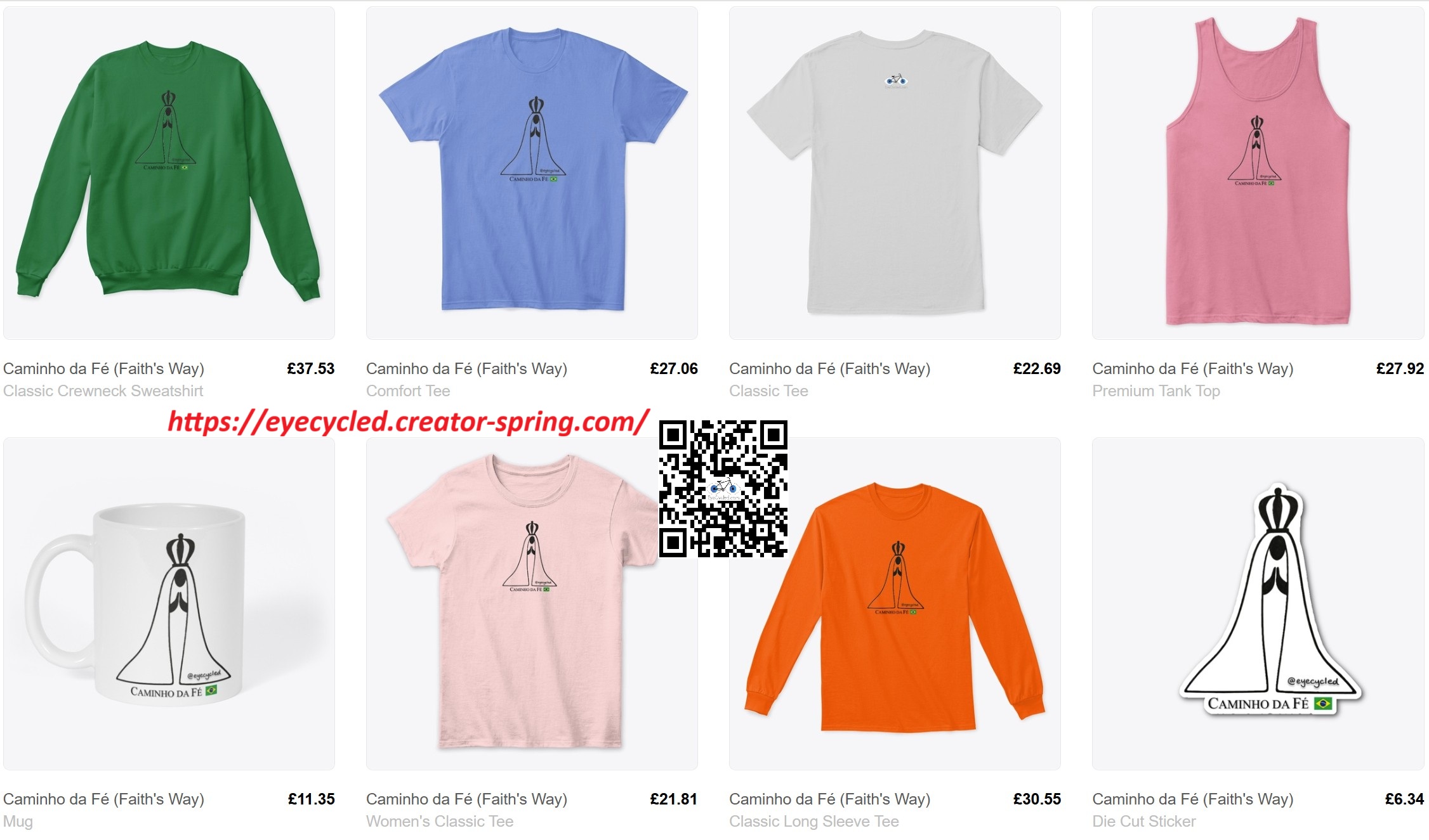
EyeCycled Store Caminho da Fé collection by EyeCycled
The “Caminho da Fé” (Faith’s Way) collection: The “Caminho da Fé” or Faith’s Way is Brazil’s best known pilgrimage route, so I don’t expect that a lot of non-Brazilians would be interested, yet the number of foreign pilgrims walking or cycling this route to the Basilica of Our Lady Aparecida, the 2nd largest in thr world, has been increasing year over year.
EyeCycled Store Caminho da Fé collection by EyeCycled
The collections include items like t-shirts, pullovers, a sticker, a mug and a few others.
They don’t come with Chinese merch prices because they are sold and managed by Spring, an American business who prints them to order and takes care of the entire end-to-end transactions. I only get a small commission from every sale.
If you like them and would like to proudly display the symbol of your pilgrimage, you’d be helping me maintain my Website/Blog running.
Blog post about the 8th and 9th day published during the journey on the 2n August 2016
This post complements the post I published on the 2 of September 2016 in which I described the experiences I had on the 7th of August 2016 while riding between Arc-en-Barrois and Langres, in France. I am not going to repeat the content of that post in this one again, but I will try to add a few highlights for each one of the stages below. I encourage you to read the previous post before continuing on this one.
As I mentioned in my earlier Blog Post, I had a terrible night in the tent and ready struggled to breath. I presume it was the humidity that built up inside the tent during the night that triggered my asthma and prevented me from falling asleep.
In addition to a bad night sleep I also left the camping ground quite late as the tent was completely wet on the inside, so I turned it inside-out and let it dry under the sun for about 30 to 45 min before packing it in the bag.
Goggle Maps guided me to a forest and other than having to lower the bike closed to the ground once to go under a barrier, it was an easy ride. I did have a strange encounter with what I believe was a small lost dog (a Dachshund “sausage” dog) in the middle of that forest, but as I explained this encounter in the earlier Blog Post, I am not going to repeat it here again.
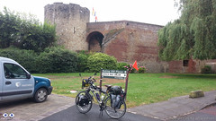
It was the right decision to stay in Arc-en-Barrois the night before as when I arrived in MormantI confirmed that it is a tiny village with just a few houses. There used to be an Abbey there where Sigeric allegedly stayed during his pilgrimage, but it is now in ruins. There are some historic plaques telling the story of the site.
There is nothing to do in Mormant, so after taking a few pictures I resumed the ride and a few kilometres later I met Nicholas from Lancaster, the very first Francigena pilgrim, after more than 600 Km and 9 days into the journey. I was so happy to see I wasn’t alone in this journey 🙂
He had left Canterbury on the 11th of July 2016 (nearly 3 weeks before I did) and expected to arrive in Rome by the end of October.
He told me that after his brother died, a few years earlier, he walked from Lancaster to Canterbury in his memory and there was when he heard of the Via Francigena. He was dedicating the pilgrimage to the memory of his niece, who 40 years ago was abducted (or went missing) right after birth. He says that even after all this time, his sister is still grieving for the loss of her girl, so he was taking her little hospital blanket with him to Rome. Just one of the many interesting stories along the way.
If you watch the video of my ride after Mormantyou’ll see that Google guided me to a point where the path was closed, so I had to make a “U-Turn” and that also meant I wasted some time.
As I arrived in Langres there was (obviously) a substantial hill to climb to get to town and I was already feeling very tired from the bad night sleep, so I looked for the Tourism Information Office and asked if there were pilgrim accommodation in town and they sent me to the “L’Abri du Pèlerin” (the Pilgrim Shelter), offered and maintained by the Catholic church, located nearby the Cathedral. It is a small place, only 2 rooms (although in the web site it says there is only 1). One room has 2 beds and was already occupied by a couple, the other 1 bed (the one I slept in). It has a bathroom and a kitchen and it cost €10 a night. There was no WiFi there.
It was Sunday and those that have been to France know that trying to find anything open on a Sunday is a challenge, but thankfully, as I arrived quite early, after a shower there was still time walk to the town centre where I found a mini-marked opened and buy some food which I prepared in the hostel.
As I was leaving the hostel to walk to the town centre that evening, the bells of the Cathedral started to ring and this is what they sound like.
I had a good night sleep there. It seems camping isn’t really my cup of tea.
If you have any questions, don’t hesitate to comment or send me a message through the contact form.
Please subscribe to my Blog and/or to my YouTube channel if you don’t want to miss the next one and help me spread the word by liking and sharing my Facebook Page and Tweeter feed also.
Thank you for your time!
Do you like these posts? Why, then, don’t you pay me a coffee to help with the blog hosting cost and as a caffeine incentive to keep me going through the long hours of the night?(Suggested amount: £2.00 or USD $3.00 or 2.50€ or whatever you want to give).
You may donate through my Patreon Page or through PayPal directly.
Please rate this post by clicking on the desired star (1 = Awful, 5
= Excellent)
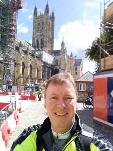
Yes, I know… you thought EyeCycled.com was only about cycling. Well, you are not wrong. This is an exception. Hopefully an interesting one. Still, if you only want to see cycling material on EyeCycled.com, then look at this post I wrote (opens in separate tab) when I cycled from Canterbury to Dover on the regional cycling route 16 on the 8th of June 2016.
While the workshop was great with some great presentations given by pilgrims who walked the Via Francigena and other routes, as well as insights into historical aspect of pilgrimage in Kent, this post is about the walking pilgrimage between Canterbury and Shepherdswell that happened on the 15th.
I will not write much here though… I will let the pictures do the talking…
IF…
… after seeing the pictures you are interested in knowing more about the historical significance of what you saw, I have added a number of online links below that you can visit to understand.
OK, there is a little part missing at the beginning, something like 1.3 Km, as I forgot to turn the tracking on when we left the cathedral. Adding this distance to the 23 Km tracked below you should expect to have to walk around 24 Km if you follow this route.
The Canterbury area has been inhabited since prehistoric times. Lower Paleolithic axes, and Neolithic and Bronze Age pots have been found in the area.
Canterbury was first recorded as the main settlement of the Celtic tribe of the Cantiaci, which inhabited most of modern-day Kent. In the 1st century AD, the Romans captured the settlement and named it Durovernum Cantiacorum.
The Romans rebuilt the city, with new streets in a grid pattern, a theatre, a temple, a forum, and public baths.
Although they did not maintain a major military garrison, its position on Watling Street relative to the major Kentish ports of Rutupiae (Richborough), Dubrae (Dover), and Lemanae (Lymne) gave it considerable strategic importance.
In the late 3rd century, to defend against attack from barbarians, the Romans built an earth bank around the city and a wall with seven gates, which enclosed an area of 130 acres (53 ha)....
Canterbury Cathedral is one of the oldest and most famous Christian structures in England. It forms part of a World Heritage Site. It is the cathedral of the Archbishop of Canterbury, leader of the Church of England and symbolic leader of the worldwide Anglican Communion. Its formal title is the Cathedral and Metropolitical Church of Christ at Canterbury.
Founded in 597, the cathedral was completely rebuilt between 1070 and 1077. The east end was greatly enlarged at the beginning of the 12th century, and largely rebuilt in the Gothic style following a fire in 1174, with significant eastward extensions to accommodate the flow of pilgrims visiting the shrine of Thomas Becket, the archbishop who was murdered in the cathedral in 1170. The Norman nave and transepts survived until the late 14th century, when they were demolished to make way for the present structures.
St Augustine's Abbey was a Benedictine monastery.
The abbey was founded in 598 and functioned as a monastery until its dissolution in 1538 during the English Reformation. After the abbey's dissolution, it underwent dismantlement until 1848. Since 1848, part of the site has been used for educational purposes and the abbey ruins have been preserved for their historical value.
St Martin's was the private chapel of Queen Bertha of Kent in the 6th century before Augustine arrived from Rome. Queen Bertha was a Christian Frankish princess who arrived in England with her Chaplain, Bishop Liudhard. King Æthelberht of Kent, her pagan husband, allowed her to continue to practise her religion by renovating (ca. AD 580) an existing church which the Venerable Bede says had been in use in the late Roman period but had fallen into disuse. As Bede specifically names it, this church was dedicated to Saint Martin of Tours, a city located near where Bertha grew up.
Patrixbourne is a rural English village south-east of Canterbury in Kent, mostly taken up by agricultural hills. Along with almost contiguous Bekesbourne to the north it makes up the civil parish of Bekesbourne-with-Patrixbourne in the City of Canterbury district
The village of Patrixbourne lies on the route of the Pilgrims Way, the trail that led untold thousands of weary medieval feet towards Canterbury Cathedral and the shrine of Thomas Becket. But the villge long predates the arrival of the pilgrims; at the time of the Domesday Book in 1086 there was a church and four mills in the village, then called 'Born'. The manor was in the hands of a Norman lord called Richard Patric, whose family came from the Calvados region of France.
Historically, Womenswold has been recorded with various spellings, including Wymynswold[2] and Wimlingswold.[3] A further one may be Wymelyngewolde [4]
The church of St, Margaret of Antioch covers all three hamlets, in Womenswold proper rather than the woodland, cereal and pasture fields within its bounds. A small mediaeval building without any side aisles, it is part of the Barham Downs group of churches.
The church building is unusual, in having no side aisles and a large Chancel, where services are usually held on the comfortable chairs that were installed in place of Victorian choir stalls.
Village social life centres on the local Grade I listed church 'Church of St Andrew', and the village hall which is hosts events including charity jumble sales and a pre-school playgroup. The village pub is the Grade II listed Bell by the village green, near to the church
St. Andrews Church occupies a site of continuing Christian worship since at least the Domesday Book, 1086. It was thought to have originally been a wooden Saxon Church that was replaced around the 12th century with the two-celled Romanesque church.
As you saw in the pictures above, we took the train back from Shepherdswell to Canterbury and the walked from the Canterbury East train station to the hall where the pilgrim’s feast was being celebrated. A celebration of medieval music, dances and food. It was good to be able to rest our tired feet, meet other like minded people, fill our bellies with delicious food and have fun.
You’ll find here a few pictures and some videos recorded during the pilgrims feast (none of them are in the YouTube channel).
If you have any questions, don’t hesitate to comment or send me a message through the contact form.
Please subscribe to my Blog and/or to my YouTube channel if you don’t want to miss the next one and help me spread the word by liking and sharing my Facebook Page and Tweeter feed also.
Thank you for your time!
Do you like these posts? Why, then, don’t you pay me a coffee to help with the blog hosting cost and as a caffeine incentive to keep me going through the long hours of the night?(Suggested amount: £2.00 or USD $3.00 or 2.50€ or whatever you want to give).
You may donate through my Patreon Page or through PayPal directly.
Please rate this post by clicking on the desired star (1 = Awful, 5
= Excellent)
Blog post about the 8th and 9th day published during the journey on the 22 of September 2016
This post complements the post I published on the 22nd of September 2016 in which I described the experiences I had on the 4th of August 2016 while riding between Brienne-le-Château and Arc-en-Barrois, in France. I am not going to repeat the content of that post in this one again, but I will try to add a few highlights for each one of the stages below. I encourage you to read the previous post before continuing on this one.
This was another long day in the pilgrimage, despite leaving Brienne-le-Château a bit later than I wanted to. I had opened the house in the morning to let some fresh air in and prepared my breakfast, so prior to leaving I had to make sure everything was the way I found it and then ride back to the tourism information office in town to return the key.
This day was a bit atypical in relation to the entire journey as I did not complete (or finished) a stage of the Lightfoot guide. That stage was stage 33, that according to the guide is between Châteauvillain and Mormant. Reason being when I arrived in Châteauvillain, around 4:30pm, I had to take the decision to stop there or continue to the next village in the guide (Mormant). I knew Mormant was a tiny village and looking at the list of accommodations, I also knew there would not be a lot of options of places to sleep. If I couldn’t find a place to sleep in Mormant, I would either have to wild-camp (not really my cup of tea) or ride another 30 Km to Langres, which would mean I would get there quite late in the evening. So I decided to take the safe route of riding to Arc-en-Barrois and, if upon getting there I couldn’t find or didn’t like any of the places to sleep I would then decide if I wanted to continue or not. I believe it was the right decision.
As I already wrote about the experiences of this day in the post I published on the 22nd of September 2016, I don’t think it would be productive to write the same thing here again. Some of the highlights of that post were the theme park in Dolancourt, the beautiful Clairvaux Abbey, the fact that the stamp for Châteauvillain in my pilgrim’s credentials was obtained from a news agent in town (the only business I could find open), the ride to Arc-en-Barrois through a beautiful forest and the arrival there (getting lost and riding 6 Km more than needed again) as well as setting up my tent, which is all captured in the videos below too.
So, before continuing on this post, I invite you to take a look at the post mentioned above (opens in a new tab) and come back to this post when done.
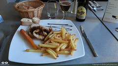
Oh, before I end this section of the post, when I arrived in Arc-en-Barrois, thankfully the Tourism Information Office was still open (which is quite unusual in France, considering it was a Saturday) and I was able to get my pilgrim’s credential stamped there. Right across the road from the office there is a very cosy hotel called Hotel du Parc, which I decided not to stay, as the rate there was above €60 for the night (against the €3 I was told I would have to pay in the camping site), but I end up going back for dinner that night as I could not find anything else open and I was starving. The meal and the beer were fantastic and the price was reasonable (€23).
Just as an unrelated footnote on this section, I have already published all the photos of this day’s ride in a Flickr album (link in the post mentioned above), but the pictures in that album are in a lower resolution because the computer I had with me during the pilgrimage struggled to process the watermark and get them uploaded. At the time I thought I would just upload them again when I came back in full resolution, but Flickr is no longer free now, so I have created an album in the EyeCycled Facebook page with the pictures (Facebook pictures and not high res either, but it is still free) and that is the picture gallery you will find down below.
You will also find below the pictures for every page in the Visitors’ book of the Pilgrims Hostel in Brienne-le-Château. I enjoyed reading the messages previous pilgrims left in the books and I thought so would you.
If you have any questions, don’t hesitate to comment or send me a message through the contact form.
Please subscribe to my Blog and/or to my YouTube channel if you don’t want to miss the next one and help me spread the word by liking and sharing my Facebook Page and Tweeter feed also.
Thank you for your time!
Do you like these posts? Why, then, don’t you pay me a coffee to help with the blog hosting cost and as a caffeine incentive to keep me going through the long hours of the night?(Suggested amount: £2.00 or USD $3.00 or 2.50€ or whatever you want to give).
You may donate through my Patreon Page or through PayPal directly.
Please rate this post by clicking on the desired star (1 = Awful, 5
= Excellent)
Blog post about the 6th and 7th day published during the journey on the 23rd August 2016
This post complements the post I published on the 23rd of August 2016 in which I described the experiences I had on the 5th of August 2016 while riding between Châlons-en-Champagne and Brienne-le-Château, in France. I am not going to repeat the content of that post in this one again, but I will try to add a few highlights for each one of the stages below. I encourage you to read the previous post before continuing on this one.
Departure time from Châlons-en-Champagne:Around 08:54h.
Arrival at Brienne-le-Château:Around 17:56h
Duration of day’s Journey: 8h 53min
Expenses this day:Total = € 45.33
€35.33 for food, incl. items bought in a market for breakfast next day.
€10.00 – Accommodation (Municipal Pilgrims’ Hostel of Brienne-le-Château)
Overnight Location:Pilgrims’ Hostel. You need to first go to the Tourism Information Office to pay the fee and get the key to the hostel. The office is located at 34 rue de l’Ecole Militaire 10500 Brienne-le-Château. Tel. : +33 03 25 92 82 41
This was a long day in the Via Francigena. I covered several stages of the Lightfoot guide and rode almost 90 Km. It wouldn’t be productive to write again about something I have already written in this blog post, therefore if you didn’t have a chance to read the previous post click on this link, read the post and jump back here as that post does not include any of the videos for this day.
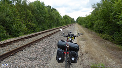
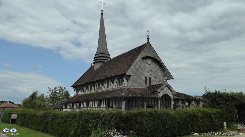
I will however mentioned again that if you are cycling this route using Google Maps for navigation, it is possible that the cycling route Google Maps will propose is the same one it did for me, in other words, along side the railway tracks after the tiny village of Arrembécourt (see video of stage 27). If you are travelling light and on a mountain bike, then that should be no problem, but if that isn’t the case and like mine your bike weights 50 Kg and is a hybrid or touring bike with touring tyres, then I would recommend that you continue the journey on the D6 towards Chavanges and take the D2 to Lentilles (the same one I took after the train track adventure). It’s a longer route, but stone free.As you arrive in Lentilles be sure to factor in some time to visit the 16th Century church built of wood and clay; the Church of St Jacques et St Philippe. Personally that small church had a bigger impact on me than many of the ostentatious cathedrals I have seen along the Via Francigena.
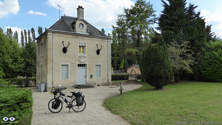
Another thing I want to mention before I finalize this text is the municipal pilgrims’ hostel in Brienne-le-Château and also how nice the lady in the tourism information office was to me. First of all, to stay in the pilgrims’ hostel you need to arrive in town at a time that the tourist information office is open, as you have to pay the fee and collect the hostel’s keys from there (although the hostel itself is about 2 Km away in the perimeter of town). Second, before going on the pilgrimage, like most people I did a lot of research about the route and the places to stay. I read in some blogs that some pilgrims thought the house to be haunted. I must confess, being the only pilgrim sleeping there that night made me apprehensive. The house is indeed a little spooky, but if there were other spiritual entities sharing the house with me that night they did not bother me. The house is old and used to be a hunters’ cabin so my guess is that, if there were to be any ghosts there, they would have been those of the animals that were killed (incl. the two deers whose heads are at the front wall of the house, assuming they are real)
If you want to see more pictures from this day, please take a look at my picture gallery (down below) from Flickr.
If you have any questions, don’t hesitate to comment or send me a message through the contact form.
Please subscribe to my Blog and/or to my YouTube channel if you don’t want to miss the next one and help me spread the word by liking and sharing my Facebook Page and Tweeter feed also.
Thank you for your time!
Do you like these posts? Why, then, don’t you pay me a coffee to help with the blog hosting cost and as a caffeine incentive to keep me going through the long hours of the night?(Suggested amount: £2.00 or USD $3.00 or 2.50€ or whatever you want to give).
You may donate through my Patreon Page or through PayPal directly.
Please rate this post by clicking on the desired star (1 = Awful, 5
= Excellent)
"I like to walk at my ease, and stop when I like. A wandering life is what I want. To walk through a beautiful country in fine weather, without being obliged to hurry, with a pleasant prospect at the end, is of all kinds of life, the one best suited to my taste.", Rousseau.
Blog post about the 6th and 7th day published during the journey on the 23rd August 2016
This post complements the post I published on the 23rd of August 2016 in which I described the experiences I had on the 4th of August 2016 while riding between Reims and Châlons-en-Champagne in France. I am not going to repeat the content of that post in this one again, but I will try to add a few highlights for each one of the stages below. I encourage you to read the previous post before continuing on this one.
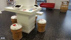
Champagne cork seats in Reims’ Tourist Information Office
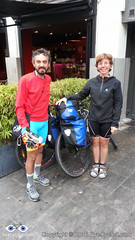
As I mentioned on the earlier post, I left Reims quite late because I walked to a nearby MacDonalds to have breakfast and to the Tourism Information Office to get my pilgrim’s credential stamped. On the way back I decided to go have a chat with a couple that was sitting with their bikes on a café and, confirming my suspicions they were also Francigena Pilgrims who started in Canterbury and were heading to Rome by bike.
Giovanni and wife were also cycling from Canterbury to Rome
The gentleman’s name was Giovanni. Unfortunately I forgot to write their names down and don’t remember the name of his wife anymore. I believe she was German, but I could be mistaken. They were, at that time, the first cycling pilgrims I had seen on the journey, so I was very happy to meet them, even though I thought it was going to be the last time I see them as they were following a different route. They were riding Mountain Bikes and decided for a rougher track. I was, however, wrong. As I arrived in Châlons-en-Champagne at the end of the day, guess who I met at the Tourism Information Office? Exactly! Small world. We then got our pilgrims’ credentials stamped and the address of the local youth hostel and decided to spend the night there.
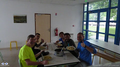
Myself in Yellow, David at my side. On the other side of the table, Fabio in blue and Giovanni and wife.
The Youth Hostel in Châlons-en-Champagne is very good. Typical hostel with rooms containing several bunk beds, but every thing was clean and tidy. There we meet other pilgrims and travelers, like David from Belgium, who wanted to walk all the way to Santiago de Compostela, and Fabio who was just cycling from Holland, were he lived with family, to his home town of Brindisi in Italy. Fabio had already bought some food on the local market and invited us all for dinner. A delicious pasta, that he cooked in the Youth Hostel’s guest kitchen.
After dinner we all went out for a walk around town and for some beers. It was a great evening in the company of some really nice people.
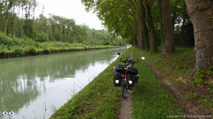
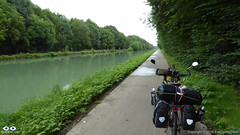
The journey from Reims to Châlons-en-Champagne was really beautiful, despite the rain and the risk of falling due to the slippery tyre grooves on the ground of the canal towpath.
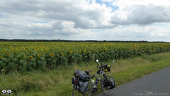
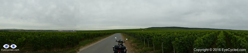
Champagne Vineyards on the way to Verzenay.
On the way to Verzenay I rode among the vineyards of champagne produces like Moet et Chandon, one of the most recognisable (and expensive) brands of Champagne. If was like being in the middle of a sea of grapes. I was tempted to eat a few off the trees, but they appeared to be too green. As in Verzenay, everything in Condé-sur-Marne was closed, so I couldn’t find any place to stamp my pilgrim’s credentials.
Those tyre grooves where my bike is standing were at times quite deep and with the rain quite muddy and slippery. Really beautiful ride though.Felt almost like I was riding on a “Cycling Autobahn”. Very smooth surface.
From Condé-sur-Marne to Châlons-en-Champagne was entirely done on canal towpaths as my bike was also heavy in the front (I had 2x 10 Kg panniers in the front) it wasn’t easy to steer quickly at times and the grooves were wet and narrow and had quite a bit of mud in them. The townpath eventually became a concrete paved cycle lane and I felt like I was riding on a “Cycling Autobahn”. It was one of the best cycle lanes I rode in life, completely smooth.
Although I covered less than 54 Km this day and despite the rain I had a great time cycling this track and would recommend it to everyone, pilgrim or not.
Please take a look at my picture album (down below) for this day in Flickr.
If you have any questions, don’t hesitate to comment or send me a message through the contact form. Please subscribe to my Blog and/or to my YouTube channel if you don’t want to miss the next one and help me spread the word by liking and sharing my Facebook Page and Tweeter feed also. Thank you for your time!
Do you like these posts? Why, then, don’t you pay me a coffee to help with the blog hosting cost and as a caffeine incentive to keep me going through the long hours of the night?(Suggested amount: £2.00 or USD $3.00 or 2.50€ or whatever you want to give). You may donate through my Patreon Page or through PayPal directly.
Please rate this post by clicking on the desired star (1 = Awful, 5
= Excellent)
This post complements the post I published on the 10th of August 2016 in which I described the experiences I had on the 3rd of August 2016 while riding between Tergnier and Reims, including the additional (and unnecessary, might I add) ride from the Auberge de Villequier, where I spent the night before, back to Tergnier . I am not going to repeat the content of that post in this one again, but I will try to add a few highlights for each one of the stages below. I encourage you to read the previous post before continuing on this one.
Starting a bike ride under heavy rain is always a challenge for me. Yet, I don’t mind if it starts to rain in the middle of the ride. Go figure!
The extra 15 or so Kilometres I rode to and from the Village of Villequier (Auberge where I stayed that night) should be deducted from the total distance to Rome. It was an unnecessary detour
The translation of the word “Auberge” (hostel) has different meanings in different languages. In Spanish (Albergue) those are the most common pilgrim accommodations along the Camino de Santiago. In French they are similar to a hotel. In Portuguese (Brazil) they are usually understood as being a shelter house for the homeless.
Be prepared to push your bike up to the cathedral / town centre in Laon. Very steep inclines.
Laon’s Tourist Information office is conveniently located right besides the cathedral. You can get your pilgrim’s credentials stamped there.
When leaving Laon, if using Google Maps to navigate, beware the App will lead you to a footpath which has very narrow restriction bars at the end. Thankfully, even with all the panniers and load on the bike, I’ve managed to get passed them by raising the bike vertically, but it wasn’t easy.
During a water rest at the church in Corbeny I looked at the guide and decided to skip Hermonville and ride straight to Reims. I wanted to stay in Reims and didn’t want to arrive too late there, so I could have a chance to walk around to city to get to know it a little. I think it was a wise decision, but that was, I believe, the last time I decided to skip a stage in the guide. It wouldn’t have taken me much longer to ride to Hermonville and from there to Reims.
The road to Reims was quite busy and no hard shoulder to ride on. Although I did not feel unsafe, I would advise caution. I am inclined to believe the Lightfoot recommended route is probably a better option in terms of vehicle traffic.
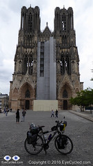
Reims is a city worth spending time. The cathedral is pretty amazing, even with all the scaffolding at the time. The city centre is lively with lots of things to see. The opera house (which I called a theater in the video) has some pretty interesting colour changing lighting in addition to being a very interesting building. Reims is also the French capital of Champagne and you will find references to it in many places like in the tourist information office. You can book visitations and Champagne tasting tours to many of the local producing houses. According to Wikipedia, Champagne ages in the many caves and tunnels under Reims, which form a sort of maze below the city. Carved from chalk, some of these passages date back to Roman times. The a look at the footage I recorded during my short walk around the city centre.
If you have any questions, don’t hesitate to comment or send me a message through the contact form.
Please subscribe to my Blog and/or to my YouTube channel if you don’t want to miss the next one and help me spread the word by liking and sharing my Facebook Page and Tweeter feed also.
Thank you for your time! (more…)
Please rate this post by clicking on the desired star (1 = Awful, 5
= Excellent)
Post about the 4th (and 5th) day of journey, published on 10th August 2016
This post complements the post I published on the 10th of August 2016 in which I described the experiences I had while riding between Péronne and Tergnier, including the additional (and unnecessary, might I add) ride from Tergnier to the Auberge de Villequier, where I spent the night. I am not going to repeat the contents of that post in this one again, but I will add a few highlights for each stage below. I encourage you to read the previous before continuing on this one.
To go or not to go? Woke up many times during the night to the sound of heavy rain. In the early morning I decided to wait in the tent to see if the rain would stop. It meant that by the time I was done with breakfast and packing it was past 11am in the morning, but I think it proved to be the right decision this time (aided by some weather forecast on the phone). Wasn’t really looking forward to packing my gear under rain. The rain resumed just after I left, so I guess I can consider it a lucky dry window, just long enough for me to pack my gear.
Château de Péronne
After leaving the Camping Site the first stop was at Péronne’s tourism information office in the town centre to collect a stamp on my Pilgrim’s Credential. As I was late I couldn’t really explore the town. As with many other towns and villages I’ve been through, Péronne looked like it would have been worth at least a few hours, if I had time to spare.
Again and again, Google Maps is good, especially to those like me that are “navigation challenged”. One problem for cyclists is that it tries, as much as it can, to guide the cyclists away from heavy vehicle traffic. Yes, this is good, but it also means it guides you to paths that during or after heavy rain might be very challenging to transpose. As I left Pèronne Google Maps instructed me to leave the “D” road I was to some dirt paths that were very muddy, only to guide me back to the same “D” road about 1.5 Km later. When you don’t know the way, the decision is not always easy. Overall Google Maps helped me more than it hindered me though.
The ride to Trefcon was uneventful and the village itself is tiny and it appeared to be completely deserted.
It rained basically all day that day (on and off) and after leaving Trefcon the route was mostly on good roads up to the town of Montescourt-Lizerolles, where Google Maps instructed to take a path alongside the railway. The terrain was somewhat challenging as the Swalbe Marathon tyres I have in the bike are not really suited for them. After overcoming the path, I decided not to follow the route Google had planned and take my chances on the major “D” road, the D1, that took me straight to Tergnier. The traffic was intense and the road had guard-rails and no hard-shoulder. I don’t recommend this route, but on hindsight I believe it was the right decision, albeit somewhat riskier than to stick (no pun intended) to the dirt paths.
Riding under constant rain is not really fun, but the main challenge, besides the muddy paths, was the strong wind which slowed me down considerably and took away the high visibility orange flag I had in th back of the bike. I arrived in Tergnier tired and feeling a bit ill, probably due to the wet conditions (I am slightly asthmatic and humidity is not a good thing for me). The town hall was closed, so I turned to Google again for a place to sleep and the 1st option Google gave me was a hotel / hostel in the nearby village of Villequier.
Dinner at the Auberge de Villequier
The concept of “nearby” changes when you are travelling on the bike though. It took me almost 1h riding in the wrong direction (as I found out the next day) to get there, but the Auberge is lovely and the owners were very nice to me. The room was small, but big enough to wash and dry my wet clothes and dry the tent and camping equipment. Also enjoyed a very nice meal that night, my personal reward for a hard day of cycling under rain.
Took very few pictures during the day. The rain was the biggest contributor to this, but in all honesty I did not feel like there were a lot of picture worthy moments anyway.
If you have any questions, don’t hesitate to comment or send me a message through the contact form.
Please subscribe to my Blog and/or to my YouTube channel if you don’t want to miss the next one and help me spread the word by liking and sharing my Facebook Page and Tweeter feed also.
Thank you for your time!
Please rate this post by clicking on the desired star (1 = Awful, 5
= Excellent)
VF post from 8AUG16, from Bruay-la-Buissière to Péronne
This post complements the post I published on the 8th of August 2016 in which I described the experiences I had while riding between Bruay-la-Buissière and Péronne. I am not going to repeat the contents of that post in this one again, but I will add a few highlights for each stage below. I would strongly encourage you to ready the August, 2016 post before continuing on this one, though.
Via Francigena can be just bike touring, of course, but if you want your Testimonium when you get to Rome, you have to present your pilgrim’s credential and it needs to have stamps in it. They do do a deep analyses of the stamps, but they will expect that in a 2,000 Km bike ride you will have collected a few. In the digital age is getting more and more difficult to find stamps… so analogical (illogical?). In many of the small towns and villages the chance of you to find a government facility (town hall, tourist information office, etc) will depend on the day of the week (Weekends? No chance) and the time of the day as some of these facilities will be closed, e.g. lunch time, or may have public opening hours. I really tried getting my pilgrim’s credential stamped but as it was the case in Ablain-Saint-Nazaire and others, as I got there I could not find anything open. Even the pharmacy was closed.
Arras is spectacular. Worth a visit if you can afford staying for a day. It’s a UNESCO World Heritage site and is more than 2,000 years old.
There is a “Route 66” café in Ervillers, between Arras and Bapaume, with a big statue of “the King” (Elvis). Coming across that reminded me of a friend who was about the ride the entire route 66 by bicycle. Her name is Cacá Strina. Check out her page here.
Don’t completely trust technology. Have always some low tech option to fall back if technology fails you. For some reason I lost GPS connection between Baupame and Péronne and I was relying on Google Maps entirely. At the very least download the offline maps over a WiFi connection, if possible, before you leave. Getting to Péronne was no problem, I simply follow the signs, but finding the Municipal Camping site took some time and effort (about 5 Km more than necessary).
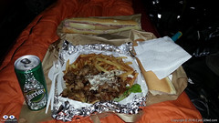
Tent Feast (Large Kebab Plate)
By the time I setup camp, had a shower and was ready to go out to find something to eat, the nearby supermarket in Péronne was already closed and after almost 30 min walking the only place I could find was a kebab trailer. So I ordered an extra large Kebab plate for dinner (and a baguette sandwhich for breakfast next day) and had a feast in the comfort of my tent. In small towns it may not easy to find a place for a meal at night. Keep that in mind.
Video of Lightfoot Guide Stage 14, From Bapaume – Péronne
Video Length: 5 min 38 sec To skip introductions and recommendations jump to time stamp 0:40 in the video timeline.
The next video is a time-lapse recording of my “awesomely akward” tent pitching skills. Took me “only” 20 min to pitch the tent. Thank God I don’t do this for a living… 🙂
In the municipal camping site of Péronne in France. Between the 3rd and 4th day of my Via Francigena pilgrimage. It raining a lot during that night and in the morning. Didn’t have a good night of sleept that day.
If you have any questions, don’t hesitate to comment or send me a message through the contact form.
Please subscribe to my Blog and/or to my YouTube channel if you don’t want to miss the next one and help me spread the word by liking and sharing my Facebook Page and Tweeter feed also.
Thank you for your time!
Please rate this post by clicking on the desired star (1 = Awful, 5
= Excellent)
"Life is a pilgrimage. The wise man does not rest by the roadside inns. He marches direct to the illimitable domain of eternal bliss, his ultimate destination", Swami Sivananda
This post complements the post I published on the 2nd of August 2016 in which I described the experiences I had while riding between Alembon and Bruay-la-Buissière. I am not going to repeat the contents of that post in this one again, but I will add a few highlights for each stage below. I would strongly encourage you to ready the August, 2016 post before continuing on this one, though.
Route:From the Rural Gite in Alembon to the Ibis Style Hotel in Bruay-la-Buissière via Licques, Tournehem-sur-la-Hem, Thérouanne, Amettes and Bruay-la-Buissière
Distance: 86.02 Km
Departure time from Alembon:10:29am
Arrival at Destination:5:58pm
Duration of day’s Journey:7h 29min
Expenses this day:Total = € 99.00
€30.00 – Food
€69.00 – Accommodation (Ibis Styles Hotel Bruay-la-Buissière)
Everything was going well, until… The unexpected, yes the unexpected again… By 9:30am I had packed everything and was ready to leave the Gite. I then realised my CatEye cycling computer was missing. Looked in the front bag, as I was certain I had put it there the night before. Wasn’t there, of course. Went back to the room and looked everywhere as I thought it might have fallen of the front bag during packing. Wasn’t there, of course. So all what was left was to look for it in the panniers, which were already neatly locked to the bike. Well, a pilgrim has go to do what a pilgrim has got to do. Looked for it in the front panniers as these were a lot easier to remove. Not there, of course. Took everything off the back of the bike again and looked in one pannier (not there, of course) and then the next, and bingo! It had fallen into the pannier as I was packing my things. I was happy not to have lost it, although I knew it was with me the night before, but the unpacking and packing took me almost 1 full hour. I didn’t do that mistake again…
Do not underestimate the SUN! The day before had been rainy and not particularly hot.
50 Shades of Red
I had seen on the phone’s Weather App that this day was supposed to be cloudy, but not rainy. It didn’t occur to me that I no longer was under British Weather. The day turned out to be very hot and sunny and I hadn’t passed any sunscreen on my skin. By the middle of the afternoon I was already feeling the damage the sun had done to my skin, which now looked very burned. The sunscreen was on the very bottom of one of my rear panniers. I should have stopped and passed the sunscreen on, but the thought of removing everything on the back of the bike (I had an intricate system there) was not appealing, so I continued. By the time I realised my mistake it was too late. The result was some heavy sun burns and sun fever by the time I got to Bruay-la-Buissière. As it was Sunday I knew it wouldn’t be easy to find accommodation and I wasn’t feeling very well so I used Google Maps to show me the available hotels nearby and the most affordable was the Ibis Style hotel 5 Km away from the town centre.
Video of Lightfoot Guide Stages 10, From Amettes to Bruay-la-Buissière
Video Length: 6 min 05 sec To skip introductions and recommendations jump to time stamp 0:48 in the video timeline.
The next video was recorded as I was crossing the town of Marles-les-Mines, between Amettes and Bruay-la-Buissière and their Folkloric group parade was about to start at the town’s FÊTE FORAINE.
If you have any questions, don’t hesitate to comment or send me a message through the contact form.
Please subscribe to my Blog and/or to my YouTube channel if you don’t want to miss the next one and help me spread the word by liking and sharing my Facebook Page and Tweeter feed also.
Thank you for your time!
Please rate this post by clicking on the desired star (1 = Awful, 5
= Excellent)


You must be logged in to post a comment.