<- Previous Post (Day 1) | Next Post (Day 3) ->
"Curiosity does, no less than devotion, pilgrims make", Abraham Cowley.
-
- Introduction (this is the same as on previous posts, so skip to next section if you’ve already seen it)
- The statistics and metrics of the day
- Stage 04: From the Bishops Table Hotel in Farnham to St.Catherine’s Village in Guildford.
- Stage 05: From St. Catherine’s Village in Guildford to the National Trust’s Box Hill Stepping Stones
- Stage 06: From the National Trust’s Box Hill Stepping Stones to the Feathers Hotel in Merstham
- Stage 07: From the Feathers Hotel in Merstham to the Chalkpit Lane in Oxted
OK, if this is the first Pilgrim’s Way post of mine that you are reading, I’d recommend you go back a little and read my Introduction to the Pilgrims’ Way blog. There are a few things I explain there that I don’t here and this post might look confusing if you don’t know these things beforehand (e.g. why 15 stages?).
This post is all about the second day of the pilgrimage – but do take into consideration I was cycling, so if you are walking it is likely you’ll cover much less ground than me! In this one day I covered stages 4, 5, 6 and 7 and I describe them separately here. The section below provides the statistics for the full day, but in each video, there are some statistics for each one of the stages such as distance and time.

I reckon that the videos show the route and the difficulties quite well, despite being so speeded-up. You can pause them for more detail or reduce the playback speed in the YouTube interface, if you don’t mind watching it for a longer time (if you do this, don’t forget to mute the video to avoid hearing a slowed-down version of the music!).
Also, bear in mind that this pilgrimage was undertaken during the pandemic and that, although some restrictions had been lifted in the UK in August/September, many places, such as small community churches, were still closed.
Statistics and metrics of the day
All of the details below are in my Pilgrims’ Way Google Sheets Spreadsheet.
- Date: Tuesday, 1 September 2020
- Route: From the Bishops Table Hotel, Farnham to the Days Inn Hotel at the M25 Clacket Lane Service Station near Westerham.
- Distance: 77.81 km
- Departure time from Winchester: Around 9:30h.
- Arrival at Farnham: Around 20:30h.
- Duration of day’s Journey: 11h 04min
- Expenses this day: Total = £57.57
- £22.47 for food.
- £35.10 – Accommodation
- Overnight Location: Days Inn Hotel at the M25 Clacket Lane Service Station near Westerham, Kent, England. ✆ +44-844-2250772
- Type of Accommodation: Hotel
- Walking the Pilgrims’ Way Guide (Leigh Hatts) Stages:
- Physical and Body Stats: Link to the Garmin Connect Page for this ride
-
- Duration (elapsed time): 11h 45min
- Moving time: 11h 04min
- Average Speed: 7 km/h
- Average Moving Speed: 13.4 km/h
-
- Max. Speed: 65.1 km/h
- Total Elevation Gain: 1,253 m
- Average Heart Rate: N/A
- Max. Heart Rate: N/A
- Calories: 2,566 CAL (Est.)
-
Stage 04: From the Bishops Table Hotel in Farnham to St.Catherine’s Village in Guildford
If you haven’t done so already, please watch the video first and then read this blog for more detail! I didn’t want to include all this information in the video voiceover because it would have added too much to the length of the video (which is 10’31″).
The picture below was used in the video and I hope will help you make more sense of the text below.

Katy left the hotel about 1h before I did. The destinations was Guildford for both of us, but as she had a train to catch and a time to get home for her first professional engagement that day, she took a more direct route to Guildford’s the train station while I continued on the Pilgrims’ Way.
After retrivieng my bike from the hotel’s shed (it does fit 2 bikes easily… more than two might be a bit of the squezze though), I set out on my way. Because of the Covid restrictions the hotel wasn’t offering breakfast to its guests, but I thought I’d find a place to have breakfast along the way. Easier said than done in times of lock-down.
It was a beautiful day and getting out of Farnham is very easy. As you can see in the video immediatelly after crossing the A31 (after the bridge where I took the pictures of the flowers), the Pilgrims’ Way route took me to Darvills Ln which is already way marked as being a part of the North Downs Way. At the end of Darvills Ln I found myself at what appeared to be the gate of a property I reluctantly entered as it was a clear public footpath that led to a small bridge after a little gate. I am not sure what to advise future cycling pilgrims here. If I write my Pilgrims’ Way cycling guide I will try to find an alternative, as after the bridge the bushes on the path get a bit too dense to make it a comfortable ride. I didn’t see any “No Cycling” sign, but it is just a bit of common sense. Regardless, this path will lead you back to the A31 Farnham-bypass road which you’ll have to cross. I don’t recommend you ride on the A31 as traffic is extremelly intense and there are no hardshoulders, but there are low traffic roads inside of Farnham that lead to this point as well.
After crossing the A31 I got a bit lost at Guildford Road as I was supposed to take the underpass (subway passage) to Park Ln but crossed to the other side of the road instead (you’ll see it in the video). I quickly realised my mistake and back-tracked a few meters, taking the underpass and finding myself right in front of the Shepherd & Flock pub, where you should keep to the right. The path leads to, what I suspect, might be a small farm, but I do believe there is still right of passage there. There is a closed gate, but the gate has an open passage to the left to get through. After the gate you’ll find yourself first on Rock House Ln and then on Guildford Road where you’re going to pass the Princess Royal pub on the left (good food, been there before) and continue on the direction to Runfold and Seale (on Seale Ln).
Arriving in Seale I tried to enter St Lawrence’s Chruch, but it was unfortunatelly closed. Right after the church there is a war memorial and I thought it was the perfect and quiet spot to fly the drone and capture some aerial footage of the church and the path ahead / behind. Katy did the voice-over about Guildford, in the distance, and St Lawrence’s Chruch at this point and I personally believe that, in addition to the nice views from above, her explanations are very interesting and spot on. You should watch this part at least, even if the rest of the video might not be that interesting to you 🙂
After Seale you’ll continue on the Puttenham Rd, which eventually becomes Seale Ln again (I know… the English have a distinct pleasure in making everyone confused with their road naming system – or the lack thereof) passing by St John the Baptist Church (where I stopped to take some pictures) towards the Puttenham Golf Club which you’ll enter as the North Downs Way squezzes between it’s fields on the right the small farms on the left. This portion of the Pilgrims’ Way is beautiful, but you should be aware on dry summer periods you may find several patches of sand banks which make cycling challenging (I presume it will be quite muddy in winter too)..
I left the North Downs on an appropriatelly named Sandy Ln, but on hindsight I think I could have continued on the North Downs. Sandy Ln will lead you to the destination of this stage, which is St Catherine’s village, belonging to the town of Guildford. This stage ends at the Ye Olde Ship Inn Pub where pilgrims can rest and have some refreshments (closed at the time of my pilgrimage).
The picture gallery below shows the pictures taken by Katy and me along this stage. Click on any picture to enlarge.
I hope you enjoy the video and the photos.


Stage 05: From St. Catherine’s Village in Guildford to the National Trust’s Box Hill Stepping Stones
If you haven’t done so already, please watch the video first and then read this blog for more detail! I didn’t want to include all this information in the video voiceover because it would have added too much to the length of the video (which is 13’46”).
The picture below was used in the video and I hope will help you make more sense of the text below.

As you might have heard in the video of Stage 4 during the drone footage at St Lawrence’s chruch in Seale, when Katy told you about the town, Guildford is one of the largest towns along the Pilgrims’ Way. It has 80 thousand residents and stage 5 starts in St Catherine’s village in the outskirts of the town. The first landmark you reach is the crossing over the river Wey. The pedestrian bridge has a few steps, which means you’ll likely have to push your bike up and down the bridge as you can see in the video above and in the pictures below. Its a really peacefull corner of Guildford that I didn’t know existed until then.
After the bridge you’ll find yourself riding on the fields of Shalford Park to get to the Pilgrims Way, which in this case is the name of the road you take. It was at the corner of Pilgrims Way and the A281 (Shalford Rd) that I took the picture of the Pilgrims Way road sign with my bike to the right. I used that picture at the start of all Pilgrims’ Way videos I made.
You’ll ride (or walk) on Pilgrims Way for only a few hundred metres until you reach Shepherd’s Way, which I missed and had to back-track a few metres. At the end of Shepherd’s Way you will enter the dirt track of the North Downs Way which is really beautiful and will present you with views of forest tracks, rural landscapes, horses and nature in general. If you’re cycling, please be careful as there are deep sand-banks in places where cycling is not possible or very treacherous (many horse riders and dog-walkers along this path as well). After you cross Halftpenny Ln and continue on the North Downs Way, you’ll have a climb through a path of woodland to reach the Church of St Martha-on-the-Hill, which I really recommend that you take your time to appreciate, specially the views. I regret not having flown my drone in this location as this is one of the most interesting chruches along the Pilgrims’ Way (imho) given its somewhat remote location. The altitude will allow you to see very far and perhaps let your inner child enjoy the rope swing hanging from a tree branch, but make sure it can sustain your weight 🙂 (I also regret not having tried it myself).
Unfortunatelly the church was closed due to the covid restricitions at the time, but I know they have a purpose made stamp for Pilgrims’ Way pilgrims, so take the opportunity to get your pilgrim’s passaport stamped as well.
The descent from St Martha’s Hill was very mountain-biking like, which was fun, but be careful as there are patches of sand and lose rocks along the way. Zooming in on this spot you’ll also notice that my track and the walker’s track diverge a little on the descent until they reach Guildford Ln, but you’ll soon enter a single-track which will lead to some farm fields which are perfectly rideable. If you continue on the single-track following the walker’s path you’ll reach a locked gate with a stile I would not recommend overcoming, so I had back-track a few meters and diverge to the A25, which, despite the heavy traffic, has a small pedestrian footpath on the right. My navigation software lead me to another closed gate in what appeared to be private property (it was probably trying to make me re-join the the original Pilgrims’ Way path), so I just continued on the A25 turning right at Upper Street and then Chantry Ln where you’ll cross a Ford and get to a footpath gate clearly marked with a “No Cycling” sign. I was nearly back-tracking or considering pushing my bike when I realised there was another track a few metres up with a cemitery to the right. It doesn’t seem to be on any map, but it was on the downloaded walker’s track. There were no signs that I should not cycle on it, so I took it, and surprisingly that path led me to a road called “Pilgrims Way” again. You’ll find “Pilgrims Way” roads in many different places along the Pilgrims’ Way route, probably remnants of the ancient pilgrims’ track. This is in the village of Shere and you’ll take a few more single-tracks to reach the village of Gomshall.
As I arrived in Gomshall it was already 14:00h and I was really hungry, not having had anything to eat that day. That’s when I rode pass the Compasses Inn and decided to stop for a bite in their beatiful river side beer-garden (this is the River Tillingbourne, the same you crossed over on the Ford in Shere). I had a delicious veggie-burger and I totally recommend it to you.
I left the Compasses Inn after about 45 min and continued following the Walkers’ path only to reach a set of kissing gates too narrow to fit my bike trhough, so I had to back-track once again, riding past the Compasses Inn again on the A25, under the railway bridge until I reached Beggars Ln which is a long climb that forced me to push the bike up through most of it (I blame it on the veggie-burger 😉 but, seriously, it was difficult terrain with sand and deep erosion cracks in places). Once you’re done climbing, the path through the woods becomes flat and leads you to Ranmore Common Rd. This road will lead to the St Barnabas Church where I did take the opportunity to fly my drone again and where Katy did some wonderful commentary on the video. I particularly like the reference she made to the Bishop of Guildford calling it a “cathedral in the woods”. Well worth watching, if you ask me.
After St Barnabas Church you’ll pass by the vineyard fields of the Denbies Wine State which Katy also references in the video. To me, I felt like I was somwehere in France, having riden my bike through the vineyards of the Champagne region in France on my way to Rome during my Via Francigena pilgrimage of 2016. Take your time to enjoy the sights.
The final descent will lead you to the A24 which is really tricky and dangerous to cross due to the extreme high-traffic, please be careful. Once you cross it you’ll find yourself at the car park of the Box Hill Stepping Stones, where this stage ends and it is one of the main natural landmarks of the Pilgrims’ Way.
The picture gallery below shows the pictures taken by me along this stage. Click on any picture to enlarge.
I hope you enjoy the video and the photos .


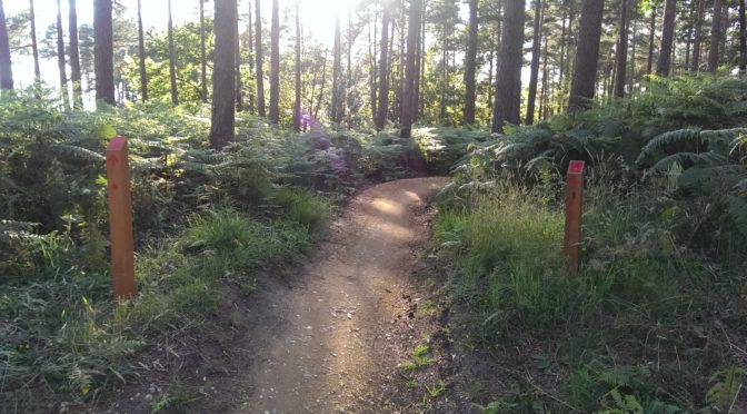
Stage 06: From the National Trust’s Box Hill Stepping Stones to the Feathers Hotel in Merstham.
If you haven’t done so already, please watch the video first and then read this blog for more detail! I didn’t want to include all this information in the video voiceover because it would have added too much to the length of the video (which is 14’53”).
The picture below was used in the video and I hope will help you make more sense of the text below.

This stage was, without a doubt, one of the most challenging (if not the most) of the entire journey.
As you can see straight from the start of the video (after my little speech at the beginning), the footbridge has steps, but these steps are really a child’s play in relation to the steps up Box Hill (nearly 300 in total). Lack of attention on my part made me miss the right turn my navigation software was telling me to take. I was really tired and not feeling very demotivated at the moment and climbed a lot more steps than I needed to (I probably did about 200 of the 300 steps when I needed to climb only about 100). “Here you do, here you pay” as per a Portuguese Proverb. I could have removed this portion from the video, but I decided to keep it in for your amuzement.
After all the bike pushing ordeal, I reached a kissing gate too narrow for the bike to get through. Ordinarily I would try to find an alternate route, but this was not an ordinary moment. Thankfully as I was removing my panniers to lift the bike over the gate on my own a runner arrived and he was more than happy to give a helping hand. There are good people on this Earth. After that I thought to myself “That’s it! No more bloddy kissing gates“… yeah, right mate… I didn’t quite follow that, I’m afraid.
At least at the beginning I did put in practice my new “no more kiising gates” resolve, as when I got to the Box Hill Rd the walker’s path pointed to a field with a kissing gate, which I promptly declined to take and continued down on Box Hill Rd turning left at Old Reigate Rd and joining the A25 (Reigate Rd) a little later. I did make an attempt to re-join the walker’s path at Chalkpit Ln (you’ll see this name again in other places) when I found it just to be another dead end (a local resident told me there was no way through, unless I wanted to cross some people’s gardens, which I obviously wouldn’t). Back on the A25 I rode to the next round-about and took the first exit to the left on the B2032 toward Betchworth Station and then re-joined the walker’s path about 1 km later. If you do take the same route, please be careful as these roads are narrow have no cycling/pedestrian paths and traffic is intense.
Once I re-join the walker’s path on a single track, guess what? Another kissing gate! That was how long my resolve of “no more kissing gates” lasted. Thankfully it was one that I could easily overcome with the bike, so I decided to continue on that track. Met a few local cyclists on that path which indicates it is used for cycling as well, however, there are footpaths on which I decided to just push my bike out of respect for the rules. This portion of the Pilgrims’ Way will take you up Reigate Hill, so there was a lot of pushing the bike in places, up to the Inglis Memorial where I arrived just as the sun was setting. Reigate Hill is similar in elevation to Box Hill, just not as steep. Just before the Inglis Memorial I recorded a video explaining the situation and that I was going to abandon the Pilgrims’ Way in favour of an urban route. I recorded another video at the Reigate Hill car park where Komoot re-routed over to Gatton Bottom instead of going through Gatton Park and the Golf Course the get to the final destination of this stage which is, according the the guide, Quality St. I set my stage’s end to be at the Feathers Hotel in Merstham as it stands right at the corner of Merstham High Street and Quality St, so a very good approximation of where I would have ended had I stayed on the walker’s route.
The picture gallery below shows the pictures taken by me along this stage. Click on any picture to enlarge.
I hope you enjoy the video and the photos.


Stage 07: From the Feathers Hotel in Merstham to the Chalkpit Lane in Oxted
If you haven’t done so already, please watch the video first and then read this blog for more detail! I didn’t want to include all this information in the video voiceover because it would have added too much to the length of the video (which is 3’47”).
The picture below was used in the video and I hope will help you make more sense of the text below.

As stated in the video above I have no footage recorded for this stage (or at least quality footage I could use). As I arrived at the Feathers Hotel in Merstham, it was already getting dark and I still had at least another 20 km to ride to the place I was staying that night, the Days Inn Hotel near Westerham at the M25 Clacket Lane Service Station. So, I stopped recording shortly after, but in order not to have a break in the series I’ve put together this short Google Earth Fly-Along video animation showing the downloaded Walkers’ route compared to the route I took to the hotel that night.
A brief explanation is given by me at the start of the video. I apologise for the gap, but a pilgrimage, like any other outdoor adventure, is full of surprises and the unexpected adds spice to the experience.
According to Leigh Hatts’ “Walking the Pilgrims’ Way” guidebook, this stage is 12.8 Km long for pilgrims walking on the traditional walkers’ path. If I ever get to do this stage on a bike in the future I’ll add it to the series also.
As you would expect, I was pressed for time and it was getting really dark so I didn’t stop to take any pictures along the way.
<- Previous Post (Day 1) | Next Post (Day 3) ->
If you have any questions, don’t hesitate to comment or send me a message through the contact form.
Please subscribe to my Blog and/or to my YouTube channel if you don’t want to miss the next one and help me spread the word by liking and sharing my Facebook Page, Instagram and Tweeter feed also.
Thank you for your time!
Do you like these posts? Why, then, don’t you pay me a coffee to help with the blog hosting cost and as a caffeine incentive to keep me going through the long hours of the night? (Suggested amount: £2.00 or USD $3.00 or 2.50€ or whatever you want to give).
You may donate through my Patreon Page or through PayPal directly.
![]()
 Infelizmente este “post” não está disponível em Português. Meu tempo é muito limitado e a tradução, preparação e publicação de um post deste genero necessita várias horas de trabalho.