This is the 11th post on a series about the Via Beata pilgrimage by bike concluded on the 3rd of August 2021.
This post has been written in English only. For other languages, please use the Google Translation drop-down option on the right menu (desktop version).
<- Previous Post (Day 9) | Next Post (Day 11+) ->
- Promote the cycling video for this day of the journey.
- Provide an overview of the route and allow for the download of a “cleaned-up” version of the GPX track we rode on this day of the journey’s.
- Provide the link to the written account for this day of the journey in Katy’s Blog.
- Provide the gallery of photographs that Katy and I took on this day of the journey.
- Provide links to useful online resources about this day of the journey.
- Provide a communication channel to enable readers and interested parties to ask questions or drop us a message through the blog.
1. The Video for this day of the journey
The 31m 48s video below was recorded between Tregaron and Llechryd on the 3rd of August 2021.
2. The route we cycled on this day of the journey
The map below shows a “cleaned-up” version of our route between Lowestoft and East Harling on this day. By “cleaned-up” I mean, where I considered necessary, I edited the “real-life” track to exclude some of the mistakes or issues we encountered along the way, such as navigation errors, closed gates or other impassable obstacles (with a bike), etc. The objective being to prevent you from making these same mistakes or benefiting from the experience we acquired while riding on this route. Keep in mind everything changes… life is dynamic, roads and paths are closed for maintenance or become impassable for a number of reasons, access to certain locations may become restricted, etc. Use it at your own risk.
In addition to the raw GPX route shown in the map above, which you may download through the link below the map, I have also created a Google Maps version of the entire route in the EyeCycled Google Account.
To visualise the Google Map of the Via Beata route and main Waypoints please click on the link below (opens in a new tab).
https://www.google.com/maps/d/edit?mid=1mKIjBROBR1o6IiHTRx0Mh6dNUSpa7oc&usp=sharing
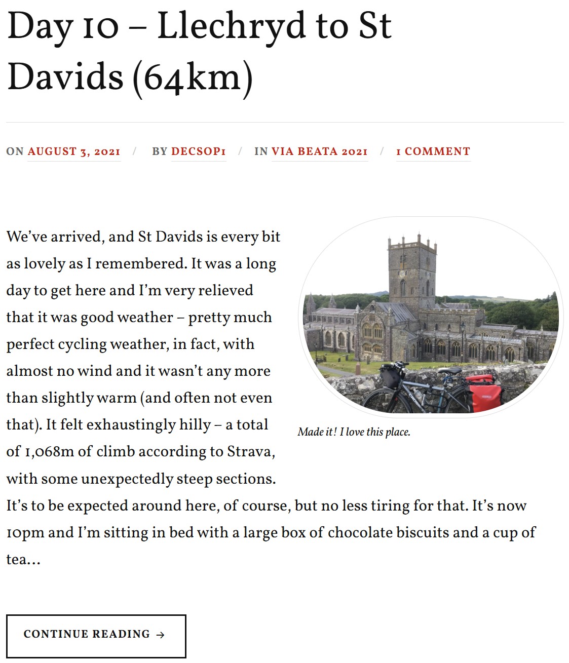
3. Katy’s written account of the day
Please click on the picture below to be taken to her blog post.
4. Photo-Gallery
A picture is worth a thousand words.
These are the pictures we took on this day of the journey. Where possible we provided some context in every picture taken. These pictures are not to be sold or used without prior consent.
Click on the thumbnail to expand picture and read about that moment. The navigation numbers below each gallery refer to the number of viewable pages in the gallery.
Day 04 Photos (Fourth day of the 10 days journey)


5. Links to useful online resources for this day of the journey.
We are giving you our experiences here for free, but it is up to you if you want to replicate them or not. Each journey is different and you may want to plan a custom one for you. Hopefully some of your journey may match ours, but for any portions that don’t these are useful online resources for this day.
| # | Resource Link | Description |
|---|---|---|
| 1 | The Flambards Hotel in Llechryd, Wales. | This is the Hotel we departed from on this day of the journey. We enjoyed our stay here and have no issues recommending it to you. |
| 2 | National Trust website about the Cilgerran Castle | The first castle on this site is thought to have been built by Gerald of Windsor between 1110 and 1115, and it changed hands several times over the following century between English and Welsh forces. The stone construction of what is left today began in 1223 under William Marshal, the 2nd Earl of Pembroke. It was abandoned by 1400 and left to ruin. |
| 3 | Wikipedia page about the Cilgerran Castle | As per above. |
| 4 | The Ffald y Brenin religious retreat | The Ffald y Brenin religious retreat, is a Christian retreat centre & house of prayer for Wales and all nations. Hundreds of visitors come to visit or stay every year. They have simple accommodation available but you'll need to pre-book and because it is a religious retreat you'll be expected to adhere to their daily routine of peace and quiet and perhaps also participate in their daily prayers. Keep this in mind if you are not a religious person. |
| 5 | Way-Station: The Cross, Flald-y-Brenin. | This was the last way-station of our pilgrimage. It is located at the Ffald y Brenin religious retreat and is a simple cross at the top of the hill and one interesting aspect of it for those who have done the French Camino to Santiago de Compostela is that is reminiscent of the Iron Cross between Foncebadón and Manjarín in Spain. |
| 6 | Wikipedia page about the St Davids Cathedral | St Davids cathedral was the destination of our pilgrimage. There is no rule that says it cannot be the start, but we believe most pilgrims do the Via Beata from East to West. |
6. How to get in touch with us
The easiest way is to use the form below and send us a message, but you can also leave comments both here as well as in YouTube or our social media accounts. Keep in mind we do this as a hobby, not as a job, so our responses might be delayed. We aim to provide a response within a week, but it can happen that we are travelling or otherwise unavailable for longer than that. If you didn’t receive a response within 2 weeks, but send us a follow-up message.
<- Previous Post (Day 9) | Next Post (Day 11+) ->
Do you like these posts? Why, then, don’t you pay me a coffee to help with the blog hosting cost and as a caffeine incentive to keep me going through the long hours of the night? (Suggested amount: £2.00 or USD $3.00 or 2.50€ or whatever you want to give).
You may donate through my Patreon Page or through PayPal directly.
![]()


You must be logged in to post a comment.