
This is the 1st post on a series about the Via Beata pilgrimage by bike concluded on the 3rd of August 2021.
This post has been written in English only. For other languages, please use the Google Translation drop-down option on the right menu (desktop version).
| Next Post (Day 01) ->
- Promote the introduction video to the Blog.
- Provide an overview of the route and allow for the download of a “cleaned-up” version of the GPX track we rode from Lowestoft to St. David’s.
- Explain what the Via Beata is.
- Explain how this series will be presented and made publicly available to you.
- Provide the galleries of photographs that Katy and I took along the way for each day of the journey.
- Provide links to useful online resources in case you are considering walking on cycling this pilgrimage yourself.
- Provide a communication channel to enable readers and interested parties to ask questions or drop us a message through the blog.
1. The Introduction Video
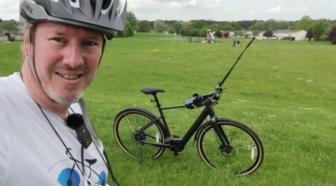
The 7m 30s video below was recorded at the Ness Point, the UK’s most easterly point, in Lowestoft on the 24th of July 2021.
2. The route we cycled
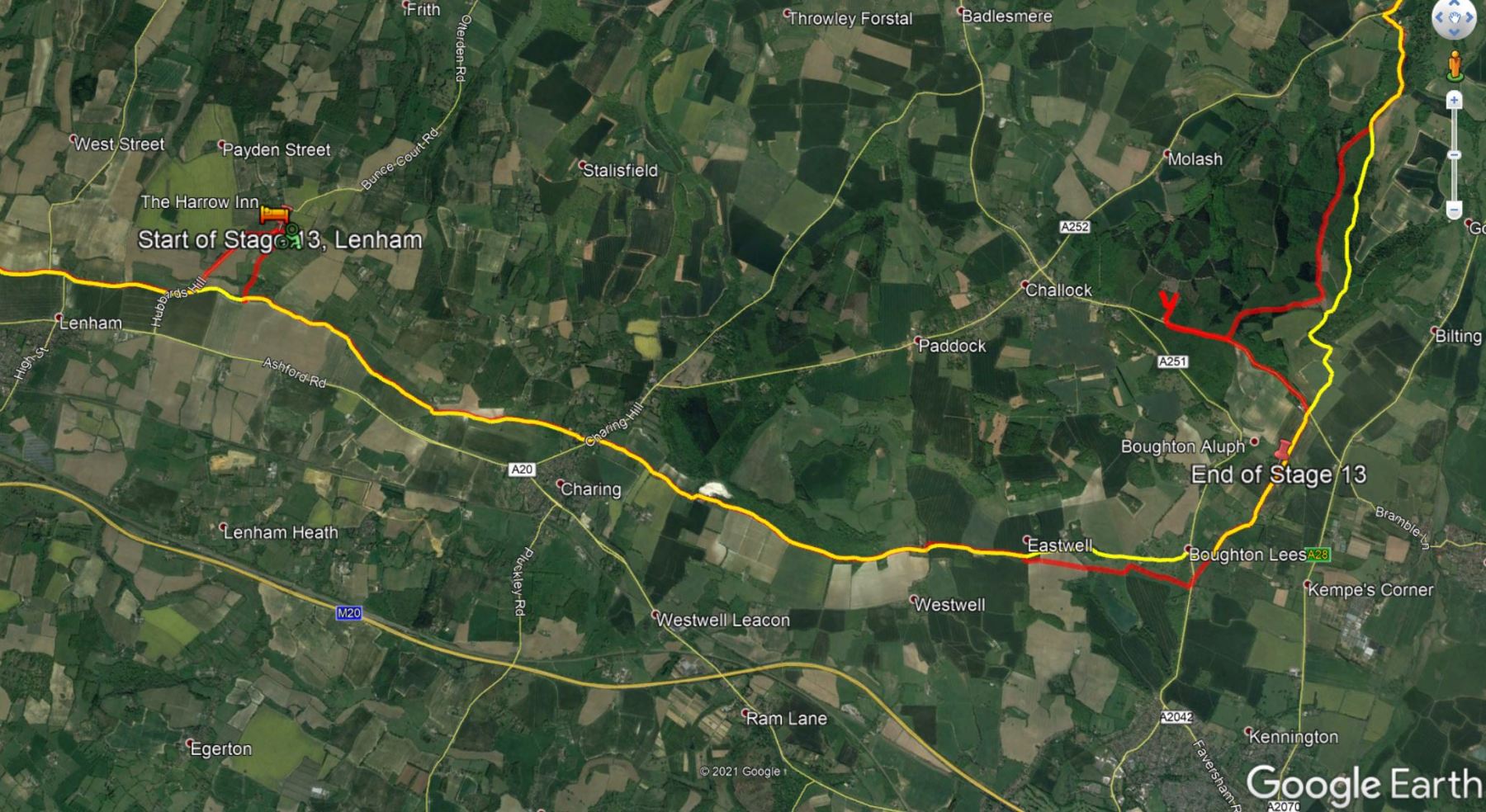
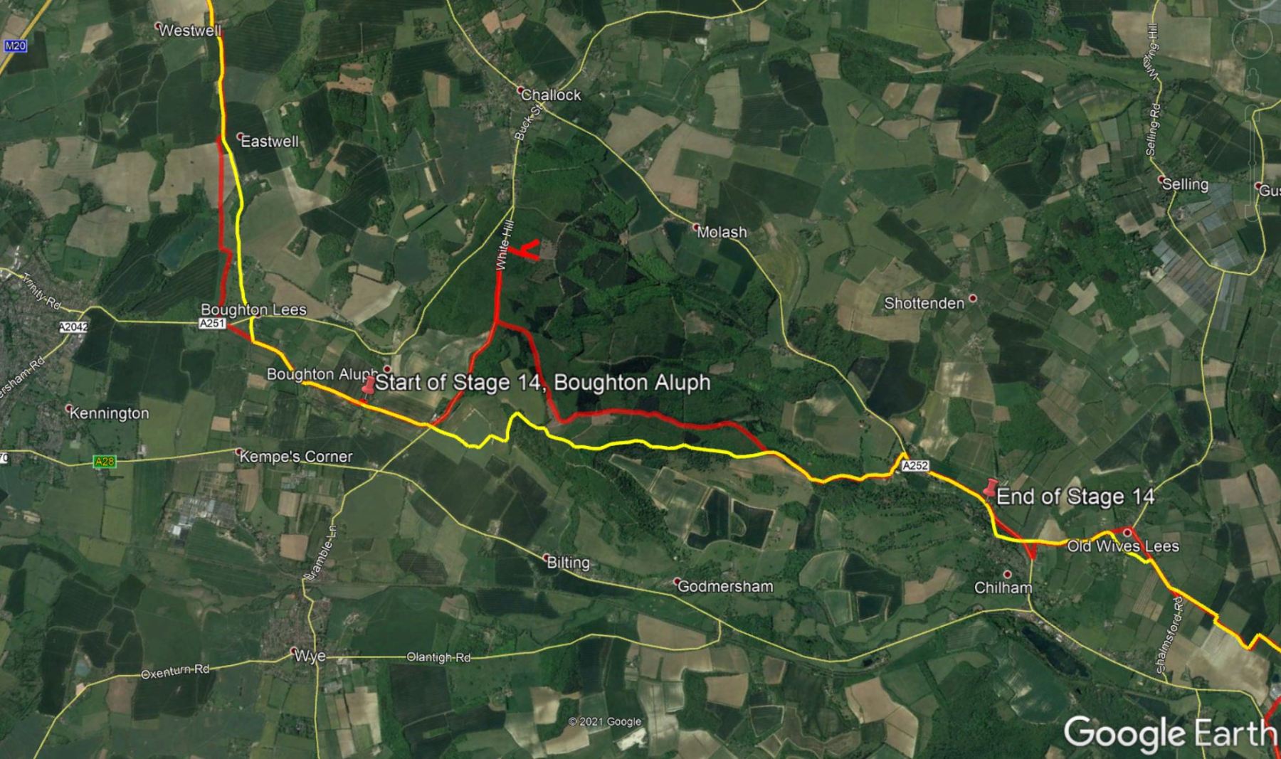
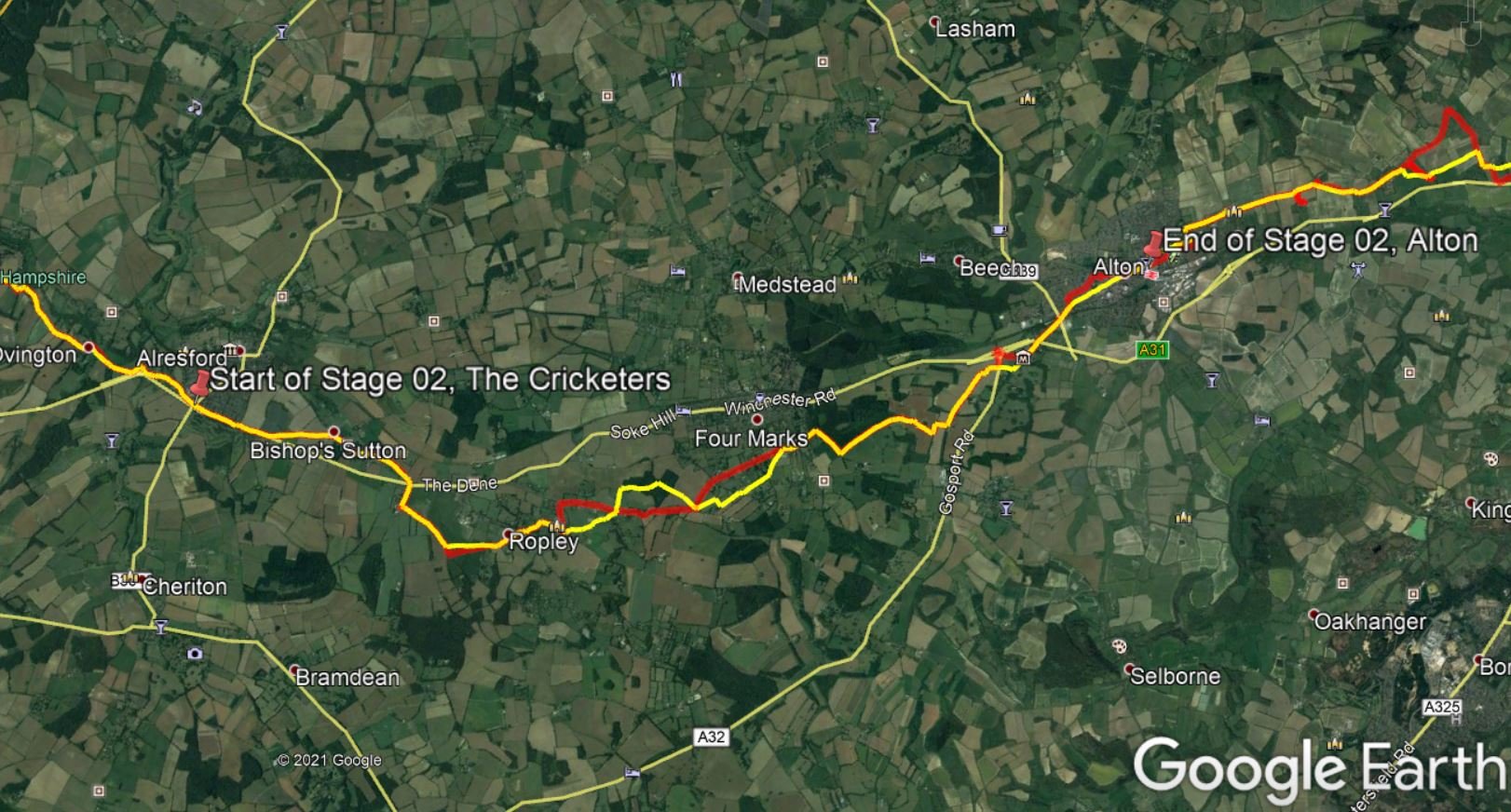
The map below shows a “cleaned-up” route from Lowestoft to St Davids. By “cleaned-up” I mean, I edited the “real-life” track to exclude some of the mistakes or issues we encountered along the way, such as navigation errors, closed gates or other impassable obstacles (with a bike), etc. The objective being to prevent you from making these same mistakes or benefiting from the experience we acquired while riding from Lowestoft to St. David’s in 2021. Keep in mind everything changes… life is dynamic, roads and paths are closed for maintenance or become impassable for a number of reasons, access to certain locations may become restricted, etc. Use it at your own risk.
In addition to the raw GPX route shown in the map above, which you may download through the link below the map, I have also created a Google Maps version of this route in the EyeCycled Google Account.
I know it looks identical to the map above, but this map can be shared with anyone you know who you think might benefit from it without the need to download it.
As the items it the map don’t appear to be clear, I’ve add a little picture below that might help.

3. What is the Via Beata?
The name ‘Via Beata’ in Italian means “blessed way” or in as preferred by its British founders ‘a way of blessing’.
The Via Beata was the idea of Steve Eggleton, who lives in Banham, located right on the route. In conversation with Steve, before we started our journey, he mentioned that he literally dreamt of it one night and the idea never left his mind. The dream was of a line connecting the west coast to the east coast at its widest point, from Lowestoft (the UK’s most easterly point) to St. David’s Cathedral in Wales. As Steve is master artisan of wood carvings, his dream included a network of Christian art-works along this route that had the intention to communicate God’s love for people. These art-works are referred to by him as “Way-Stations”, positioned in key points along the way. The number of way-stations is increasing gradually with new way-stations being added to the route every year, which gives this pilgrimage a dynamic nature.
The first way-station was set up in Banham in the Summer of 2009 and then the organizers have worked outwards to the East and to the West with the initial aim of establishing a way-station every ten miles or so and linking them with existing footpaths and rights-of-way. The Via Beata was therefore established as a walkers path.
The Via Beata really isn’t yet an established bike route: like Lands-End-to-John-O’Groats, so there is no one way to do it. But it has piqued Sustrans’ interest and we were lucky enough to have been sent a pdf and GPX files of a possible route that Sustrans had put together from various National Cycle Routes and other bike-friendly paths and roads. Katy, who has discovered this route and worked tirelessly on planning before our start in 2021 dedicated a disconcerting number of hours to tweaking the route, avoiding some of the more obvious possible pratfalls resulting in a planned journey to go in 10 stages: long days towards the start (where it is flat) with the shorter days saved for the Welsh mountains.
 I confess, if it wasn’t for Katy’s research and planning I’d have probably never heard of the Via Beata, so all credits must go to her. She wrote a blog explaining her motivations and how close this was to her heart. I encourage you to read her blog here.
As it is often the case, things never go completely as planned, especially when you are in a group of pioneers executing th plan for the 1st time. We had our fair share of issues and problems along the way… from inexistent paths, locked gates, weather related detours, blocked roads and other impassable obstacles with a loaded bike. Yet, we’ve managed to keep our route reasonably close to the planned one and achieved our goal in the planned 10 days of the journey.
The series of videos and blog post that follow are an account of our experiences in these 10 days. For the vast majority it was an extremely positive experience. Both Katy and I loved this trip and when you really like something it is only natural that you want to share it with other like minded people.
So, the product we are giving you for free here, are our experiences and advice on how to avoid the major pitfalls we had along the way. We’ve spent countless hours editing the videos so they look consistent and present a view of every meter of the route so that, if you want to follow in our footsteps (or bike tracks rather) you’ll know exactly what to expect. For the few people left in the world who are avid readers, Katy has written detailed accounts of every day of the trip in her blog and I’ll be linking my blog posts to hers as she does a much better job in textually describing our experiences than I ever could hope to. The more technical details, such as the GPX route, the stats (altimetry, distances, speed, heart rate and other telemetry stats) and the videos are more on me than on her, but we did work cooperatively in order to provide you with a reasonable guide.
If you read to this point, I’d like to invite you to donate us a coffee for this work. We don’t sell the information, nor get any money through monetising or advertisement at the moment, so donations are this blog’s only source of income. If enough money is obtained through your generous donations that will enable us to pay for the renewal of EyeCycled.com, the hosting of the information and as a added motivation for us to keep doing this. We are very thankful for anything you can spare.
4. How will the Via Beata materials be presented and made available to you?
The Via Beata materials will be available in written format here, in the blog, and as a playlist of videos in the EyeCycled’s YouTube Channel.
The blog posts will follow a similar structure as presented here with 1 major difference: For the written account of each day’s journey, I’ll just provide a link to Katy’s Via Beata Blog posts. She worked hard in publishing these posts on the same days the journeys happened. I was always very impressed by her commitment and dedication. Even after having cycled long distances all day and being very tired, she always found the motivation to stay up in the evenings writing the posts. There is no need to reinvent the wheel. Her blogs are fantastic written accounts of the journey and if it wasn’t for them a lot would have been lost in memory from 2021, when we actually did the journey, to 2025 when these posts and videos are being published in EyeCycled.com.
For those familiar with EyeCycled’s YouTube channel you will know that videos are mostly the “time-lapse” recordings of the journey, with commentary and a musical background. The difference between these videos and previous ones are, in my humble opinion, the unprecedented level of clarity and stabilization of the footage provided by mechanical and electronic means and the clear 4K resolution footage recorded. Katy and I also worked hard in providing relevant commentary to the footage where we considered it to be useful.
From the time this introduction blog post and video are published, there will be 1 new blog post and video every week until the entire journey is covered. As the journey took 10 days and the playlist is planned to contain 12 videos, incl. today’s one, we expect the entire program will complete in 11 weeks after this publication.
The series of Blog posts and videos were the result of hundreds of hours of hard work. We didn’t do this with the objective of making any money out of it, but if they are useful to you and you’d like to recognise the value of this work, please consider sponsoring EyeCycled.com or providing a one-off donation to keep the blog going.
5. Photo-Galleries
A picture is worth a thousand words.
You’ll find below several picture galleries, one for each day of the journey plus an extra one for the days we spent in St Davids after the pilgrimage was complete. These will be repeated on the posts for each specific day. There are 463 pictures between “Day Zero” and “Day 10” of the journey and then another 261 pictures for the remaining 3 days we spent in St Davids. I considered not posting them all at once, but perhaps they might serve as an incentive for you to follow the series of videos and blog posts as they are published. Where possible I provided some context in every picture taken. These pictures are not to be sold or used without prior consent.
Click on the thumbnail to expand picture and read about that moment. The navigation numbers below each gallery refer to the number of viewable pages in the gallery.
Use the links below to jump directly to the desired gallery.
Day Zero – Day 01 – Day 02 – Day 03 – Day 04 – Day 05
Day 06 – Day 07 – Day 08 – Day 09 – Day 10 – Day 11+
Day Zero Photos (prior to the start of the Journey)


Day 01 Photos (First day of the 10 days journey)


Day 02 Photos (Second day of the 10 days journey)


Day 03 Photos (Third day of the 10 days journey)


Day 04 Photos (Fourth day of the 10 days journey)


Day 05 Photos (Fifth day of the 10 days journey)


Day 06 Photos (Sixth day of the 10 days journey)


Day 07 Photos (Seventh day of the 10 days journey)


Day 08 Photos (Eighth day of the 10 days journey)


Day 09 Photos (Ninth day of the 10 days journey)


Day 10 Photos (Tenth day of the 10 days journey)


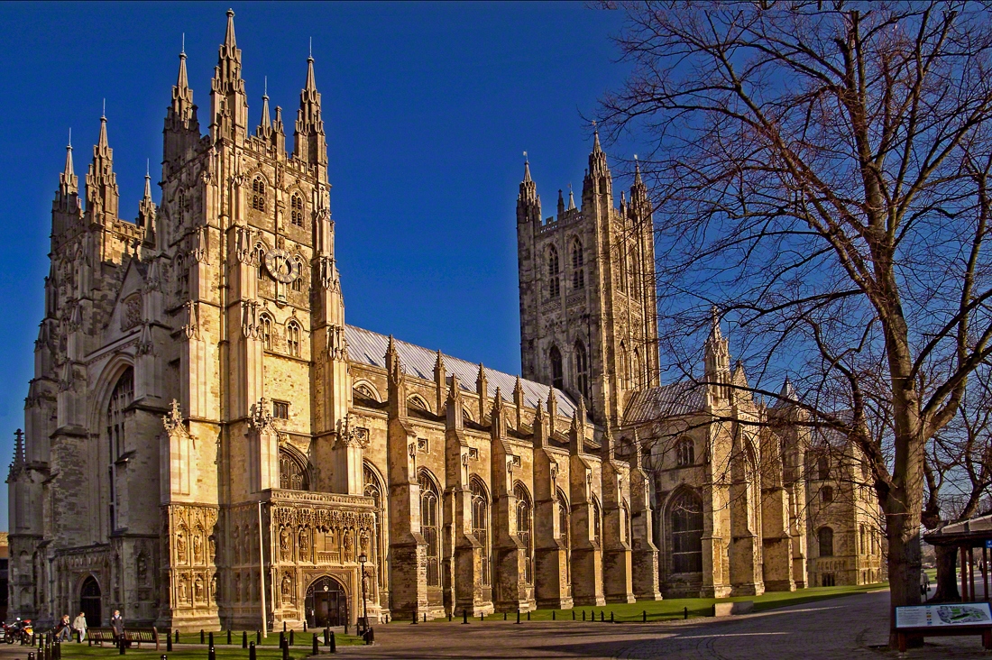
Days 11, 12 and 13 Photos (These are pictures taken of the Cathedral and of our walks during our 3 days stay in St Davids)


6. Useful online resources for planning your own journey.
We are giving you our experiences here for free, but it is up to you if you want to replicate them or not. Each journey is different and you may want to plan a custom one for you. Hopefully some of your journey may match ours, but for any portions that don’t these are useful online places you can go to aid in your planning.
| # | Resource Link | Description |
|---|---|---|
| 1 | Official Via Beata Website | If you are walking (or cycling) the Via Beata, this is the main place to go. Keep in mind, however, the Via Beata route is mainly designed for walking and there are a few stiles and kissing gates on the route that are challenging for cyclists. |
| 2 | Katy's Via Beata Blogs | A must read for anyone doing the Via Beata, especially if cycling. |
| 3 | Via Beata Playlist in YouTube. | Currently composed of 12 videos, incl. 1 introduction video, 10 videos of the journey (1 for each day) and a final conclusion video in St Davids after out arrival there. |
| 4 | Via Beata Page in the British Pilgrimage Trust | Not much info there, but proves the Via Beata is recognised as an official pilgrimage route in the UK. |
| 5 | Unofficial Via Beata Facebook Group | This group is mantained by us (EyeCycled). It is unofficial, but it may be useful as a forum for the exchange of information between those who have already done the pilgrimage and those who are planning to do it. We've created a similar group for the Pilgrims' Way pilgrimage and that has proven to be a valuable resource for pilgims. |
| 6 | Via Beata Official Facebook Page | The official Via Beata Facebook page. Keep in mind this is not a group, so exchange of information might be limited to messages only. |
| 7 | Via Beata Instragram Page | For pictures of new developments, new way-stations and general visual information. |
| 8 | Via Beata Page in the LDWA | The LDWA - Long Distance Walkers Association has information and paths / routes for many British treks and pilgrimages. |
| 9 | Great article about the Via Beata on Norfolk Magazine | Found by "accident". Published on the 18th April. Contains a picture of Steve Eggleton and pictures of some of the Way-Station while in production. Worth reading. |
7. How to get in touch with us
The easiest way is to use the form below and send us a message, but you can also leave comments both here as well as in YouTube or our social media accounts. Keep in mind we do this as a hobby, not as a job, so our responses might be delayed. We aim to provide a response within a week, but it can happen that we are travelling or otherwise unavailable for longer than that. If you didn’t receive a response within 2 weeks, but send us a follow-up message.
| Next Post (Day 01) ->
Do you like these posts? Why, then, don’t you pay me a coffee to help with the blog hosting cost and as a caffeine incentive to keep me going through the long hours of the night? (Suggested amount: £2.00 or USD $3.00 or 2.50€ or whatever you want to give).
You may donate through my Patreon Page or through PayPal directly.
![]()


")


You must be logged in to post a comment.