Welcome back to the series about my Camino de Santiago Pilgrimage by bike. This is going to be a long one folks… (but it’s the last one)
Menu: In this post…
- Intro
- Day 16: From Santiago de Compostela to Fisterra / Finisterre
- Day 17: Return from Fisterra to Santiago by bus and walk around Town + the Botafumeiro experience
- Day 18: Drive back to Saint Jean Pied de Port and Pamplona
- Day 19: Drive from Pamplona back to Bracknell, UK
Intro
Most pilgrims arrive in Santiago de Compostelaand end their pilgrimage there, but a substantial number walk or cycle further to Fisterra, as known in Galician, or Finisterre, in Spanish. Fisterra is the nearest town to Cape Fisterra or Cape Finisterre, which In Roman times was believed to be the end of the known world, hence its name.
If you read the last post about our arrival in Santiago you will know that the next day we spent just getting to know the city and that on the 9th of June 2015, I decided to cycle further from Santiago to Fisterra. This was the 16th day overall and I did this stage of 94.45 Km or 58.7 miles from Santiago de Compostela to Fisterra in 8h 43 min, of which 5h 53 min were of actual moving time.
In this post I will write not only about the ride to Fisterra that day, but also what happened the day after, the 10th of July 2015, upon returning to Santiago and spending one more day there before leaving Spain and driving back to the UK on the 11th and 12th of July 2015.
Day 16: From Santiago de Compostela to Fisterra / Finisterre by bike
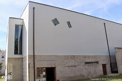
As I was going away for just a day, I packed on one of my panniers just the essentials for the day’s ride and the night in Fisterra. That included the sleeping bag, a change of clothes, the sandals, items of personal hygiene as well as the electronic gear to record the video and take the pictures. Having the big locker at the Albergue Fin del Camino was very handy and since Fernando had decided to stay he did keep an eye on the few things that didn’t fit in the locker.
If you decide to cycle further to Fisterra this is a good option. If you are walking it will probably take you 3 days to reach Fisterra, so I am not sure leaving your belongings unattended at the hostel for such an extended period of time is wise and you will likely need everything you have anyway as you’ll be spending more time under way.
I left the hostel just after 8:00am and crossed the centre of Santiago to capture the image of the Cathedral one last time. Got a bit lost as the day before wasn’t enough to familiarized myself with all the small streets and roads in the centre of Santiago. Sometimes they look very similar to each other.
I, once again, used Google Maps to find my way out of Town and, as I mentioned many times before, this technology can be a bit of hit and miss, especially as in Spain cycling routes didn’t seem to be available in Google Maps, so I used the walking route as a guide. I didn’t want to use the car routes in fear that Google could guide me to some motorway or major roads.
Finding the way out of town wasn’t too difficult. Just before entering the AC-453, which was the major road out of town, I stopped at a little café for some breakfast as I hadn’t eaten anything before leaving the hostel. I then rode on the AC-453 for about 4 Km until a roundabout about 1 Km after Roxos, where I turned right in the direction to Portela de Villestro and Ventosa. Strangely enough, as I look at the map right now, although the road splits at the roundabout, both sections are called AC-453. I don’t understand the Spanish road naming system very well.
If you take the same route as me, some 2 Km after passing Ventosa, get ready for some hills that on a fully loaded bike may be quite challenging. As I was considerably lighter, I managed to pedal up, albeit very slowly.
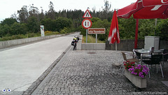
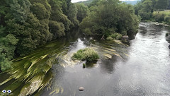
After Augapesada you’ll cross through some nice patches of forest. Google Maps doesn’t even show a name for these small roads, but although a bit narrow their tarmac is good. The next small town on this route is Negreira and on your way there you’ll cross many tiny villages like Castiñeiro do Lobo, Carballo and also cross the river Tambre on an old stone bridge which will give you the opportunity for some nice photoshoots. Just before crossing the river there was a nice restaurant which I would have considered stopping for a few minutes, but it appeared to be closed. As you cross the river you go through a village called Barca before you reach Negreira.
I only stopped in Negreira for a few minutes to get directions and had a talk with a group of Portuguese cyclists who were also riding to Fisterra. The town appears to have a good infrastructure and it’s probably a good place to stop if you are walking and can reach it in a day (24 Km from the hostel in Santiago).
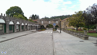
After Negreira there appears to be much less density and the villages appear to be further apart, but that may just have been my impression. Google guided me to the DP-5603 in the direction to Zas. After 10 Km on the DP-5603, about 3 Km after the village of A Pena, Google Maps instructed me to leave the main road and take some really minor roads, which although quite narrow where tarmac paved. I must admit I was a bit skeptical this was the right way, but I followed Google’s instructions nevertheless, only to find myself without a mobile phone signal a few Km up the road. Thankfully Google had cached enough of the map on my phone to provide me with some idea where to go next, but looking at the map right now, as I write this post, there appears to be a shorter way to get to Pesadoira through the village of Vilaserío than the one I took, which was quite hilly and had a lot of turns.
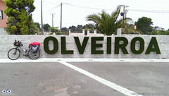
Just before Pesadoira I got some directions from local farmers and then followed to Cuíña, San Fins de Eirón and Corveira, before entering again a major road, the AC-400. Just about 1 Km on the AC-400, Google was directing me to leave the main road again. Luckily I got some instructions from another friendly farmer on his tractor that stopped what he was doing, switched off the engine, got off his tractor and came to talk to me. It was a nice chat, proving that most Spanish people are really friendly towards strangers. His advice was not to follow the route Google was suggesting and I take local advise over Google most of the time. Continuing on the AC-400 until Pino do Val was much longer than Google’s suggestion was, but from what the farmer told me I think it was the fastest, the easiest and the right option as it went around some very steep hills. On Pino do Val I turned right in the direction to A Picota and Mazaricos on the DP-3404 which I followed until short after the village of Hospital.Before getting there, however, I stopped for about 20 min in the village of Olveiroa for a rest, to eat a banana and drink some freshly squeezed orange juice. Olveiroa has a nice hostel which appears to be a good place to stay if you are walking.
After Hospital I turned left on the DP-2302 which took me all the way “down” to the town of Cee and through some interesting villages along the way (there are quite a few places to stop along the road as well, like restaurants, etc.).
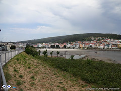
Cee is the next big town and is where you meet the sea for the 1st time. It’s pretty much glued to Corcubión and I don’t really know where one town ends and the next begins.
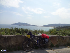
After Corcubión get ready for 3 Km of hills until you reach the next beach in Sardiñeiro de Abaixo. Just before Sardiñeiro de Abaixo there is a nice camping place which can be an option to stay, if you like to setup camp, and its right in front of the Estorde beach where you’ll also find restaurant facilities.After Sardiñeiro you pretty much follow the coastal line which offers some great photoshoot opportunities.
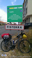
Google Maps shows that just before there is a village called Escaselas, but it all appeared connected to me so as I got there I thought I had arrived in the suburbs of Fisterra.
As I arrived in Fisterra I did a quick ride around the harbour area of the town. The street you’ll likely be on as you arrive in Fisterra ends right in front of the municipal hostel of the town, but I somehow failed to see the signs. Upon asking for some directions I found the hostel, checked-in and got my certificate of completion for having arrived on the so called Death Coast and at the end of the “Camino Jacobeo” (Jacob’s way).
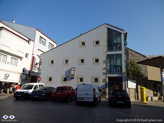
Like many others before it, the hostel in Fisterra is basic, but sufficient. There was no WiFi connection in the room I was in, on the top floor of the building, which had, I think, 5 or 6 bunk beds. The municipal hostel cost €6 and has 36 beds. There are kitchen laundry facilities available.
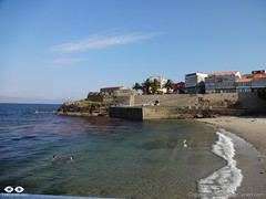
After a shower I went out on foot to find a place to eat. Had a walk around town and returned to the hostel. It is tradition for pilgrims to walk (or cycle) to the Lighthouse at the Cape Fisterra / Finisterre, some 3 Km away, but I was honestly tired and I think the variations of “dry & rainy” + “hot & fresh” weather in that day had taken a toll on me. Many pilgrims go to the cape to burn something (a piece of clothing or something they brought from their origin) to symbolize leaving old worries behind and the start of the new life.
This completes the account of this day’s ride to Fisterra. I was in bed early as I had decided to take an early bus (around 8:00am) back to Santiago so I could have time during the next day to get to know Santiago a bit better and perhaps experience the Botafumeiro mass.
Flicker Photo Album of day 16
Day 17: Return from Fisterra to Santiago by bus and walk around Town + the Botafumeiro experience
I managed to take the bus as planned back to Santiago and I managed to fit my bike in the bus’s luggage compartment without having to disassemble it, although I later saw that people just threw their luggage on top of my bike, which wasn’t cool, but then, I was taking a lot of space anyway (there was no damage to the bike).
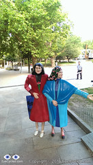
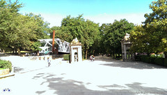
As I got the more direct bus (there is one that stops more often) and it took me just under 2 h to get back. Because I arrived in Santiago before 10:00am I rode a little around some areas of the city I had seen from a distance 2 days earlier, such as the Alameda Park in the city centre, which gave me some new photoshoot opportunities.
Given the Albergue Fin del Camino opens only 11:00am, I timed my ride around town to coincide getting to the hostel as it was about to open. I had a shower, a change of clothes and set off to the city centre again to attend the mass.
Fernando wasn’t around as he had made some friends in the hostel and decided to take the bus to Muxia with them.
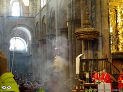
As I got to the Cathedral the mass had already started, but I got there still on time to experience the Botafumeiro.
After the mass I walked around the city centre for another 3 hours before returning to the hostel, where I met Fernando in the evening. The next day I had to wake up early to go to the airport and get the rental car I had reserved from England, so by 10:00pm I was already in bed. There was little cycling this day, but some significant walking so I was pretty tired.
Flickr Photo Album of day 17
Day 18: Drive back to Saint Jean Pied de Port and Pamplona
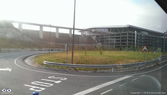
Next day I got up around 7:00h so I could be at the airport by 9:00h to get the rental car at Hertz rental. There is a bus stop on the main road, the N-634 (the one by the big shopping centre nearby) right in front the San Lazaro church (just 2 blocks away from the hostel) and there is a direct bus connection to the Airport. The bus ride takes about 25 min. Even for those leaving Santiago by plane, this is a good tip.
As I arrived at the airport there was a little queue at the Hertz counter, but I was happy to get a free upgrade to a bigger car (a Renault Megane), which meant it was easier to load the bikes and we had a bit more leg room in front. I am aware that many pilgrims on the Camino de Santiago have to return to Saint Jean, like we did. Renting a car is not the cheapest option if you are alone, but if you are in a group of 2 or more the cost of car renting starts to break even when compared to trains and buses.
Before we left England, my online research showed that returning to Pamplona by train would have a cost of at least £30 or €40 each (or £60 / €80 for both of us) not taking into consideration any possible bicycle carriage fees in the train. It’s apparently a 9h journey by train. We would then have to take the bus from Pamplona to Saint Jean the next day at a cost of approx. €20 / £15 each (not accounting for any bicycle fees). I calculated the total estimated cost of returning by train / bus to be of between £90 to £100 for both of us (approx. €130). We paid £80 for the car rental with another €45 for fuel, a total of £115 or €150. The comfort of the car rental was worth the extra £15 in my personal opinion and the drive back to Saint Jean and Pamplona through the north was wonderful.
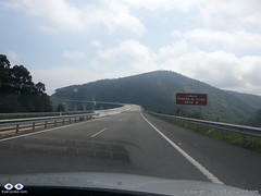
As I returned to the hostel, we loaded the car and stopped at a nearby café for breakfast before driving off to Saint Jean. We decided to take the north route back to Saint Jean and drove on the AP-9 motorway in the direction to A Coruña (also known as Autopista del Atlántico) and then further north to O Ferrol following the coastal path of main roads and motorways in the region (which change names) through Oviedo, Santander and Bilbao.
If you love driving, I truly recommend this drive back to Saint Jean. Its many tall bridges over valleys and tunnels make it an attraction in itself. There are a few tollgates along the way (can remember at least one at a tunnel near Bilbao), but the fee is nowhere near as high as the ridiculous prices practiced in France (something like €1.30 – €2). I was looking forward to drive in that part of Spain since we left England and I was not disappointed.
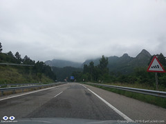 It took us about 8h to drive to Saint Jean and when we got there my car was exactly as we had left it 3 weeks before. We transferred the bikes and everything else from the rental car to my car and while I drove the rental car, Fernando drove my car back to Pamplona where we had to return the rental car at the Hertz office in Pamplona’s Airport.
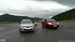
The drive from Saint Jean to Pamplona was an interesting experience, as we took practically the same route we did with our bikes 3 weeks earlier. Along the way I kept remembering the hard climb with fully loaded bikes from Saint Jean to Roncesvalles and thinking how easy it is to be corrupted by the comforts of modern life. It took us only a few minutes to get from Saint Jean to the Roncevaux Pass (Ibañeta) at 1057m that we had reached by bike, after 6h of pedalling, 3 weeks earlier.
Because I programmed my TomTom SatNav to guide us to the Airport in Pamplona, it took us through some rather minor roads after Roncesvalles, which I believe now wasn’t the best route. Believe it or not, I only had to fuel the rental car some 15 Km before Pamplona, so it managed to do more than 900 Km on just 1 tank, which I thought was very good.
We arrived at Pamplona’s airport around 20:00h and there was no one at the Hertz counter, so I dropped the car keys in the box and we left the airport to find the place we were going to stay for the night. We had already reserved a room with breakfast. Finding it wasn’t too difficult.
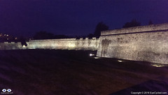
I don’t know if it was the excitement of the day’s drive, but contrary to Fernando I was very awake and full of energy. Had a shower and left to go find something to eat and walk around the city. I didn’t see much of Pamplona that evening, but from what I saw, I loved the city. It’s a city that, in my opinion, managed very well to mix it’s old heritage, with its Roman beginnings at 75–74 BC, through the ages in which it was a fortress-city, in which the Citadel is the biggest landmark, and to its modernization. I absolutely loved its wide avenues and many green places along the paths I walked to reach the city centre. It’s a place I would definitely like to spend more time if I ever have the opportunity again.
Flickr Photo Album of day 18
Day 19: Drive from Pamplona back to Bracknell, UK
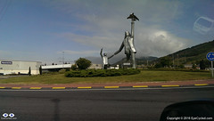
This day wasn’t as exciting as the day before. It was in fact quite boring to be honest, so I am not going to add much about this day to this account. We attempted to circumvent the motorways in order not to have to pay the expensive toll fees, but that was delaying us so much that we feared we would not get to Calais in time to get the Eurotunnel train back to England. After driving for many hours and covering only about 20% of the distance we gave up and went back the motorway and to the toll fees. They designed it so that it leaves you an alternative, but the alternative is so bad (single lane roads, lots of traffic) you end preferring to pay the motorway toll fees.
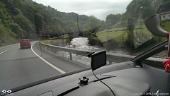
There was some nice French country side scenery along the way too, but I think at that point we had enough and just wanted to get back home.
We got lucky as we arrived in Calais and were allowed to take the next train through the tunnel (our reservation was for a train leaving 3 h later). That meant that by 23:00h we were back again on British soil and guess what? Some 20 min later, it started to rain torrentially. A rather typical welcome back to the UK.
By midnight we had arrived at my house. Fernando only transferred some of his gear to his car, which was parked there, left his bike with me and drove home.
This now completes our entire series on the Camino de Santiago, from the very beginning where we left Bracknell to the moment we got back.
I am thinking of extending the series a bit more with an extra post to summarize the experience and perhaps add some “interviews” with people I have met along the way or that have done the pilgrimage before and after I did. Don’t count on it as my time is very limited nowadays, but I’ll do my best.
Thank you for following me and coming on this journey with us. I am looking forward to the next adventure on the “Via Francigena” pilgrimage, starting on the 30th of July 2016.
If you have never done a pilgrimage before, what are you waiting for? If you are about to do yours, here goes a statement you are going to hear a lot during your pilgrimage: “Buen Camino!”
Flickr Photo Album of day 19
<< Previous day (Day 15 & 14) Summary >>

