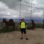
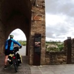
Tag Archives: Spanien

Camino de Santiago: Day 4 - From Viana to Santo Domingo de la Calzada


Church in Viana
Church in Viana

Yeah, I know, this post was well overdue, sorry. This is about the 4th day of our Camino de Santiago Pilgrimage by bike which happened on the 28th of May 2015. We´ve done this stage of 64.24 Km (40 miles) from Viana to Santo Domingo de la Calzada in 8h and 19m, of which 4h 54m were of moving time.
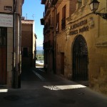
Entrance to the Albergue (hostel)

We left the hostel just before 8am on this beautiful sunny day. As with previous days we were not certain where we would stop. We were trying to keep an average of 60 Km per day or, failing that, stop cycling by around 5pm, which would enable us to get to a hostel early enough to find plenty of beds available, shower and get ready for an early dinner.

Stork´s Nest in the outskirts of Logroño.

We were near Logroño, the next big city in the Camino. The initial 5 Km were on the NA-111 with another 3 Km on a very nice and wide tarmac covered, cycle path (the “red road” you see in the video).

Logroño´s Cathedral
Logroño´s Cathedral

As we arrived in Logroño we crossed the river Ebro to get to the town centre and stopped briefly at a hostel we passed by to ask for directions and stamp our pilgrim´s credentials. We then started to look for a place to have breakfast and found this nice and friendly café bar under the arches of Calle Portales called Calenda.

Breakfast at Calenda

While we were waiting for breakfast to be served, we managed to contact Paula via Facebook messenger, who, unlike us, rode all the way to Logroño the day before. She was, actually staying not far from where we were. It was a pleasure to have her company for breakfast.

After a nice and fulfilling breakfast the 3 of us walked a little, pushing our bikes, to the tourist information centre to stamp our pilgrim´s credentials (again, yes). There was a small market in the square in front of the tourist information with music and lots of young people.
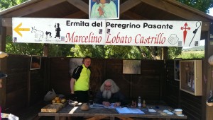
Marcelino´s Hermitage

Back on the bikes again we crossed Logroño riding together as a group for another 8 or 9 Km until we reached Marcelino´s “Ermita del peregrino Pasante” (hermitage of the passing pilgrim). What a nice bloke he is. I´d recommend you buy some mementos or souvenirs to help him out.

Marcelino and me
Marcelino and me

The ride to his hermitage was really nice, on a wide shared cycle / pedestrian path. There were a lot of pedestrians and runners on the path though, so caution is advised.

Next stop was the small town of Navarrete on a mix of minor road and dirty roads/tracks with a few places in which we had to push our bikes. In Navarrete we had some water and a bite to eat.

From Navarrete we continued on the NA-120 for another 5 to 6 Km where we left the road and continued on a dirty road that followed besides the A-12 motorway for 2 to 3 Km and then turned right onto another dirty road in the direction to Ventosa. After Ventosa we took some dirt tracks that proved quite difficult in places. This dirt track actually led us back to the same dirt road that ran besides the A-12, so we later realised we had made a big detour for nothing.

We intentionally followed mostly the same way the pilgrims on foot do this day, but in retrospect, had we stayed on the N-120 we would have probably saved some time, even though we might have had ridden a few Kilometres more.

Hostel in Najera
Hostel in Najera

The next town was Najera, where we stopped at a local hostel to stamp our pilgrim´s credentials and rest for a few minutes. Najera has an interesting rock formation, almost like a wall on one side of the town which led to some climbs on a dirt road in good condition.

Rocky wall in Najera

For the first time we started seeing sign posts with the distance still remaining to Santiago. I took a picture at one of them (580 Km remaining). This region has a lot of olive plantations. That is the small bush you can see in the video.

580 Km to Santiago
580 Km to Santiago

After Azofra is essentially just dirt roads but there is a long and difficult climb full of pebbles as we approached Cirueña in which we had to push the bikes up for quite a distance. With the strong sun on top of our heads that wasn´t very easy. Cirueña is small but has a big and rather luxurious (it seemed) golf camp, in which the

Near Cirueña
Near Cirueña

restaurant welcomes pilgrims with special prices, apparently (we didn´t stop, but lunch was advertised at 6€ and breakfast 3€). We stopped briefly at a restaurant in town for some rest and water.

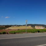
We left Cirueña on the LR-204 which had some nice and colourful wheat fields on both sides of the road.

The LR-204 took us straight into Santo Domingo de la Calzada where we stopped for the night. Almost at the same time as we arrived in Santo Domingo so did Paula. If we had agreed on a meeting time and place it would have probably not worked so well.

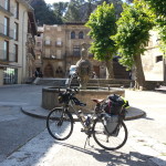
Bike Pilgrims are nothing new.

Paula, Fernando and I stayed at the same Albergue, the “Abadía Cisterciense” managed by sisters of the monastery of Nuestra Señora de la Anunciación. The albergue is very basic and the rooms felt a bit tight, with rooms that you have to pass through to get to other rooms sometimes. It’s a building built around 1609, 330 years old, so no wonder the design is a bit odd. The rooms I saw had no bunk beds. It was 5€ a night.

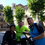
Paula, Elenice and Fernando

After we settled down, the 3 of us left the hostel in the early evening to find a place to eat and it was in the restaurant that we met Elenice, also from Brazil. After dinner we all had a walk around town together. Elenice was walking the Camino, so after that day we never saw her again, but we all kept in touch through Facebook ever since and I am aware that after returning home Paula and Elenice accidentally bumped into each other in São Paulo, a small city of only 25 million inhabitants… small world this one we live in, isn´t it?

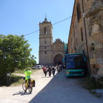
View of Santo Domingo´s Cathedral

If you visit Santo Domingo, make sure you go into the cathedral as they keep a live Hen and a Rooster by the altar in a small chicken coop, which may seem odd until you learn about the legend of the Hen that sang after being roasted.

<< Previous day                                                                                      Next day >>

Please rate this post by clicking on the desired star (1 = Awful, 5 = Excellent)
[Total: 2 Average: 4]

Camino de Santiago: Day 3 - From Puente la Reina to Viana

This post is about the 3rd day of my Camino de Santiago Pilgrimage by bike. It happened on the 27th of May 2015.

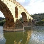
Puente la Reina (The Queen´s Bridge)

Before we get started you should know that the time-lapsed pictures for this day started about 2 Km away from Puente la Reina where we stopped the day before. I thought I had turned the camera on as I left the hostel, but it turned out I didn´t. Unfortunately the day didn´t start with a time-lapse, but with a memory-lapse, I´m afraid 🙂

We´ve done this stage of 63.67 Km from Puente la Reina to Viana in 8h and 11m, of which 4h 55m were of moving time.

As we were getting our bikes ready to leave the hostel we met Paula from Brazil. Paula was also cycling the Camino, but having started from the Notre Dame cathedral in Paris she was already on the road for much longer than we were at that point. We met Paula along the way several times this day and thereafter all the way to Santiago.

Fields near Cirauqui

We left Puente la Reina around 7:40am, not quite sure where we were going to stop. Weather improved significantly as you can see and we had a wonderful sunny day all day. Like in previous days, we left the hostel without having had breakfast. We stopped for breakfast 47 min later at a little village called Cirauqui about 10 Km away from Puente la Reina.

Poppies everywhere
Poppies everywhere

One thing I learned pretty quickly is that in Spain Breakfast is not a big meal. People typically only have a cup of coffee with toast and one or 2 pastries. My strategy was, however, to eat only once during the ride and then have dinner in the early evening after the day´s ride. I don´t like to fill up with food in the middle of a bike ride. I feel heavy and drowsy and don´t perform well.

After breakfast we continued on the NA-1110 which was the road we stayed pretty much all day, with the exception of the 10Km I rode by myself following the walker´s path after Irache, but I am going ahead of myself.

Water Fountain in Estella

As we arrived in Estella and crossed the river Ega we decided to enter this historic town for a quick look around. Few moments later Paula arrived there also and we took a few pictures together.

Paula, Fernando and Me in Estella

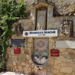
Not long after leaving Estella we arrived at another known pilgrim landmark on the Camino: The winery known as “Bodegas Irache” with its famous wine fountain. It lies right beside the Irache Monastery witch is also a Camino landmark and served as a hospital for pilgrims for many years having been also a pontifical University, between 1615 and 1824, the first university of the kingdom of Navarra.

Irache Monastery
Irache Monastery

Although it´s called a fountain, wine does not flow continuously. Like in modern water fountains, you have to press a button for the red wine to flow. Wine comes out at natural temperature. It wasn´t really to my taste. This place is usually crowded with people trying to taste the wine and take pictures or selfies of themselves at the fountain.

Wine and Water fountains of Bodegas Irache

After Irache, I was keen to experience the same paths as the walker pilgrims do, so I decided to take the walkers path and Fernando continued on the road. We agreed to meet in Los Arcos later that day.

This was the most challenging ride of that day. Please read the blog post for more information about this path and make sure that if you also want to take the walker´s path with your bike you understand the consequences.

Riding the walker´s path

The 1st 2 Km was done through a rather narrow forest path with various degrees of difficulty. Had to push my bike quite a few times because of the boulders and other obstacles along the way. The nice thing was that it was cool as the forest provided a welcome shade from the strong sun.

The remaining 8 Km are on dirt roads full of stones, sand and generally difficult to ride. Unfortunately most of it is upwards leading to a heights of above 700m in places, which is higher than that of the Alto del Perdón. If like me, you are keen to try the walker´s path with your bicycle, beware of the consequences before you commit to it. It took me 1.5 h to cover just 10 Km on the walkers´ path to a village known as Luquin were I met asphalt again. Another 1.5 Km and I was back on the NA-1110 and decided to stick to it as I thought I had suffered enough for the day.

Los Arcos indeed
Los Arcos indeed

From that point on to Los Arcos was another 10 Km on the road which I did in 35 Minutes.

Paula and Fernando in Los Arcos

When I arrived in Los Arcos Fernando and Paula were already there for some time. Given my breakfast in the morning was poor, I was starving and the paella at the little restaurant they were seated at was simply irresistible 🙂

We spend almost an hour there… we ate, we talked, drunk lots of juice and had ice creams. A truly enjoyable moment in the company of an old and new friend (no pun intended).

Church in Viana
Church in Viana

Back on the road again after the wonderful pit-stop in Los Arcos our goal was Logroño, but it was a hot afternoon and the ups and downs of the road to Viana to took a bit of a toll on us.

We arrived in Viana just before 5 in the afternoon and the intention was initially just to get our pilgrim credentials stamped. The Tourist Information office was closed until 5:30pm so we decided to stay there for the night.

View from the ruins of the San Pedro Church

Viana was officially founded in 1219 with a clearly defensive objective against the Kingdom of Castile. It´s Perched up on a hill and the urban layout is that of a fortified square, with narrow streets surrounded by part of its thick medieval wall. We walked around before heading to the hostel and one of the most interesting thing was the ruins of the Church of San Pedro which collapsed in 1844 due to damaged caused by the 2 wars that happened between 1808 and 1840.

Door to the ruins of the San Pedro Church

We stayed at the municipal hostel called Alberguería Andrés Muñoz, which was good and wasn´t full. We paid 8€ each for the night. There were several empty beds in the room we slept that night. We stayed in the downstairs´ room after the kitchen / dining room. The room had 4 bunk beds (8 people) and had also lockers that required a 1€ coin to operate. The room had only one or two power sockets as well. Pillows were available, but there were no sheets or blankets. You need your sleeping bag.

Entrance to the Albergue (hostel)

The bathroom / toilet was right outside the room and it was clean with a good warm shower. The bikes stayed in the laundry room. There were 2 washing machines and a dryer and we took the opportunity to wash our clothes (I think it was €4 for the machine with soap included). There was WiFi available in the hostel and it worked in our room, although signal was weak.

View from Viana
View from Viana

We had dinner in one of the many restaurants in town and paid 8€ for the Pilgrim´s menu, but were charged 3€ for a beer as we declined the wine. I was sun burned in that day which caused me sun

View from Viana
View from Viana

fever at night. The fresh breeze as we walked out of the restaurant felt more like an arctic wind for me at the time, so while

Fernando decided to walk a little after

dinner I headed straight to the hostel for some internet browsing before going to bed.

<< Previous day                                                                                     Next day >>

Please rate this post by clicking on the desired star (1 = Awful, 5 = Excellent)
[Total: 10 Average: 4.4]

Camino de Santiago: Day 2 - From Roncesvalles to Puente la Reina.

If you are the type of person who doesn´t like reading, I made it easy for you. The video below is an almost exact transcript of this post, with a few minor differences, so feel free to watch the video and skip the post if you want.

So… you like to read then? Good for you, because I lied 🙂

I provide more information on text than I do on video and to complement the text I added some links to interesting pages I found while doing some research as well.

Leaving Roncesvalles

We´ve done this on the 26th of May 2015 and according to my Garmin it took us just under 8 and a 1/2 h to complete the 80 Km that separates Roncesvalles from Puenta la Reina where we decided to stay for the night. Together with me was Fernando, my Pilgrimage partner.

Having done only 30 Km the day before we wanted to push ourselves a little to bring us closer to the average 60 Km per day we planned to do all the way to Santiago. This proved to be unnecessary later, but when you have a scheduled return date you have to account for some spare time in case you run into any problems during the journey. We also had the intention of riding further to Cape Finistere if we got to Santiago with time to spare.

We left Roncesvalles just before 8:00am and didn´t know exactly where we were going to stop. Puenta la Reina was one of the options. For any visually impaired person listening to this account, the day started wet and rainy. According to Garmin as we started the temperature was 12C falling to 5C 1h later and peaking at 19C around 2:30pm. Although it wasn´t necessarily cold it called for something warm to be worn.

Alto de Erro, 801m.
Alto de Erro, 801m.

Roncesvalles is still situated mid-ways up in the mountain (Pyrenees). The ride starts with an initial descent of about 200m in total with a few ups and downs in the 1st 17 Km until the town of Erro where you start a 3 Km climb to the “Alto de Erro” which is at 801m at its highest point. We stopped for a few minutes there to take some pictures.

River Arga, crossing Zubiri.

I had eaten only a banana and a cereal bar as I left Roncesvalles. This became more or less the norm for me during the ride with a proper Breakfast stop later along the way 1 or 2h later. After our short stop in the Alto de Erro, we rode for another 7 Km and decided to stop for Breakfast in Zubiri which is a little village 28 Km from Roncesvalles. It had taken us 2.5h to get there and by that point I was really hungry.

Tortillas de Patatas (Potato Omelet)

Zubiri is lovely small village. It’s the point where we first met the River Arga which flows parallel to the road almost for about 20 Km thereafter, all the way to Pamplona. The village appears to live entirely of the tourism generated by the Pilgrims as there seem to be too many hostels and hotels for such a small place. My breakfast included 2 pieces of a delicious Potato Omelette or “Tortillas de Patatas” as it’s known in Spanish as well as some pastries like a

Zubiri viewed from the Stone bridge

Croissant and a chocolate roll served with coffee and a freshly squeezed orange juice. There are many things I miss from my time in Spain but the sweet and freshly squeezed orange juice is one of the things in the top of the list. This simply does not exist in Britain and even in places where natural orange juice is served the taste is nowhere near that of the sweet and non-acidic Spanish oranges. After Breakfast we walked to the very old looking stone bridge of the village, took some pictures, stamped our pilgrims´ credentials and continued to Pamplona.

River Arga on the outskirts of Pamplona

Moving on, we continued on the N-135 road or “Carretera”, as it´s called in Spanish, all the way to the outskirts of Pamplona where we took a cycle path along the river Arga. The Arga also crosses a portion of Pamplona. As we got to the outskirts of Pamplona we stopped for a minute contemplate and take a few pictures of the serene scenes the river Arga was providing.

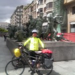
Bull running Monument (Encierro)

Our passage through Pamplona was very quick. Pamplona is where the famous running of the bulls happen, known in Spanish as the “Encierro“. We only stopped for a few minutes at the bull run monument in the city centre and at the pilgrim´s office to stamp our credentials. At that point in the journey we thought we were pressed for time and we didn´t want to arrive too late in our destination that day. We also knew we were coming back to Pamplona anyway since it was there that we were going to return the rental car we reserved to drive back from Santiago.

The Citadel in Pamplona

We crossed the city and got a bit lost in the park where the Citadel is located, but that allowed us to stop for a minute and take a few pictures. Really impressive example of an old military complex. As we left the city and started to get into more rural areas we met a local cyclist who advised us to avoid the walker´s path up to the “Alto del Perdón” (Mount of Forgiveness), which is one of the

Alto del Perdón
Alto del Perdón

many landmarks along the Camino. The company that runs the wind turbines on that mountain has created a number of bronze sculptures to celebrate the Pilgrims who climb it. The road route is about 4 Km longer than the walker´s path. Even though I perfectly understand Fernando´s reluctance to take the walkers´ path, I confess I was a bit disappointed. I only realised how big the challenge was going to be when I got up there and saw all the bikers pushing their bikes up. We took the NA-6004, then a left turn on the NA-1110, which runs parallel to the A-12 motorway, in the direction of Astrain. The climb is long but perfectly rideable even when you leave the NA-1110 to climb the NA-6056 in the direction to the mountain alongside the wind turbines.

Panoramic View from Alto del Perdón

I believe getting to the top of the “Perdón” provides the Pilgrim with the first real feeling of achievement in the Pilgrimage. The altitude recorded by my Garmin was 682m, which is by far not the highest mountain along the way, but perhaps because it’s so well known, or perhaps it’s because of the long challenging climb, I think there is something about that view on both sides that made an impression on me.

Alto del Perdón
Alto del Perdón

On one side you see Pamplona in the background and on the other you have the view of the entire valley where Puenta la Reina is situated. It´s a really magnificent view, but I guess the pictures are worth more than a thousand words. Oh by the way, if you ever wondered why there are so many wind turbines in Spain, the noise you´ll hear in a moment should provide a clue. As the saying goes, everything that goes up must come down, so no surprise that after the Perdón you´re in for a long descent. The NA-6056 which is the minor road alongside the Wind Turbines requires attention because it´s littered with pot holes, but once you are back to the NA-1110, an excellent main road, the pavement is smooth and allows for much higher speeds. In fact, it was on this descent that I achieved the highest speed in the entire journey and probably the highest speed of my life on a bicycle so far: 74.8 Km/h (or 48 mph) according to my Garmin Edge. A great rush of adrenaline.

Arriving in Puente la Reina

The distance between the Alto del Perdón and Puente la Reina is about 10 Km and it´s mostly descent, so after the Perdón you get to Puente la Reina pretty quickly. What a lovely town Puente la Reina is and its impressive main landmark: The romanic bridge over the river Arga (yes the same that crosses Pamplona). It was built by Queen Mayor (hence the name Puente la Reina or “Bridge of the Queen”) to allow pilgrim´s to easily cross the Arga.

Puente la Reina (The Queen´s Bridge)

We stayed at the “Albergue de peregrinos de los padres reparadores” (Pilgrims´ Hostel of the Fathers´ repairers?) which cost just €5 a night. The Albergue is very simple and if you are too fussy you will have issues with the shower rooms and the fact that there are almost no power outlets in the bedrooms, so people that want to charge their phones or gadgets fight for the few there are. One pilgrim actually left his phone in the bathroom to charge and stayed there for almost an hour while the phone was charging, something I would never do.

Puente la Reina
Puente la Reina

In the next day as we were leaving the Albergue we met Paula for the 1st time. Paula was from Brazil and was doing the pilgrimage by bike, with the main difference that she was on the road much longer than we were, since she started from the Notre Dame cathedral in Paris. Well, that´s it. I will try to produce one post every week. Even though I am benefiting from this writing exercise (especially in German), it hasn´t been easy to find the time to do this in 3 languages. I will complete this Pilgrimage series in all languages, but I may decide concentrate everything only in English in future “adventures”.

<< Previous Day                                                                                      Next Day >>

Please rate this post by clicking on the desired star (1 = Awful, 5 = Excellent)
[Total: 5 Average: 5]