Post about the 4th (and 5th) day of journey, published on 10th August 2016
This post complements the post I published on the 10th of August 2016 in which I described the experiences I had while riding between Péronne and Tergnier, including the additional (and unnecessary, might I add) ride from Tergnier to the Auberge de Villequier, where I spent the night. I am not going to repeat the contents of that post in this one again, but I will add a few highlights for each stage below. I encourage you to read the previous before continuing on this one.
To go or not to go? Woke up many times during the night to the sound of heavy rain. In the early morning I decided to wait in the tent to see if the rain would stop. It meant that by the time I was done with breakfast and packing it was past 11am in the morning, but I think it proved to be the right decision this time (aided by some weather forecast on the phone). Wasn’t really looking forward to packing my gear under rain. The rain resumed just after I left, so I guess I can consider it a lucky dry window, just long enough for me to pack my gear.
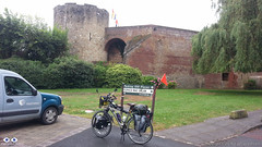
Château de Péronne
After leaving the Camping Site the first stop was at Péronne’s tourism information office in the town centre to collect a stamp on my Pilgrim’s Credential. As I was late I couldn’t really explore the town. As with many other towns and villages I’ve been through, Péronne looked like it would have been worth at least a few hours, if I had time to spare.
Again and again, Google Maps is good, especially to those like me that are “navigation challenged”. One problem for cyclists is that it tries, as much as it can, to guide the cyclists away from heavy vehicle traffic. Yes, this is good, but it also means it guides you to paths that during or after heavy rain might be very challenging to transpose. As I left Pèronne Google Maps instructed me to leave the “D” road I was to some dirt paths that were very muddy, only to guide me back to the same “D” road about 1.5 Km later. When you don’t know the way, the decision is not always easy. Overall Google Maps helped me more than it hindered me though.
The ride to Trefcon was uneventful and the village itself is tiny and it appeared to be completely deserted.
It rained basically all day that day (on and off) and after leaving Trefcon the route was mostly on good roads up to the town of Montescourt-Lizerolles, where Google Maps instructed to take a path alongside the railway. The terrain was somewhat challenging as the Swalbe Marathon tyres I have in the bike are not really suited for them. After overcoming the path, I decided not to follow the route Google had planned and take my chances on the major “D” road, the D1, that took me straight to Tergnier. The traffic was intense and the road had guard-rails and no hard-shoulder. I don’t recommend this route, but on hindsight I believe it was the right decision, albeit somewhat riskier than to stick (no pun intended) to the dirt paths.
Riding under constant rain is not really fun, but the main challenge, besides the muddy paths, was the strong wind which slowed me down considerably and took away the high visibility orange flag I had in th back of the bike. I arrived in Tergnier tired and feeling a bit ill, probably due to the wet conditions (I am slightly asthmatic and humidity is not a good thing for me). The town hall was closed, so I turned to Google again for a place to sleep and the 1st option Google gave me was a hotel / hostel in the nearby village of Villequier.
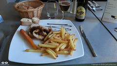
Dinner at the Auberge de Villequier
The concept of “nearby” changes when you are travelling on the bike though. It took me almost 1h riding in the wrong direction (as I found out the next day) to get there, but the Auberge is lovely and the owners were very nice to me. The room was small, but big enough to wash and dry my wet clothes and dry the tent and camping equipment. Also enjoyed a very nice meal that night, my personal reward for a hard day of cycling under rain.
Took very few pictures during the day. The rain was the biggest contributor to this, but in all honesty I did not feel like there were a lot of picture worthy moments anyway.
If you have any questions, don’t hesitate to comment or send me a message through the contact form.
Please subscribe to my Blog and/or to my YouTube channel if you don’t want to miss the next one and help me spread the word by liking and sharing my Facebook Page and Tweeter feed also.
Thank you for your time!
Please rate this post by clicking on the desired star (1 = Awful, 5
= Excellent)
VF post from 8AUG16, from Bruay-la-Buissière to Péronne
This post complements the post I published on the 8th of August 2016 in which I described the experiences I had while riding between Bruay-la-Buissière and Péronne. I am not going to repeat the contents of that post in this one again, but I will add a few highlights for each stage below. I would strongly encourage you to ready the August, 2016 post before continuing on this one, though.
Via Francigena can be just bike touring, of course, but if you want your Testimonium when you get to Rome, you have to present your pilgrim’s credential and it needs to have stamps in it. They do do a deep analyses of the stamps, but they will expect that in a 2,000 Km bike ride you will have collected a few. In the digital age is getting more and more difficult to find stamps… so analogical (illogical?). In many of the small towns and villages the chance of you to find a government facility (town hall, tourist information office, etc) will depend on the day of the week (Weekends? No chance) and the time of the day as some of these facilities will be closed, e.g. lunch time, or may have public opening hours. I really tried getting my pilgrim’s credential stamped but as it was the case in Ablain-Saint-Nazaire and others, as I got there I could not find anything open. Even the pharmacy was closed.
Arras is spectacular. Worth a visit if you can afford staying for a day. It’s a UNESCO World Heritage site and is more than 2,000 years old.
There is a “Route 66” café in Ervillers, between Arras and Bapaume, with a big statue of “the King” (Elvis). Coming across that reminded me of a friend who was about the ride the entire route 66 by bicycle. Her name is Cacá Strina. Check out her page here.
Don’t completely trust technology. Have always some low tech option to fall back if technology fails you. For some reason I lost GPS connection between Baupame and Péronne and I was relying on Google Maps entirely. At the very least download the offline maps over a WiFi connection, if possible, before you leave. Getting to Péronne was no problem, I simply follow the signs, but finding the Municipal Camping site took some time and effort (about 5 Km more than necessary).
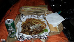
Tent Feast (Large Kebab Plate)
By the time I setup camp, had a shower and was ready to go out to find something to eat, the nearby supermarket in Péronne was already closed and after almost 30 min walking the only place I could find was a kebab trailer. So I ordered an extra large Kebab plate for dinner (and a baguette sandwhich for breakfast next day) and had a feast in the comfort of my tent. In small towns it may not easy to find a place for a meal at night. Keep that in mind.
Video of Lightfoot Guide Stage 14, From Bapaume – Péronne
Video Length: 5 min 38 sec To skip introductions and recommendations jump to time stamp 0:40 in the video timeline.
The next video is a time-lapse recording of my “awesomely akward” tent pitching skills. Took me “only” 20 min to pitch the tent. Thank God I don’t do this for a living… 🙂
In the municipal camping site of Péronne in France. Between the 3rd and 4th day of my Via Francigena pilgrimage. It raining a lot during that night and in the morning. Didn’t have a good night of sleept that day.
If you have any questions, don’t hesitate to comment or send me a message through the contact form.
Please subscribe to my Blog and/or to my YouTube channel if you don’t want to miss the next one and help me spread the word by liking and sharing my Facebook Page and Tweeter feed also.
Thank you for your time!
Please rate this post by clicking on the desired star (1 = Awful, 5
= Excellent)
"Life is a pilgrimage. The wise man does not rest by the roadside inns. He marches direct to the illimitable domain of eternal bliss, his ultimate destination", Swami Sivananda
This post complements the post I published on the 2nd of August 2016 in which I described the experiences I had while riding between Alembon and Bruay-la-Buissière. I am not going to repeat the contents of that post in this one again, but I will add a few highlights for each stage below. I would strongly encourage you to ready the August, 2016 post before continuing on this one, though.
Route:From the Rural Gite in Alembon to the Ibis Style Hotel in Bruay-la-Buissière via Licques, Tournehem-sur-la-Hem, Thérouanne, Amettes and Bruay-la-Buissière
Distance: 86.02 Km
Departure time from Alembon:10:29am
Arrival at Destination:5:58pm
Duration of day’s Journey:7h 29min
Expenses this day:Total = € 99.00
€30.00 – Food
€69.00 – Accommodation (Ibis Styles Hotel Bruay-la-Buissière)
Everything was going well, until… The unexpected, yes the unexpected again… By 9:30am I had packed everything and was ready to leave the Gite. I then realised my CatEye cycling computer was missing. Looked in the front bag, as I was certain I had put it there the night before. Wasn’t there, of course. Went back to the room and looked everywhere as I thought it might have fallen of the front bag during packing. Wasn’t there, of course. So all what was left was to look for it in the panniers, which were already neatly locked to the bike. Well, a pilgrim has go to do what a pilgrim has got to do. Looked for it in the front panniers as these were a lot easier to remove. Not there, of course. Took everything off the back of the bike again and looked in one pannier (not there, of course) and then the next, and bingo! It had fallen into the pannier as I was packing my things. I was happy not to have lost it, although I knew it was with me the night before, but the unpacking and packing took me almost 1 full hour. I didn’t do that mistake again…
Do not underestimate the SUN! The day before had been rainy and not particularly hot.
50 Shades of Red
I had seen on the phone’s Weather App that this day was supposed to be cloudy, but not rainy. It didn’t occur to me that I no longer was under British Weather. The day turned out to be very hot and sunny and I hadn’t passed any sunscreen on my skin. By the middle of the afternoon I was already feeling the damage the sun had done to my skin, which now looked very burned. The sunscreen was on the very bottom of one of my rear panniers. I should have stopped and passed the sunscreen on, but the thought of removing everything on the back of the bike (I had an intricate system there) was not appealing, so I continued. By the time I realised my mistake it was too late. The result was some heavy sun burns and sun fever by the time I got to Bruay-la-Buissière. As it was Sunday I knew it wouldn’t be easy to find accommodation and I wasn’t feeling very well so I used Google Maps to show me the available hotels nearby and the most affordable was the Ibis Style hotel 5 Km away from the town centre.
Video of Lightfoot Guide Stages 10, From Amettes to Bruay-la-Buissière
Video Length: 6 min 05 sec To skip introductions and recommendations jump to time stamp 0:48 in the video timeline.
The next video was recorded as I was crossing the town of Marles-les-Mines, between Amettes and Bruay-la-Buissière and their Folkloric group parade was about to start at the town’s FÊTE FORAINE.
If you have any questions, don’t hesitate to comment or send me a message through the contact form.
Please subscribe to my Blog and/or to my YouTube channel if you don’t want to miss the next one and help me spread the word by liking and sharing my Facebook Page and Tweeter feed also.
Thank you for your time!
Please rate this post by clicking on the desired star (1 = Awful, 5
= Excellent)
Post about Via Francigena, Day 1, written during the pilgrimage.
Introduction
This post complements the post I published on the 30th of July in which I described the experiences I had while riding between Canterbury and Alembon.I don’t think I need to repeat the same things here, so if you didn’t get a chance to read about this day on that post, I would strongly encourage you to do so before continuing on this one.So, in this post I am skipping the story and just adding some data, the GPS route, the pictures and the videos of that day’s ride.
Do not ride on the A2! Use the improved Lightfoot GPS route which you can download from here (Scroll down to the “Bike Touring Route” section and clink on the + to expand). Also read / watch my post / video from the 8th of June 2016 of my bike ride between Canterbury and Dover on the Regional Cycle Route 16, which more closely matches the official route. The GPS route I took that day is available in that post.
Rain and bad weather in the UK and strong sun just after crossing the channel.
If you don’t have time to get a stamp on your pilgrim’s credential in Dover, after you board the ferry go to the information desk on board and ask them to stamp your credentials. Better than nothing.
In Calais and other towns, do use the services of the tourism information offices, if you can. You can always get your pilgrim credentials stamped there, but keep in mind that during the weekends or certain times during weekdays they are most likely closed, especially in small towns.
When you buy a new SIM card for your phone abroad, it can take quite some time until it properly registers on the network and you have full access to the Internet again. Download offline maps if using Google Maps for Navigation or use something that does not rely on an internet connection (I used Garmin Navigation
Gite in Alembon
If you cannot find pilgrim accommodations, where available, stay at a rural Gite. They are cheap and the people are very nice. I totally recommend the one I stayed in Alembon if you want to stop there. Keep in mind Alembon is a tiny village. There is nothing to do around, I mean, no restaurants, shops, etc, but if my experience is a reference Madam Levray will take very good care of you. She is very used to having pilgrims in the house. Before me she told me she received a pilgrim’s couple who were doing the pilgrimage on horsebacks I believe.
Video of Lightfoot Guide Stages 01 and 02, from Canterbury to Dover Ferry Port (UK)
Video Length: 6 min and 14 sec To skip introductions and recommendations jump to time stamp 1:17 in the video timeline.
As I mentioned above and in my earlier post if you are planning on riding between Canterbury and Dover (either as a pleasure ride or as part of your pilgrimage) I do NOT recommend you do what I did. Do not take the A2. The reasons for this recommendation would be self-evident if you watched the video above.
I know I am repeating myself here, but I feel some repetition is granted. I recommend you either follow the Lightfoot Improved GPS route (which link to download is up above) or follow the same route I took on June 2016 on the regional cycle route 16. For your convenience the video of that route is down below.
… and this is how the Cathedral looked like on that sunny day in June 2016…
If you have any questions, don’t hesitate to comment or send me a message through the contact form.
Please subscribe to my Blog and/or to my YouTube channel if you don’t want to miss the next one and help me spread the word by liking and sharing my Facebook Page and Tweeter feed also.
Thank you for your time!
Please rate this post by clicking on the desired star (1 = Awful, 5
= Excellent)
I honestly tried to publish content about my Via Francigena Pilgrimage by bike last year, but life got in the way and the ideas I had in my head for the blog posts and videos were perhaps a little out of my league.
Some time ago, as I was editing the 3rd video, I believe, I decided that I before I started the series of Via Francigena Blog posts I should publish an introduction first. I looked back into my “old” plans and realised things didn’t quite go as planned, but that they could probably have the potential of being worst if I hadn’t planned.
This introduction allows me to share my original plan with you and compare it with some of the real life post-pilgrimage information I collected. Perhaps it can be useful to other pilgrims.
In this introduction I also want to explain why I will be doing things in a certain way (by “things” I mean, the posts, the videos, etc). Call it the publishing “strategy”, if you like.
So, here it goes… the introduction to my Via Francigena Blog Series.
Click on the links below to jump directly to that section.
I could answer this with “Google is your friend“, or I could just provide a number of links to web resources such as this one, this one and this one, but they would not be my answer or at least answer what Via Francigena was to me.
In 2015 a friend and I decided to do the Camino de Santiago by bike. I had done some shorter bike trips before, but this was, at the time, the longest bike ride of my life. I loved it! Since coming back I was looking for the next challenge. For various reasons a number of ideas were raised and dropped. Some would take too long and be too expensive requiring me to take a license from work or quit my job. Not quite sure how I got to know about the Via Francigena (VF), but as a pilgrimage it is quite akin to the Camino de Santiago, so much in fact that is often also called “Camino di Roma” and it was probably during my research to write about my experiences with the Camino that I came across the details for the VF.
I really needed a challenge to get my mind off certain things that were consuming me during that period. Therapy and medication wasn’t helping much, so I started planning and the more I put my head to it, the more I was certain it was a feasible adventure, not too hard and not too easy. I found out that I was OK to spend the expected amount of money needed, but getting the approval from my company for the extended holiday period required for the trip, plus a few extra days for contingencies, wasn’t too easy.
It took me 29 days to complete the pilgrimage end to end, so my plan is to write at least 29 posts, as short as they may be, one for each day.
To promote consistency and order to the posts, I will divide each post in the respective Lightfoot Guide stages I covered on that day. More about the Lightfoot guide stages below.
For those old enough to understand this, it is not only Frank Sinatra that did things in his own way… I did my Via Francigena in my own way too… but, of course, like the Beatles (and Joe Cocker) with a little help from my friends.
First I bought the electronic version (PDF) of the Via Francigena Lightfoot volume set, containing 4 volumes. I do recommend them to you, but to be brutally honest, I don’t know if it was a worthwhile investment for me.
Lightfoot Via Francigena Guides, 4 Volumes
You can acquire the guides in paperback format at a cost of €67.99 or in digital PDF format at lower cost of €38.99 (at the time of writing) which comes watermarked with your name and email address to prevent misuse. I would recommend the e-book version as you honestly would not benefit from carrying 4 volumes of books, with hundreds of pages each, on your bicycle panniers (or backpack if doing by foot).
Although the guides are extremely detailed, I’ve personally found the maps very confusing to follow on my bike, but, please, don’t take me as reference as I am a terrible map reader anyway. I believe they would be a much better help to those doing the pilgrimage on foot. The most useful aspect of the guides for me was to provide direction, hints and tips and the list of pilgrim accommodations.
The Lightfoot guide divides the Via Francigena into 98 stages, which are, presumably, the segments covered by Archbishop Sigeric, the Serious, on his 80 days return journey from Rome to Canterbury after receiving his Cope and Pallium (a circular band of white wool with pendants, worn by archbishops) from the Pope.
I deliberately missed some of these stages, such as the one from Calais to Wissant, and a few more during the journey because of various reasons, but I did cover most of these stages and the posts and videos will focus on them for each day of the pilgrimage.
You will be able to download the GPS files of the routes I took every day, but they include mistakes and tracks I would not recommend to you, so it would be important to read the posts for some context if you want to avoid making the same mistakes I did.
I am an Engineer by formation and a project manager by trade. With this in mind, how can you expect me to go into anything without at least a minimum amount of planning? It is in my nature…
So I am making available here the original planning document in PDF format. I don’t mind sharing the original Microsoft Word document, nor any of the other supporting documents (Excel Spreadsheets, Microsoft Project Plan, PowerPoints, etc), but if you want them you’ll have to message me requesting them. They might be useful to you, if you are planning on doing your own Via Francigena.
Keep in mind, they should only be used as a guide. When I did the Camino de Santiago in 2015 I heard many times that although the route might be the same, the Camino is different for each person. That is one of the truths about pilgrimages: The Camino is yours… a very individual thing. Even if you do it more than once, they will always be different. When I did the Camino de Santiago in 2015 I met pilgrims who had done it several times and confirmed to me that every time they did it, was different, even if walking or riding the exact same route. That is perhaps one of the things that make this type of adventure so appealing to many. There will be decisions to be made along the way and a variety of random things that may force you to change your plans or your route, like road closures, weather conditions, sickness, mechanical failures, little accidents and so on… (knock on wood).
I know this may sound ridiculously obvious, but I don’t think I can over-emphasize that you should not rely too much on other people’s experiences as a recipe for success, if there is such a thing as a successful pilgrimage.
Now, this is not going to sound positive in terms of my planning skills, but no plan I’ve ever made worked out 100%. Other project managers might understand and accept this, however, one thing stands out with project planning: “Fail to plan is planning to fail”. At the very least a good project plan gets you thinking about what you want to achieve and how to achieve it. It is no guarantee of success, especially if you never done before, whatever you are doing, but it is better than to face the challenge completely unprepared.
I decided not to write a lengthy analysis about the things that worked and the things that didn’t. At the end of this series I may do that, but by then, if you have the intention of following the series, you’ll probably know that already.
I attempted to collect a lot of data during the journey, and that failed. I think I over-estimated my ability to do the collection while ensuring I was on the right track, got to the top of that mountain and was not run over by a truck or a car. It is a lot to take in and I had my hands full most of the time, but it wasn’t a complete disaster either.
Those that have done any amount of cycle-touring in their lives will know that at the end of the day you will be tired, dirty and hungry. The last thing on your mind would be “I need to record the stats / log for the day”. It wasn’t easy to get in front of a computer to write anything after a challenging day of riding 8 to 9 hours on a bike, yet I did it most days (feel free to leave me your kudos in the comments).
I was using multiple files as I originally thought it would be easier to separate the information, but upon my return I combined everything into a single file which I make available for download below. It contains all of the expenses, categorized by food, accommodation, repairs, transportation and extras as well as route and track information and a few other “bits and bobs” which might be useful to those attempting to do the same. I originally planned to collect information about other pilgrims, signage along the route and so on, but that was too much.
Video creation is by far the most consuming task in the project. I learned that after coming back from doing the Camino de Santiago in 2015. While it took me about 2 weeks to complete that pilgrimage, it took me a year to write about it and that is alright, after all this is my hobby and not my day job.
After the “Camino” I produced at least 1 time-lapsed video for each day of the journey. Some of these videos became a bit too long and I became a bit frustrated that after all the work I had put in them, almost no one was watching them ’till the end. So, for this series of posts I decided on a different approach: I’ll create shorter videos, more specifically breaking them down by stages, the same stages defined by the Lightfoot guide I used. Although there are 98 stages in the guide, I don’t expect to produce 98 videos as I skipped some of the stages.
As the videos were recorded in time-lapse mode with a GoPRO 4 Silver, that means they are very shaky and fast (the series 4 does not have digital image stabilization built in), so I want to leave a few hints and tips on how to best use the videos. I thought the best way to do that would be in a video itself, so, here it goes…
The photos will all be in Flickr as I found media to be very difficult to handle in WordPress itself. There will be albums containing all the photos for each day of the journey and all albums in be joined in what Flickr calls a “collection”.
Unfortunately, if you want more context to the photos you’ll have to read the blog posts as I simply don’t have the time and the will power to write descriptions for each of the thousands of pictures there.
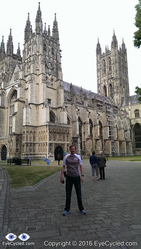
I live in a small town called Bracknell in the county of Berkshire, England. The distance between my home and Canterbury is roughly 100 miles or 160 Km, so I got a good friend of mine to drive me to Canterbury the day before. I also had the company of my older son.
I had a reservation at the local Youth Hostel and after leaving the bike and gear in the hostel we all left to walk around Canterbury and find a place to eat dinner.
You can read a lot about Canterbury in Wikepidia, so I will just refrain from copy and pasting and leave you the invitation to click on the link above to learn more about this historic town, a UNESCO World Heritage Site, which has been inhabited since pre-historic times and played an important role in British history.
There isn’t actually much more to say about that day. After having dinner, my friend and my son drove back home and I spent some time in the hostel writing this blog post here.
At that point I was still deluding myself that I would be able to write one short post for each day of the journey. I did write several, but I now know better.
I don’t want to repeat in this post what I wrote on the above mentioned one, but I thought it was OK to, at least, point back to it and also share the pictures of the day.
Please subscribe to my Blog and/or to my YouTube channel if you don’t want to miss the next one. Please help me spread the word by liking and sharing my Facebook Page and Tweeter feed also.
Thank you for your time!
Please rate this post by clicking on the desired star (1 = Awful, 5
= Excellent)
quick post just to let you know that I did not abandon the Blog… 🙂
I am working on writing Via Francigena content, editing the videos and sharing this experience with you, but progress has been slow due to life’s demands. Please, subscribe to be informed of new post or like our Facebook page.
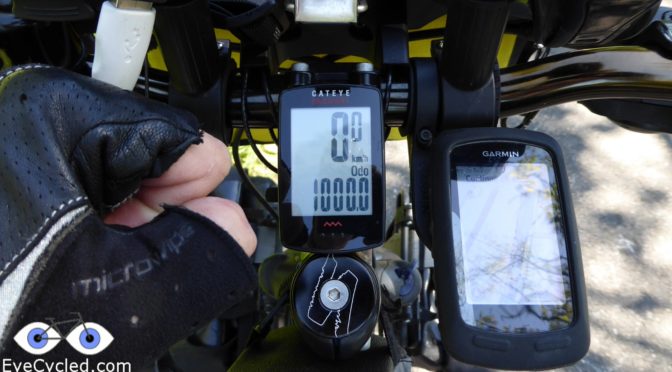
On the 12th of August 2016, the 14th day of cycling between Canterbury and Rome, I completed the 1st 1000 Kms of daily bike riding of my life.
I know, compared to cyclists that cycled around the world, some of which with 100s of 1000s of Kilometers in their Odometers, just is just a drop in the ocean, but for me it was a pretty special moment in a nice location.
The pilgrimage has ended now and I am back in the UK to my “normal” life. I end up having cycled 2,043 Km when I arrived at Saint Peter’s Square in Rome. Was an experience I will cherish forever, but I somehow don’t think it was the experience of a life time. Not ready for the grave yet… 🙂
New challenges are definitely on the horizon.
Thank you your time!
Please rate this post by clicking on the desired star (1 = Awful, 5
= Excellent)
Left the Ibis hotel in Bruay after a great breakfast. The first destination of the day was Ablain-Saint-Nazaire and it took me just over 1h and a half to cover the about 20 Km of this stage.
As usual in these small villages, I couldn’t find any place that could provide a stamp onto my pilgrim’s credential. I don’t let that stop me from riding to these tiny villages as the goal is to follow the same 80 stages Sigeric did 700 years ago (not the route he took though, as many parts are only suitable to those walking). I always spend a few minutes in the villages, taking pictures, having a little rest and taking up some water.
After Ablain-Saint-Nazaire I rode to Arras, which is a big town in comparison to the previous villages. As I got there what stroke me most was the distinctive architecture and the “beach party” place they had built in one of the empty spaces, complete with sand, Caribbean music, palms trees and everything.
Few hundred meters more and I was in the town centre looking at their impressive cathedral. Took a few pictures and headed to the nearby Tourism Information Office to collect my stamp.
After getting my stamp, I left to Bapaume, another small town (not a village though) village along the way. I managed to get a stamp in the Hotel de Ville, or town hall. On my way from Arras to Bapaume I passed by a curious “Route 66” American style dinner, with a big statue of Elvis in front.
Left Bapaume a bit unsure as to how many more kilometres I should ride before to stop. Decided to just check the next stop in Sigeric’s route and decide when I got there. Next stop was Péronne and as I arrived in the outskirts of the small town it was already 7:00pm, so I decided to stay there. I had seen a sign pointing to the municipal camping site and decided to stay there, but then, for some unexpected reason my phone lost GPS connections, which meant Google Maps didn’t work. I tried the navigation on the Garmin, but it didn’t have the camping site on its database and I didn’t know the address. So I rode around for about 30 min and stopped a few times asking for directions. It is not easy to ask for directions in France when you don’t speak French, but a very nice gentleman took the time and drew me a little map on a piece of paper and with that I managed to find the camping site. Must confess I was looking at the navigation, when I should have been looking at the road signs as there were clear indications on the streets to the camping site.
Thankfully as I arrived the camping manager was still there and told me to just go and setup camp and pay me the next day. The charge was €8.00 for the night. After a shower I went out to see if I could buy something to eat, but the only thing I found open at 8:30pm was a kebab trailer in the town centre. So I got myself some Kebab take-away (and something for breakfast next morning) and had a tent feast.
It rained heavily all night and that prevented me from sleeping well. I had never used this tent under rain before, but it performed well and no water came inside.
Before closing this blog post, I have to ask: Have you already donated to my cause? Please, do so. One of the reasons I am writing these posts, even though very tired after riding all day is so that I am able to give you something in return for your contribution.
Now let’s write the next day as I am already behind of these posts.
Flickr API error: Invalid API Key (Key has invalid format)
Please rate this post by clicking on the desired star (1 = Awful, 5
= Excellent)
As suggested by my host in Alembon the day before, 8:00am I was downstairs for breakfast. Got to taste all the home made compote she does and home baked cake as well.
After breakfast I started packing. I confess, this is one of my weak points and something I definitely need to get better at. The Camino de Santiago has taught me a few lessons last year, which I seemed to have forgotten, but the Via Francigena is being quick at reminding me of them.
Before I left home I packed everything according to item type, e.g. clothes and footwear all in one pannier, electronics in another, 1st aid kit and items of personal hygiene in another and so on…
The thing is, when you are on the move and need something you don’t want to be opening several different panniers to get items you may need. The lesson I learned on the Camino was to pack a pannier with the most likely things you are going to need during the day (in the case of the Camino I packed it in a rucksack, as I had only 2 panniers then, where I now have 4), so you’ll only need to open one bag during the day, unless something out of the ordinary happens, which is not uncommon. I am, therefore, attempting to change the packing accordingly and moved several items around the panniers.
When I finished packing everything (took me about 25 min… yes, I am slow) brought everything downstairs, where the bike was, and started to load them in the bike. About 15 min later, when all panniers and the camping bag were loaded and fastened, I realised I was missing my Cateye cycling computer, which I thought I had placed in the handlebar bag together with the Garmin Edge 810. It wasn’t there. Went back to the room and searched everywhere as I knew I had it the day before… couldn’t find it. There was only one option left: Search in the panniers, which, as I mentioned before, were already loaded in the bike. I’ll give you one chance to guess if it was in the 1st pannier or in the last. Did you guess? Of course it was in the last. It must have fallen in the pannier as I was rearranging the packing. Altogether, I literally spend 1h looking for the damn thing. That meant I left the B&B only around 11:30am. For a pilgrim this is almost time of arrival, not time of departure. Anyway… need to give no excuses to anyone as I am alone, but it was a bit stressful. My own fault.
From Alembon I rode to Licques, where I managed to get a stamp from a water park there, as everything else was closed. Then to Tournehem-sur-la-Hem, where there was also nothing open. Not to say nothing, the church was open, but there was no one in it. From Tournehem my next destination was Thérouanne, where, according to my host the day before, there was a pilgrim’s hostel, but… everything was closed. I wasn’t planning to stay there anyway, as I wanted to ride more, so I rode further to Amettes where there is another hostel with special rates for pilgrims (€13/night). Guess what? Closed!
In all the villages I rode through everything was closed. Even the petrol stations were closed. if I wanted to setup camp somewhere I would have to go hungry as I couldn’t find anything open to buy food. I also couldn’t get any stamps on my Pilgrim’s credential which, upon arrival in Rome, is the document you have to show.
So I decided to continue riding to Bruay-la-Buissière as I knew it was a bigger town and there was bound to be something open. As I got there I asked several people about “auberges” or hotels but I couldn’t find any near, so I turned to Google which offered me a few, with one of the cheapest being the Ibis Style in the outskirts of town. Had to ride another 4 or 5 Km to get there and the daily rate wasn’t the €53 Google suggested, but €69 with Breakfast. By that point it was late and I was too tired to go searching for something cheaper, so that is where I stayed. The room was great and the hotel was near several restaurants. Had a really good meal at the 3 Les 3 Brasseurs.
When I left Alembon in the morning, the day was a bit unsettled and that made me forget to pass on the sunscreen on my skin. I live in the UK, so this is something we use very little there 🙂
The sunscreen was on the bottom of one of my panniers, which I really didn’t want to take off the bike again. The result was a really bad sun burn and fever at night which made for an uncomfortable night. I should have stopped to get the sunscreen… lesson number… ? (who’s counting anyway).
Well, that was it. I’m attaching a few pictures to this “post by email” which I hope will be self-explanatory. If you have any questions, just drop me a comment.
Before I close the post, have you made your donation to Mind UK, which is the charity I am sponsoring during this ride? Common, 20 quid will not be much at the end of the month and it’s all for a good cause.
Flickr API error: Invalid API Key (Key has invalid format)
Please rate this post by clicking on the desired star (1 = Awful, 5
= Excellent)
Browsing through WordPress the other day I discovered it is possible to configure it to post by email, in other words, I write an email, send it to the blog and WordPress publishes it as a blog post. I believe that would be ideal for when I am on the road, so decided to give it a try and this is my 1st “post by email” blog post. If it doesn’t look good, don’t blame me… 🙂
Last Sunday I did my first fully loaded test ride to Windsor. Packed in the panniers and rack everything I think I need to take with me and rode to Windsor and back, an approx. 42 Km round trip. The way to Windsor took 1h and 11 min which wasn’t bad, but the route to Windsor is quite flat. Will be a very different type of ride when crossing the Alps.
I used a bathroom scale to measure myself and the loaded bike and the weight of the bike + cargo is just over 50 Kg. The bike itself weighs about 15 Kg, so 35 Kg is load, which is probably too much. As usual, I “think” I am taking with me everything I “think” I am going to use along the ride, incl. all camping equipment and gear plus a small kitchen, clothing for 2 seasons (it can be rather cold in the Alps at the evening, even in summer), bike tools, etc.
I’ll try to reduce the weight by 10 to 15% before I leave.
I have also setup camp in my own back garden to test the new Alpkit Ordos 2 tent I bought especially for this occasion. I must confess I am way too used to the comfort of my bed and it wasn’t a good night sleep, but I am hoping that after a long day of cycling, sleeping at night won’t be an issue.
I am not exactly sure how pictures are displayed in a post, when the post is generated by an email, but I’ll attach some pictures in the hope they will look more or less self-explaining.
Just 3 days from my departure, there is still lots to be done. I have contacted several Warmshowers and Couchsurfing hosts, but the time of the year means a lot of people are themselves not home as they are traveling on holidays.
Well, as this is just a test to determine how this “WordPress Post by Email” feature works, I think that is it. If it works well, I may use it to post more often from the road as it looks like a really convenient method to post.
Stay tuned and if you can, please donate to my charity of choice, Mind UK, which link you can find in my previous blog post.
Thank you!
Please rate this post by clicking on the desired star (1 = Awful, 5
= Excellent)
Please read the blog post below and if you feel inclined to do so, donate generously to my charity of choice through the Virgin Money Giving link below:
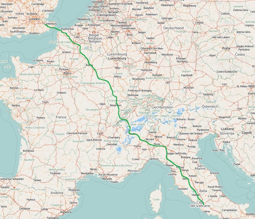
If you have been following my blog or Facebook page, you will know that I am soon going to be undertaking my biggest bike ride yet, a 2,000 Km long (approx.) bike ride from Canterbury in UK to Rome in Italy, on an ancient pilgrimage route known as Via Francigena.
Via Francigena Route
My motivations for doing this bike ride are many, some of which are quite obvious and some are not. On the obvious side, you may have followed my series of blog posts about the Camino de Santiago last year. The Via Francigena is a natural step up from that as it is 2x as long and not as well structured as the Camino (what I mean is that there aren’t as many pilgrims’ accommodations along the way and the route is not well sign posted, especially in France).
As for the non-obvious reasons, I feel strong enough now to share at least one with you all. Since the very unfriendly break-up of my marriage, some 15 months ago, I’ve been battling on and off with depression. I took antidepressants for a few months and gone through therapies.
Depression is an odd kind of illness… Due to sheer ignorance, like many I had a very stigmatized view of it. To be honest, of any type of mental illnesses, actually.
I truly thought it was sort of a rich people’s sickness. An illness that affected only those people who had too much free time on their hands. Life has a funny way of teaching you things sometimes.
So, imagine my surprise when I started to notice very physical symptoms caused by anxiety and my general mental state. Among others where teeth-grinding (also known as Bruxism), sleeplessness, difficulty to breath and more. Life hadn’t stopped, of course, and there were still bills to be paid and things to be done, which at times, associated with loneliness gave me the real feeling I wouldn’t be able to coupe anymore.
Went to the GP several times and he confirmed the diagnosis of clinical depression. It was somewhat interesting to understand how your mental state can have such a powerful impact on your physical condition and I am not talking here about normal day to day worries most people have with their children, their financial affairs, their jobs, etc. This is not a learning experience I wish anyone to go through, but it is generally hard to choose not to be depressed when you’re affected by certain life circumstances, which can vary of importance from person to person, especially when there is so much negative going on in the world these days. Depression is usually a package.
In extreme cases, for some the easy way out appears to become the only solution (even though it is clearly not) and it may surprise you to know that suicide remains the leading cause of death for men between 20 and 34 in England and Wales, representing 24% of all deaths in 2013, and for men aged 35-49, at 13% of deaths (source: The Guardian).
Thankfully the ultimate act was never an option for me… not that I didn’t occasionally think about it, but I’ve always considered it a very unlikely outcome for me in particular. I value my life and the life of others way too much and I personally don’t think ending your physical existence ends the mental problems you might be facing (I believe in “life” after death).
Needless to say this condition had an impact not only on my personal life, but on my professional one too. I don’t subscribe to the idea that a person can fully compartmentalized his personal and professional lives. An unbalance in one, will have repercussions in the other.
The drug I was taking didn’t appear to be making much of a change, although it did help me sleep at night (helped even a bit too much at times as it made it a lot harder to jump out of bed in the morning as well), and when my GP suggested the prescription of a more powerful drug I took the decision upon myself to try to beat this thing without chemicals (or artificial ones, at least).
Cycling has been “my thing” for quite a few years now and it was only natural for me to turn to cycling as a means to combat my depression. Convincing my bosses to give me a 42 days holiday was a tough sell, but I manage to do it and here I am, just a few weeks from starting my cycling pilgrimage.
I am no expert, but I believe that for most there can be a drug-free way to find balance in life again. Some may find it through meditation, others through physical exercise, others by drastically changing their life-styles and so on. I do believe in drug-free treatments are not always possible and that the ultimate word has to remain with the medical or psychological experts treating each case, but I personally don’t think emotions are just a chemical unbalance that can be corrected through drugs. If that was true it would be possible to “correct” love and hate the same way. But even if drugs are the answer, I still believe there are ways for our bodies to produce some of these chemicals naturally such as Serotonin, a neurotransmitter, regarded by some researchers as a chemical that is responsible for maintaining mood balance, and that often link a deficit of serotonin to depression. No doubt, you can take drugs that will aid to increase Serotonin levels in the brain, but according to the Psychology Today Blog, “In numerous studies exercise has been shown to increase both serotonin production and release. In particular, aerobic exercises, like running and biking, are the most likely to boost serotonin.”
So, what I am trying to prove to you, in case you don’t already know, is that, if you know someone who suffers from a mental illness (or if you experience or have experienced it yourself) a drug-free treatment through physical activity can be a powerful boost to your well-being, not to mention a big reduction of the cost to businesses and society overall, given that antidepressant use has doubled in England over the past 10 years (source NewScientist). Most concerning is that the number of children prescribed with antidepressants have increased by 50% in 7 years (source: The Independent).
A US study has estimated that about 300 million work days are lost to sickness every year with 56% of employees reporting depression and anxiety as a cause. Not even the most cold-hearted business person can ignore these stats.
That is why I converted my solo bike ride to Rome into a charity event and have partnered with Mind UK, one of the UK’s leading Mental Health charities, on this enterprise and am here asking for you to donate some of your hard earned cash to this cause. I know how hard it is to try to get out of a bad situation alone and sometimes you need someone that can provide you with an independent perspective about your situation.
Every pound (or dollar, or Euro… whatever) you donate makes a difference. For example:
£8.70 gives a lifeline to someone in desperate need of support
£30 helps Mind work with the government to promote mental health needs and improve services
£150 could fund a local support group
£250 could fund equipment for an art therapy group
£500 can keep Mind’s legal advice service open for a day helping people understand their rights and receive practical legal advice on mental health issues.
What Mind has achieved in 2015. Click on the image to read MInd’s annual review document for 2014-2015 (PDF reader required).
I believe the best thing to combat depression is to try to live life to the fullest. What that means changes from person to person. To live life to it’s full potential will likely be related to finding a job or work that is fulfilling, having a loving family relation, good friends, include hobbies and physical activities and help those you can, through volunteering or other social efforts in benefit of those in need.
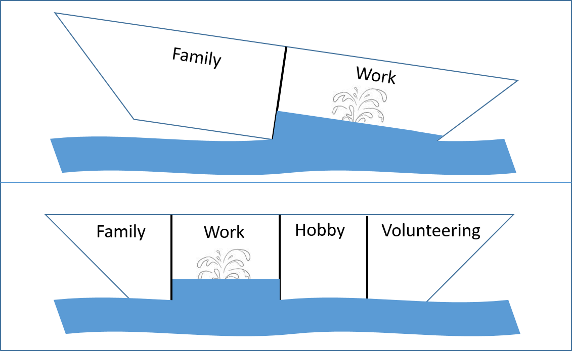
During a recent well-being course, I was shown how to graphically represent life as a boat. If you divide your boat only between work and family chances are that if one of them isn’t going well your boat will have more trouble to stay afloat than if you are able to divide your life’s boat in more compartments.
Which one do you think is more likely to stay afloat?
Cycling has been one of these compartments for me… it’s a low impact form of exercise providing an increased cardiovascular fitness as well as a good muscle workout, as it uses all the major muscle groups as you pedal. It is excellent in reducing obesity and controlling weight and while you are on your bike your stress levels seem to fall dramatically even when you are thinking about your problems which automatically leads to a reduction in anxiety and depression. But if cycling is not your thing, just pick something else… There is plenty to choose from.
The important thing is that you don’t give up.
If you allow me to suggest a strategy, rather than choosing something cheap and easy just to “try it out first, to see how it goes”, go the full mile. Choose something you think you will like (inform yourself) and go buy the gear for it.
Do not buy the cheapest!
If you can afford to buy expensive things, buy, for example, the best running shoes you can afford, if you decide to run, or the best bicycle, if you decide to cycle, or the best tennis or water sports gear if you go for those… that way you are making not only a personal commitment, but a financial investment also and this has 2 advantages:
Generally speaking people don’t like to waste money.
Generally speaking, you get what you paid for. Buying good quality gear will enhance your experience and help you transition into it more easily, with less efforts and pain.
Of course, this is not for everyone, but keep in mind managing limited resources are very much a question of priorities. If you are ill, getting healthy should be one. As Mr Spock would say, it is illogical to want to remain sick!
To contribute to this cause, please click on the Virgin Money Giving page below (just in case, nothing of your contribution is given to me).
If you have contributed, but still feel generous, you could also consider to pay me a coffee to help me keep up with the Blog costs and as an incentive for me to keep doing this sort of thing and blogging about it…
(suggested amount = £2.00 or USD $3.00 or 2.50€).
Please rate this post by clicking on the desired star (1 = Awful, 5
= Excellent)