Category Archives: Touring

Posts about touring bikes

Camino de Santiago, day 16 (17, 18 and 19): From Santiago de Compostela to Fisterra / Finisterre

Welcome back to the series about my Camino de Santiago Pilgrimage by bike. This is going to be a long one folks… (but it’s the last one)

Menu: In this post…

  1. Intro
  2. Day 16: From Santiago de Compostela to Fisterra / Finisterre
    1. Day 16: Photo Album
  3. Day 17: Return from Fisterra to Santiago by bus and walk around Town + the Botafumeiro experience
    1. Day 17: Photo Album
  4. Day 18: Drive back to Saint Jean Pied de Port and Pamplona
    1. Day 18: Photo Album
  5. Day 19: Drive from Pamplona back to Bracknell, UK
    1. Day 19: Photo Album

Intro

Most pilgrims arrive in Santiago de Compostelaand end their pilgrimage there, but a substantial number walk or cycle further to Fisterra, as known in Galician, or Finisterre, in Spanish. Fisterra is the nearest town to Cape Fisterra or Cape Finisterre, which In Roman times was believed to be the end of the known world, hence its name.

If you read the last post about our arrival in Santiago you will know that the next day we spent just getting to know the city and that on the 9th of June 2015, I decided to cycle further from Santiago to Fisterra. This was the 16th day overall and I did this stage of 94.45 Km or 58.7 miles from Santiago de Compostela to Fisterra in 8h 43 min, of which 5h 53 min were of actual moving time.

In this post I will write not only about the ride to Fisterra that day, but also what happened the day after, the 10th of July 2015, upon returning to Santiago and spending one more day there before leaving Spain and driving back to the UK on the 11th and 12th of July 2015.

Back to Menu

Day 16: From Santiago de Compostela to Fisterra / Finisterre by bike

Hostel Fin del Camino, Santiago de Compostela

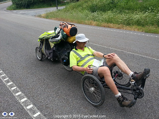
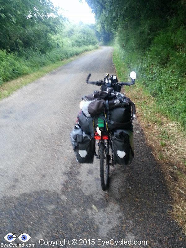
As I was going away for just a day, I packed on one of my panniers just the essentials for the day’s ride and the night in Fisterra. That included the sleeping bag, a change of clothes, the sandals, items of personal hygiene as well as the electronic gear to record the video and take the pictures. Having the big locker at the Albergue Fin del Camino was very handy and since Fernando had decided to stay he did keep an eye on the few things that didn’t fit in the locker.

If you decide to cycle further to Fisterra this is a good option. If you are walking it will probably take you 3 days to reach Fisterra, so I am not sure leaving your belongings unattended at the hostel for such an extended period of time is wise and you will likely need everything you have anyway as you’ll be spending more time under way.

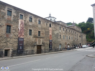
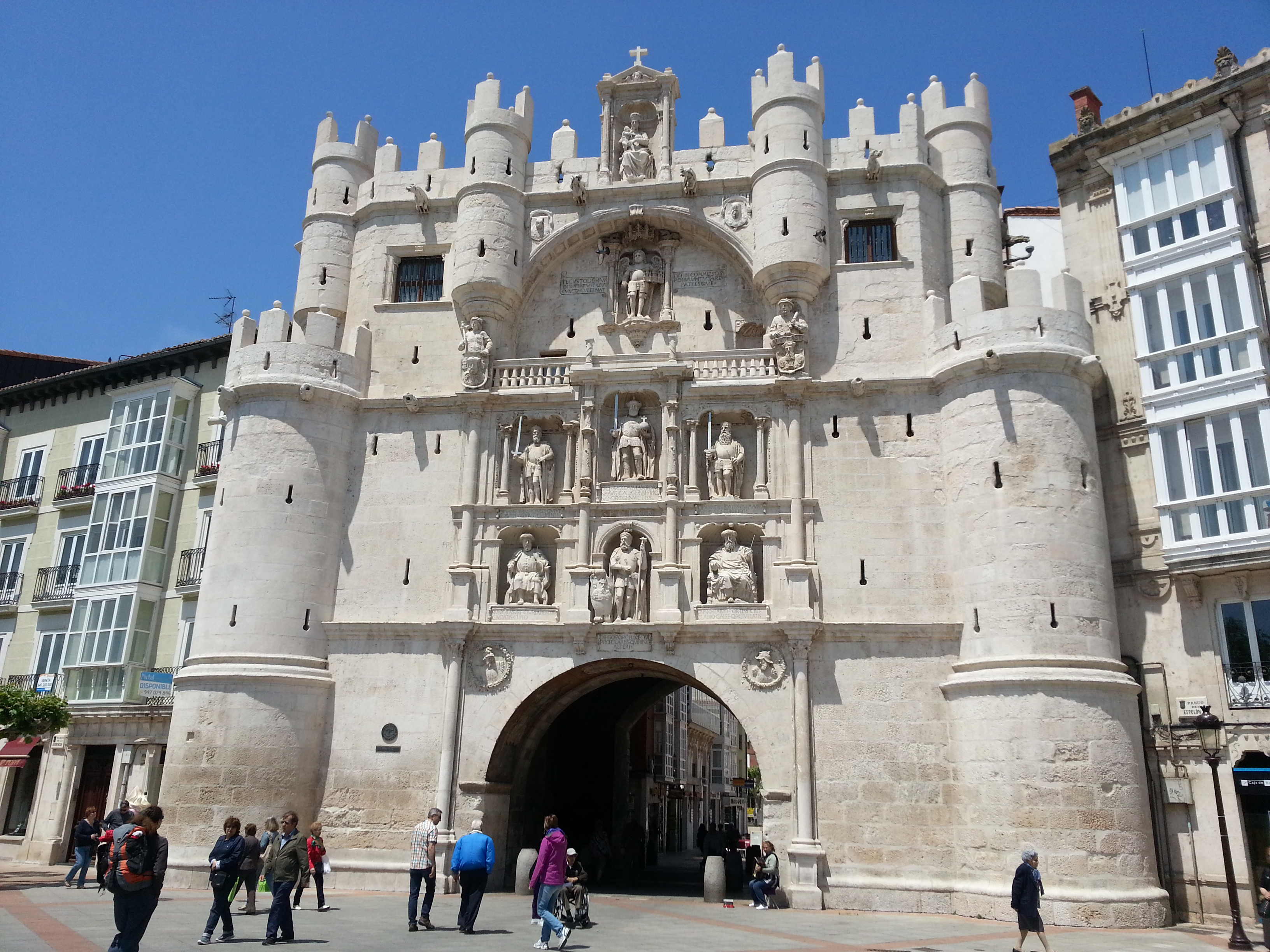
I left the hostel just after 8:00am and crossed the centre of Santiago to capture the image of the Cathedral one last time. Got a bit lost as the day before wasn’t enough to familiarized myself with all the small streets and roads in the centre of Santiago. Sometimes they look very similar to each other.

I, once again, used Google Maps to find my way out of Town and, as I mentioned many times before, this technology can be a bit of hit and miss, especially as in Spain cycling routes didn’t seem to be available in Google Maps, so I used the walking route as a guide. I didn’t want to use the car routes in fear that Google could guide me to some motorway or major roads.

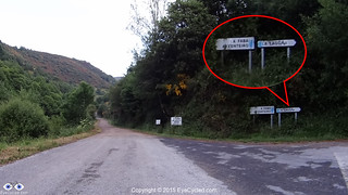
Finding the way out of town wasn’t too difficult. Just before entering the AC-453, which was the major road out of town, I stopped at a little café for some breakfast as I hadn’t eaten anything before leaving the hostel. I then rode on the AC-453 for about 4 Km until a roundabout about 1 Km after Roxos, where I turned right in the direction to Portela de Villestro and Ventosa. Strangely enough, as I look at the map right now, although the road splits at the roundabout, both sections are called AC-453. I don’t understand the Spanish road naming system very well.

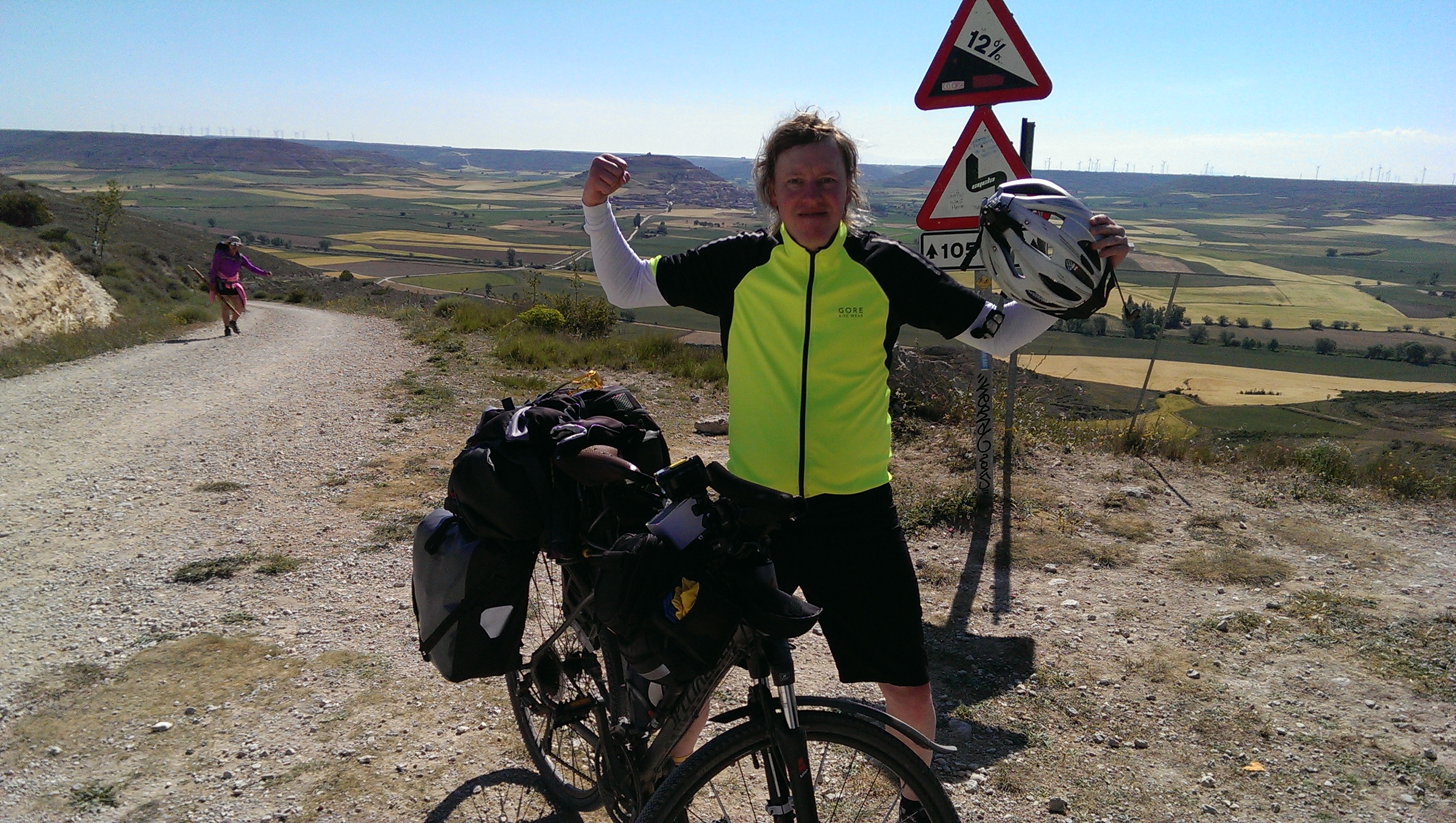
If you take the same route as me, some 2 Km after passing Ventosa, get ready for some hills that on a fully loaded bike may be quite challenging. As I was considerably lighter, I managed to pedal up, albeit very slowly.

River Tambre
River Tambre
View of the river Tambre from the bridge

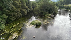
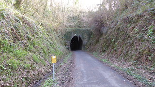
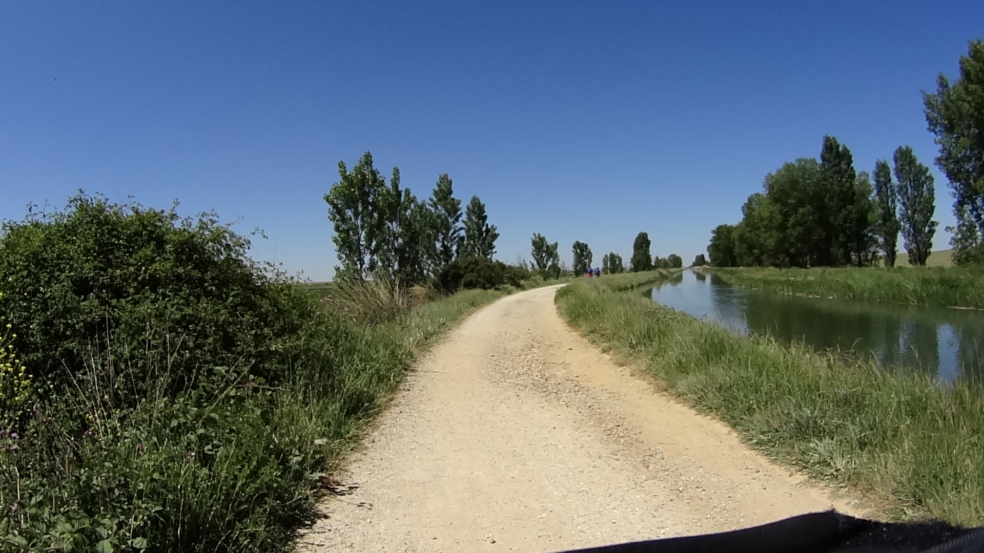
After Augapesada you’ll cross through some nice patches of forest. Google Maps doesn’t even show a name for these small roads, but although a bit narrow their tarmac is good. The next small town on this route is Negreira and on your way there you’ll cross many tiny villages like Castiñeiro do Lobo, Carballo and also cross the river Tambre on an old stone bridge which will give you the opportunity for some nice photoshoots. Just before crossing the river there was a nice restaurant which I would have considered stopping for a few minutes, but it appeared to be closed. As you cross the river you go through a village called Barca before you reach Negreira.

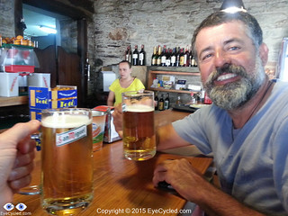
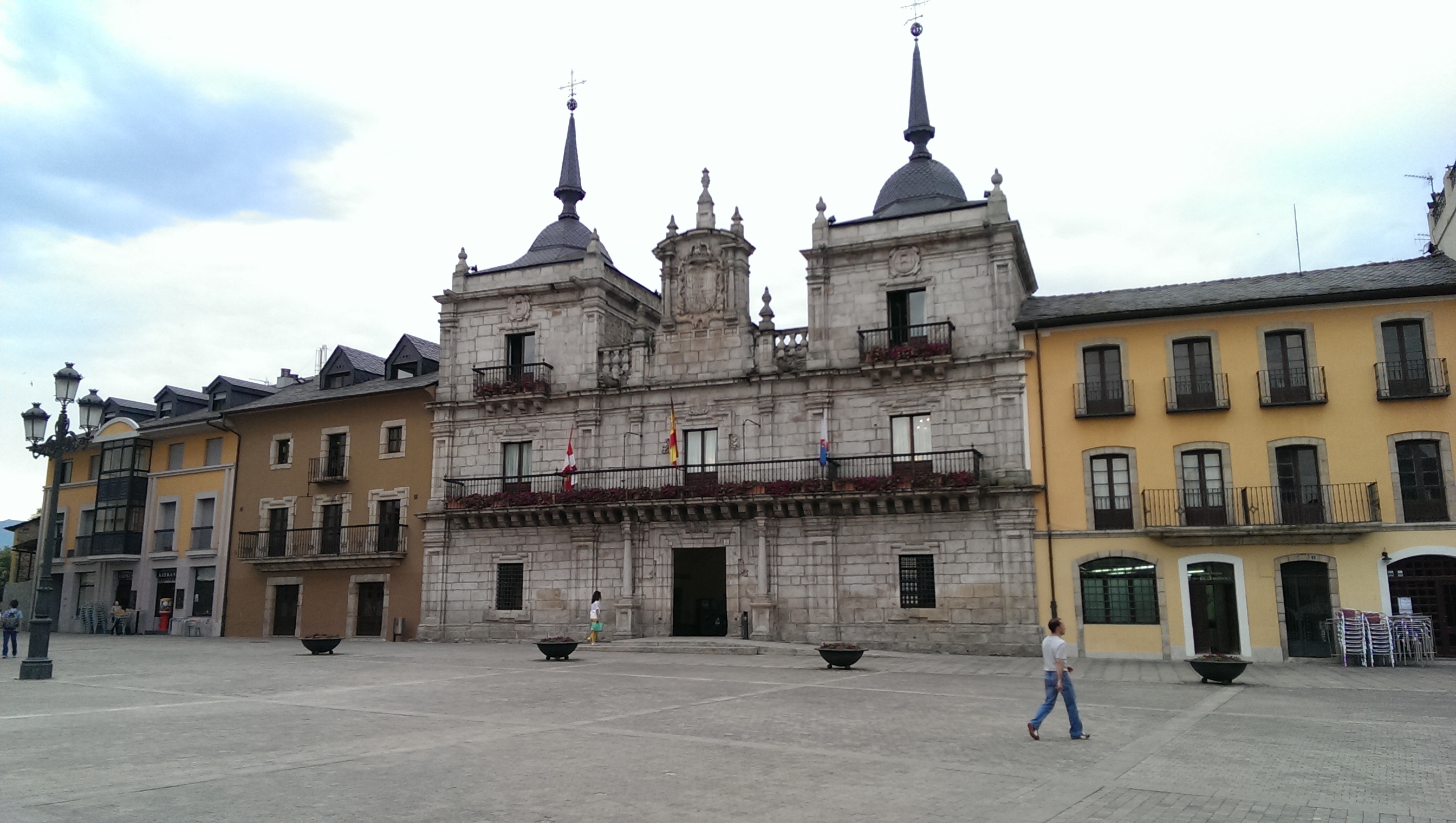
I only stopped in Negreira for a few minutes to get directions and had a talk with a group of Portuguese cyclists who were also riding to Fisterra. The town appears to have a good infrastructure and it’s probably a good place to stop if you are walking and can reach it in a day (24 Km from the hostel in Santiago).

Negreira City Wall
Negreira City Wall

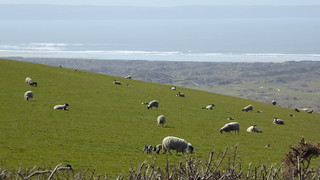
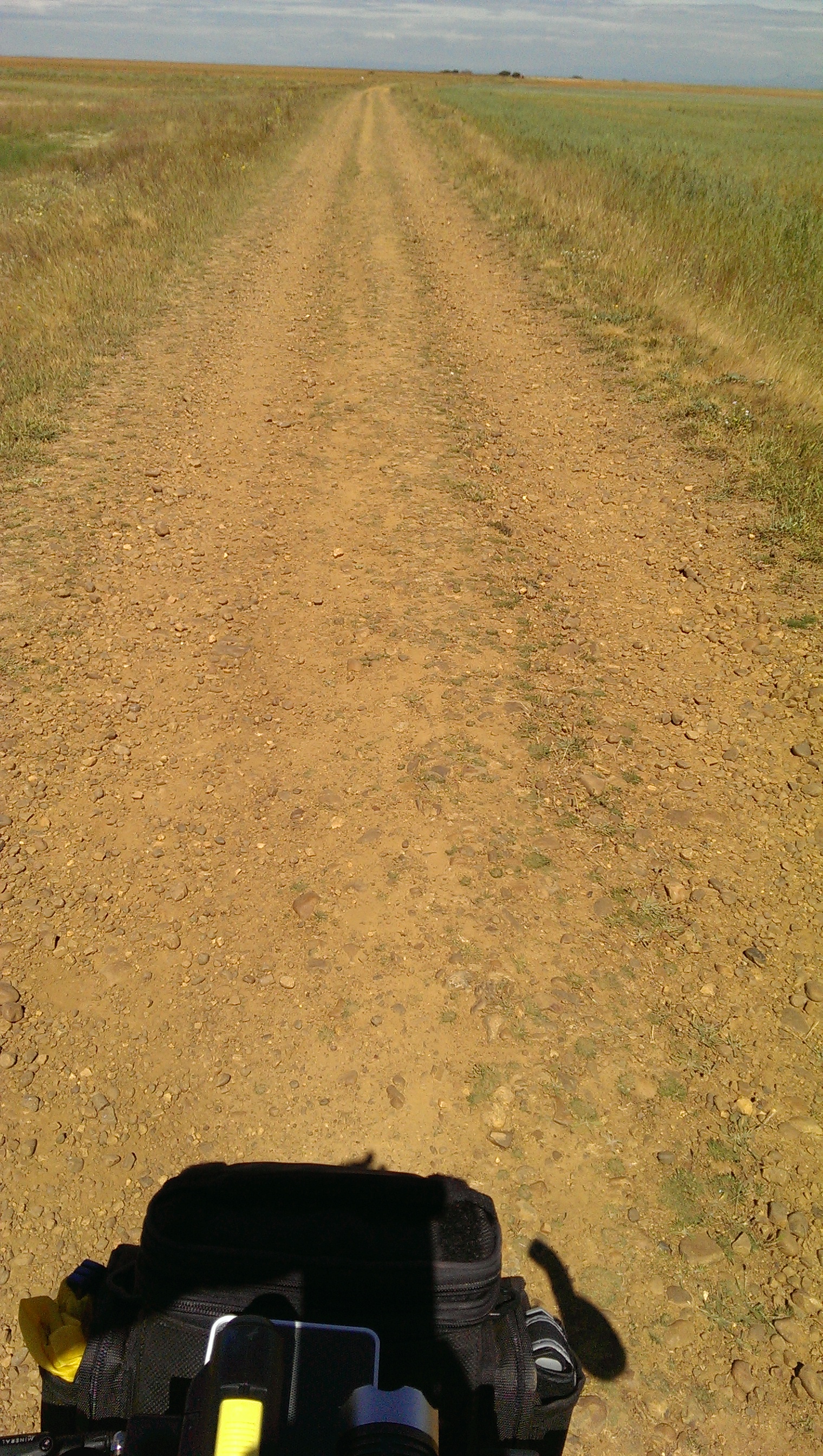
After Negreira there appears to be much less density and the villages appear to be further apart, but that may just have been my impression. Google guided me to the DP-5603 in the direction to Zas. After 10 Km on the DP-5603, about 3 Km after the village of A Pena, Google Maps instructed me to leave the main road and take some really minor roads, which although quite narrow where tarmac paved. I must admit I was a bit skeptical this was the right way, but I followed Google’s instructions nevertheless, only to find myself without a mobile phone signal a few Km up the road. Thankfully Google had cached enough of the map on my phone to provide me with some idea where to go next, but looking at the map right now, as I write this post, there appears to be a shorter way to get to Pesadoira through the village of Vilaserío than the one I took, which was quite hilly and had a lot of turns.

The letters are living plants (grass, I think)

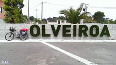
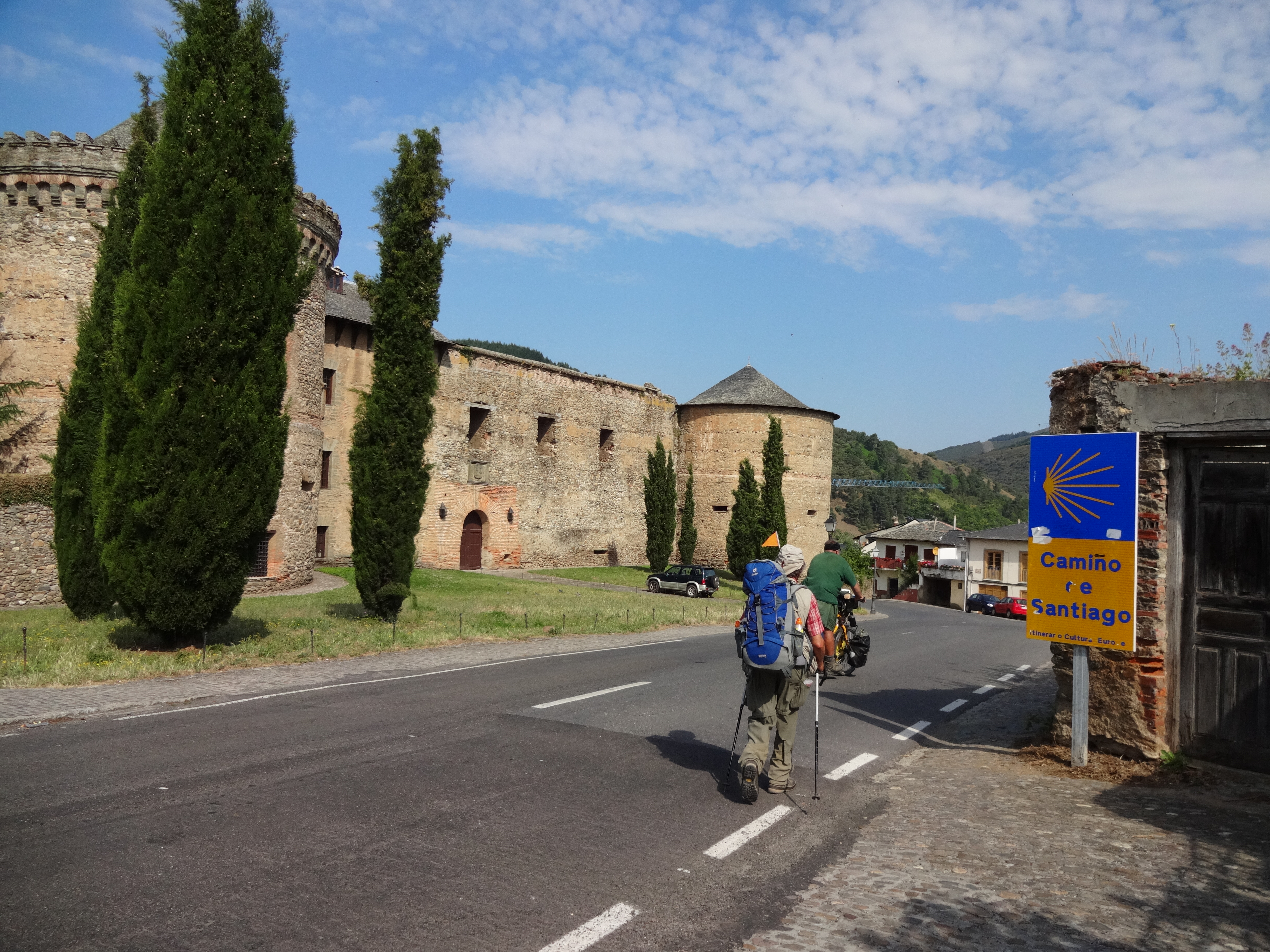
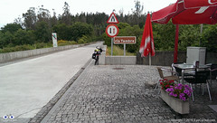
Just before Pesadoira I got some directions from local farmers and then followed to Cuíña, San Fins de Eirón and Corveira, before entering again a major road, the AC-400. Just about 1 Km on the AC-400, Google was directing me to leave the main road again. Luckily I got some instructions from another friendly farmer on his tractor that stopped what he was doing, switched off the engine, got off his tractor and came to talk to me. It was a nice chat, proving that most Spanish people are really friendly towards strangers. His advice was not to follow the route Google was suggesting and I take local advise over Google most of the time. Continuing on the AC-400 until Pino do Val was much longer than Google’s suggestion was, but from what the farmer told me I think it was the fastest, the easiest and the right option as it went around some very steep hills. On Pino do Val I turned right in the direction to A Picota and Mazaricos on the DP-3404 which I followed until short after the village of Hospital.Before getting there, however, I stopped for about 20 min in the village of Olveiroa for a rest, to eat a banana and drink some freshly squeezed orange juice. Olveiroa has a nice hostel which appears to be a good place to stay if you are walking.

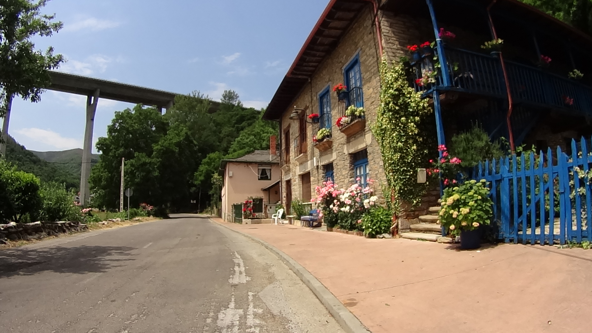
After Hospital I turned left on the DP-2302 which took me all the way “down” to the town of Cee and through some interesting villages along the way (there are quite a few places to stop along the road as well, like restaurants, etc.).

Town of Cee. Encounter with the sea.

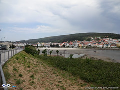
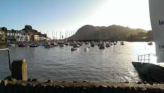
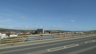
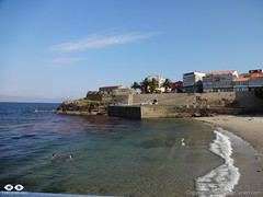
Cee is the next big town and is where you meet the sea for the 1st time. It’s pretty much glued to Corcubión and I don’t really know where one town ends and the next begins.

Nice sea views along the way.

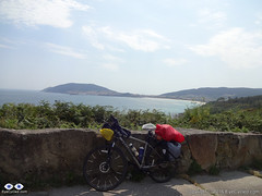
After Corcubión get ready for 3 Km of hills until you reach the next beach in Sardiñeiro de Abaixo. Just before Sardiñeiro de Abaixo there is a nice camping place which can be an option to stay, if you like to setup camp, and its right in front of the Estorde beach where you’ll also find restaurant facilities.After Sardiñeiro you pretty much follow the coastal line which offers some great photoshoot opportunities.

Arrival in Fisterra
Arrival in Fisterra

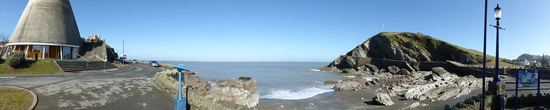
Google Maps shows that just before there is a village called Escaselas, but it all appeared connected to me so as I got there I thought I had arrived in the suburbs of Fisterra.

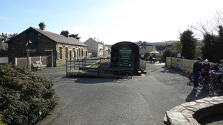
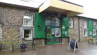
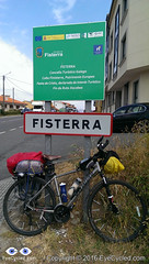
As I arrived in Fisterra I did a quick ride around the harbour area of the town. The street you’ll likely be on as you arrive in Fisterra ends right in front of the municipal hostel of the town, but I somehow failed to see the signs. Upon asking for some directions I found the hostel, checked-in and got my certificate of completion for having arrived on the so called Death Coast and at the end of the “Camino Jacobeo” (Jacob’s way).

Municipal Hostel in Fisterra

Like many others before it, the hostel in Fisterra is basic, but sufficient. There was no WiFi connection in the room I was in, on the top floor of the building, which had, I think, 5 or 6 bunk beds. The municipal hostel cost €6 and has 36 beds. There are kitchen laundry facilities available.

Small beach in the town of Fisterra. San Carlos castle at the, today a "fishing museum".
Small beach in the town of Fisterra. San Carlos castle at the, today a “fishing museum”.

After a shower I went out on foot to find a place to eat. Had a walk around town and returned to the hostel. It is tradition for pilgrims to walk (or cycle) to the Lighthouse at the Cape Fisterra / Finisterre, some 3 Km away, but I was honestly tired and I think the variations of “dry & rainy” + “hot & fresh” weather in that day had taken a toll on me. Many pilgrims go to the cape to burn something (a piece of clothing or something they brought from their origin) to symbolize leaving old worries behind and the start of the new life.

This completes the account of this day’s ride to Fisterra. I was in bed early as I had decided to take an early bus (around 8:00am) back to Santiago so I could have time during the next day to get to know Santiago a bit better and perhaps experience the Botafumeiro mass.

Back to Menu

Flicker Photo Album of day 16

Back to Menu

Day 17: Return from Fisterra to Santiago by bus and walk around Town + the Botafumeiro experience

Alameda Park in Santiago

I managed to take the bus as planned back to Santiago and I managed to fit my bike in the bus’s luggage compartment without having to disassemble it, although I later saw that people just threw their luggage on top of my bike, which wasn’t cool, but then, I was taking a lot of space anyway (there was no damage to the bike).

Nope, they are not real...
Nope, they are not real…

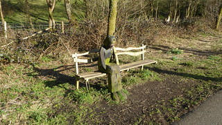
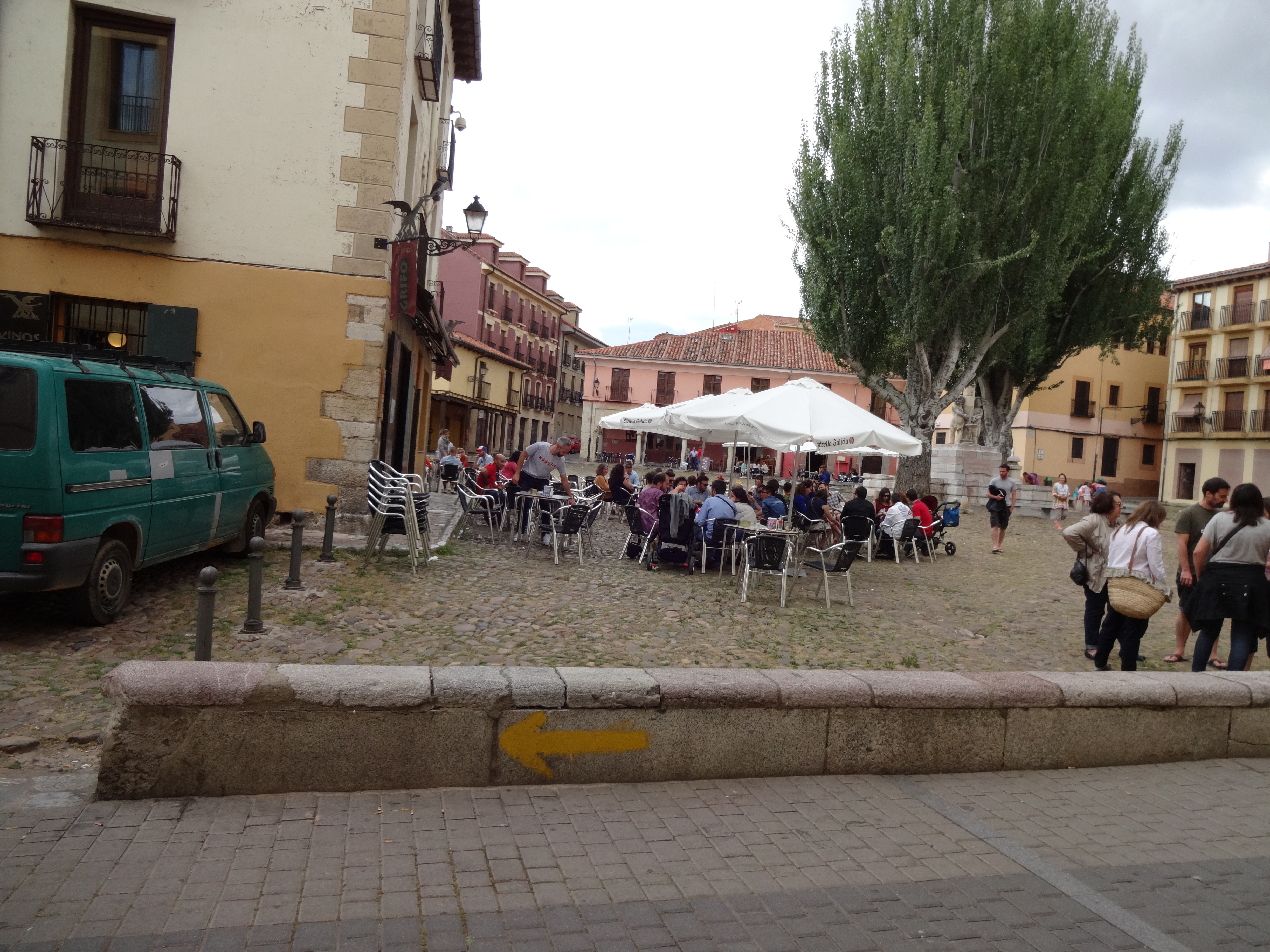
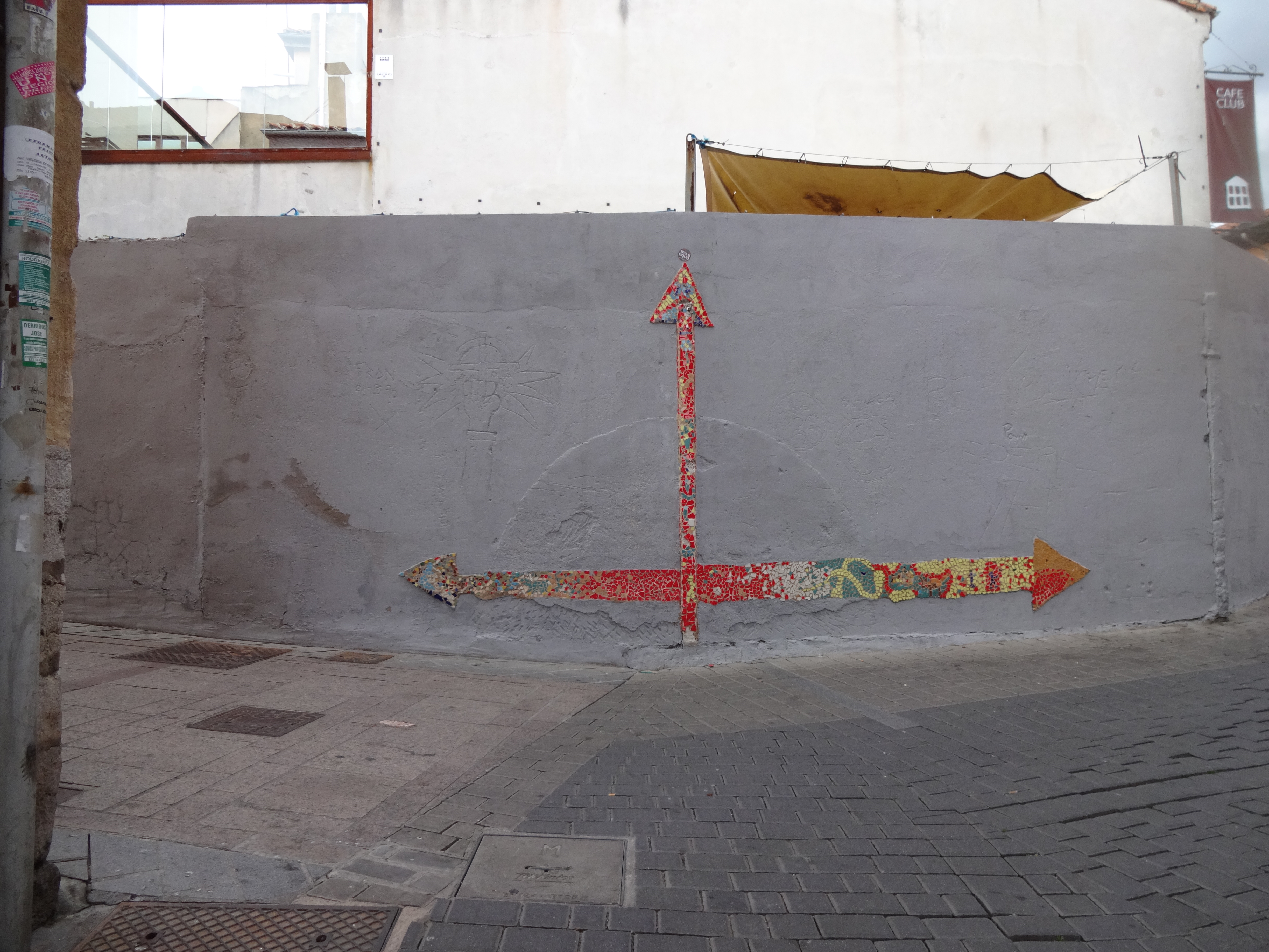
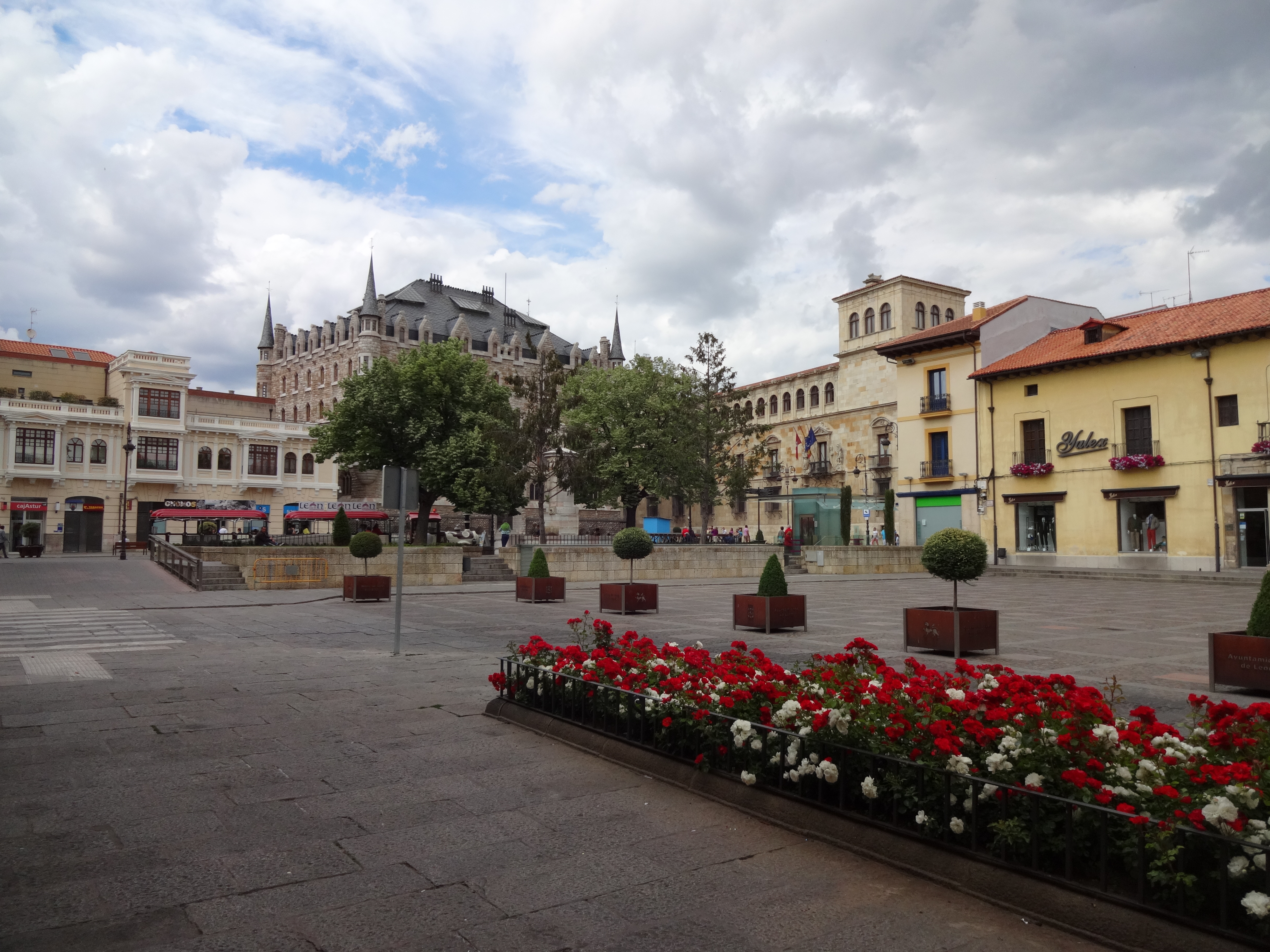
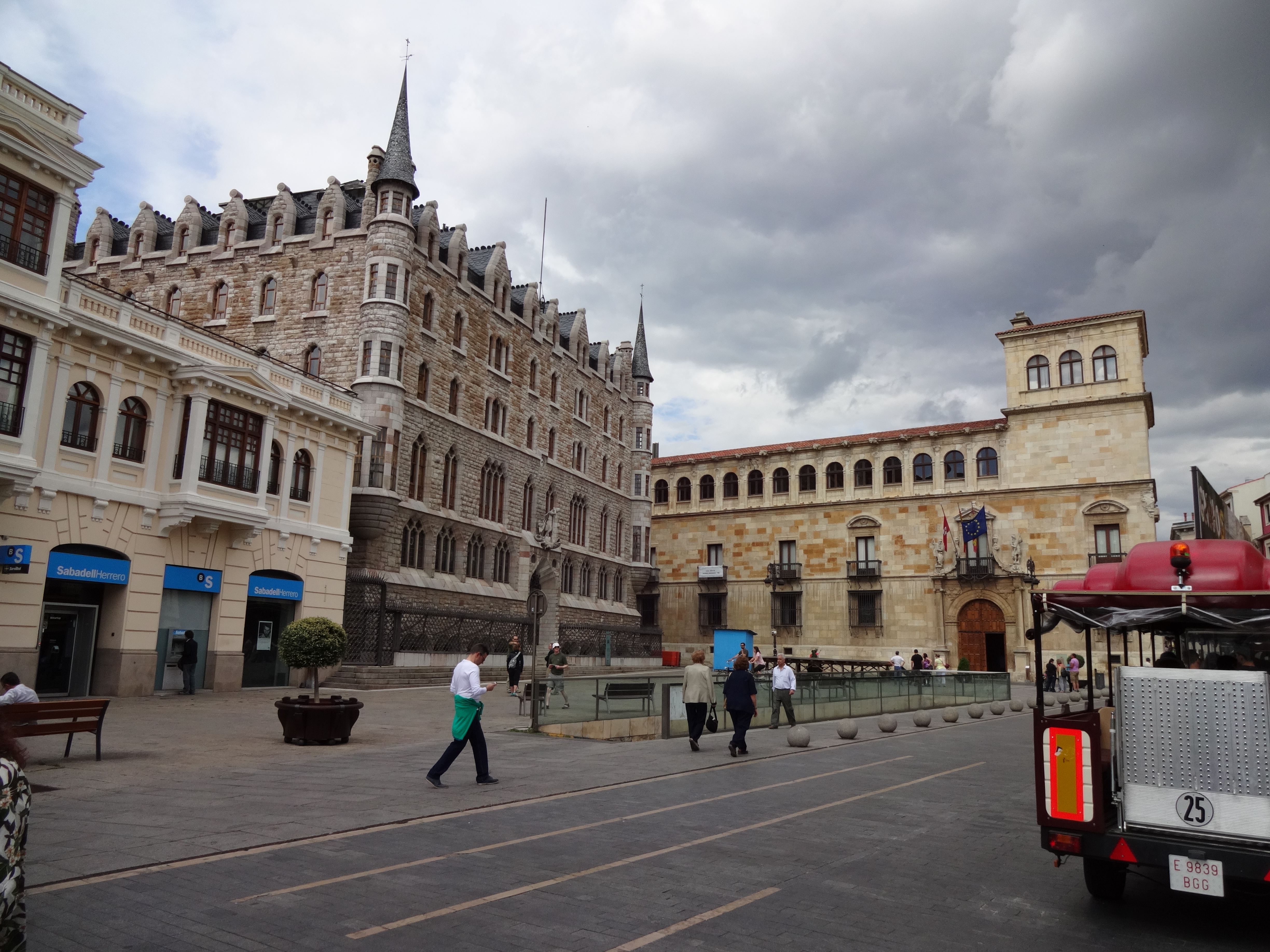
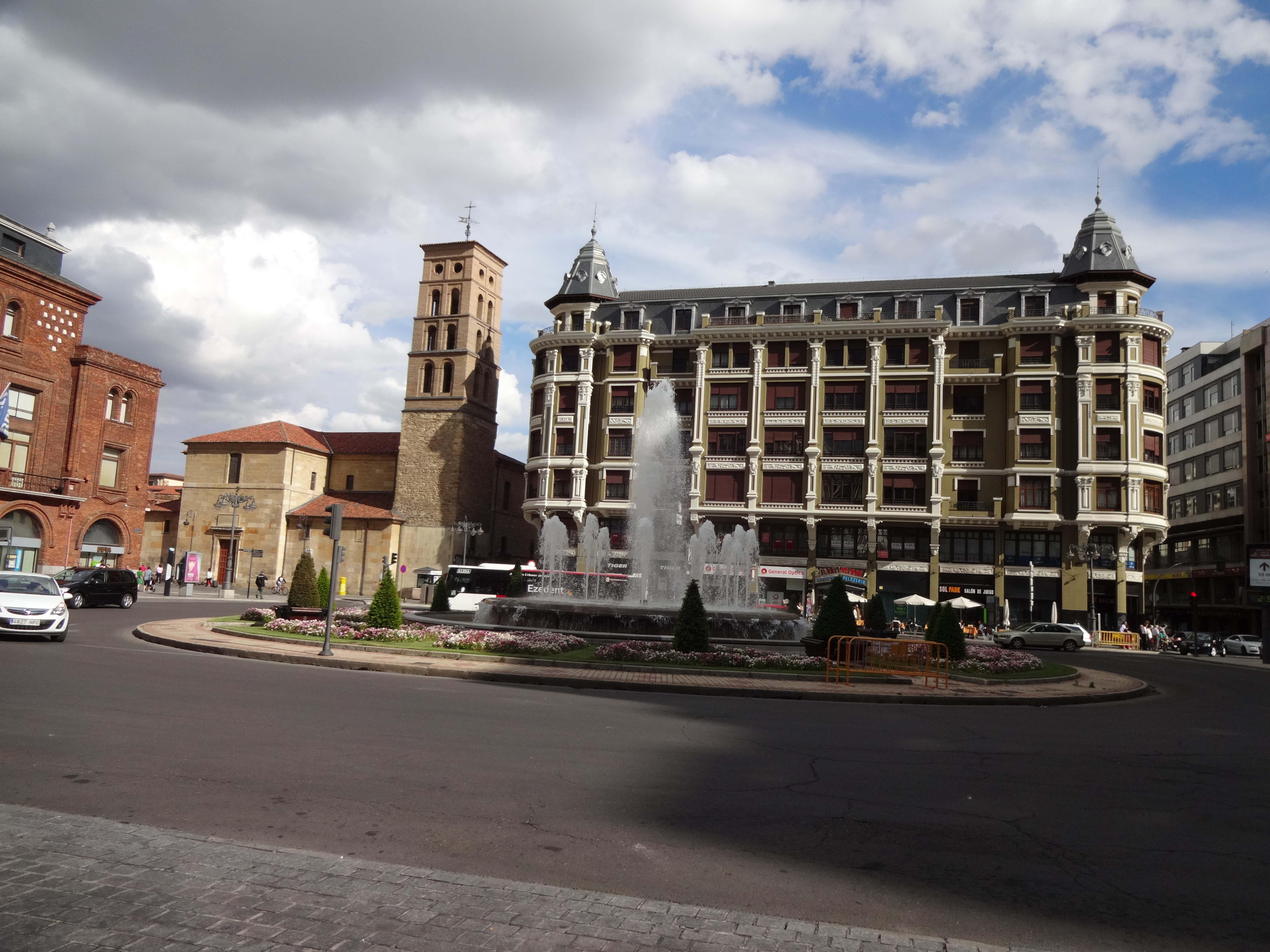
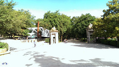
As I got the more direct bus (there is one that stops more often) and it took me just under 2 h to get back. Because I arrived in Santiago before 10:00am I rode a little around some areas of the city I had seen from a distance 2 days earlier, such as the Alameda Park in the city centre, which gave me some new photoshoot opportunities.

Given the Albergue Fin del Camino opens only 11:00am, I timed my ride around town to coincide getting to the hostel as it was about to open. I had a shower, a change of clothes and set off to the city centre again to attend the mass.

The famous Botafumeiro mass in the Cathedral of Santiago de Compostela.

Fernando wasn’t around as he had made some friends in the hostel and decided to take the bus to Muxia with them.

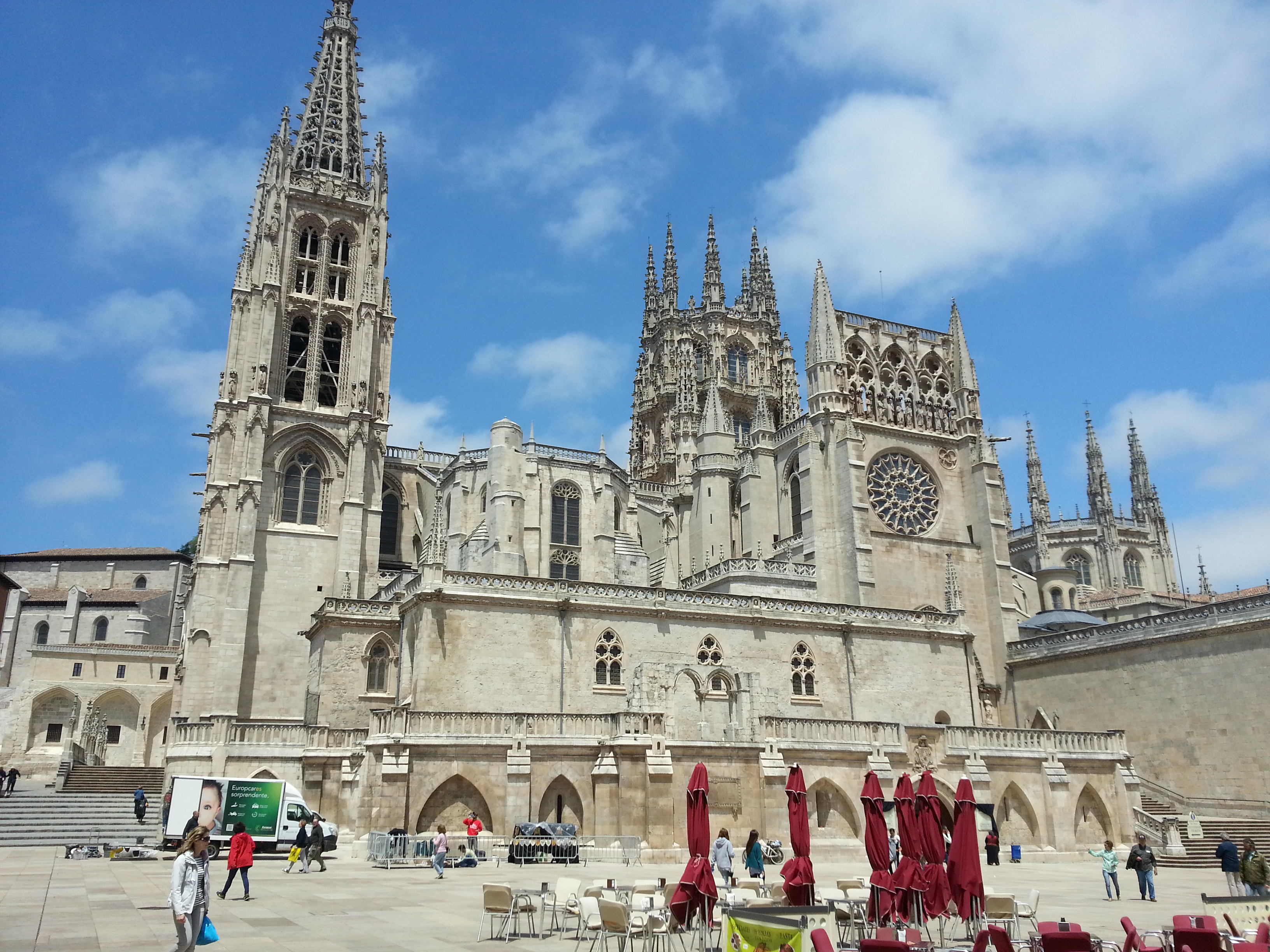
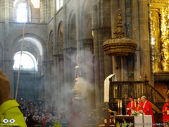
As I got to the Cathedral the mass had already started, but I got there still on time to experience the Botafumeiro.

After the mass I walked around the city centre for another 3 hours before returning to the hostel, where I met Fernando in the evening. The next day I had to wake up early to go to the airport and get the rental car I had reserved from England, so by 10:00pm I was already in bed. There was little cycling this day, but some significant walking so I was pretty tired.

Back to Menu

Flickr Photo Album of day 17

Back to Menu

Day 18: Drive back to Saint Jean Pied de Port and Pamplona

Santiago de Compostela International Airport.

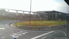
Next day I got up around 7:00h so I could be at the airport by 9:00h to get the rental car at Hertz rental. There is a bus stop on the main road, the N-634 (the one by the big shopping centre nearby) right in front the San Lazaro church (just 2 blocks away from the hostel) and there is a direct bus connection to the Airport. The bus ride takes about 25 min. Even for those leaving Santiago by plane, this is a good tip.

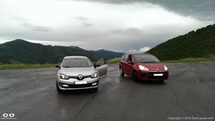
As I arrived at the airport there was a little queue at the Hertz counter, but I was happy to get a free upgrade to a bigger car (a Renault Megane), which meant it was easier to load the bikes and we had a bit more leg room in front. I am aware that many pilgrims on the Camino de Santiago have to return to Saint Jean, like we did. Renting a car is not the cheapest option if you are alone, but if you are in a group of 2 or more the cost of car renting starts to break even when compared to trains and buses.

Before we left England, my online research showed that returning to Pamplona by train would have a cost of at least £30 or €40 each (or £60 / €80 for both of us) not taking into consideration any possible bicycle carriage fees in the train. It’s apparently a 9h journey by train. We would then have to take the bus from Pamplona to Saint Jean the next day at a cost of approx. €20 / £15 each (not accounting for any bicycle fees). I calculated the total estimated cost of returning by train / bus to be of between £90 to £100 for both of us (approx. €130). We paid £80 for the car rental with another €45 for fuel, a total of £115 or €150. The comfort of the car rental was worth the extra £15 in my personal opinion and the drive back to Saint Jean and Pamplona through the north was wonderful.

Tall bridges along the way.

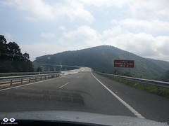
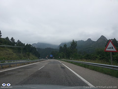
As I returned to the hostel, we loaded the car and stopped at a nearby café for breakfast before driving off to Saint Jean. We decided to take the north route back to Saint Jean and drove on the AP-9 motorway in the direction to A Coruña (also known as Autopista del Atlántico) and then further north to O Ferrol following the coastal path of main roads and motorways in the region (which change names) through Oviedo, Santander and Bilbao.

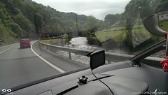
If you love driving, I truly recommend this drive back to Saint Jean. Its many tall bridges over valleys and tunnels make it an attraction in itself. There are a few tollgates along the way (can remember at least one at a tunnel near Bilbao), but the fee is nowhere near as high as the ridiculous prices practiced in France (something like €1.30 – €2). I was looking forward to drive in that part of Spain since we left England and I was not disappointed.

20150611_140046It took us about 8h to drive to Saint Jean and when we got there my car was exactly as we had left it 3 weeks before. We transferred the bikes and everything else from the rental car to my car and while I drove the rental car, Fernando drove my car back to Pamplona where we had to return the rental car at the Hertz office in Pamplona’s Airport.

Roncevaux Pass (Ibañeta) at 1057m. 6h by bike, 20 min by car.

The drive from Saint Jean to Pamplona was an interesting experience, as we took practically the same route we did with our bikes 3 weeks earlier. Along the way I kept remembering the hard climb with fully loaded bikes from Saint Jean to Roncesvalles and thinking how easy it is to be corrupted by the comforts of modern life. It took us only a few minutes to get from Saint Jean to the Roncevaux Pass (Ibañeta) at 1057m that we had reached by bike, after 6h of pedalling, 3 weeks earlier.

Because I programmed my TomTom SatNav to guide us to the Airport in Pamplona, it took us through some rather minor roads after Roncesvalles, which I believe now wasn’t the best route. Believe it or not, I only had to fuel the rental car some 15 Km before Pamplona, so it managed to do more than 900 Km on just 1 tank, which I thought was very good.

We arrived at Pamplona’s airport around 20:00h and there was no one at the Hertz counter, so I dropped the car keys in the box and we left the airport to find the place we were going to stay for the night. We had already reserved a room with breakfast. Finding it wasn’t too difficult.

Walls of the Citadel, Pamplona (mobile phone picture).

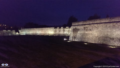
I don’t know if it was the excitement of the day’s drive, but contrary to Fernando I was very awake and full of energy. Had a shower and left to go find something to eat and walk around the city. I didn’t see much of Pamplona that evening, but from what I saw, I loved the city. It’s a city that, in my opinion, managed very well to mix it’s old heritage, with its Roman beginnings at 75–74 BC, through the ages in which it was a fortress-city, in which the Citadel is the biggest landmark, and to its modernization. I absolutely loved its wide avenues and many green places along the paths I walked to reach the city centre. It’s a place I would definitely like to spend more time if I ever have the opportunity again.

Back to Menu

Flickr Photo Album of day 18

Back to Menu

Day 19: Drive from Pamplona back to Bracknell, UK

Leaving Pamplona.
Leaving Pamplona.

This day wasn’t as exciting as the day before. It was in fact quite boring to be honest, so I am not going to add much about this day to this account. We attempted to circumvent the motorways in order not to have to pay the expensive toll fees, but that was delaying us so much that we feared we would not get to Calais in time to get the Eurotunnel train back to England. After driving for many hours and covering only about 20% of the distance we gave up and went back the motorway and to the toll fees. They designed it so that it leaves you an alternative, but the alternative is so bad (single lane roads, lots of traffic) you end preferring to pay the motorway toll fees.

French country side is beautiful, but we were just too tired of all the driving.

There was some nice French country side scenery along the way too, but I think at that point we had enough and just wanted to get back home.

We got lucky as we arrived in Calais and were allowed to take the next train through the tunnel (our reservation was for a train leaving 3 h later). That meant that by 23:00h we were back again on British soil and guess what? Some 20 min later, it started to rain torrentially. A rather typical welcome back to the UK.

By midnight we had arrived at my house. Fernando only transferred some of his gear to his car, which was parked there, left his bike with me and drove home.

This now completes our entire series on the Camino de Santiago, from the very beginning where we left Bracknell to the moment we got back.

I am thinking of extending the series a bit more with an extra post to summarize the experience and perhaps add some “interviews” with people I have met along the way or that have done the pilgrimage before and after I did. Don’t count on it as my time is very limited nowadays, but I’ll do my best.

Thank you for following me and coming on this journey with us. I am looking forward to the next adventure on the “Via Francigena” pilgrimage, starting on the 30th of July 2016.

If you have never done a pilgrimage before, what are you waiting for? If you are about to do yours, here goes a statement you are going to hear a lot during your pilgrimage: “Buen Camino!”

Back to Menu

Flickr Photo Album of day 19

Back to Menu

<< Previous day (Day 15 & 14)                                                        Summary >>

Please rate this post by clicking on the desired star (1 = Awful, 5 = Excellent)
[Total: 3 Average: 3.7]

Canterbury to Dover, National Cycle Route 16, Via Francigena Pilgrimage

Via Francigena Pilgrim's Credentials
Front and back side of the Via Francigena Pilgrim’s credential (picture shows 2 credentials, I got 3, just in case)

If you have been following my Blog, you will already know I am currently preparing myself for a 2,200 Km (approx.) bike ride, starting from the Canterbury Cathedral on the 30th of July 2016 and finishing in Rome, Italy, on the 1st week of September.

This is a pilgrimage known as Via Francigena  or Via Romea Francigena. In the EuroVelo project this route is the biggest portion of route number 5, which actually starts in London and ends in Brindisi, Italy.

Via Francigena Pilgrim's Credentials
The 1st stamp of many more to come

So, although I am still several weeks away from the start of the Pilgrimage, a friend and I decided to drive to Canterbury last weekend, to do some initial reconnaissance, as I had never been there before. That has also enabled me to get my pilgrim’s credentials (also known as pilgrim’s passport for Camino de Santiago pilgrims) and ride to the Dover Ferry Terminal as I have a per-determined time to arrive there on the 30th of July to catch the ferry to Calais in France.
The video below is the time-lapse of the entire bike ride between Canterbury and Dover, recorded by a GoPro 4 Silver mounted on a handlebar T-Mount (I need to do something to reduce the shaking in that mount).

They say Kent (the region where Canterbury is located) is the garden of England, and it is certainly a beautiful part of the country.

We followed the National Cycle Route 16, which proved not to be the most direct route to Dover and had some challenging hills to climb. Nothing too hard on a bike without any load other than the rider, but considering I’ll be carrying with me about 20 Kg in 4 panniers and on the rack, I had to make sure I know when to leave in order to arrive in Dover on time to catch the ferry,

I will not to an extensive written description of the route as you have the map and the video, but if you have any questions don’t hesitate to get in touch through the contact form.

I’ve also created a Flickr album to store all the pictures I’ve taken along the way. Feel free to browse the pictures below or click on them to see them in higher resolution in Flickr.

If you like this post, please share and subscribe.

Thank you for your time.

Flickr Album with pictures of the day.

Please rate this post by clicking on the desired star (1 = Awful, 5 = Excellent)
[Total: 6 Average: 4.8]

Devon Coast to Coast, Day 1 of 3: From Ilfracombe to Okehampton


This is the 1st post of 3 about the Devon Coast to Coast bike ride that I did during Easter 2016 with two good friends: Fernando and Eduardo. For the most part I stayed on the National Cycle Route 27, but in these 3 days I can say I experienced what I can closely call, the best and the worst of British Weather. Although I would understand if people say that was nowhere near as bad as the weather can get here in the UK, the 2nd day of the ride was bad enough for me, but let me focus on the 1st day.

If you don’t like reading, please watch this bike Vlog where I give a good verbal account of these 3 days of bike riding:

On this day, Friday the 25th of March, I rode from Ilfracombe on the north coast of Devon to the town of Okehampton. According to the data collected by my Garmin 810, I rode 86.43 Km or just under 54 miles in 6 h and 16 min, but the total time elapsed from start to finish was 9 h and 22 min. We had to make long stops this day due to problems on Fernando’s bike.

IMAG2559
Ilfracombe Harbour

We left the Royal Britannia hotel in Ilfracombe just after 7:00 am, had breakfast at a nice, family run, café near the hotel, the  Adeles café, and then went to get all the bikes out of the car, which we left parked at the Ilfracombe Harbour (at £10 per day).

With all the bikes out of the car, the next stop was the Ilfracombe Promenade where the video starts.

P1000499
View from the Ilfracombe Promenade with the Landmark Seaview Theater to the left

Now, before you go watch the video, let me make a few remarks, so you don’t get too disappointed at the start and give up on it:

  1. I usually use time-lapse photography to compress the time and the GoPro is usually mounted on the handlebar. This time, however, I had forgotten the camera handlebar mount at home and was forced to use the mount on my helmet, which for time-lapse is not ideal. There is a lot of head movement, especially in urban areas as I had to be aware of my surroundings. There is a limit for how much image stabilization can reduce the shakiness. It does get better on rural areas.
  2. In a few places the camera seemed to have moved out of position and recorded mostly the sky 🙁 Sorry for that!
  3. On the last 3 minutes of the video, as night fell (and added to the fact the time-lapse video was taken from my moving head) made the video unwatchable, but I decided to keep it anyway as a complete record of the day. Up to you if you have the eyes to watch it.

This video is a different approach from previous ones, not only because of the problems above, but because I decided not to worry about the length of the video (it’s 33 min long). I know most people watch only 3 to 5 min of video in YouTube and then give up, but I am assuming that if you are watching it is because you probably intend to ride this route also, so the more detail, the better.

Right at the start prepared to be challenged by some steep hills as you cross the town to get to the start of the route 27 cycle path. The path is very nice though, with some beautiful views of the valley below and the water reservoirs. You’ll cycle about 7 Km on cycle paths and then take right on Georgeham Road. From that point you’ll cycle on minor narrow roads (sometimes barely wide enough for a car) practically all the way to Braunton. Along the way, you’ll see some nice sea views on the distance.

P1000515
Sheeps and Sea

We had to stop in Braunton because Fernando’s bike developed a rather serious disc brake issue, practically resulting in the loss of all brakes. Luckily the Southfork bike shop in Braunton was opened for business, despite being a bank holiday in the UK, and the entire hydraulic disc brake set was replaced.

P1000529
View of Barnstaple from Long Bridge

It took about 1.5 h for them to complete the work which gave us enough time for some very tasty fish and chips at Squires, which I totally recommend. After the brake fault and the repair, we re-joined route 27 towards Barnstaple, one of the region’s biggest towns and the place we would come back to by train on Sunday. The ride alongside the river Taw is great and the path is smooth. Once you get to cross to the other side over the “Long Bridge”, you’ll continue to ride alongside the River Taw for several kilometres still.

P1000536
Bideford Station, Tarka Trail.

The next town / village along the way is Instow, were you’ll pass by a 130 years old railway signal box on your way to Bideford. I found that after the old Bideford Station the Tarka Trail is really beautiful, with lots of old railway bridges over the river Torridge, such as the one where you can see the old Beam Aqueduct, which used to carry the Rolle Canal over the river Torrington, but is now a road bridge, and the Landcross tunnel,  which I think is the longest tunnel along route 27 (in the video above I recorded these in normal video, not as time-lapse).

P1000546
Landcross Tunnel

You’ll then follow the cycle path to the old Victorian railway station of Torrington which has now become the Puffing Billy Trading Co. Restaurant, really worth a rest stop (even though I didn’t).

P1000552
Puffing Billy Trading Co. Restaurant

The stretch that follows after Torrington is really beautiful and I would recommend that, even if you don’t want to watch the entire 33 minutes video above, jump to about 21 min into the video and take a look at the surroundings. The cycle path follows the curvy path of little rivers and creeks with some simple, but interesting surprises along the way. If it was nice during spring time, I suppose in summer must be even nicer.

P1000569
She looks so sad… Watch the video to find out why.

After that comes a long stretch of unpaved, but nicely compacted, of the Tarka trail through patches of forest. The ascent is small (perhaps 5 to 8%), but is very long. At times it gives the impression you will never stop going uphill. If you are fit and not carrying a lot of load on your bike, it will not be a challenge at all, but after 60 Km and with some 15 Kg on the bike it may not be as easy as it sounds. Looking at my Garmin stats I still managed to maintain an average speed of about 15 Km/h, peaking 22-25 Km/h at times, so it wasn’t so bad. There are some interesting sculptures along the way, which appeared to may have been created by school kids.

After that portion of the Tarka Trail ends you are back on the road, the A386 and traffic can be intense. If you’re riding with children I would advise extreme caution or find alternative routes as in some patches of the A386 there is barely any space for a bike and no hard shoulders (in some places you have a stone wall right beside the road on an incline).

As I was using Google Maps to guide me and wanted to follow the path of route 27, just before Hatherleigh the app guided me away from the A386 through some back roads of Hatherleigh. I did ask for directions, but decided to stick to Google Maps instead (it is not always advantageous to do so, listen to my Bike Vlog).

Google Maps guided me through some minor single lane farm roads and that was likely the reason why I did 4 Km more than my riding partners that day, as they stuck to the A386. All the time Google Maps was telling me I was on route 27, though, and I saw the many sign posts confirming that, so I believe I kept true to route 27’s intended path.

If it was summer time I would have arrived in Okehampton still in daylight, but as it was early spring the sun went down at around 6:30 pm and it became quite a dark night that day as stormy weather was being predicted to the next day (the arrival of storm Katie over the next 2 days).

So for about 40 min I had to use my headlight and, as mentioned before, the video became just a mess of shaky moving lights.

P1000582
Okehampton Youth Hostel

As you arrive in Okehampton, in case you decide to stay in the Youth Hostel as well and having done more than 80 Km, be prepared for a long ascent as the Youth Hostel is located in the old train station in the highest part of town. So you’ll have about 2 Km uphill to go, with inclines that can reach about 10% at places. Not ashamed to say I pushed my bike on the last Km or so and that is why the video was so long at that final part. I got the Youth Hostel at around 7:30 pm in the evening and after doing the check-in, safely storing my bike in their bike shed, having a little rest and a shower I had missed dinner time, but I wasn’t hungry anyway.

To finish the account of my 1st day I’d like to thank the staff at the Okehampton Youth Hostel who went out of their way to help us and stayed until late so that when my riding partners arrived just before 10:00 pm that evening they could store their bikes too.

If you like this post, please help me out and share it in social media (Facebook, Twitter, etc.). Also let me know of your opinion by simple clicking on the 5 stars below the photo gallery. If you like the videos please hit the Thumbs-up button in YouTube.

Thank you for your time!

Flickr Photo Album of that day.

https://flic.kr/s/aHskxCQxf9


Please rate this post by clicking on the desired star (1 = Awful, 5 = Excellent)
[Total: 10 Average: 4.5]

Camino de Santiago, Day 12: Las Herrerías to Sarria

Albergue Las Herreíras (Hostel)

Welcome to the day 12 post of our Camino de Santiago Pilgrimage by bike which happened on the 5th of June 2015. I did this stage of 63.82 Km or 39.7 miles from Las Herrerías to Sarria in 8h and 05 min, of which 5h 14 min were of actual moving time.

I must confess, I’ve been dreading to write this post as it reminds me of the biggest navigation error I’ve made in the entire pilgrimage. I felt (and still do) like a fool for having done that error, but if this post and video help prevent other pilgrims from doing the same mistakes than it is worth it. My ego can take it 🙂

20150605_080033
Going uphill between Las Herrerías and La Faba

I left the hostel in Las Herrerías around 7:30am, 30 min earlier than I was used to, because I knew it would be a day of challenges ahead. Fernando had left the hostel about 40 min earlier, I think (he is used to waking up with the birds).

La Laguna Sign Zommed
Decision time… La Faba or La Laguna? Should have gone to La Laguna, but went to La Faba.

Full of energy and disposition I started cycling up hill, but without my Navigator by my side (I don’t have a very good sense of direction) it wasn’t long before I made the 1st mistake.
When I came to a crossroad junction and had to decide to continue in the direction of La Faba on the small road I was on (labelled CV-125/1) or take another small road to La Laguna (labelled CV-125/15) I decided to continue to La Faba (there was no yellow sign to help out at that point).

20150605_082935
Can you cycle uphill here with a loaded touring bike?
DSC07390
One of the many obstacles bike pilgrim must overcome between La Faba and La Laguna.

I must add a note here to say that this mistake is only relevant to those who do the Camino by bike. I essentially took the same route as the walking pilgrims do, which from the village of La Faba onwards is totally unsuitable for most cycling pilgrims. It is a 4 Km long uphill track that even walking pilgrims carrying a heavy backpack would struggle with, I think, let alone those pushing a loaded bike up.
So, for anyone reading this post and planning to do the Camino, do yourself a favour and take the road to La Laguna. It is about 2 Km longer, but believe me, it’s worth it!

DSC07385
The “grey” matter left by horses along the way and the inevitable “gazillion” flies around it


The worst part of the 4 Km uphill track actually wasn’t so much having to push the bike up. It was the huge number of flies because of the amount of horse manure left in the track. In Las Herrerías it is possible to “rent” horses to carry the luggage up for you (is that cheating? I don’t think so, as you have to walk it up anyway… the horses only carry the luggage). Obviously the horses leave “stuff” behind when going uphill.

I arrived in La Laguna with a feeling of achievement, but was really tired and it was a slow ascent. So much so that some walking pilgrims that had left the hostel after me, actually caught up with me in La Laguna as I stopped for a few minutes to drink some freshly squeezed orange juice and eat a banana. La Laguna is by far not the end of the ascent to “O Cebreiro“. After La Laguna there are still another 2 Km of uphill which was steep enough to force me to get off my bike again and push (I’d say perhaps a 12% incline in places… about 150m up in 2 Km).

O Cebreiro Detail Zommed
Biggest navigation mistake of my Pilgrimage was here. I failed to see that yellow sign.
20150605_103156
The view from “O Cebreiro” is spectacular.

Well, now we come to the point that I got to the Village of “O Cebreiro” and stopped to take a few pictures. Once the pictures were taken I decided not to go into the village (which I should have done) and moved on. Somehow I missed the yellow sign that was actually pointing towards the village. Instead of entering the village, in order to get onto the LU-633 in the direction of Liñares, I continued on the small CV-125/1 and happily rode the wrong way downhill for more than 6 Km until a lady waved at me with the typical “no” gesture. Must confess, by that point I was already suspicious of having taken the wrong route, but God knows how much more I would have traveled if that lady didn’t do this small gesture and took the time to explain to me how to get back to the Camino.

Google Earth, Wrong and Right Way, O Cebreiro
In BLUE, the way I should have taken. In RED, the way I took 🙁

Angels appear in many shapes and forms. We are all angels when we help other people. Religious chatter aside, I feel I can say that for me that it was God who placed that lady there, right when I needed it, to bring me back to the right track, so “Thank you God!”.

Well, as you all can imagine the frustration of having taken the wrong direction for so long was only matched by the realization that I now had to climb another 6 Km again after an already challenging morning climb pushing my bike most of the way up, but that was what the universe wanted me to do at that point, so I did it. Thankfully the directions given by my angel were clear and precise and with some checking along the way I was able to re-join the Camino near the village of Liñares 1h and 38 min later. So the result of my mistake was a loss of about 2h and the need to ride nearly 10 Km or 6 miles more than I should have, of which 8 Km or 5 miles where of steep uphill again.

After that, you could think that the rest of the day was a breeze… Well, it wasn’t bad, but as I paid more attention to the yellow signs they led me to paths which were again not suitable for cycling pilgrims after the village of Hospital, but the worst parts of these paths were relatively short compared to what I had endured between La Faba and O Cebreiro in the morning. I would strongly advise though that if you are cycling the Camino you stick to the road (the LU-633) until about 1 Km after the village of Fonfria where you may follow the yellow signs onto the walkers path which is very smooth compared to the previous ones and it will save you some 2 Km over staying on the LU-633.

If you do take the walkers path, about 1 Km after the little village of Fillobal, you will re-join the LU-633 again. From that point onwards I decided I had had enough, no matter where the yellow signs pointed to. I knew that road would take me to Samos and Sarria, but I didn’t know at the time in which city I was going to stay for the night (was aiming Sarria though).

20150605_133034
On his trailer, he was carrying his dog.

Along the way I crossed little villages and towns, such as Pasantes, Triacastela (where I met a pilgrim on a recumbent tricycle, pulling a little trailer behind with his dog in it), San Cristovo do Real, Renche, San Martiño do Real and Samos.

20150605_140844
Samos Monastery

I didn’t know at the time, but it was in Samos that Fernando had stopped.

As I arrived in Samos at was still about 2:00pm and I decided to ride further to Sarria, the next town in the Camino. I stopped in Samos just to stamp my Pilgrim’s credential at the municipal hostel and moved on. I added some of Fernando’s pictures here, although I have not experienced the town myself. From Samos to Sarria is just another 12 Km, but I was pretty tired from all the uphill climbing this day, so my plan was to make an early stop there. Crossed through and by tiny villages with distinct Galician names such as A Ferrería, Teiguín, O Vao until arriving in Sarria around 3:00pm. Sarria is a well-developed town and I followed the yellow signs to see if they would take me to a hostel in town.

IMAG1450
Paintings at the Santa Marina Church, Sarria.

By cheer luck, as I was riding through Sarria I passed by a little souvenir shop and glimpse inside only to see Marcelo and Alice in there. I stopped to say hi and ask what their plans were. At that time they were uncertain if they were going to stay in Sarria or ride a bit further, but when I told them I was pretty tired and was going to stay they decided to stay as well. It just happened that nearby there was a private hostel named Casa Peltre. Alice went to take a look inside and came back saying she thought it was very good (and it was indeed). The overnight was €10 and the albergue is clean and comfortable with a fascinating decoration (take a look at the pictures in their web site). Maria, the “hospitalero” who received us is a really nice person. It is a small hostel and can accommodate only 22 people at once, distributed in 3 bedrooms: A big dormitory room with 14 beds on bunk-beds where we stayed and two other rooms with four beds in each (2 bunk-beds). The hostel has two spacious and very clean bathrooms, with very good and warm pressure showers. It has also a fully fitted kitchen upstairs and a dining area.

20150605_190304
Well deserved break. Marcelo in the picture.


After a warm shower Marcelo and I decided to walk around town to find something to eat (Alice was a bit tired and decided to stay and have a nap). We found a Kebab place by the Sarria river side and filled our bellies with Kebabs. With bellies full we walked around town a bit more until we got to a tapas bar called “Mesón O Tapas” and treated ourselves to some delicious Spanish beers. IMAG1456
It was a day filled with mixed emotions: The physical challenge of having to push the bike up some very steep paths full of obstacles, the frustrations of the mistakes I made along the way this day, the blessing of having an Angel direct me to the right path again and the joy to encounter good Camino friends at the end. I certainly could have lived without the mistakes, but it was a good day, in spite of them. Well, that concludes this post about the 12th day of the Pilgrimage. Please feel free to leave comments, questions or at least indicate if you liked it or not by clicking on the stars in the bottom of the post.

Day 12, Camino de Santiago, 5 Jun 2015
Click on the left and right arrows in the picture to navigate through the Slideshow —- Click on the picture to see them in higher resolution in Flickr.

<< Previous day                                                                                         Next day >>

Please rate this post by clicking on the desired star (1 = Awful, 5 = Excellent)
[Total: 13 Average: 4.7]

Camino de Santiago, Day 11: El Acebo de San Miguel to Las Herreiras

If there is such a thing as a "5-Star" Pilgrim's hostel, this must be it.
If there is such a thing as a “5-Star” Pilgrim’s hostel, this must be it.

Welcome to the DAY 11 post of our Camino de Santiago Pilgrimage by bike which happened on the 4th of June 2015. We did this stage of 61.89 Km or 38.5 miles from El Acebo de San Miguel to Las Herrerías in 6h and 12 min, of which 3h 58 min were of actual moving time.

Picture taken from the old stone bridge over the Meruelo river in Molinaseca.

I left the 5-Star hostel “La casa del peregrino” about 8 in the morning as usual, and as usual Fernando had already left by then. El Acebo is located at an altitude of 1,130m according to my Garmin and in a period of just 15 min I went down nearly 500 m and covered more than 10 Km distance. The only thing preventing me to go faster was the tight curves and turns of the road, which nearly tricked me once and forced me to go over the opposite lane due to the speed I was riding. Thankfully there was no incoming traffic, or that could have been a problem. In Molinaseca the altitude evened out and remain more or less constant through the ride this day.

Molinaseca Stone Bridge

I crossed through the village of Molinaseca, but not before taking a couple of pictures from the old stone bridge over the Meruelo river, built in Ancient Rome times.

Next was the town of Ponferrada.

City Hall of Ponferrada

As I arrived in the town centre I found Fernando taking pictures. This town has that wonderful mix of new and old and would be worth staying for a couple of days, if you can afford it. I believe one of the main attractions is the Templars‘ Castle known as the “Castillo de los Templarios”.

Templars' Castle in Ponferrada
Templars’ Castle in Ponferrada

It’s is a well preserved and impressive middle-age edification and has all the characteristics you would expect of a middle age castle.

Main gate of the Templars' Castle
Main gate of the Templars’ Castle

Fernando and I made a Breakfast stop in one of the restaurants facing the Castle.

Breakfast is served.

After Ponferrada we rode through small towns and villages such as Camponaraya, Cacabelos, Pieros and Villafranca del Bierzo where we stopped for about 15 min for a rest and something to eat and drink.

A Wolf on a bike
A Wolf on a bike
Villafranca Castle. Michael, one of our "Camino" friends can be seen riding his bicicle in this picture.
Villafranca Castle. Michael, one of our “Camino” friends can be seen riding his bicicle in this picture.

Villafranca de Bierzo is an old medieval town with very interesting architecture, such as the Villafranca Castle, the church of San Juan and other religious buildings such as the Collegiate of St. Maria and the convents as well as the narrow bridge over the river Burbia overlooking the town.

Picture taken from the narrow bridge over the river Burbia.

The route then follows the “snake” like path of the N-VI road alongside the magnificent A-6 motorway (Autovia del Noroeste) crossing under it several times. With its many tunnels and high valley bridges, whose pillars can be seen from bellow, the motorway offers an interesting and modern perspective to the views on the road (N-VI).

Mix of old and new in Vega de Valcarce.

This road also follows the path of the small Valcarce river which lends its name to some of the towns and villages along the way.

As I was pedalling on the shared pedestrian / cycle path, protected from the cars by a concrete wall, I kept looking at small river below and all the green around it and thinking that the people who travel at 70 – 80 mpg on the motorway above will never know the natural beauty that was just below them. This is something you can only experience in slow forms of transportation such as cycling or if you are walking.

Along this route we crossed through the villages or towns of Pereje, Trabadelo, La Portela de Valcarce, Ambasmestas, Vega de Valcarce, Ruitelán until we finally decided to call it the day in Las Herreíras.

Albergue Las Herreíras (Hostel)

Las Herreiras is a tiny village just before the El Cebreiro mountain which is known as one of the greatest challenges of the Camino and we could see a storm approaching in the horizon, so it made sense to stay there. To my knowledge there is only 1 Pilgrim’s hostel in Las Herreíras, appropriately called “Albergue Las Herreíras“.

Detail in Las Herreíras.

The hostel was 8€ for the night and is run by a nice lady who speaks many languages (I’ve overheard she talking in Spanish, German, English and French) who is a strict vegetarian. She offers evening meals, but no meat.

Las Herreíras
Las Herreíras

She cooks the meal herself and there is no menu to choose from. I believe she charged us 12€ and it had soup, some type of salad as main meal and carrot cake as desert. It was enough and delicious even for a meat eater. Other than that there is only 1 other place in the village where you can get something to eat.

Two Pilgrims of different species

There are essentially only 2 rooms. The upper floor has the main room with about 10 bunkbeds and a small individual room for 2 pilgrims or a couple which costs a bit more (12€, I believe). Downstairs there is a small reception and the common areas with two bathrooms / toilets, a laundry area with a washer / drier and the dining room with 1 big and 1 small table.

Willy is an 8 year old daschund pilgrim.

After having a shower and handwashing a few pieces of clothes I had a walk through the village and took a few pictures of the small “Las Ramas” river by the village. Moments later the storm came and a flash of lighting appeared to have been the cause of the complete power blackout in the village for more than 1 hour. The time was spent talking to other pilgrims from various parts of the world and playing cards.

It was an enjoyable evening. The “No Wi-Fi” policy of the hostel actually works 🙂

No Wi-FI in the Albergue
No Wi-FI in the Albergue. “We want you to talk to each other”.

That’s it for day 11 of the Pilgrimage. Please feel free to leave comments, questions or at least indicate if you liked it or not by clicking on the stars in the bottom of the post.


<< Previous day                                                                                         Next day >>

Please rate this post by clicking on the desired star (1 = Awful, 5 = Excellent)
[Total: 5 Average: 4.6]

Camino de Santiago, Day 7: Calzadilla de la Cueza to León

Municipal Hostel in Calzadilla de la Cueza

Welcome to the DAY 7 post of my Camino de Santiago Pilgrimage by bike which happened on the 31st of May 2015. I did his stage of 81 Km or 50.33 miles from the tiny village of Calzadilla de la Cueza to León in 6h and 24m, of which 5h 16m were of moving time.

I left the hostel that morning just after 8:00am as usual. The first 18 Km on the familiar N-120 were reasonably uneventful. Passed by small villages and towns such as Ledigos, Terradillos de los Templarios, San Nicolas del Real Camino at a reasonably good pace. Just before Sahagún, however, I’ve made a mistake which I am still puzzled how I could have made.

About 2 Km from Sahagún. Immediately after crossing the river Valderaduey.
On the N-120, about 2 Km from Sahagún. Immediately after crossing the river Valderaduey.

As I was approaching Sahagún on the N-120, just after crossing the river Valderaduey, I saw one of the typical yellow arrows that guide the walking pilgrims and decided to leave the road and take the pilgrim’s route.

Stone bridge leading to the Ermita de la Virgen del Puente. Can you see the clear yellow signs?
Stone bridge leading to the Ermita de la Virgen del Puente. Can you see the clear yellow signs pointing to the chapel?

Few meters later I came to a small bridge over a creek and there was again a clear yellow sign pointing towards a small chapel passed the bridge, the “Ermita de la Virgen del Puente“. I don’t really understand what led me to ignore the sign and just continue straight ahead. That mistake cost me 35 min and an additional 7.28 Km to what could have been about 2 Km had I continued on the N-120.

A mistake with a nice view.
A mistake with a nice view. Beautiful poppie fields along the way.

Proves that if you just let your thoughts wander too much while on a pilgrimage and don’t pay attention where you are going you will pay for it physically later. There is no mistake, however, that cannot be corrected, so once I realized I was heading the wrong way I took the LE-6707 and rode back to Sahagún. As I crossed under the N-120, there was no point of entry back onto the main road, so I had to ride into the outskirts of Sahagún to get back to the N-120. This was by far not the biggest mistake I´ve made (more on that in later posts), but it got me very pissed anyway. So, if you download the GPX file with the intention of using it to guide you in your pilgrimage, please make a mental note that as you reach the river Valderaduey you should just continue on the N-120 and you will be fine. If you are walking I recommend you follow the yellow signs to avoid the roads.

Via Trajana. Pilgrim's resting place amongst the trees to the right.
Via Trajana. Pilgrim’s resting place amongst the trees to the right.

About 5 Km after I re-joined the N-120, I left it towards Calzada del Coto, crossing through this little village to take a dirt road identified in Google Maps as Via Trajana. There are no ideal road alternatives from that point onwards as the N-120 takes a turn south (and Leon is north) and it is forbidden to cycle or walk in motorways (the A-231 motorway runs parallel to the via Trajana a few Kilometres south). About 9 Km later at around 11am I reached the village of Calzadilla de los Hermanillos and stopped for late breakfast or early lunch, whatever you prefer to call it.

After Calzadilla de los Hermanillos in the direction to Reliegos.

After Calzadilla de los Hermanillos I rode for another 4 Km on tarmac (not very good though) to the point where the road crosses the LE-6620 and then 14 Km on a dirt road all the way to a village called Reliegos.

Dirt road littered with stones.

Those 14 Km were somewhat challenging for me because the sun was hitting me hard and the stones on the path were shaking the bike all the time and making me change tracks from right to left and vice-versa very often. It was in one of these moments that I stopped for a few seconds thinking how much that situation reflected my life (our lives?). We are always looking for the easy way, a way with less stones. I decided then to capture these thoughts in a voice recording, originally with the intention to write about them, but I´ve taken the decision to expose myself a little and share the recording with you. Hope you won´t consider me a fool for doing so. There were several moments in this pilgrimage I felt emotional and this was just one of them.

Wild Poppies on the streets of Reliegos.

After Reliegos, the remaining 24 Km to León were all on good tarmac on the LE-6615 and all pretty flat, but I was feeling tired from all the shaking of the previous 14 Km. It took me just over 2 h to reach León. In León I stayed at the Albergue del Monasterio de las Benedictinas (Carbajalas) which was 5€ a night and was very basic. The hostel is maintained by volunteers and you need the pilgrim credentials to stay. It´s essential one large room with slots of 6 bunk beds on the left separated by thin plastic walls.

Pilgrims's resting place near Mansilla de las Mulas
Pilgrims’s resting place near Mansilla de las Mulas

The hostel is relatively large with 132 beds (66 bunk beds) and the number of bathrooms didn’t seem to be enough. In terms of hygiene it was also not the best in my opinion, but it was OK. If you expect to find a power outlet to charge your electronic devices (phone, etc) good luck. I didn´t find any near to my bed and the place somehow did not inspire in me the confidence to simply leave my gadgets unattended. There is Wi-Fi outside by the reception area, but no Wi-Fi in the room. There is also no lockers or safe places to leave your stuff, but I didn’t have any problems (nothing was missing).

Arrival in León
Arrival in León

I had dinner in the restaurant in the “hospedaria” which opens at 7pm. The pilgrim’s menu was 9€ and the food was OK (not exceptional though).

Pilgrims' Menu
Pilgrims’ Menu

Before dinner I walked around the city centre for about 2h. León is a great place. I felt well there. Very interesting gothic architecture and lots of flowers. I walked around the cathedral, but I did not enter it, as I thought I was not dressed in a respectful manner for that type of venue given the mass was just about to start, but from the outside it looks very impressive in all aspects. I’ll add some pictures of my short walk around town on the bottom of the post. The next video is of the cathedral bells calling the faithful for the mass.

Well, that´s it for day 7. Please feel free to leave comments, questions or at least indicate if you like it or not by clicking on the stars on the bottom of the post. Sometimes I have the feeling I am wasting my time here, but I do enjoy the opportunity to travel back in time, in my mind, and relive all those wonderful moments in the Camino.

Photos of León

Old city wallsOld city walls

Plaza Sta Maria del Camino.Plaza Sta Maria del Camino.

Where to?Where to?

Plaza San MarceloPlaza San Marcelo.

Plaza San Marcelo Plaza San Marcelo.

3D map of León3D map of León.

The Botines Building. Designed by Gaudi.The Botines Building. Designed by Gaudi.

Before e-Bikes there were petrol head bikes.Before e-Bikes there were petrol head bikes.
 
León's impressive CathedralLeón’s impressive Cathedral.
 
10 to 610 to 6.
 
Right side of the CathedralRight side of the Cathedral.
 
 
Water Fountain at the Plaza de Santo DomingoWater Fountain at the Plaza de Santo Domingo.
 
CuteCute
 
Wonder how they taste Wonder how they taste
 
<< Previous day                                                                                        Next day >>
Please rate this post by clicking on the desired star (1 = Awful, 5 = Excellent)
[Total: 8 Average: 4.4]

Camino de Santiago, Day 6: Hornillos del Camino to Calzadilla de la Cueza

Hornillos Meeting Point Hostel

Welcome to the 6th post about my Camino de Santiago Pilgrimage by bike which happened on the 30th of May 2015. I did his stage of 70.29 Km or 44 miles from Hornillos Del Camino to the tiny village of Calzadilla de la Cueza in 6h and 29m, of which 4h 41m were of moving time.

I need to clarify a few things before I move on to report the day.

  1. The distance travelled is likely to be between 5 – 10 Km greater than the 70 Km measured by my Garmin Edge Cycling computer. This is because some 4 Km after Castrojeriz I stopped at the top of a mountain to appreciate the view and take some pictures and turned the Garmin off forgetting to turn it back on as I left. I only noticed the mistake as I arrived in Fromista some 15 Km later (zoom the map above and look for a straight line).
  2. I rode alone this day as Fernando decided to leave early and travelled more than I did that day.

After these two points, there is nothing else to add, thank you for your visit…

Just joking 🙂

I´ve added to the start of the video a short clip I took just before leaving the Hostel in Hornillos. Not a cloud in the sky, really beautiful and warm day.

I think 60% of the day´s route were “off-road” this day, and by that I mean dirt roads and some tracks. It means the speed is less, but the beauty of the landscape compensates in full.

I any attempt to describe the path in words will be a poor replacement to the pictures, so watch the video and ask me anything you want to know that is not in here.

El Puntido
El Puntido

The first stop after Hornillos was in the little village of Hontanas. I stopped at an establishment that is a café / restaurant / hostel that I had already seen pictures of before starting the pilgrimage: The El Puntido. Had just an egg sandwich and a coffee. Hontanas is small but has a certain charm and like many os the Spanish villages along the Camino is heavily dependent on the economy promoted by the pilgrims. There are likely more Pilgrims crossing it every day, than there are residents.

Breakfast done, I moved on in the direction of Castrojeriz, but this before Castrojeriz I crossed another milestone in the Camino, the ruins of the Monastery of Saint Anthony (according to Google) or San Anton according to the link (take your peek).

Ruins of the Monastery of Saint Anthony

As with many of such architectural landmarks along the Camino it had served as a Hospital for Pilgrims and was the palace of King Pedro I in the past until the Ecclesiastical confiscations of Mendizábal which left it to ruins.

Castrojeriz on the background

Castrojeriz is a place I wished I could have spent some time. I think a short walk up the hill where the Ruins of Castrojeriz Castle are would be a very interesting thing to do. The view of the small place by the church also offers nice views to the valley below.

Mountain (or hill?) after Castrojeriz (far off in the background). THis was 1/2 way up.
Mountain (or hill?) after Castrojeriz (far off in the background). This was 1/2 way up.

After Castrojeriz you are in for a 3 Km climb at an ascent level of 12%. I had to push my bike most of the way up. I think it would be doable to ride it up, even on a loaded bike, if it wasn´t for the fact the dirt road that takes you up there is full of fine gravel, stones and sand, which provided little traction on the wheels. It takes a while to get up there.

Top of the Mountain (or hill?) after Castrojeriz, 1050 m.

At 1050m this is the highest point along this route. If you are following my posts, you´ll know there were crossings higher than this in days before, but this is is particularly challenging because of the road conditions.

Yeah... I´ve made it!
Yeah… I´ve made it!

It is by far, however, not the worst climbing conditions I had to face on the Camino, but this is a topic for future posts (probably day 12 post, when I will write about the crossing of the devilish “El Cebreiro”). I stopped there to film the surroundings, take some pictures and rest a little. The descent on the way down is even steeper, but easier because it is all cement paved. Make sure your bike brakes are good.

San Nicolas de Puente Fitero, pilgrims' hospital (is in fact a hostel)
San Nicolas de Puente Fitero, pilgrims’ hospital (is in fact a hostel)

Few kilometres later I passed by the San Nicolás de Puente Fitero pilgrim´s hospital and had to stop for a moment to take a picture and think of my son, also Nicolas. Few meters later I crossed the 11th century built Itero del Castillo bridge over the river Pisuerga and found myself in the province of Palencia. I then rode to Itero de la Vega e turned left towards Boadilla del Camino.

Canal of Castile
Canal of Castile

Short after Boadilla you will ride about 2 to 3 kilometres alongside the Canal of Castile (Canal de Castilla) until you reach the locks in Fromista. Beautiful place to walk / ride a bike.

Frómista
Frómista

The sun was high and the day was hot, so I stopped in Frómista for about 1h to rest and eat something (a pizza, which was not very appetizing actually).

From Frómista I took the P-980 road to Carrion de los Condes passing through several small villages along the way.

Carrion de los Condes

Carrion de los Condes is one of these small towns along the Camino that probably deserves a longer stay as well, but I decided to move on and only stopped to take a few pictures and ask for directions.

Stork's Nest in Carrion de los Condes
Stork’s Nest in Carrion de los Condes

After some 4 – 5 Km on a small asphalted road, the PP-2411, I rode another 12 Kms on a dirt road all the way to Calzadilla de la Cueza.

I had the intention of riding all the way to Ledigos this day as this was the place Fernando told me he would stop for the night, but when I arrived in Calzadilla I saw a Hostel advertised for 5€ that had a swimming pool. What more could you want, right? I was also no feeling very well (probably too much sun and too little sunscreen) so I decided to stay there. The problem, however, was that there were 2 hostels side by side. The municipal hostel (without a pool) and the hostel Camino Real, the one with the pool. They both charge 5€ a night, but I end up staying in the municipal hostel, which despite not having a swimming pool was very good also.

Municipal Hostel in Calzadilla de la Cueza

Good shower, with warm water and gave me the opportunity to wash some clothes by hand and the bike, which was extremely dirty from all the dirt roads I took this day.

I had dinner in the “Camino Real” restaurant down the street and met Cristina and Pete from Holland and we decided to share a table and have dinner together. As we started to talk we were joined by Michael from Devon in the UK, an experienced pilgrim, who has walked the Camino many times before and said he planned to do it every year, since he was retired and had the time to do it. The year before he did it in 29 days and this year he was giving himself 39 days.

I know that feeling...
I know that feeling…

I wish I had the means to contact some of the people I met, but strangely I have never written down their phones or email address. Hope they are doing well.

Well, that’s it for the 6th day. If you are following my Camino posts you have my promise that I will write all 14 post I plan to, but it may take some time.

Thank you very much for your time.

<< Previous day                                                                                        Next day >>

Please rate this post by clicking on the desired star (1 = Awful, 5 = Excellent)
[Total: 2 Average: 5]

EyeCycled Bike Vlog - From the South Hill Park in Bracknell to Windsor Castle and back

Decided to try something new… This is my first, and possibly last, attempt to create something people have called a “Bike VLog“. I´ve been watching a few over the past weeks. They are generally edited “best moments” of someone riding a bicycle to work or for pleasure.

My choice was to record my ride to Windsor yesterday, something I do quite often. I thought of recording this ride especially for the people who don´t live in the UK, as Windsor Castle is a major tourist destination here.

The problem is that it took me more than 1 hour to get there (I usually to do it in 40 to 45 min) and I don´t have the time (nor the will) to spend hours editing it. If you ever wanted to know how it is to ride in England, this long video might offer some insights.

In all Bike VLogs I´ve seen the riders usually narrate the ride and talk about their day and their lives. They share a bit of their lives with the audience and it is kind of interesting. So this is what I tried to do… keep talking. That is not a problem for me (I am a big talker), but as I ride alone most of the time, this was quite unusual. Not sure how interesting it will be for you to listen to my “bla bla bla” for 1h, but I am not here to judge myself. I am sure there will be plenty of people out there doing this for me already. Please be kind, I am taking myself out of my comfort zone here.

OK, let´s get on with this then… I recorded the ride from the South Hill Park, a landmark of Bracknell to Windsor Castle, a landmark of Windsor. I also recorded a little 10 min walk I did around the Windsor Town Centre for those that might be interested of knowing a bit about this tourist destination and then a recorded my way back to Bracknell, which was even longer as I amazingly managed to get lost a few times. Not used to do all this talking while riding and I got  distracted and missed a few turns.

From South Hill Park in Bracknell to Windsor Castle

This was the route I took… I was not in a hurry and there are faster routes to Windsor.

Walk around Windsor Town Centre

Ten minutes walk pushing my bike around the pedestrian zone of Windsor.

From the Chocolate Theater Café in Windsor to Bracknell Town Centre (Princess Square shopping centre)

This was the way back from Windsor to Bracknell, via Legoland. Got distracted with all the talking and missed a few turns which took me to some places in town I wasn´t very familiar with, but I was happy for the mistakes as it gave me the opportunity to explore a bit.

Please rate this post by clicking on the desired star (1 = Awful, 5 = Excellent)
[Total: 0 Average: 0]

Camino de Santiago, Day 5: Santo Domingo de la Calzada to Hornillos del Camino

View of Santo Domingo´s Cathedral

Hi again and welcome to the 5th day post, the 5th day of my Camino de Santiago Pilgrimage by bike which happened on the 29th of May 2015. We´ve done this stage of 97.26 Km (60.5 miles) from Santo Domingo de la Calzada to Hornillos Del Camino in 7h and 36m, of which 5h 38m were of moving time.

This post is likely going to be shorter than previous ones, not because there is less to say, but because I´ve been struggling in getting these done and also because we rode a lot more this day, so stopped less for pictures and so on. Please message me with any questions in case there is something you´d like to know which is not here.

I left the hostel around 8am as usual, but Fernando opted for an early start and left about 1h before I did, so we rode the first 70 Km to Burgos separately and met in Burgos for lunch later.

Post Card I posted from Villafranca Montes de Oca to my "2nd Mum".
Post Card I posted from Villafranca Montes de Oca to my “2nd Mum”.

The “Camino” is about a time to reflect as much as it is about anything else and reflection and meditation is best done alone. On the subject of inner thoughts, one of the things I noticed during the Pilgrimage was that even for people walking in pairs, they tend to be very immersed in their own thoughts and often walked in complete silence. Of course there is laughter and sharing, but for many the pilgrimage has a spiritual meaning and provides them with the time they need to reflect about their lives so far. I honestly believe this is something every one of us should schedule in our calendars from time to time.

Time to reflect about one’s life, but not seated in the living room couch feeling sorry for oneself. Walking or riding a bicycle has a strange, but wonderful effect on thinking. Something about the fact you are not only mentally, but also physically active makes the reflection a truly enjoyable and positive experience, even if there are tears involved (or for the manly men, those bugs that hit their eyes). It somehow allows people to see themselves from a different perspective as the mind is thinking, but not overly caught in an inward attention since the body is also busy avoiding the obstacles of the track/road and taking care of those things we take for granted, such as breathing, heart rate, muscle fatigue, etc. Have a walk around the block today and think about this. Take the initiative! It doesn´t need to be an 800 Km pilgrimage, but perhaps a weekend trekking a mountain or something like that. It is very therapeutic.

Now, back to day 5… and I believe this is not going to be as short as I thought 🙂

Red delight. Wild Poppies on the right.

I left Santo Domingo on the familiar N-120 road and with the exception of 4.5 Km on a dirt road used by the walking pilgrims (which follows parallel to the N-120 though) I stayed on it all the way to Burgos. About 3.5 Km after Santo Domingo, one of the lanes of the N-120 takes a strange and rather confusing turn to the right and if you continue straight on it, like I did, you end up getting on the wrong side of the road or you take the parallel dirt road, used by the walkers, like I did. If you are not keen on doing the walkers´ path, I´d advise you to stick to the road and save about 1 Km of your journey. Even if you do take the dirt road you will be able to re-join the N-120 at a little village called Grañon, 4.5 Km later, so no big deal.

Water Fountain at the entrance to Burgos

As for the rest of the way to Burgos, I´ll ask you to watch the video and let the pictures “talk”.

I really enjoyed this ride. The road is nice and smooth, surrounded by green fields of wheat and other plantations. It was a cool, but not cold, day… so perfect conditions. The road is mainly flat, but when you get to the locality of Villafranca Montes de Oca you have a long, but manageable (6% ascent), climb of almost 4 Km in front of you. It is the highest point in the ride at 1,155m and I managed to climb it without having to push the bike. There was a bit of fog on the top that day. After the climb, the road is pretty much flat again all the way to Burgos.

Pedestrian zone in Burgos

Burgos is the next big city in the Camino, the capital of the Province of Burgos and once the capital of the Crown of Castile. I arrived in Burgos shortly before 1pm and Fernando was already waiting for me there. We went to the tourist information centre to stamp our Pilgrim´s credentials and had lunch at one of the various restaurants on the footsteps of the cathedral. I wish I could have spent more time in Burgos as it looked like a really interesting city. I did not enter the cathedral, but from the outside it looks majestic.

Burgos impressive Cathedral

Apart from the Cathedral, Burgos has also a very interesting gothic architecture such as the gateway arch of Santa Maria, the old entrance gate to the town.

Gateway arch of Santa María

After Burgos we rode another 27 Km to Hornillos del Camino were we stopped for the night. We decided to stay on the N-120, but if you want to save about 10 Km of your journey, after you pass the town of Tardajos, turn left into the minor road that leads to the village of Rabé de las Calzadas and then take the walker´s path to Hornillos del Camino. I can´t talk about the conditions of this route for cyclists, as I have not done it, but looking at Google maps it doesn´t appear too bad (looks like it is a dirt road). I think it would save you lots of time. We got there about 1/4 to 5 in the afternoon.

Hornillos Meeting Point Hostel

In Hornillos we stayed at a newly refurbished Hostel called Meeting Point. When we arrived there were already lots of people in the garden enjoying the late afternoon´s sun, playing guitar and singing. The hostel was 8€ a night and we also used the washing machine to wash some of our clothes (4€ incl. Soap) which dried quickly as there was sun light for quite a few hours after 5. The hostel was great, however, the problem we faced in Hornillos was the number of pilgrims staying there was greater than what the village appeared to be able to handle. We could find only 1 restaurant in the village and the waiting queues were huge. We end up buying a sandwich at what appeared to be the only other commercial place open that night, and eating in the hostel´s kitchen, which gave us the opportunity to share some wine and hear some more fascinating stories from some of the other pilgrims staying there (Aussies, Korean´s, Dutch, Germans, just to name a few). It was great!

Well, that´s it… so much for a short post, right? 🙂

People that know me, know I can rarely keep it short… So much to tell. I hope it was worth reading, though. I shall soon have the “day 6” post ready, likely as short as this one… 🙂

<< Previous day                                                                                        Next day >>

Please rate this post by clicking on the desired star (1 = Awful, 5 = Excellent)
[Total: 6 Average: 5]

Camino, day 3, Puente de Reina to Viana

Did about 62 Km today. The intention was to ride all the way to Logrono, but as we stopped in Viana just to look around (around 5pm) we decided to stay for the night.
We did a little stop at Irache where they have the famous wine fountain and I decided to part ways with my riding partner for a while and the the walkers route to Los Arcos, while my partner took the road. Needless to say he got there mucb earlier and what I got was my own experience to tell you there are parts of the camino there are definitely not suitable for biking, at least not for a loaded bike. There were moments I had literatelly lift my entire bike with all its load off the ground.
After a quick stop in Los Arcos for food we continued in the direction to Logrono stoping at Viana for the night.
Viana is such a great little town, high up in the hill. Albergue for the night was €8 and the pilgrims menu also €8 and food was great.
Please take a look at the EyeCycled Facebook page for some pictures.

Please rate this post by clicking on the desired star (1 = Awful, 5 = Excellent)
[Total: 1 Average: 5]