Post about the 4th (and 5th) day of journey, published on 10th August 2016
This post complements the post I published on the 10th of August 2016 in which I described the experiences I had while riding between Péronne and Tergnier, including the additional (and unnecessary, might I add) ride from Tergnier to the Auberge de Villequier, where I spent the night. I am not going to repeat the contents of that post in this one again, but I will add a few highlights for each stage below. I encourage you to read the previous before continuing on this one.
To go or not to go? Woke up many times during the night to the sound of heavy rain. In the early morning I decided to wait in the tent to see if the rain would stop. It meant that by the time I was done with breakfast and packing it was past 11am in the morning, but I think it proved to be the right decision this time (aided by some weather forecast on the phone). Wasn’t really looking forward to packing my gear under rain. The rain resumed just after I left, so I guess I can consider it a lucky dry window, just long enough for me to pack my gear.
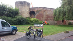
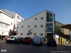
Château de Péronne
After leaving the Camping Site the first stop was at Péronne’s tourism information office in the town centre to collect a stamp on my Pilgrim’s Credential. As I was late I couldn’t really explore the town. As with many other towns and villages I’ve been through, Péronne looked like it would have been worth at least a few hours, if I had time to spare.
Again and again, Google Maps is good, especially to those like me that are “navigation challenged”. One problem for cyclists is that it tries, as much as it can, to guide the cyclists away from heavy vehicle traffic. Yes, this is good, but it also means it guides you to paths that during or after heavy rain might be very challenging to transpose. As I left Pèronne Google Maps instructed me to leave the “D” road I was to some dirt paths that were very muddy, only to guide me back to the same “D” road about 1.5 Km later. When you don’t know the way, the decision is not always easy. Overall Google Maps helped me more than it hindered me though.
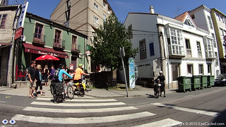
The ride to Trefcon was uneventful and the village itself is tiny and it appeared to be completely deserted.
It rained basically all day that day (on and off) and after leaving Trefcon the route was mostly on good roads up to the town of Montescourt-Lizerolles, where Google Maps instructed to take a path alongside the railway. The terrain was somewhat challenging as the Swalbe Marathon tyres I have in the bike are not really suited for them. After overcoming the path, I decided not to follow the route Google had planned and take my chances on the major “D” road, the D1, that took me straight to Tergnier. The traffic was intense and the road had guard-rails and no hard-shoulder. I don’t recommend this route, but on hindsight I believe it was the right decision, albeit somewhat riskier than to stick (no pun intended) to the dirt paths.
Riding under constant rain is not really fun, but the main challenge, besides the muddy paths, was the strong wind which slowed me down considerably and took away the high visibility orange flag I had in th back of the bike. I arrived in Tergnier tired and feeling a bit ill, probably due to the wet conditions (I am slightly asthmatic and humidity is not a good thing for me). The town hall was closed, so I turned to Google again for a place to sleep and the 1st option Google gave me was a hotel / hostel in the nearby village of Villequier.
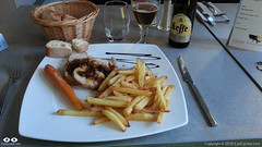
Dinner at the Auberge de Villequier
The concept of “nearby” changes when you are travelling on the bike though. It took me almost 1h riding in the wrong direction (as I found out the next day) to get there, but the Auberge is lovely and the owners were very nice to me. The room was small, but big enough to wash and dry my wet clothes and dry the tent and camping equipment. Also enjoyed a very nice meal that night, my personal reward for a hard day of cycling under rain.
Took very few pictures during the day. The rain was the biggest contributor to this, but in all honesty I did not feel like there were a lot of picture worthy moments anyway.
If you have any questions, don’t hesitate to comment or send me a message through the contact form.
Please subscribe to my Blog and/or to my YouTube channel if you don’t want to miss the next one and help me spread the word by liking and sharing my Facebook Page and Tweeter feed also.
Thank you for your time!
Please rate this post by clicking on the desired star (1 = Awful, 5
= Excellent)
VF post from 8AUG16, from Bruay-la-Buissière to Péronne
This post complements the post I published on the 8th of August 2016 in which I described the experiences I had while riding between Bruay-la-Buissière and Péronne. I am not going to repeat the contents of that post in this one again, but I will add a few highlights for each stage below. I would strongly encourage you to ready the August, 2016 post before continuing on this one, though.
Via Francigena can be just bike touring, of course, but if you want your Testimonium when you get to Rome, you have to present your pilgrim’s credential and it needs to have stamps in it. They do do a deep analyses of the stamps, but they will expect that in a 2,000 Km bike ride you will have collected a few. In the digital age is getting more and more difficult to find stamps… so analogical (illogical?). In many of the small towns and villages the chance of you to find a government facility (town hall, tourist information office, etc) will depend on the day of the week (Weekends? No chance) and the time of the day as some of these facilities will be closed, e.g. lunch time, or may have public opening hours. I really tried getting my pilgrim’s credential stamped but as it was the case in Ablain-Saint-Nazaire and others, as I got there I could not find anything open. Even the pharmacy was closed.
Arras is spectacular. Worth a visit if you can afford staying for a day. It’s a UNESCO World Heritage site and is more than 2,000 years old.
There is a “Route 66” café in Ervillers, between Arras and Bapaume, with a big statue of “the King” (Elvis). Coming across that reminded me of a friend who was about the ride the entire route 66 by bicycle. Her name is Cacá Strina. Check out her page here.
Don’t completely trust technology. Have always some low tech option to fall back if technology fails you. For some reason I lost GPS connection between Baupame and Péronne and I was relying on Google Maps entirely. At the very least download the offline maps over a WiFi connection, if possible, before you leave. Getting to Péronne was no problem, I simply follow the signs, but finding the Municipal Camping site took some time and effort (about 5 Km more than necessary).
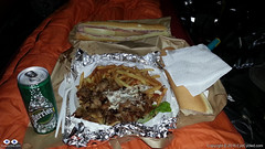
Tent Feast (Large Kebab Plate)
By the time I setup camp, had a shower and was ready to go out to find something to eat, the nearby supermarket in Péronne was already closed and after almost 30 min walking the only place I could find was a kebab trailer. So I ordered an extra large Kebab plate for dinner (and a baguette sandwhich for breakfast next day) and had a feast in the comfort of my tent. In small towns it may not easy to find a place for a meal at night. Keep that in mind.
Video of Lightfoot Guide Stage 14, From Bapaume – Péronne
Video Length: 5 min 38 sec To skip introductions and recommendations jump to time stamp 0:40 in the video timeline.
The next video is a time-lapse recording of my “awesomely akward” tent pitching skills. Took me “only” 20 min to pitch the tent. Thank God I don’t do this for a living… 🙂
In the municipal camping site of Péronne in France. Between the 3rd and 4th day of my Via Francigena pilgrimage. It raining a lot during that night and in the morning. Didn’t have a good night of sleept that day.
If you have any questions, don’t hesitate to comment or send me a message through the contact form.
Please subscribe to my Blog and/or to my YouTube channel if you don’t want to miss the next one and help me spread the word by liking and sharing my Facebook Page and Tweeter feed also.
Thank you for your time!
Please rate this post by clicking on the desired star (1 = Awful, 5
= Excellent)
"Life is a pilgrimage. The wise man does not rest by the roadside inns. He marches direct to the illimitable domain of eternal bliss, his ultimate destination", Swami Sivananda
This post complements the post I published on the 2nd of August 2016 in which I described the experiences I had while riding between Alembon and Bruay-la-Buissière. I am not going to repeat the contents of that post in this one again, but I will add a few highlights for each stage below. I would strongly encourage you to ready the August, 2016 post before continuing on this one, though.
Route:From the Rural Gite in Alembon to the Ibis Style Hotel in Bruay-la-Buissière via Licques, Tournehem-sur-la-Hem, Thérouanne, Amettes and Bruay-la-Buissière
Distance: 86.02 Km
Departure time from Alembon:10:29am
Arrival at Destination:5:58pm
Duration of day’s Journey:7h 29min
Expenses this day:Total = € 99.00
€30.00 – Food
€69.00 – Accommodation (Ibis Styles Hotel Bruay-la-Buissière)
Everything was going well, until… The unexpected, yes the unexpected again… By 9:30am I had packed everything and was ready to leave the Gite. I then realised my CatEye cycling computer was missing. Looked in the front bag, as I was certain I had put it there the night before. Wasn’t there, of course. Went back to the room and looked everywhere as I thought it might have fallen of the front bag during packing. Wasn’t there, of course. So all what was left was to look for it in the panniers, which were already neatly locked to the bike. Well, a pilgrim has go to do what a pilgrim has got to do. Looked for it in the front panniers as these were a lot easier to remove. Not there, of course. Took everything off the back of the bike again and looked in one pannier (not there, of course) and then the next, and bingo! It had fallen into the pannier as I was packing my things. I was happy not to have lost it, although I knew it was with me the night before, but the unpacking and packing took me almost 1 full hour. I didn’t do that mistake again…
Do not underestimate the SUN! The day before had been rainy and not particularly hot.
50 Shades of Red
I had seen on the phone’s Weather App that this day was supposed to be cloudy, but not rainy. It didn’t occur to me that I no longer was under British Weather. The day turned out to be very hot and sunny and I hadn’t passed any sunscreen on my skin. By the middle of the afternoon I was already feeling the damage the sun had done to my skin, which now looked very burned. The sunscreen was on the very bottom of one of my rear panniers. I should have stopped and passed the sunscreen on, but the thought of removing everything on the back of the bike (I had an intricate system there) was not appealing, so I continued. By the time I realised my mistake it was too late. The result was some heavy sun burns and sun fever by the time I got to Bruay-la-Buissière. As it was Sunday I knew it wouldn’t be easy to find accommodation and I wasn’t feeling very well so I used Google Maps to show me the available hotels nearby and the most affordable was the Ibis Style hotel 5 Km away from the town centre.
Video of Lightfoot Guide Stages 10, From Amettes to Bruay-la-Buissière
Video Length: 6 min 05 sec To skip introductions and recommendations jump to time stamp 0:48 in the video timeline.
The next video was recorded as I was crossing the town of Marles-les-Mines, between Amettes and Bruay-la-Buissière and their Folkloric group parade was about to start at the town’s FÊTE FORAINE.
If you have any questions, don’t hesitate to comment or send me a message through the contact form.
Please subscribe to my Blog and/or to my YouTube channel if you don’t want to miss the next one and help me spread the word by liking and sharing my Facebook Page and Tweeter feed also.
Thank you for your time!
Please rate this post by clicking on the desired star (1 = Awful, 5
= Excellent)
Post about Via Francigena, Day 1, written during the pilgrimage.
Introduction
This post complements the post I published on the 30th of July in which I described the experiences I had while riding between Canterbury and Alembon.I don’t think I need to repeat the same things here, so if you didn’t get a chance to read about this day on that post, I would strongly encourage you to do so before continuing on this one.So, in this post I am skipping the story and just adding some data, the GPS route, the pictures and the videos of that day’s ride.
Do not ride on the A2! Use the improved Lightfoot GPS route which you can download from here (Scroll down to the “Bike Touring Route” section and clink on the + to expand). Also read / watch my post / video from the 8th of June 2016 of my bike ride between Canterbury and Dover on the Regional Cycle Route 16, which more closely matches the official route. The GPS route I took that day is available in that post.
Rain and bad weather in the UK and strong sun just after crossing the channel.
If you don’t have time to get a stamp on your pilgrim’s credential in Dover, after you board the ferry go to the information desk on board and ask them to stamp your credentials. Better than nothing.
In Calais and other towns, do use the services of the tourism information offices, if you can. You can always get your pilgrim credentials stamped there, but keep in mind that during the weekends or certain times during weekdays they are most likely closed, especially in small towns.
When you buy a new SIM card for your phone abroad, it can take quite some time until it properly registers on the network and you have full access to the Internet again. Download offline maps if using Google Maps for Navigation or use something that does not rely on an internet connection (I used Garmin Navigation
Gite in Alembon
If you cannot find pilgrim accommodations, where available, stay at a rural Gite. They are cheap and the people are very nice. I totally recommend the one I stayed in Alembon if you want to stop there. Keep in mind Alembon is a tiny village. There is nothing to do around, I mean, no restaurants, shops, etc, but if my experience is a reference Madam Levray will take very good care of you. She is very used to having pilgrims in the house. Before me she told me she received a pilgrim’s couple who were doing the pilgrimage on horsebacks I believe.
Video of Lightfoot Guide Stages 01 and 02, from Canterbury to Dover Ferry Port (UK)
Video Length: 6 min and 14 sec To skip introductions and recommendations jump to time stamp 1:17 in the video timeline.
As I mentioned above and in my earlier post if you are planning on riding between Canterbury and Dover (either as a pleasure ride or as part of your pilgrimage) I do NOT recommend you do what I did. Do not take the A2. The reasons for this recommendation would be self-evident if you watched the video above.
I know I am repeating myself here, but I feel some repetition is granted. I recommend you either follow the Lightfoot Improved GPS route (which link to download is up above) or follow the same route I took on June 2016 on the regional cycle route 16. For your convenience the video of that route is down below.
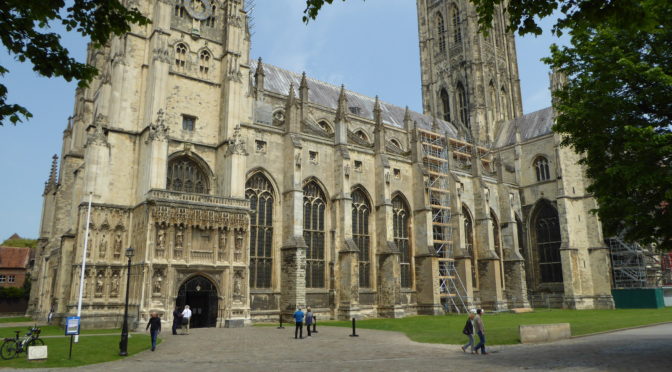
… and this is how the Cathedral looked like on that sunny day in June 2016…
If you have any questions, don’t hesitate to comment or send me a message through the contact form.
Please subscribe to my Blog and/or to my YouTube channel if you don’t want to miss the next one and help me spread the word by liking and sharing my Facebook Page and Tweeter feed also.
Thank you for your time!
Please rate this post by clicking on the desired star (1 = Awful, 5
= Excellent)
As suggested by my host in Alembon the day before, 8:00am I was downstairs for breakfast. Got to taste all the home made compote she does and home baked cake as well.
After breakfast I started packing. I confess, this is one of my weak points and something I definitely need to get better at. The Camino de Santiago has taught me a few lessons last year, which I seemed to have forgotten, but the Via Francigena is being quick at reminding me of them.
Before I left home I packed everything according to item type, e.g. clothes and footwear all in one pannier, electronics in another, 1st aid kit and items of personal hygiene in another and so on…
The thing is, when you are on the move and need something you don’t want to be opening several different panniers to get items you may need. The lesson I learned on the Camino was to pack a pannier with the most likely things you are going to need during the day (in the case of the Camino I packed it in a rucksack, as I had only 2 panniers then, where I now have 4), so you’ll only need to open one bag during the day, unless something out of the ordinary happens, which is not uncommon. I am, therefore, attempting to change the packing accordingly and moved several items around the panniers.
When I finished packing everything (took me about 25 min… yes, I am slow) brought everything downstairs, where the bike was, and started to load them in the bike. About 15 min later, when all panniers and the camping bag were loaded and fastened, I realised I was missing my Cateye cycling computer, which I thought I had placed in the handlebar bag together with the Garmin Edge 810. It wasn’t there. Went back to the room and searched everywhere as I knew I had it the day before… couldn’t find it. There was only one option left: Search in the panniers, which, as I mentioned before, were already loaded in the bike. I’ll give you one chance to guess if it was in the 1st pannier or in the last. Did you guess? Of course it was in the last. It must have fallen in the pannier as I was rearranging the packing. Altogether, I literally spend 1h looking for the damn thing. That meant I left the B&B only around 11:30am. For a pilgrim this is almost time of arrival, not time of departure. Anyway… need to give no excuses to anyone as I am alone, but it was a bit stressful. My own fault.
From Alembon I rode to Licques, where I managed to get a stamp from a water park there, as everything else was closed. Then to Tournehem-sur-la-Hem, where there was also nothing open. Not to say nothing, the church was open, but there was no one in it. From Tournehem my next destination was Thérouanne, where, according to my host the day before, there was a pilgrim’s hostel, but… everything was closed. I wasn’t planning to stay there anyway, as I wanted to ride more, so I rode further to Amettes where there is another hostel with special rates for pilgrims (€13/night). Guess what? Closed!
In all the villages I rode through everything was closed. Even the petrol stations were closed. if I wanted to setup camp somewhere I would have to go hungry as I couldn’t find anything open to buy food. I also couldn’t get any stamps on my Pilgrim’s credential which, upon arrival in Rome, is the document you have to show.
So I decided to continue riding to Bruay-la-Buissière as I knew it was a bigger town and there was bound to be something open. As I got there I asked several people about “auberges” or hotels but I couldn’t find any near, so I turned to Google which offered me a few, with one of the cheapest being the Ibis Style in the outskirts of town. Had to ride another 4 or 5 Km to get there and the daily rate wasn’t the €53 Google suggested, but €69 with Breakfast. By that point it was late and I was too tired to go searching for something cheaper, so that is where I stayed. The room was great and the hotel was near several restaurants. Had a really good meal at the 3 Les 3 Brasseurs.
When I left Alembon in the morning, the day was a bit unsettled and that made me forget to pass on the sunscreen on my skin. I live in the UK, so this is something we use very little there 🙂
The sunscreen was on the bottom of one of my panniers, which I really didn’t want to take off the bike again. The result was a really bad sun burn and fever at night which made for an uncomfortable night. I should have stopped to get the sunscreen… lesson number… ? (who’s counting anyway).
Well, that was it. I’m attaching a few pictures to this “post by email” which I hope will be self-explanatory. If you have any questions, just drop me a comment.
Before I close the post, have you made your donation to Mind UK, which is the charity I am sponsoring during this ride? Common, 20 quid will not be much at the end of the month and it’s all for a good cause.
Flickr API error: Invalid API Key (Key has invalid format)
Please rate this post by clicking on the desired star (1 = Awful, 5
= Excellent)
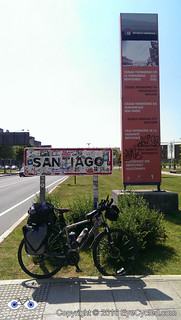
Most pilgrims arrive in Santiago de Compostelaand end their pilgrimage there, but a substantial number walk or cycle further to Fisterra, as known in Galician, or Finisterre, in Spanish. Fisterra is the nearest town to Cape Fisterra or Cape Finisterre, which In Roman times was believed to be the end of the known world, hence its name.
If you read the last post about our arrival in Santiago you will know that the next day we spent just getting to know the city and that on the 9th of June 2015, I decided to cycle further from Santiago to Fisterra. This was the 16th day overall and I did this stage of 94.45 Km or 58.7 miles from Santiago de Compostela to Fisterra in 8h 43 min, of which 5h 53 min were of actual moving time.
In this post I will write not only about the ride to Fisterra that day, but also what happened the day after, the 10th of July 2015, upon returning to Santiago and spending one more day there before leaving Spain and driving back to the UK on the 11th and 12th of July 2015.
As I was going away for just a day, I packed on one of my panniers just the essentials for the day’s ride and the night in Fisterra. That included the sleeping bag, a change of clothes, the sandals, items of personal hygiene as well as the electronic gear to record the video and take the pictures. Having the big locker at the Albergue Fin del Camino was very handy and since Fernando had decided to stay he did keep an eye on the few things that didn’t fit in the locker.
If you decide to cycle further to Fisterra this is a good option. If you are walking it will probably take you 3 days to reach Fisterra, so I am not sure leaving your belongings unattended at the hostel for such an extended period of time is wise and you will likely need everything you have anyway as you’ll be spending more time under way.
I left the hostel just after 8:00am and crossed the centre of Santiago to capture the image of the Cathedral one last time. Got a bit lost as the day before wasn’t enough to familiarized myself with all the small streets and roads in the centre of Santiago. Sometimes they look very similar to each other.
I, once again, used Google Maps to find my way out of Town and, as I mentioned many times before, this technology can be a bit of hit and miss, especially as in Spain cycling routes didn’t seem to be available in Google Maps, so I used the walking route as a guide. I didn’t want to use the car routes in fear that Google could guide me to some motorway or major roads.
Finding the way out of town wasn’t too difficult. Just before entering the AC-453, which was the major road out of town, I stopped at a little café for some breakfast as I hadn’t eaten anything before leaving the hostel. I then rode on the AC-453 for about 4 Km until a roundabout about 1 Km after Roxos, where I turned right in the direction to Portela de Villestro and Ventosa. Strangely enough, as I look at the map right now, although the road splits at the roundabout, both sections are called AC-453. I don’t understand the Spanish road naming system very well.
If you take the same route as me, some 2 Km after passing Ventosa, get ready for some hills that on a fully loaded bike may be quite challenging. As I was considerably lighter, I managed to pedal up, albeit very slowly.
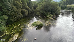
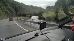
River TambreView of the river Tambre from the bridge
After Augapesada you’ll cross through some nice patches of forest. Google Maps doesn’t even show a name for these small roads, but although a bit narrow their tarmac is good. The next small town on this route is Negreira and on your way there you’ll cross many tiny villages like Castiñeiro do Lobo, Carballo and also cross the river Tambre on an old stone bridge which will give you the opportunity for some nice photoshoots. Just before crossing the river there was a nice restaurant which I would have considered stopping for a few minutes, but it appeared to be closed. As you cross the river you go through a village called Barca before you reach Negreira.
I only stopped in Negreira for a few minutes to get directions and had a talk with a group of Portuguese cyclists who were also riding to Fisterra. The town appears to have a good infrastructure and it’s probably a good place to stop if you are walking and can reach it in a day (24 Km from the hostel in Santiago).
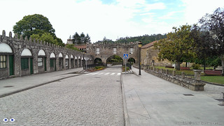
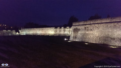
Negreira City Wall
After Negreira there appears to be much less density and the villages appear to be further apart, but that may just have been my impression. Google guided me to the DP-5603 in the direction to Zas. After 10 Km on the DP-5603, about 3 Km after the village of A Pena, Google Maps instructed me to leave the main road and take some really minor roads, which although quite narrow where tarmac paved. I must admit I was a bit skeptical this was the right way, but I followed Google’s instructions nevertheless, only to find myself without a mobile phone signal a few Km up the road. Thankfully Google had cached enough of the map on my phone to provide me with some idea where to go next, but looking at the map right now, as I write this post, there appears to be a shorter way to get to Pesadoira through the village of Vilaserío than the one I took, which was quite hilly and had a lot of turns.
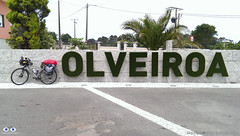
The letters are living plants (grass, I think)
Just before Pesadoira I got some directions from local farmers and then followed to Cuíña, San Fins de Eirón and Corveira, before entering again a major road, the AC-400. Just about 1 Km on the AC-400, Google was directing me to leave the main road again. Luckily I got some instructions from another friendly farmer on his tractor that stopped what he was doing, switched off the engine, got off his tractor and came to talk to me. It was a nice chat, proving that most Spanish people are really friendly towards strangers. His advice was not to follow the route Google was suggesting and I take local advise over Google most of the time. Continuing on the AC-400 until Pino do Val was much longer than Google’s suggestion was, but from what the farmer told me I think it was the fastest, the easiest and the right option as it went around some very steep hills. On Pino do Val I turned right in the direction to A Picota and Mazaricos on the DP-3404 which I followed until short after the village of Hospital.Before getting there, however, I stopped for about 20 min in the village of Olveiroa for a rest, to eat a banana and drink some freshly squeezed orange juice. Olveiroa has a nice hostel which appears to be a good place to stay if you are walking.
After Hospital I turned left on the DP-2302 which took me all the way “down” to the town of Cee and through some interesting villages along the way (there are quite a few places to stop along the road as well, like restaurants, etc.).
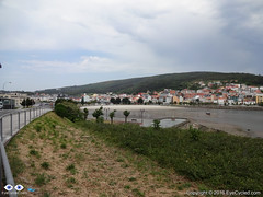
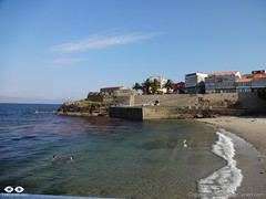
Town of Cee. Encounter with the sea.
Cee is the next big town and is where you meet the sea for the 1st time. It’s pretty much glued to Corcubión and I don’t really know where one town ends and the next begins.
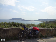
Nice sea views along the way.
After Corcubión get ready for 3 Km of hills until you reach the next beach in Sardiñeiro de Abaixo. Just before Sardiñeiro de Abaixo there is a nice camping place which can be an option to stay, if you like to setup camp, and its right in front of the Estorde beach where you’ll also find restaurant facilities.After Sardiñeiro you pretty much follow the coastal line which offers some great photoshoot opportunities.
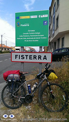
Arrival in Fisterra
Google Maps shows that just before there is a village called Escaselas, but it all appeared connected to me so as I got there I thought I had arrived in the suburbs of Fisterra.
As I arrived in Fisterra I did a quick ride around the harbour area of the town. The street you’ll likely be on as you arrive in Fisterra ends right in front of the municipal hostel of the town, but I somehow failed to see the signs. Upon asking for some directions I found the hostel, checked-in and got my certificate of completion for having arrived on the so called Death Coast and at the end of the “Camino Jacobeo” (Jacob’s way).
Municipal Hostel in Fisterra
Like many others before it, the hostel in Fisterra is basic, but sufficient. There was no WiFi connection in the room I was in, on the top floor of the building, which had, I think, 5 or 6 bunk beds. The municipal hostel cost €6 and has 36 beds. There are kitchen laundry facilities available.
Small beach in the town of Fisterra. San Carlos castle at the, today a “fishing museum”.
After a shower I went out on foot to find a place to eat. Had a walk around town and returned to the hostel. It is tradition for pilgrims to walk (or cycle) to the Lighthouse at the Cape Fisterra / Finisterre, some 3 Km away, but I was honestly tired and I think the variations of “dry & rainy” + “hot & fresh” weather in that day had taken a toll on me. Many pilgrims go to the cape to burn something (a piece of clothing or something they brought from their origin) to symbolize leaving old worries behind and the start of the new life.
This completes the account of this day’s ride to Fisterra. I was in bed early as I had decided to take an early bus (around 8:00am) back to Santiago so I could have time during the next day to get to know Santiago a bit better and perhaps experience the Botafumeiro mass.
I managed to take the bus as planned back to Santiago and I managed to fit my bike in the bus’s luggage compartment without having to disassemble it, although I later saw that people just threw their luggage on top of my bike, which wasn’t cool, but then, I was taking a lot of space anyway (there was no damage to the bike).
Nope, they are not real…
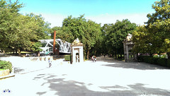
As I got the more direct bus (there is one that stops more often) and it took me just under 2 h to get back. Because I arrived in Santiago before 10:00am I rode a little around some areas of the city I had seen from a distance 2 days earlier, such as the Alameda Park in the city centre, which gave me some new photoshoot opportunities.
Given the Albergue Fin del Camino opens only 11:00am, I timed my ride around town to coincide getting to the hostel as it was about to open. I had a shower, a change of clothes and set off to the city centre again to attend the mass.
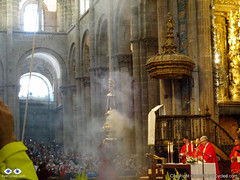
The famous Botafumeiro mass in the Cathedral of Santiago de Compostela.
Fernando wasn’t around as he had made some friends in the hostel and decided to take the bus to Muxia with them.
As I got to the Cathedral the mass had already started, but I got there still on time to experience the Botafumeiro.
After the mass I walked around the city centre for another 3 hours before returning to the hostel, where I met Fernando in the evening. The next day I had to wake up early to go to the airport and get the rental car I had reserved from England, so by 10:00pm I was already in bed. There was little cycling this day, but some significant walking so I was pretty tired.
Next day I got up around 7:00h so I could be at the airport by 9:00h to get the rental car at Hertz rental. There is a bus stop on the main road, the N-634 (the one by the big shopping centre nearby) right in front the San Lazaro church (just 2 blocks away from the hostel) and there is a direct bus connection to the Airport. The bus ride takes about 25 min. Even for those leaving Santiago by plane, this is a good tip.
As I arrived at the airport there was a little queue at the Hertz counter, but I was happy to get a free upgrade to a bigger car (a Renault Megane), which meant it was easier to load the bikes and we had a bit more leg room in front. I am aware that many pilgrims on the Camino de Santiago have to return to Saint Jean, like we did. Renting a car is not the cheapest option if you are alone, but if you are in a group of 2 or more the cost of car renting starts to break even when compared to trains and buses.
Before we left England, my online research showed that returning to Pamplona by train would have a cost of at least £30 or €40 each (or £60 / €80 for both of us) not taking into consideration any possible bicycle carriage fees in the train. It’s apparently a 9h journey by train. We would then have to take the bus from Pamplona to Saint Jean the next day at a cost of approx. €20 / £15 each (not accounting for any bicycle fees). I calculated the total estimated cost of returning by train / bus to be of between £90 to £100 for both of us (approx. €130). We paid £80 for the car rental with another €45 for fuel, a total of £115 or €150. The comfort of the car rental was worth the extra £15 in my personal opinion and the drive back to Saint Jean and Pamplona through the north was wonderful.
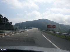
Tall bridges along the way.
As I returned to the hostel, we loaded the car and stopped at a nearby café for breakfast before driving off to Saint Jean. We decided to take the north route back to Saint Jean and drove on the AP-9 motorway in the direction to A Coruña (also known as Autopista del Atlántico) and then further north to O Ferrol following the coastal path of main roads and motorways in the region (which change names) through Oviedo, Santander and Bilbao.
If you love driving, I truly recommend this drive back to Saint Jean. Its many tall bridges over valleys and tunnels make it an attraction in itself. There are a few tollgates along the way (can remember at least one at a tunnel near Bilbao), but the fee is nowhere near as high as the ridiculous prices practiced in France (something like €1.30 – €2). I was looking forward to drive in that part of Spain since we left England and I was not disappointed.
It took us about 8h to drive to Saint Jean and when we got there my car was exactly as we had left it 3 weeks before. We transferred the bikes and everything else from the rental car to my car and while I drove the rental car, Fernando drove my car back to Pamplona where we had to return the rental car at the Hertz office in Pamplona’s Airport.
Roncevaux Pass (Ibañeta) at 1057m. 6h by bike, 20 min by car.
The drive from Saint Jean to Pamplona was an interesting experience, as we took practically the same route we did with our bikes 3 weeks earlier. Along the way I kept remembering the hard climb with fully loaded bikes from Saint Jean to Roncesvalles and thinking how easy it is to be corrupted by the comforts of modern life. It took us only a few minutes to get from Saint Jean to the Roncevaux Pass (Ibañeta) at 1057m that we had reached by bike, after 6h of pedalling, 3 weeks earlier.
Because I programmed my TomTom SatNav to guide us to the Airport in Pamplona, it took us through some rather minor roads after Roncesvalles, which I believe now wasn’t the best route. Believe it or not, I only had to fuel the rental car some 15 Km before Pamplona, so it managed to do more than 900 Km on just 1 tank, which I thought was very good.
We arrived at Pamplona’s airport around 20:00h and there was no one at the Hertz counter, so I dropped the car keys in the box and we left the airport to find the place we were going to stay for the night. We had already reserved a room with breakfast. Finding it wasn’t too difficult.
Walls of the Citadel, Pamplona (mobile phone picture).
I don’t know if it was the excitement of the day’s drive, but contrary to Fernando I was very awake and full of energy. Had a shower and left to go find something to eat and walk around the city. I didn’t see much of Pamplona that evening, but from what I saw, I loved the city. It’s a city that, in my opinion, managed very well to mix it’s old heritage, with its Roman beginnings at 75–74 BC, through the ages in which it was a fortress-city, in which the Citadel is the biggest landmark, and to its modernization. I absolutely loved its wide avenues and many green places along the paths I walked to reach the city centre. It’s a place I would definitely like to spend more time if I ever have the opportunity again.
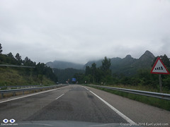
This day wasn’t as exciting as the day before. It was in fact quite boring to be honest, so I am not going to add much about this day to this account. We attempted to circumvent the motorways in order not to have to pay the expensive toll fees, but that was delaying us so much that we feared we would not get to Calais in time to get the Eurotunnel train back to England. After driving for many hours and covering only about 20% of the distance we gave up and went back the motorway and to the toll fees. They designed it so that it leaves you an alternative, but the alternative is so bad (single lane roads, lots of traffic) you end preferring to pay the motorway toll fees.
French country side is beautiful, but we were just too tired of all the driving.
There was some nice French country side scenery along the way too, but I think at that point we had enough and just wanted to get back home.
We got lucky as we arrived in Calais and were allowed to take the next train through the tunnel (our reservation was for a train leaving 3 h later). That meant that by 23:00h we were back again on British soil and guess what? Some 20 min later, it started to rain torrentially. A rather typical welcome back to the UK.
By midnight we had arrived at my house. Fernando only transferred some of his gear to his car, which was parked there, left his bike with me and drove home.
This now completes our entire series on the Camino de Santiago, from the very beginning where we left Bracknell to the moment we got back.
I am thinking of extending the series a bit more with an extra post to summarize the experience and perhaps add some “interviews” with people I have met along the way or that have done the pilgrimage before and after I did. Don’t count on it as my time is very limited nowadays, but I’ll do my best.
Thank you for following me and coming on this journey with us. I am looking forward to the next adventure on the “Via Francigena” pilgrimage, starting on the 30th of July 2016.
If you have never done a pilgrimage before, what are you waiting for? If you are about to do yours, here goes a statement you are going to hear a lot during your pilgrimage: “Buen Camino!”
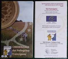
Front and back side of the Via Francigena Pilgrim’s credential (picture shows 2 credentials, I got 3, just in case)
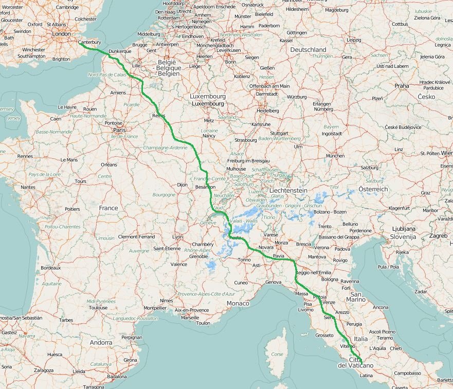
If you have been following my Blog, you will already know I am currently preparing myself for a 2,200 Km (approx.) bike ride, starting from the Canterbury Cathedral on the 30th of July 2016 and finishing in Rome, Italy, on the 1st week of September.
This is a pilgrimage known as Via Francigena or Via Romea Francigena. In the EuroVelo project this route is the biggest portion of route number 5, which actually starts in London and ends in Brindisi, Italy.
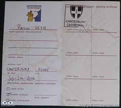
The 1st stamp of many more to come
So, although I am still several weeks away from the start of the Pilgrimage, a friend and I decided to drive to Canterbury last weekend, to do some initial reconnaissance, as I had never been there before. That has also enabled me to get my pilgrim’s credentials (also known as pilgrim’s passport for Camino de Santiago pilgrims) and ride to the Dover Ferry Terminal as I have a per-determined time to arrive there on the 30th of July to catch the ferry to Calais in France.
The video below is the time-lapse of the entire bike ride between Canterbury and Dover, recorded by a GoPro 4 Silver mounted on a handlebar T-Mount (I need to do something to reduce the shaking in that mount).
They say Kent (the region where Canterbury is located) is the garden of England, and it is certainly a beautiful part of the country.
We followed the National Cycle Route 16, which proved not to be the most direct route to Dover and had some challenging hills to climb. Nothing too hard on a bike without any load other than the rider, but considering I’ll be carrying with me about 20 Kg in 4 panniers and on the rack, I had to make sure I know when to leave in order to arrive in Dover on time to catch the ferry,
I will not to an extensive written description of the route as you have the map and the video, but if you have any questions don’t hesitate to get in touch through the contact form.
I’ve also created a Flickr album to store all the pictures I’ve taken along the way. Feel free to browse the pictures below or click on them to see them in higher resolution in Flickr.
If you like this post, please share and subscribe.
Thank you for your time.
Flickr Album with pictures of the day.
Flickr API error: Invalid API Key (Key has invalid format)
Please rate this post by clicking on the desired star (1 = Awful, 5
= Excellent)
It is not that I haven’t recorded a Bike Vlog every week in the past 3 weeks… I did record them! Watch the Vlog and I explain my sudden disappearance.
This Vlog was recorded 2 weeks ago (Friday, the 29th of April), but I had some personal issues and had no time to work on the video editing.
Via Francigena Map
So, I hope you can forgive me for not showing up in the past few weeks, as I will assume that if you are here is because you like to watch this old man talking (my children were actually relieved as they think I am making a fool of myself 🙂 )
Sorry for my sudden disappearance. It’s been quite busy on my professional and personal life right now, so haven’t had much time to dedicate myself to posting on EyeCycled.com during these past 2 weeks nor ride my bike. Still working on the posts and videos of the Devon Coast to Coast bike ride, though (rather slowly though).
Got some good news to share… The Via Francigena project is confirmed!
My request for an extended holiday leave has been approved by the company and I am booking my return flight from Rome this week.
I’ll be leaving the UK from the Canterbury Cathedral on Saturday the 30th of July and will have to arrive in Rome on the 8th of September, at the latest, to catch my flight back from Rome to the UK on the 9th.
This is a very exciting development for me and will be the longest bike ride of my life. I will have to do an average of 54 Km a day to cover the almost 2,200 Km from Canterbury to Rome, but I think it can be done and I am really looking forward to it.
Thank you for your support and stay tuned for more details.
Welcome to the post about the 14th and last day of our Camino de Santiago Pilgrimage by bike, which happened on the 7th of June 2015. We did this stage of 70.75 Km or 44 miles from Palas de Rei to Santiago de Compostela in 8h and 22 min, of which 4h 42 min were of actual moving time.
As I was in the middle of the writing of this post I decided to come back here to the top of the text again, just to let everybody know about the avalanche of emotions I feel as I write these words. Not only the emotion to have completed the “Camino de Santiago” Pilgrimage, which was in fact my 1st “real” long distance bike tour, but also about the incident which happened when we were just 19 Km away from Santiago.
I will get to that point in the text below, but first I want to go back to the subjective description of the day.
We left the hostel in Palas de Rei just after 8:00am and as we were riding out of town, on the main street, we stopped at a café for breakfast. That gave Guy, the Australian doctor who had ridden together with us the day before, time to catch up and join us again for a good portion of the day’s ride. Guy wasn’t riding all the way to Santiago this day as his scheduled called for a stop in Arzúa and the completion of his pilgrimage the next day.
The day was nice and sunny and we rode 15 Km for about 1h 45 min crossing through little villages like Carballal (just outside of Palas de Rei), San Pedro and many more (this region appears to be a densely populated area in northern Spain) until we got to the town of Melide, which had a lively Sunday market just across the road from the café we stopped for some coffee and juice. We were probably there for about 20 to 30 min and then back on the road again, the N-547, which was the only road we took this day and it brought us all the way to Santiago.
After leaving Melide, we rode another 15 km to a nice petrol station just before Arzúa (nature was calling some of us) had some water, ate some bananas and rested for a few minutes.
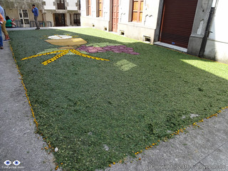
Picture made of coulourful leafs
Just a few hundred meters after the petrol station we stopped again at the town centre as there was some sort of religious celebration taking place (I think it was Corpus Christi as there was a huge picture frame made of colourful leafs on the floor near the church). There was a little market with religious items on sale and a nice choir / band playing. As Guy stayed in Arzúa that was the last time we saw him. We left Arzúa feeling re-energized by all the happiness around us and with a clear goal to reach Santiago this day.
Little did we know at the time that a sad moment was waiting for us up ahead.
After Arzúa we rode pretty much non-stop for 21 Km all the way to Pedrouzo. The little villages we crossed along the way were far too many to list here, so I am not even going to mention them. It was a day of mainly flat ride so we managed those 21 Km in just over 1h and 45 min.
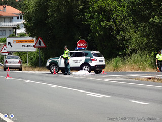
Just before the town of Pedrouzo, few meters after a sign that indicated Santiago was 19 Km away, we witnessed something we were really not prepared for: Death!
Body of a 67 years old female pilgrim that was hit by a car while crossing the road.
There are statistics on pilgrims deaths during the Camino de Santiago. Apart from this 67 years old woman who was struck by a car, I am aware of another 41 years old American woman who, in April (2015) had gone missing for months until police found her body near the town of Astorga. She had been assaulted by a men after she got lost and apparently knocked at his door for directions (police suspects he painted fake yellow arrows to lure pilgrims to his house).
I write this not to scare anyone, as statistically speaking the number of deaths during the Camino is very, very small (about 15 to 20 every year for almost 250,000 pilgrims per year, or 0.0006%). Also keep in mind that the majority of those deaths are by natural causes (heart attacks, existing medical conditions, such as cancer, etc). I do believe there are pilgrims who know their lives are nearing the end and the pilgrimage is the last thing they want to do before passing, but many don’t make it. It is poetic though, to die trying.
So I would like to leave here a humble prayer, not only in the memory of the 2 ladies I mentioned above, but to all those who lost their life during the pilgrimage.
Please don’t be put you off by the incidents I described above! If you are thinking of doing the Camino de Santiago by foot or by bike, please keep in mind that the danger of doing it is probably NOT greater than any other dangers you might be exposed to in your normal day to day life (like crossing roads, etc), but because of the physical efforts necessary to walk or ride such a long distance carrying with you everything you will need for the journey, please be prepared, healthy and reasonably fit (nobody needs a 6 pack though), take good care of yourself and watch out for other pilgrims who you think may be struggling on their pilgrimage.
Make sure you don’t overly rely on the yellow arrows for direction. They are generally very good and are maintained by a legion of kind volunteers along the way whose only concern is to help the pilgrims, however, reports of fake yellow arrows are common, with the overwhelming majority being painted for commercial interests, like restaurants, hotels or hostels who want to attract pilgrims to come to or stay in their establishments.
After the initial shock, some of us considered not continuing the pilgrimage to Santiago that day and staying in Pedrouzo. The incident has even managed to generate a level of conflict between some of us, but thank God we didn’t stayed and moved. For me there is nothing like a bike ride to think and clear the mind of all worries.
Five kilometres later we were approaching the International Airport of Santiago and met a group of fellow cycling pilgrims whose one member had a broken chain. We tried to help as much as we could, but unfortunately were not able to and they had to proceed, presumably, pushing their bikes the rest of the way as it was Sunday and bike shops were closed.
As we got nearer to Santiago a new avalanche of emotions was starting to take place. Santiago the final destination for most Camino Pilgrims. I was firmly in the decision to extend my pilgrimage to Finisterre as I knew we would get to Santiago with time to spare, but Fernando, Marcelo and Alice ended their journeys here.We had ridden for more than 820 Km with just 3 Km to go to the Cathedral when Marcelo had a bit of bad luck and got a flat tyre. None of us had a spare inner tube that would fit his 29′ wheel and the tyre sealant spray I had brought with me didn’t help either (I came to the conclusion these things are a waste of money and time), so we had to fix the tube the old way, with a rubber patch and glue. It wasn’t perfect, as we probably were too impatient to leave and didn’t wait long enough for the glue to properly work, but it was good enough to get Marcelo the rest of the way.
The little ride from that point to the Cathedral, which is the final destination for most pilgrims, was for me a mixture of excitement and apprehension. You know when you come to the end of a journey and you are happy to be completing it, but you wish it wouldn’t end? Emotions in conflict.
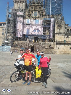
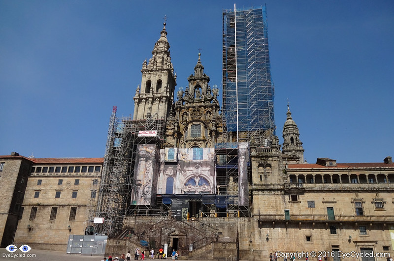
Santiago is an old medieval city and the streets of the old town centre are narrow and, at first, a bit confusing to navigate, but we kept asking for directions and managed to find our way relatively quickly.The arrival at the cathedral square was a great moment. I know this is something hundreds of thousands of people do each year and millions have done it over centuries, yet, there are 7 billion people living on this planet right now and God knows how many have lived since the times of Saint James (Santiago), so it feels pretty special when you know you have done something not many humans will ever get a chance (or be willing) to do. We took pictures and enjoyed the moment before leaving the square to look for the pilgrims’ office, where the Compostela certificate is issued by the Catholic Church upon presenting your fully stamped pilgrim’s passport. Luckily the queue was not too big and we had to wait perhaps less than 30 min to get ours. Again, time for everyone in the group to take pictures of their certificates and proudly show them to the world over the internet.
We left the pilgrims’ office and went to the tourist information bureau which is just a few meters down the road. Accommodation in Santiago is pretty expensive in relation to the other places, towns and cities along the way.
The cheapest private hostel we could find, which was in the city centre, charged us 22€ each for a bed in a tiny room with 2 bunk beds (4 beds). There were a couple of showers / toilets which were OK, but not exceptional in cleanliness and functionality (please read the day 15 notes below for more recommendations about accommodation in Santiago). In strong contrast to the “5 Star” hostel we stayed in El Acebo and considering Santiago is the final destination for most pilgrims, the volume of business should justify an increase in the offer of beds in my opinion. Again, the ugly face of the system of things is always showing itself, where money and commercial interest take priority over everything else. Yes, I understand the reason for it to be so, that doesn’t mean I have to like it.
After a shower and a little rest, we left the hostel to look for a place to eat dinner. There is absolutely no shortage of restaurants, cafés and eateries in Santiago and the city, seems to be alive until late hours even on weekends (this was Sunday). After some lovely dinner and wine we walked a bit around the city centre and took many night pictures of its magnificent cathedral.
Click on the picture to see all other 110 photos in the Flickr Album.
It was the perfect end of the day, for a day full of contrasting emotions. Even the sadness of the fatal accident we’ve witnessed could be seen in a positive light, in the sense that it reinforced in us the certainty of our own mortality and how precious every moment of our physical lives is, because you never know when it will be the last.
So the lyrics of the theme song I choose for the final video are some of the last words I wish to leave you with, for this part of the post.
This was the 14th and final day of our Camino de Santiago by bike, but I think the experiences we had the next day, when we moved to a different pilgrims’ hostel might be relevant for many reading this.
I will also write at least 2 more posts: One to cover my ride from Santiago to Cape Finisterre (Fisterra) and another to perhaps summarize all the experiences and provide some extra resources and information for future pilgrims planning to do the pilgrimage themselves (they say the pilgrimage starts when you decide to do it).
Just some quick notes about the next day in Santiago.
The first thing we wanted to do was to move hostels. Marcelo and Alice had a few things to sort out in relation to the transportation of their bikes back to Brazil and decided to stay somewhere else, so this was the last time we saw them.
After some research we decided to move to a hostel maintained by a not for profit organization, the Albergue Fin del Camino or Hostel the end of the way (Click here for a flyer in Spanish), at the Rúa de Moscova (Moscow Street) near Santiago’s biggest shopping centre, the “As Cancelas“. Although this hostel is not in the city centre it is not far, about 25 min walk and if you take a bus it’s just about 10 min away. The price for the bed was 8€ and the hostel has been recently fully renovated. Everything is brand new and clean.
The hostel has 110 beds and the beds are in large dorms with up to 10 bunkbeds (20 beds) per room. Included in the price is your own bedsheet (a kind of cheap linen with stretchy borders). The mattresses are comfortable and the beds are sturdy. Another great thing about this hostel, which is different from many others in the Camino, is that in this one you can stay for as long as you like, which is quite handy if you planned some extra days and get in Santiago too early. Each pilgrim can have a large locker, but you need to pay a 5€ deposit for the key, which is returned when you return the key.
There is more detail on the links above (kitchen and laundry facilities, etc), but I would like to leave here a strong recommendation that if you are doing your pilgrimage on a budget, i.e. you are looking for good value pilgrims’ hostels to stay, this is definitely the best in Santiago (some pilgrims chose to reward themselves with a bit of comfort when they get to Santiago, and that is perfectly alright). One IMPORTANT thing about this hostel is that is almost right in the path of the pilgrims’ route to the cathedral, in fact only 2 blocks down the road you will most likely take to get to the city centre, the N-634. The problem is that there aren’t any sign postings to the hostel, so it is easy to miss. My recommendation to you would be, if you can, that as you approach the first signs for the “As Cancelas” shopping centre, go look for the hostel, or use these Google coordinates. I have highlighted in the “Video Moments” video the direction to the hostel. You can then leave everything there in your locker and then walk or cycle to the city centre, load free, but don’t forget to bring your pilgrim’s passport and other documents with you. Keep in mind the hostel opens only at 11:30am, so if you get to Santiago too early that may not be an option for you, unless you are OK waiting or perhaps walking around the shopping centre until the hostel opens.
After we were re-lodged in our new home for the next few days, Fernando and I walked to the city centre, and by sheer luck met Paula again who we met on days 2, 3 and 4 of the pilgrimage (what a small world, right?)
This day we have checked another of the pilgrims’ traditions from the list: To hug the golden statue of Saint James from behind. It seems to be the final act that closes the Camino pilgrimage. Unfortunately photography is forbidden, likely due to the high value of the gem stones engraved in the statue.
We did not witness the famous “botafumeiro” event this day, but I did witness it after my return from Finisterre and I am going to write about it in my next post.
Feel free to browse through the photos of this day in the Flickr album.
If you like this post, please indicate so clicking on the 5 stars on the bottom of the post, share it in social media (Facebook, Twitter, etc), leave comments or to get in touch through the contact form, if you have questions you believe I can answer.