Tag Archives: fahrrad

Faith's Way (Caminho da Fé), Day 4: From Casa Branca to Vargem Grande do Sul (D. Cidinha)

In this post…

    1. Introduction
    2. Measures and expenses for this day (Garmin Telemetry)
    3. Stage 07: From  Casa Branca to Itobi + Video
    4. Stage 08 (+ 1/2 of 9): From Itobi to Vargem Grande do Sul (Dona Cidinha’s Hostel) + Video
    5. Pictures taken on this day.

Introduction

If this is the first post you read on this series, I recommend you take a look at the introduction post published on the 28th of February 2018. That post explains what the Faith’s Way is, my reasons for doing it and provides information that might be useful to you, if you decide you want to do it too.

In this post I will cover the 4th day of this 12 day / 600 Km journey between the town of Casa Branca and the rural hostel of Dona Cidinha (Dona translates to Mrs. in Portuguese, hence Mrs. Cidinha) via the town of Vargem Grande do Sul, all in the federal state of São Paulo.

As explained in the introduction post, based on the experience I had when creating videos for the Camino de Santiago in 2015, when I started this series my intention was to divide the distance between the major towns or urban centres as separate stages, otherwise the videos would become too long to watch. It turns out, however, that many pilgrims prefer to overnight away from urban areas in one of the many rural hostels along the caminho.

So, if I was to follow this rule, stage 7 would be between Casa Branca and Itobi, stage 8 between Itobi and Vargem Grande do Sul and stage 9 between Vargem Grande do Sul and the village of São Roque da Fartura, however as I stopped in Dona Cidinha’s hostel that night, half of stage 9 is covered here and the other half will be covered in the next post.

You can download the official map of the Caminho from the website of the Friends of the Caminho Association. From there you can also download a list of credentialed accommodations for your journey. Most places in that list are simple family owned pilgrims’ hostels. Some in very rural locations (farms) others in more urban areas. Some establishments are hotels. Family owned Pilgrims’ hostels along the way have usually a set value that includes the meals as well, typically dinner and breakfast, but all hotels listed there will also offer a reduced pilgrim’s rate provided you present them your pilgrim’s credentials.

Back to Top

Measures and expenses for this day (Garmin Telemetry)

    • Distance traveled from Casa Branca to Dona Cidinha’s Rural Hostel : 59.73 Km
    • Total duration of this journey: 7h 6min
    • Total moving time: 4h 39m
    • Overnight location at the end of the journey:
      • Dona Cidinha’s Rural Hostel (they do not speak English), +55 19 9 81700069
    • Total expenses on this day: R$ 99.00
      • Food: R$ 29.00 (Burger in Itobi)
      • Accommodation: R$ 70.00 (Includes Dinner and Breakfast)
  • Total Elevation Gain on this track: 880m
  • Average Speed: 8.0 Km/h
  • Average Moving Speed: 12.2 Km/h
  • Max Speed achieved: 61.6 Km/h
  • Average Heart Rate: 124 bpm
  • Max. Heart Rate: 160 bpm
  • Calories burned: 2,556 CAL
  • Click here to see the Garmin Connect page for this activity
CF04, Garmin Stats
Elevation, Speed and Heart Rate between Casa Branca and Dona Cidinha’s Rural Hostel on the day 4 of my Pilgrimage.

Back to Top

Stage 07: From  Casa Branca to Itobi + Video.

Pilgrims who want to experience the “true” pilgrimage experience (if there is such a thing) have to accept that pilgrims’ hostel are often a difficult place to sleep. Some people have trouble sharing a room with just one person more, imagine several. As described in the previous post, The pilgrim’s hostel  of the Catholic Church of our lady of the exile in Casa Branca has 2 large bedrooms. The one I stayed in has a little common area with a sofa, a TV and a dinning table and the room itself with 3 beds and a bathroom / toilet, which is a bit of a luxury. I don’t mind sharing, but there is nothing like having a room just for oneself. No worries about noises from people snoring (one’s one or others) and those that have to go the the toilet in the middle of the night. As I was fortunate to be the only one in the room that night, I slept very well. Bed was comfy and the temperature was perfect.

The next morning breakfast was served in the hall and was very simple. Consisted of bread, butter, different types of jam and some fruit. Coffee and milk were also available. This was the moment I stamped my pilgrim’s credentials and also signed the guest book (they leave the stamp and the book on the breakfast table). I did not meet the pilgrim ladies from the day before, but I met Andrea, who was setting up the breakfast table.

After breakfast I packed the bike and left, making the mistake of taking the room key with me. I had put the key in the back pocket of my shirt to return it to Andrea in the breakfast room, but in the hurry to leave (as it was already a bit late by that time), I forgot to do it.

I rode to the town centre of Casa Branca and visited the cathedral. The cathedral is quite impressive for the size of the town. I spend quite some time there taking pictures and appreciating the paintings in the walls and ceiling. It was at that moment I realised I still had the room key with me, so I phoned Andrea at the hostel who told me to leave it at the cathedral and someone would pick it up later. It was a relief not having to cycle back the distance from the cathedral to the hostel.

The GPS data tracked by my Garmin shows that I rode 15.61 Km between Casa Branca and Itobi, which is consistent with the distance shown in the official map of the Caminho. I did this in 1h 59m by bike, but this includes the stop at the cathedral.

I’m not going to describe the journey to Itobi as you can watch it on the video above, but as highlights I can mentioned the small forest fire that the town’s public service was putting off on the outskirts of Casa Branca and the fact that when I arrived in Itobi, I followed the yellow arrows that led me away from town. Although the same thing happened in Cravinhos on the 1st day of the pilgrimage I was still under the impression that the arrows would always take you first to the town centre or to the nearest pilgrim accommodation, but that doesn’t appear to be the case. I rode about 3.5 Km and then turned back to the town centre, a 7 Km waste of time and effort, but that is part of a pilgrimage. At least I had the opportunity to have a really nice burger in Itobi after stamping my pilgrim’s credentials at the Ypê Hotel, the only credentialed pilgrims’ accommodation in the accommodation list of the friends of the caminho association.

Back to Top

Stage 08 (+ 1/2 of 9): From Itobi to Vargem Grande do Sul (Dona Cidinha’s Hostel) + Video

OK, as explained in the above introduction, the next stage should cover only the distance between the towns of Itobi and Vargem Grande do Sul, however, as I arrived at the Prince Hotel (Hotel Principe) in Vargem Grande do Sul, it was still early in the day for me, so I decided to cycle the further 15 Km to Mrs Cidinha’s hostel, which I had heard good things about before leaving to do the caminho. This is the reason why this video is a little longer than usual and why stage 9 will be broken in two. So let’s call this the stage 8 plus 1/2 of stage 9, shall we? The next half of stage 9 between the rural hostel of Dona Cidinha and the village of São Roque da Fartura, will be covered in the next post.

If you are just covering the distance between Itobi and Vargem Grande do Sul (stage 8), the Prince Hotel is one of the credentialed places for pilgrim accommodation in town. The hotel is practically inside the grounds of a petrol station, so it might be a little difficult to find. They will also stamp your pilgrim credentials and offer you a pilgrim rate if you decide to stay there.

The GPS data tracked by my Garmin shows that I rode 18 Km between Itobi and Vargem Grande do Sul, which for some reason is 3 Km more than indicated in the official map of the Caminho. After Vargem Grande do Sul I also rode a further 15.37 Km to the rural hostel I slept that night. It took me 1h 31m to cover this distance and a further 2h 36m to cover the distance between Vargem Grande do Sul and Mrs Cidinha’s rural hostel.

The journey between Itobi and Vargem Grande do Sul was largely uneventful, with exception to the fact that as I arrived in Vargem Grande the battery of my GoPRO ran out, hence the reason why there is a tiny portion of urban cycling missing from the footage, but nothing that matters. For walking pilgrims, please beware that about 13 Km of this route is along side the Father Gino Righetti road, which is paved and has moderate traffic. I did follow the yellow arrows, but unless I missed one, the distance tracked by my Garmin was 18 Km, which for some reason is 3 Km more than the distance shown in the official map of the caminho.

After stamping my pilgrim’s credential at the hotel, I rode into the town centre and did a quick stop for a picture at the town’s main church and continued the journey. As in any activity, distraction comes at a price. I somehow missed a pair of yellow signs painted at the lamp post indicating a right turn at the next crossing and that has also costed me an extra 2 Km of cycling. Thankfully I realised I was wrong early enough. After I watched the footage I came to the conclusion that the signs where indeed a little hard to see, so I have pointed them up at the video to avoid any other pilgrims making the same mistake.

In the outskirts of town there is a crossing over a dangerous highway. The arrows appear to invite the pilgrim to jump over the concrete barrier in the middle of the road, but please do NOT do that. Turn left towards the round-about at the bottom of the road (just about 250 m away) and use the round-about to cross to the other side. As I write this post a few years after being there, I am reliably informed that the route has changed slightly and that the yellow arrows now guide the pilgrims directly to the round about, but decided to leave this warning just in case.

The journey to Dona Cidinha’s hostel was the toughest part of the day. The small sand and dust filled dirt roads (at times), had hills that forced me to push my bike several times. That should explain the reason why I covered the 18 Km between Itobi and Vargem Grande do Sul in 1h 31m, but the 15.37 Km from Vargem Grande do Sul to Dona Cidinha’s rural hostel in 2h 36m.

I arrived at the rural hostel as the sun was setting on the horizon, which was a really nice way to end the day. The hostel is in a hill and the views from there are great. Dona Cidinha and Mr Francisco were already expecting me as I had phoned ahead. Again I was fortunate (?) to be the only pilgrim in the hostel that night, so I had the entire house for me (the hostel is a in separate building from the house of the hosts). Mr Francisco brought the home made dinner for me that night and it was delicious. They are a very nice and gentle couple and I truly recommend that you stayed with them if you don’t mind the fact the the hostel is pretty much in the middle of nowhere and that there is no WiFi there (4G signal was OK though). The hostel is large and in its 4 bedrooms and living room it can accommodate about 20 pilgrims at once. They have a large bathroom / toilet inside the house and a small toilet in the outside barbecue place, where there are also several tables and chairs. The bedroom I stayed had a double and a single bed. The other rooms have a mix of bunk beds and single beds. The living room has a sofa and a TV and also contains a single bed and a bunk bed. The hostel has also a large and fully equipped kitchen with a long table, a fridge, a freezer and a microwave oven.

The guest book contains a few notes in Spanish and English indicating that, despite its remoteness, people from several nationalities visited there. The walls of the hostel are covered with pictures and post cards sent by previous visitors and you can really spend hours looking at all of them if you want.

Back to Top

Pictures taken on this day.

Click on any picture for full detail

The following pictures are photos taken from the Guest Book pages of the pilgrims’ hostel at the Catholic Church of our lady of the exile in Casa Branca, São Paulo, Brazil.

Back to Top

If you have any questions, don’t hesitate to comment or send me a message through the contact form. Please subscribe to my Blog and/or to my YouTube channel if you don’t want to miss the next one and help me spread the word by liking and sharing my Facebook Page and Tweeter feed also. Thank you all for your time and “Bom Caminho!”.


Do you like these posts? Why, then, don’t you pay me a coffee to help with the blog hosting cost and as a caffeine incentive to keep me going through the long hours of the night? (Suggested amount: £2.00 or USD $3.00 or 2.50€ or whatever you want to give). You may donate through my Patreon Page or through PayPal directly. Become a Patron

Please rate this post by clicking on the desired star (1 = Awful, 5 = Excellent)
[Total: 1 Average: 5]

Faith's Way (Caminho da Fé), Day 03: From Santa Rosa de Viterbo to Casa Branca

In this post…

    1. Introduction
    2. Measures and expenses for this day (Garmin Telemetry)
    3. Stage 05: From  Santa Rosa de Viterbo to Tambaú + Video
    4. Stage 06: From Tambaú to Casa Branca + Video
    5. Pictures taken on this day.

Introduction

If this is the first post you read on this series, I recommend you take a look at the introduction post published on the 28th of February 2018. That post explains what the Faith’s Way is, my reasons for doing it and provides information that might be useful to you, if you decide you want to do it too.

In this post I will cover the 3rd day of this 12 day / 600 Km journey between the town of Santa Rosa de Viterbo and the town of Casa Branca via the town of Tambaú, all in the federal state of São Paulo.

As explained in the introduction post, I broke the entire journey into 21 stages, as per the official map of the Caminho. There will be 1 video for each stage of the journey, so the blog post for this day contains two videos. One covering the journey between Santa Rosa de Viterbo and Tambaú and the other covering the journey between Tambaú and Casa Branca.

You can download the official map of the Caminho from the website of the Friends of the Caminho Association. From there you can also download a list of credentialed accommodations for your journey. Most places in that list are simple family owned pilgrims’ hostels. Some in very rural locations (farms) others in more urban areas. Some establishments are hotels. Family owned Pilgrims’ hostels along the way have usually a set value that includes the meals as well, typically dinner and breakfast, but all hotels listed there will also offer a reduced pilgrim’s rate provided you present them your pilgrim’s credentials.

Back to Top

Measures and expenses for this day (Garmin Telemetry)

  • Distance traveled from Santa Rosa de Viterbo to Casa Branca: 60.19 Km
  • Total duration of this journey: 6 h 15 min
  • Total moving time: 4h 14m
  • Overnight location at the end of the journey:
  • Total expenses on this day: R$ 70.00
    • Food: R$ 20.00 (dinner – delivery)
    • Accommodation: R$ 50.00 (Breakfast incl)
    • PS. Normally the care takers of the hostel offer dinner and breakfast together with the accommodation for R$ 70.00, but the day I was there was normal a normal day for them. Read the post below to understand why.
  • Total Elevation Gain on this track: 620m
  • Average Speed: 9.6 Km/h
  • Max Speed achieved: 57.8 Km/h
  • Average Heart Rate: 128 bpm
  • Max. Heart Rate: 163 bpm
  • Calories burned: 2,347 CAL
  • Click here to see the Garmin Connect page for this activity
Garmin Telemetry, Santa Rosa de Viterbo - Casa Branca
Elevation, Speed and Heart Rate between Santa Rosa de Viterbo and Casa Branca

Back to Top

Stage 05: From  Santa Rosa de Viterbo to Tambaú + Video.

The night at the Malim Hotel was good. There was no TV in my room, but these days, who needs a TV when you have WiFi? Breakfast was good and plentiful too and I took my time enjoying it. Even spent almost 30 minutes that morning talking to the receptionist of the hotel, trying to understand if the town had any relation to the town of Viterbo in Italy, which is also along another pilgrimage route known as Via Francigena, that I completed in 2016 (it does, btw, but that was explained in the previous post).

The official map of the Caminho indicated that the distance between Santa Rosa de Viterbo and Tambaú was of 36 Km which is one of the longest stretches of the Caminho. To be honest, I wasn’t really looking forward to the same long stretches of fine sand and dust from the day before, but I decided to leave the hotel and follow the yellow arrows to see how the way was and decide later if I was going to stick on the original path or try to find an alternative route, if one was available.

Regional SP-332 Highway between Santa Rosa de Viterbo and Tambaú

So, I rode on the Caminho path for about 5.0 Km, following the yellow arrows on the dirt road. The terrain, however, was as sandy and difficult as those in the day before, and I was a tired and bored with the poor performance of the previous 2 days, so I decided to look for an alternative in Google Maps. I knew, from talking to the hotel staff in the morning, there was a paved road to Tambaú that followed in parallel to the Caminho path. At the little village of Nhumirim, 5 Km from Santa Rosa de Viterbo, instead of turning left at the yellow arrow indicating the Caminho path (see in the video), I followed on for another 2 Km to take the SP-332, a regional highway, to Tambaú. Therefore I obviously cannot show you the original caminho path from Nhumirim to Tambaú and I’ll leave it up to you to decide what to do if you find yourself in that position, but I can tell you that I do not regret having done the remaining 23 Km on the highway. I felt safe on that road due to the wide hard-shoulders and the fact that most of the drivers respected the 1.5 m distance. That route also did cut 6 Km of the distance between Santa Rosa de Viterbo and Tambaú and allowed me to cover these 23 remaining Km in 1h and 20 min, an average of 17 Km/h which was almost double the average of the day before. If you are on a bike I would recommend this route to you, but if you are walking, even though I don’t how the way is, it would be probably safer to stick to the Caminho path.

Tambaú Town Hall. It used to be Tambaú's old railway station.
Tambaú Town Hall. It used to be Tambaú’s old railway station.

Another downside of not following the original path is that you don’t have the yellow arrows to guide you anymore, so you will have to find your own method of navigation. I decided to ride the the town hall of Tambaú as typically this is one of the places you can get information about the path and also stamp your credential, but that was not the case. As I got to the town hall the staff told me that Caminho pilgrims are usually served at the town’s tourism information office / dept which was, however, not far from that location. Tambaú is not a village, but it is not a big town either, so everything is relatively close.

Tambaú's Tourism Department is where you can get your pilgrim's credential stamped.
Tambaú’s Tourism Department is where you can get your pilgrim’s credential stamped.

After having my pilgrim’s credential stamped at the tourism information office and, as I had gotten to Tambaú much quicker than I expected (had I followed the original Caminho path), I could afford a longer rest time there. The office has a cold water fountain available for the pilgrim’s at the lower level and I had a little snack I had brought with me. Even had time to do a quick chat with my children back in the UK. I had the feeling that Tambaú would have been a nice place to spend the night, but it was too early for me, so after 30 min or so, I resumed the journey following the yellow arrows towards Casa Branca, the next destination in the path. For those willing to stay in Tambaú the Eliana Hotel is right in front of the Tourism Information Office and is a credentialed hotel with special rates for pilgrims (requires the pilgrims’ credentials).

Back to Top

Stage 06: From Tambaú to Casa Branca + Video

The 30 min rest I had in Tambaú helped a lot in terms of motivation for the next stage of the path. I left with the decision that I would return to the original caminho path and follow the yellow arrows all the way to Casa Branca, regardless of how bad it was. I also don’t regret that decision, but I could, again, have saved 3.87 Km of the journey and, perhaps, prevented one of the 3 tumbles I had during the pilgrimage, had I taken the paved road between Tambaú and Casa Branca. One of my goals was to be able to show the Caminho da Fé to others as it is. I did, however, highlight that point in the video where you can take the decision of staying on the shorter paved road or taking the longer dirt tracks to Casa Branca,

P1090306
Interior of the church in Tambaú

As I was making my way out of Tambaú I rode by the town’s main church, the so called Sanctuary of our Lady Aparecida (not to be confused with the Basilica of the National Shrine of Our Lady of Aparecida in Aparecida do Norte) a church built by father Donizetti Tavares de Lima who was noted for his extensive work in the region and famed for his reported miracles and other wonders.

As I mentioned above, it was in this part of the journey which I took the 2nd of the 3 tumbles I had throughout my journey to Aparecida. Some of the dirt roads and tracks of the original caminho are farm tracks with a lot of fine sand and the sand banks are sometimes difficult to spot in the distance. All it takes is a moment of distraction for you to kiss the ground. In my case I was going down a little hill, picked up some speed and when the front wheel hit a sand bank it skidded to the right. Thankfully there were no injures or damage on this little accident. I also highlighted this incident in the video.

P1090319
Pilgrims on foot, about 10 Km before Casa Branca

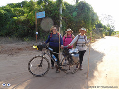
About 10 Km before Casa Branca I met 3 female pilgrims on foot who started their journey in Tambaú earlier that day. They wanted to walk all the way to Aparecida, but were considering of doing it over several different moments i.e. walking a portion of the pilgrimage, going home, then coming back a few days later to the point they stopped, walking another portion and repeating this until they got to Aparecida. This is also a valid pilgrimage option for those who don’t have the time to do it all in one go. I met one of these 3 ladies as I arrived at the pilgrims’ hostel later that evening as she wasn’t feeling well and took the rural bus to town. Her 2 friends decided to walk the rest of the caminho to Casa Branca and only arrived late that night.

Right after arriving in Casa Branca the gimbal’s batteries died, so a small portion of the video at the end was recorded with the camera mounted on the handlebar, hence the increased shakiness of the image.

P1090326
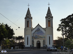
Catholic Church of our lady of the exile in Casa Branca

As I arrived at the Catholic Church of our lady of the exile in Casa Branca, where the pilgrim’s hostel is,  I was told to go talk to Mr José or Mrs Maria, his wife. They are the care takers of the pilgrims’ hostel and for a flat rate of R$ 70.00 they usually offer dinner and breakfast to the pilgrims, in addition to the accommodation. This night in particular, Mr José told me that his wife would not be able to cook dinner as their son had been kidnapped by criminals that day, who stole his motorcycle and spanked beat him causing him to be admitted into the local hospital. Mrs Maria was understandably very nervous and stressed about that all situation. Their son later appeared and despite the beating he was OK. Because of the lack of dinner Mr José charged us with only R$ 50.00 for the accommodation and breakfast the next day.

P1090334
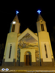
Night view of the Catholic Church of our lady of the exile in Casa Branca

After getting settled and having a shower, Mr José show me to the laundry area and I placed all my dirty clothes in the simple washing machine available there. Soap was also provided as well as indoor hanging lines.

The 3 pilgrim ladies and I ordered food to be delivered from a supplier recommended by Mr José, which cost exactly the R$ 20.00 we would have to paid him for dinner. Food arrived quickly, was plentiful, warm and delicious. A big plastic cup of delicious freshly squeezed orange juice came with it, as per my order. Although the room I was in had 3 beds I was the only pilgrim to sleep in it that night, The other 3 pilgrim ladies shared another room and I believe we were the only pilgrims in the hostel that night. My room had a private bathroom/toilet (suite) as well as a small separate living area with a table and a TV and although reception was not excellent it allowed me to watch the evening news while I was having dinner.

The weather that night was excellent. Not very warm, but not cold either, perfect for a little walk around the church grounds and for some night pictures.

Back to Top

Pictures taken on this day.

Click on any picture for full detail

Back to Top

If you have any questions, don’t hesitate to comment or send me a message through the contact form. Please subscribe to my Blog and/or to my YouTube channel if you don’t want to miss the next one and help me spread the word by liking and sharing my Facebook Page and Tweeter feed also. Thank you all for your time and “Bom Caminho!”.


Do you like these posts? Why, then, don’t you pay me a coffee to help with the blog hosting cost and as a caffeine incentive to keep me going through the long hours of the night? (Suggested amount: £2.00 or USD $3.00 or 2.50€ or whatever you want to give). You may donate through my Patreon Page or through PayPal directly. Become a Patron


Please rate this post by clicking on the desired star (1 = Awful, 5 = Excellent)
[Total: 2 Average: 5]

Faith's Way (Caminho da Fé), Day 02: From Cravinhos to Santa Rosa de Viterbo

In this post…

    1. Introduction
    2. Measures and expenses for this day (Garmin Telemetry)
    3. Stage 03: From  Cravinhos to São Simão + Video
    4. Stage 04: From São Simão to Santa Rosa de Viterbo + Video
    5. Pictures taken on this day.

Introduction

If this is the first post you read on this series, I recommend you take a look at the introduction post published on the 28th of February 2018. That post explains what the Faith’s Way is, my reasons for doing it and provides information that might be useful to you, if you decide you want to do it too.

In this post I will cover the 2nd day of this 12 day, 600 Km, journey between the town of Cravinhos and the town of Santa Rosa de Viterbo, both in the federal state of São Paulo.

As explained in the introduction post, I broke the entire journey into 21 stages, as per the official map of the Caminho. There will be 1 video for each stage of the journey, so the blog post for this day contains two videos. One covering the journey between Cravinhos and São Simão and the other between São Simão and Santa Rosa de Viterbo.

You can download the official map of the Caminho from the website of the Friends of the Caminho Association. From there you can also download a list of credentialed accommodations for your journey. Most places in that list are simple family owned pilgrims’ hostels. Some in very rural locations (farms) others in more urban areas. Some establishments are hotels. Family owned Pilgrims’ hostels along the way have usually a set value that includes the meals as well, typically dinner and breakfast, but all hotels listed there will also offer a reduced pilgrim’s rate provided you present them your pilgrim’s credentials.

Back to Top

Measures and expenses for this day (Garmin Telemetry)

  • Distance traveled from Cravinhos to Santa Rosa de Viterbo: 59.02 Km
  • Total duration of this journey: 6h 40m
  • Total moving time: 4h 57m
  • Overnight location at the end of the journey:
  • Total expenses on this day: R$ 92.50
    • Food: R$ 17.50 (dinner at a local restaurant)
    • Accommodation: R$ 75.00 (Breakfast incl)
  • Total Elevation Gain on this track: 658m
  • Average Speed: 8.9 Km/h
  • Max Speed achieved: 45.2 Km/h
  • Average Heart Rate: 132 bpm
  • Max. Heart Rate: 158 bpm
  • Calories burned: 2,815 CAL
  • Click here to see the Garmin Connect page for this activity
Elevation, Speed and Heart Rate between Cravinhos and Santa Rosa de Viterbo
Elevation, Speed and Heart Rate between Cravinhos and Santa Rosa de Viterbo (Click to open full screen).

Back to Top

Stage 03: From  Cravinhos to São Simão + Video.

A good night of sleep was all it took to recover from the exposure to sun, the dust and sand and the mistakes of the previous day. The breakfast table at the hotel had plenty of the most important things to sustain me for the entire day (among others ham, cheese, scrambled eggs, variety of jam and bread, fruit and cereal).

I had washed the clothes of the day before in the bathroom and they were all dry. The hotel has a backyard where I was able to also wash the bike with a hose and add some oil to the chain. Pilgrims in a hurry to get to their destination, perhaps would have to wake up very early in the morning to accomplish all these tasks before leaving, but fortunately that was not my case. I woke up around 8:00 am and only left the hotel at around 10:30am.

After leaving the hotel the challenge was to get back on track and I did not see any yellow arrows pointing the direction from the hotel. The plan was to ride back to town and continue from the point I had made my mistake the day before, but well before the town centre I rode by the other hotel in the official list of accommodations, the Girassol Hotel, right before the petrol station I stopped to ask for directions.

I never cease to be impressed by how easy it is to make friends in Brazil. At the petrol station I met fellow pilgrim João Candosim who pointed me to the yellow arrow some 100m after the petrol station and later became a Facebook friend.

If you watch the video of the prior stage and the one for this stage, you’ll see that from a certain point the images should become familiar as I followed the same route all the way to the “Frango Assado” petrol station at the edge of the Anhangüera Motorway (SP-330).

A note of advice, especially for pilgrims on bicycles, is to be aware of the stray dogs as you leave town. They all came running to me barking a lot, but I believe none of them had the intention of attacking me. They were just letting me know that this was their territory. I dismounted the bike and looked at them without fear and they soon calmed down.

I did a quick pit-stop to get some cold water at the same petrol station I asked for direction the day before and met a couple of “bicigrinos” (bicycle pilgrims) like me who were also planning to ride to Aparecida from that point. They had left from Ribeirão Preto that morning and were riding on the motorway (which in Brazil is allowed) despite being on full suspension mountain bikes, which would be ideal for the dirt tracks of the Caminho. There is no right or wrong. Each person’s pilgrimage is their own.

After the petrol station I continued on the dirt track and few kilometres later I got the a place with a small statue of our lady. Was a nice and well preserved place, ideal for some rest, water and a little prayer. I also replaced the gimbal batteries and to my bad luck forgot the spare batteries there. They were later found by fellow pilgrims, but sending them back to me was not economically viable.

I was replacing the gimbal batteries after each 90 min of use, which was enough time for the batteries to charge inside my handlebar bag were I was carrying a big 25,000 mAh power bank. Having lost the spare batteries meant that for the rest of the journey I would have to stop using the gimbal, while the only remaining batteries were charging (charge times varied from between 45 min to 1h). I continued recording the journey with the GoPro without the gimbal while the batteries were charging, but this meant a huge increase in the shakiness of the images, which you’ll probably notice in the video.

A good portion of this dirt track was along the motorway and there were some interesting views along the way, including the view of burned fields which are unfortunately common this time of the year due to high temperatures, lack of rain and other less natural reasons.

Up to the point where I crossed under the motorway there were significant less sand and dust than the day before (firmer ground), but after that point the tracks become very sandy and dusty again, to the point that, if you are on a bike, you’ll probably have to dismount and push quite often. In this stage you’ll have to ride or walk on a state highway (SP-253) for a few kilometres before continuing on a dirt track along the paved road. I felt safe on that road as it has a nicely flat and wide hard shoulder to ride on and most drivers were opening a distance between me and their cars as they crossed.

Just before arriving in São Simão you’ll have to cross railway tracks and I waited so long taking pictures that by the time I was ready to cross them I had to with for the incoming cargo train to pass, which took several minutes as it was a very long train.

The town of São Simão is small and the yellow arrows were close to each other, practically eliminating the possibility of getting lost. Before arriving at the São Simão Hotel, the one option for accommodation on the official guide and the place where you can get your pilgrim’s credential stamped, I stopped to talk to a couple of gents that were washing some cars and asked if I could throw some water on the bike to get rid of the dust. They asked me where I was coming from and where I was going to. They had heard of the Caminho da Fé, but neither one of them knew that the yellow arrows were in their town were there to guide the pilgrims to Aparecida do Norte. Now they know 🙂

The São Simão Hotel was a welcoming place. Got my pilgrim’s credentials stamped and filled my water bottles with cold water. They also offered me some fruit, but I declined.

Back to Top

Stage 04: From São Simão to Santa Rosa de Viterbo + Video

As I left the São Simão Hotel I did a small detour to visit the grandmother of a fellow pilgrim who I got to know through the Facebook group of the Friends of the Caminho Association. Once I explained who I was and why I was there, Mrs Vera Burin and her daughter Angelica welcomed me, a stranger, almost as if I was a member of the family. This is one of the most amazing aspect of the Brazilian culture. The ability to trust and welcome strangers. A bit like how the Irish view them, “a stranger is just a friend that you’ve never met before“. The difference between Brazil and Ireland, however, are the obvious dangers due to the high level of criminality, mainly in big cities. Yet, people still trust and help each other. I like to leave my sincere “thank you” not only to Mrs Ver and her daughter Angelica, but also to her grandson, André who told me about them and asked me to go say “Hi”. Unfortunately I was a bit of in a hurry at the time and had to decline their invitation for coffee, but it was wonderful to have met them.

As a pilgrim, however, I’ve been the receiver of other people’s generosity in other occasions too and every time this has happened it strengthen my belief that most people in the world are good and that the good in the world by far outweigh the bad. Perhaps it is because there is so much good that we have difficulty in eliminating the bad in our societies.

As the batteries of the gimbal were still charging in the handlebar bag I decided to place the camera in the waterproof casing and mount it on the handlebar. That increased the level of shakiness a lot, so in later recordings, when the use of the gimbal was not possible I started to mount the camera on the helmet as I believed the shaking would not bad as bad on my head as it was on the handlebar. The difference was not significant though. I also tried to use the gimbal more on rougher surfaces, so when I was riding on paved roads I’ve often stopped using the gimbal and put the batteries to charge instead.

Leaving the town of São Simão you will walk or ride for about 3 Km on the SP-253 highway. The hard shoulder on this road wasn’t as wide as before São Simão, but the drivers appeared to be respecting a healthy distance between them and my bike. Care is however advised.

After about 3 Km on the SP-253 you turn left crossing over the road to get back to dirt roads again and a considerable amount of sand and dust. By that time the gimbal batteries were fully charged and I was able to mount the camera on the chest mount again.

P1090289At some points the dirt road becomes quite narrow and some of these roads had a much higher level of traffic than the previous dirt roads I had to ride on. As cars and trucks passed me they lifted a lot of fine dust which made breathing harder than usual due to my asthma. A lot of coughing at some points on this road (some highlighted on the video). Also pushing the bike was necessary in quite a few portions of this track as the sand was simply too deep to even attempt to ride (no traction at all). In spite of this, there were also some beautiful portions of this track among pine trees and forest which offered some shade and helped protect from the sun a little.

As you approach Santa Rosa de Viterbo you’ll re-join the SP-253 again, which makes it worth noting that for those who don’t want to follow the “official” Caminho way, the journey will be a lot shorter and quicker if you stick to the road. It may be also more dangerous to cycle or walk on the road though, so that will be a decision you’ll often will have to make if you want to comfort of paved roads against the challenges of cycling off-road. As you arrive in the outskirts of Santa Rosa de Viterbo you’ll be happy to know that there is a 1.5 km segregated bike lane alongside the road right into the town which makes cycling a lot safer.

The Malim Hotel is the only place listed in the official accommodation guide. The guide indicates there are two options of accommodation in the hotel: A R$ 60.00 option and a R$ 85.00 option, but I believe the guide was a bit out-of-date, perhaps due to inflation or price rises. It is always a good option to call ahead and ask what the going rate is if you want to avoid any surprises. I paid R$ 75.00 for a small room with a private bathroom, but no air-con or TV. Fancier rooms will cost you about R$ 90.00.

Finding the hotel is easy. You just have to stick to the main street and the hotel will be on the left hand side.

The hotel has a bike rack on the back which is protected, but you need to be able to lock the bike in place as staff will not be looking out for your bike. It felt like a safe place to me, but I locked the bike and removed anything of value from it anyway. On the back there is also a hose and a place for you to wash your bike, if you need to.

After a good shower and some rest I left the hotel on foot and walked for about 10 min to a restaurant called Issagawa Neto & Cia that was recommended by the hotel’s reception. There weren’t many open places to eat at that time and the town is quite small. You’ll have to option of set 3 course meals for as little as R$ 17.50 with a soft drink and the food is tasty and plentiful. You will leave with your bellies full.

Went back to the hotel, browsed the web a little and checked email. The Hotel has free WiFi and the signal was good in the room I was in.

Although there were a few mosquitos in the room I was able to sleep very well. Always good if you can take a can of odourless repellent with you. In some places mosquitos may be an issue especially in hot nights and rural areas. That’s how my second day ended.

Back to Top

Pictures taken on this day.

Click on any picture for full detail

Back to Top

If you have any questions, don’t hesitate to comment or send me a message through the contact form. Please subscribe to my Blog and/or to my YouTube channel if you don’t want to miss the next one and help me spread the word by liking and sharing my Facebook Page and Tweeter feed also. Thank you all for your time and “Bom Caminho!”.


Do you like these posts? Why, then, don’t you pay me a coffee to help with the blog hosting cost and as a caffeine incentive to keep me going through the long hours of the night? (Suggested amount: £2.00 or USD $3.00 or 2.50€ or whatever you want to give). You may donate through my Patreon Page or through PayPal directly. Become a Patron

Please rate this post by clicking on the desired star (1 = Awful, 5 = Excellent)
[Total: 3 Average: 5]

Camino de Santiago, day 16 (17, 18 and 19): From Santiago de Compostela to Fisterra / Finisterre

Welcome back to the series about my Camino de Santiago Pilgrimage by bike. This is going to be a long one folks… (but it’s the last one)

Menu: In this post…

  1. Intro
  2. Day 16: From Santiago de Compostela to Fisterra / Finisterre
    1. Day 16: Photo Album
  3. Day 17: Return from Fisterra to Santiago by bus and walk around Town + the Botafumeiro experience
    1. Day 17: Photo Album
  4. Day 18: Drive back to Saint Jean Pied de Port and Pamplona
    1. Day 18: Photo Album
  5. Day 19: Drive from Pamplona back to Bracknell, UK
    1. Day 19: Photo Album

Intro

Most pilgrims arrive in Santiago de Compostelaand end their pilgrimage there, but a substantial number walk or cycle further to Fisterra, as known in Galician, or Finisterre, in Spanish. Fisterra is the nearest town to Cape Fisterra or Cape Finisterre, which In Roman times was believed to be the end of the known world, hence its name.

If you read the last post about our arrival in Santiago you will know that the next day we spent just getting to know the city and that on the 9th of June 2015, I decided to cycle further from Santiago to Fisterra. This was the 16th day overall and I did this stage of 94.45 Km or 58.7 miles from Santiago de Compostela to Fisterra in 8h 43 min, of which 5h 53 min were of actual moving time.

In this post I will write not only about the ride to Fisterra that day, but also what happened the day after, the 10th of July 2015, upon returning to Santiago and spending one more day there before leaving Spain and driving back to the UK on the 11th and 12th of July 2015.

Back to Menu

Day 16: From Santiago de Compostela to Fisterra / Finisterre by bike

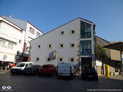
Hostel Fin del Camino, Santiago de Compostela

As I was going away for just a day, I packed on one of my panniers just the essentials for the day’s ride and the night in Fisterra. That included the sleeping bag, a change of clothes, the sandals, items of personal hygiene as well as the electronic gear to record the video and take the pictures. Having the big locker at the Albergue Fin del Camino was very handy and since Fernando had decided to stay he did keep an eye on the few things that didn’t fit in the locker.

If you decide to cycle further to Fisterra this is a good option. If you are walking it will probably take you 3 days to reach Fisterra, so I am not sure leaving your belongings unattended at the hostel for such an extended period of time is wise and you will likely need everything you have anyway as you’ll be spending more time under way.

I left the hostel just after 8:00am and crossed the centre of Santiago to capture the image of the Cathedral one last time. Got a bit lost as the day before wasn’t enough to familiarized myself with all the small streets and roads in the centre of Santiago. Sometimes they look very similar to each other.

I, once again, used Google Maps to find my way out of Town and, as I mentioned many times before, this technology can be a bit of hit and miss, especially as in Spain cycling routes didn’t seem to be available in Google Maps, so I used the walking route as a guide. I didn’t want to use the car routes in fear that Google could guide me to some motorway or major roads.

Finding the way out of town wasn’t too difficult. Just before entering the AC-453, which was the major road out of town, I stopped at a little café for some breakfast as I hadn’t eaten anything before leaving the hostel. I then rode on the AC-453 for about 4 Km until a roundabout about 1 Km after Roxos, where I turned right in the direction to Portela de Villestro and Ventosa. Strangely enough, as I look at the map right now, although the road splits at the roundabout, both sections are called AC-453. I don’t understand the Spanish road naming system very well.

If you take the same route as me, some 2 Km after passing Ventosa, get ready for some hills that on a fully loaded bike may be quite challenging. As I was considerably lighter, I managed to pedal up, albeit very slowly.

River Tambre
River Tambre
View of the river Tambre from the bridge

After Augapesada you’ll cross through some nice patches of forest. Google Maps doesn’t even show a name for these small roads, but although a bit narrow their tarmac is good. The next small town on this route is Negreira and on your way there you’ll cross many tiny villages like Castiñeiro do Lobo, Carballo and also cross the river Tambre on an old stone bridge which will give you the opportunity for some nice photoshoots. Just before crossing the river there was a nice restaurant which I would have considered stopping for a few minutes, but it appeared to be closed. As you cross the river you go through a village called Barca before you reach Negreira.

I only stopped in Negreira for a few minutes to get directions and had a talk with a group of Portuguese cyclists who were also riding to Fisterra. The town appears to have a good infrastructure and it’s probably a good place to stop if you are walking and can reach it in a day (24 Km from the hostel in Santiago).

Negreira City Wall
Negreira City Wall

After Negreira there appears to be much less density and the villages appear to be further apart, but that may just have been my impression. Google guided me to the DP-5603 in the direction to Zas. After 10 Km on the DP-5603, about 3 Km after the village of A Pena, Google Maps instructed me to leave the main road and take some really minor roads, which although quite narrow where tarmac paved. I must admit I was a bit skeptical this was the right way, but I followed Google’s instructions nevertheless, only to find myself without a mobile phone signal a few Km up the road. Thankfully Google had cached enough of the map on my phone to provide me with some idea where to go next, but looking at the map right now, as I write this post, there appears to be a shorter way to get to Pesadoira through the village of Vilaserío than the one I took, which was quite hilly and had a lot of turns.

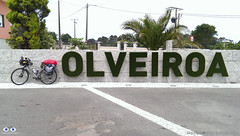
The letters are living plants (grass, I think)

Just before Pesadoira I got some directions from local farmers and then followed to Cuíña, San Fins de Eirón and Corveira, before entering again a major road, the AC-400. Just about 1 Km on the AC-400, Google was directing me to leave the main road again. Luckily I got some instructions from another friendly farmer on his tractor that stopped what he was doing, switched off the engine, got off his tractor and came to talk to me. It was a nice chat, proving that most Spanish people are really friendly towards strangers. His advice was not to follow the route Google was suggesting and I take local advise over Google most of the time. Continuing on the AC-400 until Pino do Val was much longer than Google’s suggestion was, but from what the farmer told me I think it was the fastest, the easiest and the right option as it went around some very steep hills. On Pino do Val I turned right in the direction to A Picota and Mazaricos on the DP-3404 which I followed until short after the village of Hospital.Before getting there, however, I stopped for about 20 min in the village of Olveiroa for a rest, to eat a banana and drink some freshly squeezed orange juice. Olveiroa has a nice hostel which appears to be a good place to stay if you are walking.

After Hospital I turned left on the DP-2302 which took me all the way “down” to the town of Cee and through some interesting villages along the way (there are quite a few places to stop along the road as well, like restaurants, etc.).

Town of Cee. Encounter with the sea.

Cee is the next big town and is where you meet the sea for the 1st time. It’s pretty much glued to Corcubión and I don’t really know where one town ends and the next begins.

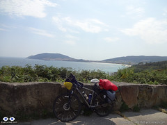
Nice sea views along the way.

After Corcubión get ready for 3 Km of hills until you reach the next beach in Sardiñeiro de Abaixo. Just before Sardiñeiro de Abaixo there is a nice camping place which can be an option to stay, if you like to setup camp, and its right in front of the Estorde beach where you’ll also find restaurant facilities.After Sardiñeiro you pretty much follow the coastal line which offers some great photoshoot opportunities.

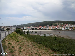
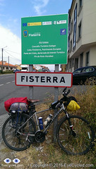
Arrival in Fisterra
Arrival in Fisterra

Google Maps shows that just before there is a village called Escaselas, but it all appeared connected to me so as I got there I thought I had arrived in the suburbs of Fisterra.

As I arrived in Fisterra I did a quick ride around the harbour area of the town. The street you’ll likely be on as you arrive in Fisterra ends right in front of the municipal hostel of the town, but I somehow failed to see the signs. Upon asking for some directions I found the hostel, checked-in and got my certificate of completion for having arrived on the so called Death Coast and at the end of the “Camino Jacobeo” (Jacob’s way).

Municipal Hostel in Fisterra

Like many others before it, the hostel in Fisterra is basic, but sufficient. There was no WiFi connection in the room I was in, on the top floor of the building, which had, I think, 5 or 6 bunk beds. The municipal hostel cost €6 and has 36 beds. There are kitchen laundry facilities available.

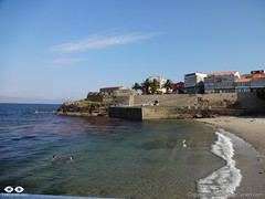
Small beach in the town of Fisterra. San Carlos castle at the, today a "fishing museum".
Small beach in the town of Fisterra. San Carlos castle at the, today a “fishing museum”.

After a shower I went out on foot to find a place to eat. Had a walk around town and returned to the hostel. It is tradition for pilgrims to walk (or cycle) to the Lighthouse at the Cape Fisterra / Finisterre, some 3 Km away, but I was honestly tired and I think the variations of “dry & rainy” + “hot & fresh” weather in that day had taken a toll on me. Many pilgrims go to the cape to burn something (a piece of clothing or something they brought from their origin) to symbolize leaving old worries behind and the start of the new life.

This completes the account of this day’s ride to Fisterra. I was in bed early as I had decided to take an early bus (around 8:00am) back to Santiago so I could have time during the next day to get to know Santiago a bit better and perhaps experience the Botafumeiro mass.

Back to Menu

Flicker Photo Album of day 16

Back to Menu

Day 17: Return from Fisterra to Santiago by bus and walk around Town + the Botafumeiro experience

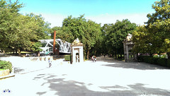
Alameda Park in Santiago

I managed to take the bus as planned back to Santiago and I managed to fit my bike in the bus’s luggage compartment without having to disassemble it, although I later saw that people just threw their luggage on top of my bike, which wasn’t cool, but then, I was taking a lot of space anyway (there was no damage to the bike).

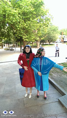
Nope, they are not real...
Nope, they are not real…

As I got the more direct bus (there is one that stops more often) and it took me just under 2 h to get back. Because I arrived in Santiago before 10:00am I rode a little around some areas of the city I had seen from a distance 2 days earlier, such as the Alameda Park in the city centre, which gave me some new photoshoot opportunities.

Given the Albergue Fin del Camino opens only 11:00am, I timed my ride around town to coincide getting to the hostel as it was about to open. I had a shower, a change of clothes and set off to the city centre again to attend the mass.

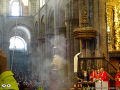
The famous Botafumeiro mass in the Cathedral of Santiago de Compostela.

Fernando wasn’t around as he had made some friends in the hostel and decided to take the bus to Muxia with them.

As I got to the Cathedral the mass had already started, but I got there still on time to experience the Botafumeiro.

After the mass I walked around the city centre for another 3 hours before returning to the hostel, where I met Fernando in the evening. The next day I had to wake up early to go to the airport and get the rental car I had reserved from England, so by 10:00pm I was already in bed. There was little cycling this day, but some significant walking so I was pretty tired.

Back to Menu

Flickr Photo Album of day 17

Back to Menu

Day 18: Drive back to Saint Jean Pied de Port and Pamplona

Santiago de Compostela International Airport.

Next day I got up around 7:00h so I could be at the airport by 9:00h to get the rental car at Hertz rental. There is a bus stop on the main road, the N-634 (the one by the big shopping centre nearby) right in front the San Lazaro church (just 2 blocks away from the hostel) and there is a direct bus connection to the Airport. The bus ride takes about 25 min. Even for those leaving Santiago by plane, this is a good tip.

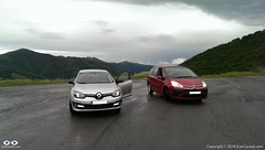
As I arrived at the airport there was a little queue at the Hertz counter, but I was happy to get a free upgrade to a bigger car (a Renault Megane), which meant it was easier to load the bikes and we had a bit more leg room in front. I am aware that many pilgrims on the Camino de Santiago have to return to Saint Jean, like we did. Renting a car is not the cheapest option if you are alone, but if you are in a group of 2 or more the cost of car renting starts to break even when compared to trains and buses.

Before we left England, my online research showed that returning to Pamplona by train would have a cost of at least £30 or €40 each (or £60 / €80 for both of us) not taking into consideration any possible bicycle carriage fees in the train. It’s apparently a 9h journey by train. We would then have to take the bus from Pamplona to Saint Jean the next day at a cost of approx. €20 / £15 each (not accounting for any bicycle fees). I calculated the total estimated cost of returning by train / bus to be of between £90 to £100 for both of us (approx. €130). We paid £80 for the car rental with another €45 for fuel, a total of £115 or €150. The comfort of the car rental was worth the extra £15 in my personal opinion and the drive back to Saint Jean and Pamplona through the north was wonderful.

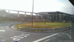
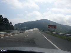
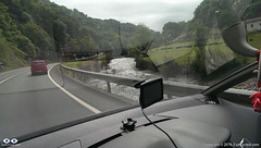
Tall bridges along the way.

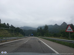
As I returned to the hostel, we loaded the car and stopped at a nearby café for breakfast before driving off to Saint Jean. We decided to take the north route back to Saint Jean and drove on the AP-9 motorway in the direction to A Coruña (also known as Autopista del Atlántico) and then further north to O Ferrol following the coastal path of main roads and motorways in the region (which change names) through Oviedo, Santander and Bilbao.

If you love driving, I truly recommend this drive back to Saint Jean. Its many tall bridges over valleys and tunnels make it an attraction in itself. There are a few tollgates along the way (can remember at least one at a tunnel near Bilbao), but the fee is nowhere near as high as the ridiculous prices practiced in France (something like €1.30 – €2). I was looking forward to drive in that part of Spain since we left England and I was not disappointed.

20150611_140046It took us about 8h to drive to Saint Jean and when we got there my car was exactly as we had left it 3 weeks before. We transferred the bikes and everything else from the rental car to my car and while I drove the rental car, Fernando drove my car back to Pamplona where we had to return the rental car at the Hertz office in Pamplona’s Airport.

Roncevaux Pass (Ibañeta) at 1057m. 6h by bike, 20 min by car.

The drive from Saint Jean to Pamplona was an interesting experience, as we took practically the same route we did with our bikes 3 weeks earlier. Along the way I kept remembering the hard climb with fully loaded bikes from Saint Jean to Roncesvalles and thinking how easy it is to be corrupted by the comforts of modern life. It took us only a few minutes to get from Saint Jean to the Roncevaux Pass (Ibañeta) at 1057m that we had reached by bike, after 6h of pedalling, 3 weeks earlier.

Because I programmed my TomTom SatNav to guide us to the Airport in Pamplona, it took us through some rather minor roads after Roncesvalles, which I believe now wasn’t the best route. Believe it or not, I only had to fuel the rental car some 15 Km before Pamplona, so it managed to do more than 900 Km on just 1 tank, which I thought was very good.

We arrived at Pamplona’s airport around 20:00h and there was no one at the Hertz counter, so I dropped the car keys in the box and we left the airport to find the place we were going to stay for the night. We had already reserved a room with breakfast. Finding it wasn’t too difficult.

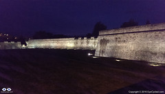
Walls of the Citadel, Pamplona (mobile phone picture).

I don’t know if it was the excitement of the day’s drive, but contrary to Fernando I was very awake and full of energy. Had a shower and left to go find something to eat and walk around the city. I didn’t see much of Pamplona that evening, but from what I saw, I loved the city. It’s a city that, in my opinion, managed very well to mix it’s old heritage, with its Roman beginnings at 75–74 BC, through the ages in which it was a fortress-city, in which the Citadel is the biggest landmark, and to its modernization. I absolutely loved its wide avenues and many green places along the paths I walked to reach the city centre. It’s a place I would definitely like to spend more time if I ever have the opportunity again.

Back to Menu

Flickr Photo Album of day 18

Back to Menu

Day 19: Drive from Pamplona back to Bracknell, UK

Leaving Pamplona.
Leaving Pamplona.

This day wasn’t as exciting as the day before. It was in fact quite boring to be honest, so I am not going to add much about this day to this account. We attempted to circumvent the motorways in order not to have to pay the expensive toll fees, but that was delaying us so much that we feared we would not get to Calais in time to get the Eurotunnel train back to England. After driving for many hours and covering only about 20% of the distance we gave up and went back the motorway and to the toll fees. They designed it so that it leaves you an alternative, but the alternative is so bad (single lane roads, lots of traffic) you end preferring to pay the motorway toll fees.

French country side is beautiful, but we were just too tired of all the driving.

There was some nice French country side scenery along the way too, but I think at that point we had enough and just wanted to get back home.

We got lucky as we arrived in Calais and were allowed to take the next train through the tunnel (our reservation was for a train leaving 3 h later). That meant that by 23:00h we were back again on British soil and guess what? Some 20 min later, it started to rain torrentially. A rather typical welcome back to the UK.

By midnight we had arrived at my house. Fernando only transferred some of his gear to his car, which was parked there, left his bike with me and drove home.

This now completes our entire series on the Camino de Santiago, from the very beginning where we left Bracknell to the moment we got back.

I am thinking of extending the series a bit more with an extra post to summarize the experience and perhaps add some “interviews” with people I have met along the way or that have done the pilgrimage before and after I did. Don’t count on it as my time is very limited nowadays, but I’ll do my best.

Thank you for following me and coming on this journey with us. I am looking forward to the next adventure on the “Via Francigena” pilgrimage, starting on the 30th of July 2016.

If you have never done a pilgrimage before, what are you waiting for? If you are about to do yours, here goes a statement you are going to hear a lot during your pilgrimage: “Buen Camino!”

Back to Menu

Flickr Photo Album of day 19

Back to Menu

<< Previous day (Day 15 & 14)                                                        Summary >>

Please rate this post by clicking on the desired star (1 = Awful, 5 = Excellent)
[Total: 3 Average: 3.7]

Canterbury to Dover, National Cycle Route 16, Via Francigena Pilgrimage

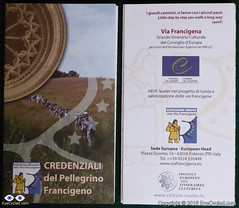
Via Francigena Pilgrim's Credentials
Front and back side of the Via Francigena Pilgrim’s credential (picture shows 2 credentials, I got 3, just in case)

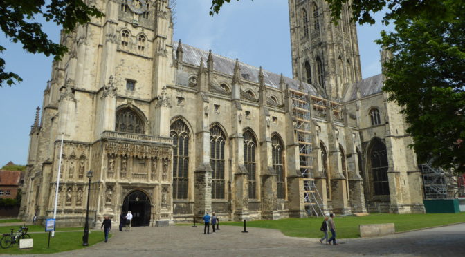
If you have been following my Blog, you will already know I am currently preparing myself for a 2,200 Km (approx.) bike ride, starting from the Canterbury Cathedral on the 30th of July 2016 and finishing in Rome, Italy, on the 1st week of September.

This is a pilgrimage known as Via Francigena  or Via Romea Francigena. In the EuroVelo project this route is the biggest portion of route number 5, which actually starts in London and ends in Brindisi, Italy.

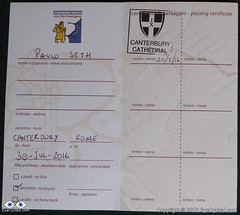
Via Francigena Pilgrim's Credentials
The 1st stamp of many more to come

So, although I am still several weeks away from the start of the Pilgrimage, a friend and I decided to drive to Canterbury last weekend, to do some initial reconnaissance, as I had never been there before. That has also enabled me to get my pilgrim’s credentials (also known as pilgrim’s passport for Camino de Santiago pilgrims) and ride to the Dover Ferry Terminal as I have a per-determined time to arrive there on the 30th of July to catch the ferry to Calais in France.
The video below is the time-lapse of the entire bike ride between Canterbury and Dover, recorded by a GoPro 4 Silver mounted on a handlebar T-Mount (I need to do something to reduce the shaking in that mount).

They say Kent (the region where Canterbury is located) is the garden of England, and it is certainly a beautiful part of the country.

We followed the National Cycle Route 16, which proved not to be the most direct route to Dover and had some challenging hills to climb. Nothing too hard on a bike without any load other than the rider, but considering I’ll be carrying with me about 20 Kg in 4 panniers and on the rack, I had to make sure I know when to leave in order to arrive in Dover on time to catch the ferry,

I will not to an extensive written description of the route as you have the map and the video, but if you have any questions don’t hesitate to get in touch through the contact form.

I’ve also created a Flickr album to store all the pictures I’ve taken along the way. Feel free to browse the pictures below or click on them to see them in higher resolution in Flickr.

If you like this post, please share and subscribe.

Thank you for your time.

Flickr Album with pictures of the day.

Please rate this post by clicking on the desired star (1 = Awful, 5 = Excellent)
[Total: 6 Average: 4.8]

EyeCycled Bike Vlog: Via Francigena

Hello!! Missed me?

Logo Via Francigena
Logo Via Francigena

It is not that I haven’t recorded a Bike Vlog every week in the past 3 weeks… I did record them! Watch the Vlog and I explain my sudden disappearance.

This Vlog was recorded 2 weeks ago (Friday, the 29th of April), but I had some personal issues and had no time to work on the video editing.

Via Francigena Map
Via Francigena Map

So, I hope you can forgive me for not showing up in the past few weeks, as I will assume that if you are here is because you like to watch this old man talking (my children were actually relieved as they think I am making a fool of myself 🙂 )

Click here for the Via Francigena event on the EyeCycled Facebook Page.

Thanks for watching!

Please rate this post by clicking on the desired star (1 = Awful, 5 = Excellent)
[Total: 4 Average: 4.8]

Via Francigena... Exciting news.

Hello folks!
Sorry for my sudden disappearance. It’s been quite busy on my professional and personal life right now, so haven’t had much time to dedicate myself to posting on EyeCycled.com during these past 2 weeks nor ride my bike. Still working on the posts and videos of the Devon Coast to Coast bike ride, though (rather slowly though).
Got some good news to share… The Via Francigena project is confirmed!
My request for an extended holiday leave has been approved by the company and I am booking my return flight from Rome this week.
I’ll be leaving the UK from the Canterbury Cathedral on Saturday the 30th of July and will have to arrive in Rome on the 8th of September, at the latest, to catch my flight back from Rome to the UK on the 9th.
This is a very exciting development for me and will be the longest bike ride of my life. I will have to do an average of 54 Km a day to cover the almost 2,200 Km from Canterbury to Rome, but I think it can be done and I am really looking forward to it.
Thank you for your support and stay tuned for more details.
The official site of the Via Francigena is here: http://www.viefrancigene.org/en/
Please rate this post by clicking on the desired star (1 = Awful, 5 = Excellent)
[Total: 1 Average: 4]

Camino de Santiago, Day 14 (and 15): From Palas de Rei to Santiago de Compostela

DSC03452
Hostel in Palas de Rei

Welcome to the post about the 14th and last day of our Camino de Santiago Pilgrimage by bike, which happened on the 7th of June 2015. We did this stage of 70.75 Km or 44 miles from Palas de Rei to Santiago de Compostela in 8h and 22 min, of which 4h 42 min were of actual moving time.

As I was in the middle of the writing of this post I decided to come back here to the top of the text again, just to let everybody know about the avalanche of emotions I feel as I write these words. Not only the emotion to have completed the “Camino de Santiago” Pilgrimage, which was in fact my 1st “real” long distance bike tour, but also about the incident which happened when we were just 19 Km away from Santiago.

I will get to that point in the text below, but first I want to go back to the subjective description of the day.

We left the hostel in Palas de Rei just after 8:00am and as we were riding out of town, on the main street, we stopped at a café for breakfast. That gave Guy, the Australian doctor who had ridden together with us the day before, time to catch up and join us again for a good portion of the day’s ride. Guy wasn’t riding all the way to Santiago this day as his scheduled called for a stop in Arzúa and the completion of his pilgrimage the next day.

The day was nice and sunny and we rode 15 Km for about 1h 45 min crossing through little villages like Carballal (just outside of Palas de Rei), San Pedro and many more (this region appears to be a densely populated area in northern Spain) until we got to the town of Melide, which had a lively Sunday market just across the road from the café we stopped for some coffee and juice. We were probably there for about 20 to 30 min and then back on the road again, the N-547, which was the only road we took this day and it brought us all the way to Santiago.

After leaving Melide, we rode another 15 km to a nice petrol station just before Arzúa (nature was calling some of us) had some water, ate some bananas and rested for a few minutes.

DSC00660
Picture made of coulourful leafs

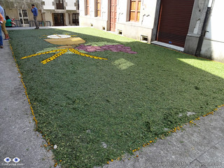
Just a few hundred meters after the petrol station we stopped again at the town centre as there was some sort of religious celebration taking place (I think it was Corpus Christi as there was a huge picture frame made of colourful leafs on the floor near the church). There was a little market with religious items on sale and a nice choir / band playing. As Guy stayed in Arzúa that was the last time we saw him. We left Arzúa feeling re-energized by all the happiness around us and with a clear goal to reach Santiago this day.

Little did we know at the time that a sad moment was waiting for us up ahead.

After Arzúa we rode pretty much non-stop for 21 Km all the way to Pedrouzo. The little villages we crossed along the way were far too many to list here, so I am not even going to mention them. It was a day of mainly flat ride so we managed those 21 Km in just over 1h and 45 min.

Just before the town of Pedrouzo, few meters after a sign that indicated Santiago was 19 Km away, we witnessed something we were really not prepared for: Death!

DSC00669
Body of a 67 years old female pilgrim that was hit by a car while crossing the road.

There are statistics on pilgrims deaths during the Camino de Santiago. Apart from this 67 years old woman who was struck by a car, I am aware of another 41 years old American woman who, in April (2015) had gone missing for months until police found her body near the town of Astorga. She had been assaulted by a men after she got lost and apparently knocked at his door for directions (police suspects he painted fake yellow arrows to lure pilgrims to his house).

I write this not to scare anyone, as statistically speaking the number of deaths during the Camino is very, very small (about 15 to 20 every year for almost 250,000 pilgrims per year, or 0.0006%). Also keep in mind that the majority of those deaths are by natural causes (heart attacks, existing medical conditions, such as cancer, etc). I do believe there are pilgrims who know their lives are nearing the end and the pilgrimage is the last thing they want to do before passing, but many don’t make it. It is poetic though, to die trying.

So I would like to leave here a humble prayer, not only in the memory of the 2 ladies I mentioned above, but to all those who lost their life during the pilgrimage.

Please don’t be put you off by the incidents I described above! If you are thinking of doing the Camino de Santiago by foot or by bike, please keep in mind that the danger of doing it is probably NOT greater than any other dangers you might be exposed to in your normal day to day life (like crossing roads, etc), but because of the physical efforts necessary to walk or ride such a long distance carrying with you everything you will need for the journey, please be prepared, healthy and reasonably fit (nobody needs a 6 pack though), take good care of yourself and watch out for other pilgrims who you think may be struggling on their pilgrimage.

Make sure you don’t overly rely on the yellow arrows for direction. They are generally very good and are maintained by a legion of kind volunteers along the way whose only concern is to help the pilgrims, however, reports of fake yellow arrows are common, with the overwhelming majority being painted for commercial interests, like restaurants, hotels or hostels who want to attract pilgrims to come to or stay in their establishments.

After the initial shock, some of us considered not continuing the pilgrimage to Santiago that day and staying in Pedrouzo. The incident has even managed to generate a level of conflict between some of us, but thank God we didn’t stayed and moved. For me there is nothing like a bike ride to think and clear the mind of all worries.

Five kilometres later we were approaching the International Airport of Santiago and met a group of fellow cycling pilgrims whose one member had a broken chain. We tried to help as much as we could, but unfortunately were not able to and they had to proceed, presumably, pushing their bikes the rest of the way as it was Sunday and bike shops were closed.

IMAG1506As we got nearer to Santiago a new avalanche of emotions was starting to take place. Santiago the final destination for most Camino Pilgrims. I was firmly in the decision to extend my pilgrimage to Finisterre as I knew we would get to Santiago with time to spare, but Fernando, Marcelo and Alice ended their journeys here. We had ridden for more than 820 Km with just 3 Km to go to the Cathedral when Marcelo had a bit of bad luck and got a flat tyre. None of us had a spare inner tube that would fit his 29′ wheel and the tyre sealant spray I had brought with me didn’t help either (I came to the conclusion these things are a waste of money and time), so we had to fix the tube the old way, with a rubber patch and glue. It wasn’t perfect, as we probably were too impatient to leave and didn’t wait long enough for the glue to properly work, but it was good enough to get Marcelo the rest of the way.

The little ride from that point to the Cathedral, which is the final destination for most pilgrims, was for me a mixture of excitement and apprehension. You know when you come to the end of a journey and you are happy to be completing it, but you wish it wouldn’t end? Emotions in conflict.

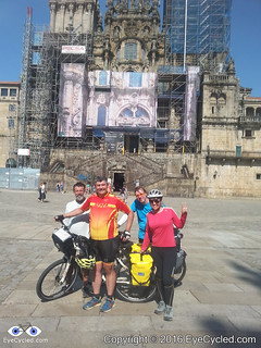
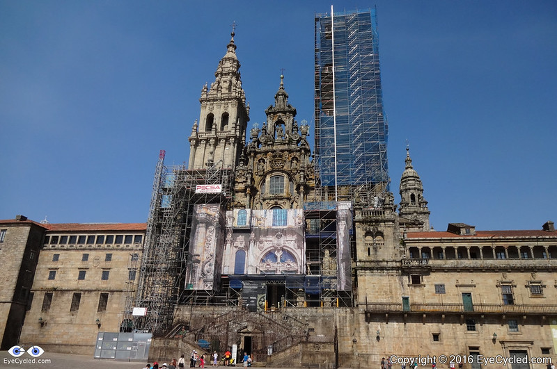
Santiago is an old medieval city and the streets of the old town centre are narrow and, at first, a bit confusing to navigate, but we kept asking for directions and managed to find our way relatively quickly. 20150607_180543The arrival at the cathedral square was a great moment. I know this is something hundreds of thousands of people do each year and millions have done it over centuries, yet, there are 7 billion people living on this planet right now and God knows how many have lived since the times of Saint James (Santiago), so it feels pretty special when you know you have done something not many humans will ever get a chance (or be willing) to do. We took pictures and enjoyed the moment before leaving the square to look for the pilgrims’ office, where the Compostela certificate is issued by the Catholic Church upon presenting your fully stamped pilgrim’s passport. Luckily the queue was not too big and we had to wait perhaps less than 30 min to get ours. Again, time for everyone in the group to take pictures of their certificates and proudly show them to the world over the internet.

We left the pilgrims’ office and went to the tourist information bureau which is just a few meters down the road. Accommodation in Santiago is pretty expensive in relation to the other places, towns and cities along the way.

The cheapest private hostel we could find, which was in the city centre, charged us 22€ each for a bed in a tiny room with 2 bunk beds (4 beds). There were a couple of showers / toilets which were OK, but not exceptional in cleanliness and functionality (please read the day 15 notes below for more recommendations about accommodation in Santiago). In strong contrast to the “5 Star” hostel we stayed in El Acebo and considering Santiago is the final destination for most pilgrims, the volume of business should justify an increase in the offer of beds in my opinion. Again, the ugly face of the system of things is always showing itself, where money and commercial interest take priority over everything else. Yes, I understand the reason for it to be so, that doesn’t mean I have to like it.

After a shower and a little rest, we left the hostel to look for a place to eat dinner. There is absolutely no shortage of restaurants, cafés and eateries in Santiago and the city, seems to be alive until late hours even on weekends (this was Sunday). After some lovely dinner and wine we walked a bit around the city centre and took many night pictures of its magnificent cathedral.

Day 14, Camino de Santiago, 7th June 2015
Click on the picture to see all other 110 photos in the Flickr Album.

It was the perfect end of the day, for a day full of contrasting emotions. Even the sadness of the fatal accident we’ve witnessed could be seen in a positive light, in the sense that it reinforced in us the certainty of our own mortality and how precious every moment of our physical lives is, because you never know when it will be the last.

So the lyrics of the theme song I choose for the final video are some of the last words I wish to leave you with, for this part of the post.

Don’t want to be afraid

Hard not to hesitate

But we can’t wait

To be the change

it is a walk away

see its not damn to you

so find an instant

to see this true

It’s not too late

Free from hate

Think of the future that we could create

Face the facts today

There’s a better way

It’s not too late

Think of the future that we could create

Face the facts today

There’s a better way

Take one step back and say

There’s a better way

Like a tree

Rooted in peace

In peace, in peace, in peace, in peace, in peace

There is a better by LoveShadow

This was the 14th and final day of our Camino de Santiago by bike, but I think the experiences we had the next day, when we moved to a different pilgrims’ hostel might be relevant for many reading this.

I will also write at least 2 more posts: One to cover my ride from Santiago to Cape Finisterre (Fisterra) and another to perhaps summarize all the experiences and provide some extra resources and information for future pilgrims planning to do the pilgrimage themselves (they say the pilgrimage starts when you decide to do it).

Day 15: In Santiago, No Cycling.

Just some quick notes about the next day in Santiago.

The first thing we wanted to do was to move hostels. Marcelo and Alice had a few things to sort out in relation to the transportation of their bikes back to Brazil and decided to stay somewhere else, so this was the last time we saw them.

After some research we decided to move to a hostel maintained by a not for profit organization, the Albergue Fin del Camino or Hostel the end of the way (Click here for a flyer in Spanish), at the Rúa de Moscova (Moscow Street) near Santiago’s biggest shopping centre, the “As Cancelas“. Although this hostel is not in the city centre it is not far, about 25 min walk and if you take a bus it’s just about 10 min away. The price for the bed was 8€ and the hostel has been recently fully renovated. Everything is brand new and clean.

The hostel has 110 beds and the beds are in large dorms with up to 10 bunkbeds (20 beds) per room. Included in the price is your own bedsheet (a kind of cheap linen with stretchy borders). The mattresses are comfortable and the beds are sturdy. Another great thing about this hostel, which is different from many others in the Camino, is that in this one you can stay for as long as you like, which is quite handy if you planned some extra days and get in Santiago too early. Each pilgrim can have a large locker, but you need to pay a 5€ deposit for the key, which is returned when you return the key.

There is more detail on the links above (kitchen and laundry facilities, etc), but I would like to leave here a strong recommendation that if you are doing your pilgrimage on a budget, i.e. you are looking for good value pilgrims’ hostels to stay, this is definitely the best in Santiago (some pilgrims chose to reward themselves with a bit of comfort when they get to Santiago, and that is perfectly alright). One IMPORTANT thing about this hostel is that is almost right in the path of the pilgrims’ route to the cathedral, in fact only 2 blocks down the road you will most likely take to get to the city centre, the N-634. The problem is that there aren’t any sign postings to the hostel, so it is easy to miss. My recommendation to you would be, if you can, that as you approach the first signs for the “As Cancelas” shopping centre, go look for the hostel, or use these Google coordinates. I have highlighted in the “Video Moments” video the direction to the hostel. You can then leave everything there in your locker and then walk or cycle to the city centre, load free, but don’t forget to bring your pilgrim’s passport and other documents with you. Keep in mind the hostel opens only at 11:30am, so if you get to Santiago too early that may not be an option for you, unless you are OK waiting or perhaps walking around the shopping centre until the hostel opens.

After we were re-lodged in our new home for the next few days, Fernando and I walked to the city centre, and by sheer luck met Paula again who we met on days 2, 3 and 4 of the pilgrimage (what a small world, right?)

This day we have checked another of the pilgrims’ traditions from the list: To hug the golden statue of Saint James from behind. It seems to be the final act that closes the Camino pilgrimage. Unfortunately photography is forbidden, likely due to the high value of the gem stones engraved in the statue.

We did not witness the famous “botafumeiro” event this day, but I did witness it after my return from Finisterre and I am going to write about it in my next post.

Feel free to browse through the photos of this day in the Flickr album.

If you like this post, please indicate so clicking on the 5 stars on the bottom of the post, share it in social media (Facebook, Twitter, etc), leave comments or to get in touch through the contact form, if you have questions you believe I can answer.

Thank you for your time!

<< Previous day                                                                                     Next day >>

Please rate this post by clicking on the desired star (1 = Awful, 5 = Excellent)
[Total: 11 Average: 4.1]

Camino de Santiago, Day 13: From Sarria to Palas de Rei

IMAG1450
Wall of the Santa Maria Church in Sarria

Welcome to the post about the 13th day of our Camino de Santiago Pilgrimage by bike, which happened on the 6th of June 2015. We did this stage of 50.57 Km or 31.4 miles from Sarria to Palas de Rei in 7h and 58 min, of which 4h 2min were of actual moving time.

This was a nice bike riding day in the company of new and old friends. Marcelo, Alice and I left the hostel in Sarria just before 8:30am and went to look for a place to have breakfast along the way out of town. As we were pushing our bikes up the “Rúa Maior” we walked passed a small Café / Restaurant called “La Taza Magica” (The magic cup) and decided to stay there for breakfast. About 15 min. later Fernando arrived coming from Samos where he had spent the night before.

DSC02456
Dr Guy Heron on road selfie time.

After our delicious breakfast we’ve moved on, but made a short stop a few hundred meters away at a public market place were Fernando bought a box of delicious cherries for just € 3.00.

IMAG1465
Bridge over an arm of the Belesar reservoir, near Portomarín.
11336879_10152977544151915_3117508628325408084_o
Uploading the picture to the EyeCycled Facebook page.


As we were making our way out of town we met Guy, a MD from Sydney, Australia, who was also cycling the Camino all the way from Saint Jean. I understood Guy had purchased sort of a cycling package in Australia which included all hotels along the way and the transfer of his luggage from town to town. All he had to do was to follow the schedule imposed by the travel company that sold the package.
I am mentioning this because it might be of interest to other people to know that there are such options and I believe there are such packages available not only for cyclists, but for walkers too.

IMAG1466
Town of Portomarín in the background


Anyway, Guy joined our little group for this day making it the biggest group I’ve cycled with throughout the entire Camino. It is not easy to cycle in a group as everybody needs to respect each other’s pace, but this day everything worked remarkably well. We took it a bit easy as well, as we were not under any time pressures and we’ve made several stops.

20150606_120707
Marcelo and Alice crossing the bridge to Portomarín.

There isn’t, honestly, much to write about. About 3/4 of the 50 Km we did this day were made on the LU-633 (the same one I failed to take when I took the wrong way after O Cebreiro). After leaving Sarria we made a quick stop at a petrol station in Paradela, which is about 16 Km away and then continued towards Portomarín for another 10 Km (about 26 Km from Sarria).

DSC00649
This staircase is actually the sole remaining part of the original 2nd century Roman bridge which was destroyed by Doña Urraca.

In Portomarín we stopped to stamp our Pilgrims’ credentials, take photos of its “fortress-like” church (Church of San Juan of Portomarín) and to eat something, together with some ice cold Spanish beer. Portomarín is a lovely town and well worth staying, if you can.

DSC00658
The 12th century Igrexa de San Nicolás. From left to right, me, Alice, Marcelo and Fernando.

Our short stop in Portomarín lasted for perhaps 30 min and then we were on the move again. We did another stop at the village of Gonzar, at a road side bar called “Descanso del Peregrino”, for a cold drink and, between the 5 of us, we ate most of the cherries from the box Fernando was carrying since Sarria. We were also joined for a few minutes by 2 female pilgrims from Germany who, upon knowing Guy was a doctor, asked for some medical advice.

IMAG1487
Always something interesting to see


About 5 Km after Gonzar, at a locally known as “O Hospital” the LU-633 appeared to end at a roundabout. We then crossed over the N-540 and took a small, unnamed road, towards Ventas de Narón.

IMAG1490
Typical ants along the Camino. You’d be better not to piss them off.

On this small road we crossed through some interesting small villages like Ligonde, Airexe, Portos (with the huge ants sculptures), Lestedo and Os Valos. This was a nice stretch of road with lots of trees and interesting things to see. After Os Valos we took the N-547 all the way to Palas de Rei for another 3 Km. Palas de Rei Sign Upon arriving in Palas de Rei, we have first looked into staying at a hostel called Albergue Buen Camino. I didn’t go in, but Fernando and Marcelo did and they came back out not very impressed. We then decided to stay at the municipal hostel of the town, which was €6 for the night. The hostel was clean and good.

DSC03452
Municipal Hostel (Albergue) in Palas de Rei

Since Guy already had accommodation in Palas de Rei as part of his Camino package he didn’t stay with us in the Albergue, but he joined us again the next day on our way to Santiago. This is where this post about the 13th day of the Pilgrimage ends. Short and sweet this time… 🙂 Please indicate if you like it or not by clicking on the stars on the bottom of the post and feel free to leave comments, questions or to get in touch through the contact form.

Day 13, Camino de Santiago, 6th Jun 2015
Click on the picture above to open the Flickr Album for this day.

Thank you for your time!

<< Previous day                                                                                     Next day >>

Please rate this post by clicking on the desired star (1 = Awful, 5 = Excellent)
[Total: 6 Average: 5]

Camino de Santiago, Day 12: Las Herrerías to Sarria

Albergue Las Herreíras (Hostel)

Welcome to the day 12 post of our Camino de Santiago Pilgrimage by bike which happened on the 5th of June 2015. I did this stage of 63.82 Km or 39.7 miles from Las Herrerías to Sarria in 8h and 05 min, of which 5h 14 min were of actual moving time.

I must confess, I’ve been dreading to write this post as it reminds me of the biggest navigation error I’ve made in the entire pilgrimage. I felt (and still do) like a fool for having done that error, but if this post and video help prevent other pilgrims from doing the same mistakes than it is worth it. My ego can take it 🙂

20150605_080033
Going uphill between Las Herrerías and La Faba

I left the hostel in Las Herrerías around 7:30am, 30 min earlier than I was used to, because I knew it would be a day of challenges ahead. Fernando had left the hostel about 40 min earlier, I think (he is used to waking up with the birds).

La Laguna Sign Zommed
Decision time… La Faba or La Laguna? Should have gone to La Laguna, but went to La Faba.

Full of energy and disposition I started cycling up hill, but without my Navigator by my side (I don’t have a very good sense of direction) it wasn’t long before I made the 1st mistake.
When I came to a crossroad junction and had to decide to continue in the direction of La Faba on the small road I was on (labelled CV-125/1) or take another small road to La Laguna (labelled CV-125/15) I decided to continue to La Faba (there was no yellow sign to help out at that point).

20150605_082935
Can you cycle uphill here with a loaded touring bike?
DSC07390
One of the many obstacles bike pilgrim must overcome between La Faba and La Laguna.

I must add a note here to say that this mistake is only relevant to those who do the Camino by bike. I essentially took the same route as the walking pilgrims do, which from the village of La Faba onwards is totally unsuitable for most cycling pilgrims. It is a 4 Km long uphill track that even walking pilgrims carrying a heavy backpack would struggle with, I think, let alone those pushing a loaded bike up.
So, for anyone reading this post and planning to do the Camino, do yourself a favour and take the road to La Laguna. It is about 2 Km longer, but believe me, it’s worth it!

DSC07385
The “grey” matter left by horses along the way and the inevitable “gazillion” flies around it


The worst part of the 4 Km uphill track actually wasn’t so much having to push the bike up. It was the huge number of flies because of the amount of horse manure left in the track. In Las Herrerías it is possible to “rent” horses to carry the luggage up for you (is that cheating? I don’t think so, as you have to walk it up anyway… the horses only carry the luggage). Obviously the horses leave “stuff” behind when going uphill.

I arrived in La Laguna with a feeling of achievement, but was really tired and it was a slow ascent. So much so that some walking pilgrims that had left the hostel after me, actually caught up with me in La Laguna as I stopped for a few minutes to drink some freshly squeezed orange juice and eat a banana. La Laguna is by far not the end of the ascent to “O Cebreiro“. After La Laguna there are still another 2 Km of uphill which was steep enough to force me to get off my bike again and push (I’d say perhaps a 12% incline in places… about 150m up in 2 Km).

O Cebreiro Detail Zommed
Biggest navigation mistake of my Pilgrimage was here. I failed to see that yellow sign.
20150605_103156
The view from “O Cebreiro” is spectacular.

Well, now we come to the point that I got to the Village of “O Cebreiro” and stopped to take a few pictures. Once the pictures were taken I decided not to go into the village (which I should have done) and moved on. Somehow I missed the yellow sign that was actually pointing towards the village. Instead of entering the village, in order to get onto the LU-633 in the direction of Liñares, I continued on the small CV-125/1 and happily rode the wrong way downhill for more than 6 Km until a lady waved at me with the typical “no” gesture. Must confess, by that point I was already suspicious of having taken the wrong route, but God knows how much more I would have traveled if that lady didn’t do this small gesture and took the time to explain to me how to get back to the Camino.

Google Earth, Wrong and Right Way, O Cebreiro
In BLUE, the way I should have taken. In RED, the way I took 🙁

Angels appear in many shapes and forms. We are all angels when we help other people. Religious chatter aside, I feel I can say that for me that it was God who placed that lady there, right when I needed it, to bring me back to the right track, so “Thank you God!”.

Well, as you all can imagine the frustration of having taken the wrong direction for so long was only matched by the realization that I now had to climb another 6 Km again after an already challenging morning climb pushing my bike most of the way up, but that was what the universe wanted me to do at that point, so I did it. Thankfully the directions given by my angel were clear and precise and with some checking along the way I was able to re-join the Camino near the village of Liñares 1h and 38 min later. So the result of my mistake was a loss of about 2h and the need to ride nearly 10 Km or 6 miles more than I should have, of which 8 Km or 5 miles where of steep uphill again.

After that, you could think that the rest of the day was a breeze… Well, it wasn’t bad, but as I paid more attention to the yellow signs they led me to paths which were again not suitable for cycling pilgrims after the village of Hospital, but the worst parts of these paths were relatively short compared to what I had endured between La Faba and O Cebreiro in the morning. I would strongly advise though that if you are cycling the Camino you stick to the road (the LU-633) until about 1 Km after the village of Fonfria where you may follow the yellow signs onto the walkers path which is very smooth compared to the previous ones and it will save you some 2 Km over staying on the LU-633.

If you do take the walkers path, about 1 Km after the little village of Fillobal, you will re-join the LU-633 again. From that point onwards I decided I had had enough, no matter where the yellow signs pointed to. I knew that road would take me to Samos and Sarria, but I didn’t know at the time in which city I was going to stay for the night (was aiming Sarria though).

20150605_133034
On his trailer, he was carrying his dog.

Along the way I crossed little villages and towns, such as Pasantes, Triacastela (where I met a pilgrim on a recumbent tricycle, pulling a little trailer behind with his dog in it), San Cristovo do Real, Renche, San Martiño do Real and Samos.

20150605_140844
Samos Monastery

I didn’t know at the time, but it was in Samos that Fernando had stopped.

As I arrived in Samos at was still about 2:00pm and I decided to ride further to Sarria, the next town in the Camino. I stopped in Samos just to stamp my Pilgrim’s credential at the municipal hostel and moved on. I added some of Fernando’s pictures here, although I have not experienced the town myself. From Samos to Sarria is just another 12 Km, but I was pretty tired from all the uphill climbing this day, so my plan was to make an early stop there. Crossed through and by tiny villages with distinct Galician names such as A Ferrería, Teiguín, O Vao until arriving in Sarria around 3:00pm. Sarria is a well-developed town and I followed the yellow signs to see if they would take me to a hostel in town.

IMAG1450
Paintings at the Santa Marina Church, Sarria.

By cheer luck, as I was riding through Sarria I passed by a little souvenir shop and glimpse inside only to see Marcelo and Alice in there. I stopped to say hi and ask what their plans were. At that time they were uncertain if they were going to stay in Sarria or ride a bit further, but when I told them I was pretty tired and was going to stay they decided to stay as well. It just happened that nearby there was a private hostel named Casa Peltre. Alice went to take a look inside and came back saying she thought it was very good (and it was indeed). The overnight was €10 and the albergue is clean and comfortable with a fascinating decoration (take a look at the pictures in their web site). Maria, the “hospitalero” who received us is a really nice person. It is a small hostel and can accommodate only 22 people at once, distributed in 3 bedrooms: A big dormitory room with 14 beds on bunk-beds where we stayed and two other rooms with four beds in each (2 bunk-beds). The hostel has two spacious and very clean bathrooms, with very good and warm pressure showers. It has also a fully fitted kitchen upstairs and a dining area.

20150605_190304
Well deserved break. Marcelo in the picture.


After a warm shower Marcelo and I decided to walk around town to find something to eat (Alice was a bit tired and decided to stay and have a nap). We found a Kebab place by the Sarria river side and filled our bellies with Kebabs. With bellies full we walked around town a bit more until we got to a tapas bar called “Mesón O Tapas” and treated ourselves to some delicious Spanish beers. IMAG1456
It was a day filled with mixed emotions: The physical challenge of having to push the bike up some very steep paths full of obstacles, the frustrations of the mistakes I made along the way this day, the blessing of having an Angel direct me to the right path again and the joy to encounter good Camino friends at the end. I certainly could have lived without the mistakes, but it was a good day, in spite of them. Well, that concludes this post about the 12th day of the Pilgrimage. Please feel free to leave comments, questions or at least indicate if you liked it or not by clicking on the stars in the bottom of the post.

Day 12, Camino de Santiago, 5 Jun 2015
Click on the left and right arrows in the picture to navigate through the Slideshow —- Click on the picture to see them in higher resolution in Flickr.

<< Previous day                                                                                         Next day >>

Please rate this post by clicking on the desired star (1 = Awful, 5 = Excellent)
[Total: 13 Average: 4.7]