Tag Archives: Sustrans

Devon Coast to Coast, Day 1 of 3: From Ilfracombe to Okehampton


This is the 1st post of 3 about the Devon Coast to Coast bike ride that I did during Easter 2016 with two good friends: Fernando and Eduardo. For the most part I stayed on the National Cycle Route 27, but in these 3 days I can say I experienced what I can closely call, the best and the worst of British Weather. Although I would understand if people say that was nowhere near as bad as the weather can get here in the UK, the 2nd day of the ride was bad enough for me, but let me focus on the 1st day.

If you don’t like reading, please watch this bike Vlog where I give a good verbal account of these 3 days of bike riding:

On this day, Friday the 25th of March, I rode from Ilfracombe on the north coast of Devon to the town of Okehampton. According to the data collected by my Garmin 810, I rode 86.43 Km or just under 54 miles in 6 h and 16 min, but the total time elapsed from start to finish was 9 h and 22 min. We had to make long stops this day due to problems on Fernando’s bike.
IMAG2559
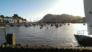
Ilfracombe Harbour

We left the Royal Britannia hotel in Ilfracombe just after 7:00 am, had breakfast at a nice, family run, café near the hotel, the  Adeles café, and then went to get all the bikes out of the car, which we left parked at the Ilfracombe Harbour (at £10 per day).

With all the bikes out of the car, the next stop was the Ilfracombe Promenade where the video starts.

P1000499
View from the Ilfracombe Promenade with the Landmark Seaview Theater to the left

Now, before you go watch the video, let me make a few remarks, so you don’t get too disappointed at the start and give up on it:

  1. I usually use time-lapse photography to compress the time and the GoPro is usually mounted on the handlebar. This time, however, I had forgotten the camera handlebar mount at home and was forced to use the mount on my helmet, which for time-lapse is not ideal. There is a lot of head movement, especially in urban areas as I had to be aware of my surroundings. There is a limit for how much image stabilization can reduce the shakiness. It does get better on rural areas.
  2. In a few places the camera seemed to have moved out of position and recorded mostly the sky 🙁 Sorry for that!
  3. On the last 3 minutes of the video, as night fell (and added to the fact the time-lapse video was taken from my moving head) made the video unwatchable, but I decided to keep it anyway as a complete record of the day. Up to you if you have the eyes to watch it.

This video is a different approach from previous ones, not only because of the problems above, but because I decided not to worry about the length of the video (it’s 33 min long). I know most people watch only 3 to 5 min of video in YouTube and then give up, but I am assuming that if you are watching it is because you probably intend to ride this route also, so the more detail, the better.

Right at the start prepared to be challenged by some steep hills as you cross the town to get to the start of the route 27 cycle path. The path is very nice though, with some beautiful views of the valley below and the water reservoirs. You’ll cycle about 7 Km on cycle paths and then take right on Georgeham Road. From that point you’ll cycle on minor narrow roads (sometimes barely wide enough for a car) practically all the way to Braunton. Along the way, you’ll see some nice sea views on the distance.
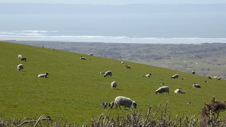
P1000515
Sheeps and Sea

We had to stop in Braunton because Fernando’s bike developed a rather serious disc brake issue, practically resulting in the loss of all brakes. Luckily the Southfork bike shop in Braunton was opened for business, despite being a bank holiday in the UK, and the entire hydraulic disc brake set was replaced.
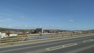
P1000529
View of Barnstaple from Long Bridge

It took about 1.5 h for them to complete the work which gave us enough time for some very tasty fish and chips at Squires, which I totally recommend. After the brake fault and the repair, we re-joined route 27 towards Barnstaple, one of the region’s biggest towns and the place we would come back to by train on Sunday. The ride alongside the river Taw is great and the path is smooth. Once you get to cross to the other side over the “Long Bridge”, you’ll continue to ride alongside the River Taw for several kilometres still.
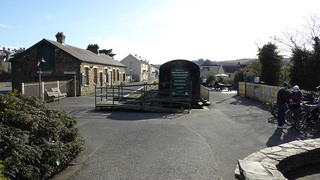
P1000536
Bideford Station, Tarka Trail.

The next town / village along the way is Instow, were you’ll pass by a 130 years old railway signal box on your way to Bideford. I found that after the old Bideford Station the Tarka Trail is really beautiful, with lots of old railway bridges over the river Torridge, such as the one where you can see the old Beam Aqueduct, which used to carry the Rolle Canal over the river Torrington, but is now a road bridge, and the Landcross tunnel,  which I think is the longest tunnel along route 27 (in the video above I recorded these in normal video, not as time-lapse).
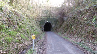
P1000546
Landcross Tunnel

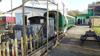
You’ll then follow the cycle path to the old Victorian railway station of Torrington which has now become the Puffing Billy Trading Co. Restaurant, really worth a rest stop (even though I didn’t).
P1000552
Puffing Billy Trading Co. Restaurant

The stretch that follows after Torrington is really beautiful and I would recommend that, even if you don’t want to watch the entire 33 minutes video above, jump to about 21 min into the video and take a look at the surroundings. The cycle path follows the curvy path of little rivers and creeks with some simple, but interesting surprises along the way. If it was nice during spring time, I suppose in summer must be even nicer.
P1000569
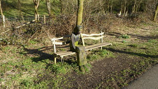
She looks so sad… Watch the video to find out why.

After that comes a long stretch of unpaved, but nicely compacted, of the Tarka trail through patches of forest. The ascent is small (perhaps 5 to 8%), but is very long. At times it gives the impression you will never stop going uphill. If you are fit and not carrying a lot of load on your bike, it will not be a challenge at all, but after 60 Km and with some 15 Kg on the bike it may not be as easy as it sounds. Looking at my Garmin stats I still managed to maintain an average speed of about 15 Km/h, peaking 22-25 Km/h at times, so it wasn’t so bad. There are some interesting sculptures along the way, which appeared to may have been created by school kids.

After that portion of the Tarka Trail ends you are back on the road, the A386 and traffic can be intense. If you’re riding with children I would advise extreme caution or find alternative routes as in some patches of the A386 there is barely any space for a bike and no hard shoulders (in some places you have a stone wall right beside the road on an incline).

As I was using Google Maps to guide me and wanted to follow the path of route 27, just before Hatherleigh the app guided me away from the A386 through some back roads of Hatherleigh. I did ask for directions, but decided to stick to Google Maps instead (it is not always advantageous to do so, listen to my Bike Vlog).

Google Maps guided me through some minor single lane farm roads and that was likely the reason why I did 4 Km more than my riding partners that day, as they stuck to the A386. All the time Google Maps was telling me I was on route 27, though, and I saw the many sign posts confirming that, so I believe I kept true to route 27’s intended path.

If it was summer time I would have arrived in Okehampton still in daylight, but as it was early spring the sun went down at around 6:30 pm and it became quite a dark night that day as stormy weather was being predicted to the next day (the arrival of storm Katie over the next 2 days).

So for about 40 min I had to use my headlight and, as mentioned before, the video became just a mess of shaky moving lights.
P1000582
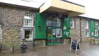
Okehampton Youth Hostel

As you arrive in Okehampton, in case you decide to stay in the Youth Hostel as well and having done more than 80 Km, be prepared for a long ascent as the Youth Hostel is located in the old train station in the highest part of town. So you’ll have about 2 Km uphill to go, with inclines that can reach about 10% at places. Not ashamed to say I pushed my bike on the last Km or so and that is why the video was so long at that final part. I got the Youth Hostel at around 7:30 pm in the evening and after doing the check-in, safely storing my bike in their bike shed, having a little rest and a shower I had missed dinner time, but I wasn’t hungry anyway.

To finish the account of my 1st day I’d like to thank the staff at the Okehampton Youth Hostel who went out of their way to help us and stayed until late so that when my riding partners arrived just before 10:00 pm that evening they could store their bikes too.

If you like this post, please help me out and share it in social media (Facebook, Twitter, etc.). Also let me know of your opinion by simple clicking on the 5 stars below the photo gallery. If you like the videos please hit the Thumbs-up button in YouTube.

Thank you for your time!

Flickr Photo Album of that day.

https://flic.kr/s/aHskxCQxf9


Please rate this post by clicking on the desired star (1 = Awful, 5 = Excellent)
[Total: 10 Average: 4.5]

EyeCycled Bike Vlog: Devon Coast to Coast bike ride during Easter

This was my first bike ride of the week after returning from Devon where I completed the Devon Coast to Coast bike ride on the National Cycle Route 27.

I will be publishing posts about that ride here, but you can hear about some of my experiences on this Vlog.

If you enjoyed listening to this Vlog, please share it in social media.

Thank you for your time!

Please rate this post by clicking on the desired star (1 = Awful, 5 = Excellent)
[Total: 0 Average: 0]

EyeCycled the Bath Two Tunnels Greenway Circuit

This is a follow-up post of my previous report about my bike ride from Bracknell to Bath on the National Cycle Route 4.

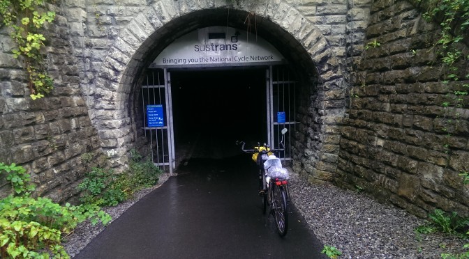
At the entrance to the Devonshire tunnel
Devonshire Tunnel
Devonshire Tunnel

As I mentioned before the reason I cycled to Bath was to experience the Bath Two Tunnels Greenway Circular Route. After two days of brilliant weather and sunshine the day of this ride was pouring down with rain. Unfortunately weather is something we still cannot control and unlike people who might be doing this for living, this is my hobby and as such I don´t have the luxury of choosing to ride and record only in good weather.

Despite the bad weather it was worth it.

Just a few notes before we proceed to the video:

  • The route I took didn´t follow exactly the Sustrans route (PDF), but is very close. In urban areas the Sustrans signage is very poor and I got a bit lost a few times. Google Maps helped a lot as well as passers-by to which I am very grateful (if you can recognize yourself in the video drop me a note).
  • Visit Bath as a page dedicated to the Two Tunnels Greenway Path full of interesting pictures
  • If you are planning to do this with small children note there are portions of this route on busy urban roads
  • The Combe Down tunnel is said to be the longest cycling / walking tunnel only in the UK and possibly in Europe. It´s just over 1 mile long (or 1672 metres to be precise). It has some quite interesting light / music displays inside.
  • The Devonshire Tunnels is smaller at 409 m
  • On the cycle paths the surface is paved and smooth.
  • If you are not local and are staying at the YHA Bath, like I did, the closest point to the route appears to be the The Holburne Museum, which is where I started from and went back to.

Note to self 1: Next time I go out to cycle under heavy rain, need to remember to wipe the water of the camera lens more often.

Note to self 2: Find a better solution to protect my phone during rides under heavy rain. The phone pouch got completely wet inside.

Back to the hostel, soaking wet.

Planning my next cycling to be around this area as well, taking the route from Bath to Bristol which is only 13 miles long, completely paved over an old railway track and full of things to see.

Keep tuned!

Please rate this post by clicking on the desired star (1 = Awful, 5 = Excellent)
[Total: 2 Average: 4]

Bracknell to Bath on the National Cycling Route 4

(If you don´t like reading, scrool down for the videos)

Few weeks ago I was watching the Cycle Show on ITV4 and they brought a piece celebrating the 20 years of Sustrans in the UK. They recorded a portion of that show riding on what is known as the Bath Two Tunnels Greenway circuit, a 13 miles (21 Km) long circular route around Bath.

Bath on it own is already worth the trip, but what is interesting about this route are the two re-purposed railway tunnels, that had their tracks replaced by paved and smooth shared pedestrian / cycle way.

With just over 1 mile, the Combe Down tunnel is the UK´s longest pedestrian / cycle ONLY tunnel and possibly the longest in Europe as well.

Sign of the National Cycle Route 4 in Reading

That sparked my interest! I was already thinking of riding the route 4 to Bath or Bristol, so, naturally I had to go check it out. The plan was to leave Bracknell and ride to initially to Reading and take route 4 from there.

The trip was done in 2 days.

In day 1 the plan was to ride from Bracknell to Pewsey, which is half way between Reading and Bath. On Day 2 I would complete the trip to Bath. Pewsey is a small town and there aren´t a lot of places to stay for the night. The only B&B in town (well, the only I could find) was already fully booked as there was a music festival happening in town that weekend.

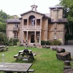
The Bruce Arms
The Bruce Arms

I didn´t take my tent with me, but took an air mattress and a sleeping bag just in case. As I was getting closer to Pewsey I was stopping and asking people for places to stay and was already thinking I would have to sleep under the stars that night. Thankfully I met a nice gentleman, whose name I unfortunately can no longer remember, who suggested a small change in the route and a pub along the way where I may find accommodation.

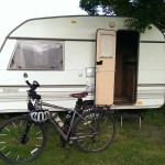
Small Caravan in the Bruce Arms, my home for the night.

That was the Bruce Arms, about 2.5 miles before Pewsey.

The Bruce Arms has actually a good camping ground, with all facilities available, but as I hadn´t brought my tend, Matt, the owner of Bruce Arms, kindly offered a small caravan for the night.

I did just under 80 Km that day and the beer was well deserved.

Day 1 video is below

Things to watch out for on this ride:

  • The NCR4 between Reading and Bath follows mostly the towpath of the rivers Kennet and Avon as well as the canals. The towpath is smooth in a few places, but mostly very bumpy. Lots of loose gravel and exposed tree roots. In places the path is very close to the edge of the canal especially when you go under bridges, so be careful.
  • Lots of gates, I mean, lots really. It´s a very rural area and you find cattle roaming around. Make sure you don´t leave any gates open.
  • Don´t take too much on your rack as you will have to remove the cargo to overcome some of the gates and obstacles along the way. If you use quick release panniers you won´t have a problem, but if you have to unload and load again you´re going to be pissed.

On day Day 2 the ride was shorter, just 62 Km or 39 miles. Initially on minor roads and then back on the towpath.

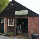
The Honey Street Café

I left the Bruce Arms without breakfast, so the plan was to ride a few miles and find a nice café along the way. I was thinking I would find one in Pewsey few miles down the road, but it was Sunday and pretty much everything was closed. So I continued on my way until a small village called Honey Street where I found the Honey Street café. definitely a great place for tea or breakfast.

Honey Street Café Garden

Their garden is full of flowers and is right alongside the canal and the food is also delicious. To my surprise they had freshly squeezed Orange juice and it tasted almost the same as the Spanish juice during my Pilgrimage couple of months ago. I had the Big Boaters Breakfast which is essentially a double English Breakfast. I truly recommend this small café.

From that point on I was back on the towpath and would be pretty much towpath all the way to Bath.

Caen Hill Locks. View from the top.

If you have time there are many points worth stopping along the way, but the Caen Hill Locks in Devizes is one of the most impressive.

As you approach Bath you´s pass by 2 aqueducts as well (bridges of water over water). The Avoncliff aqueduct near Bradford on Avon is the first and a few miles later the Dundas Aqueduct near Bath. Although I didn´t, there are nice cafés and pubs nearby for a stop if you want.

The day 2 video is below

Things to watch out for on this route:

  • Same as above
  • Lots of vegetation on both side of the towpath, sometimes completely covering the view ahead.
  • A lot of traffic with cyclists and pedestrians (remember if was Sunday and it was a nice day. Work days the route is likely quieter)
YHA Bath
YHA Bath

I had booked 2 nights in the Youth Hostel in Bath, which is almost on top of Bathwick Hill. The hostel is great, one of the best I stayed. Rooms and facilities are very clean, staff is extremely friendly and always ready to help, breakfast and dinner are really good. The room I stayed had 5 bunk beds (10 beds) and everyone has a locker, but you have to remember to bring your own lock to secure your stuff in the locker. The hostel is only about 15 – 20 min walk from Bath´s historic town centre or there is a frequent bus service right in front (Bus 18 or U18). The only problem with the hostel really is that is on top of the hill and after having ridden 62 Km on a loaded bike that hill is a challenge.

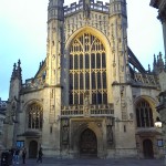
Bath Abbey
Bath Abbey

I won´t go much about how nice Bath is. Go there and see for yourself… It´s worth it!

Well, as I mentioned at the start of this post, I went to Bath to ride the Two Tunnels circuit and so I did on the next day, under heavy rain. unfortunately 2 sunny days seems to be the limit of nice days in a row in the UK 🙂

Pulteney Bridge in Bath

I´m working on the video for the Two Tunnels now and will add another post about it here shortly.

Hope this is useful and thank you for your time. Please share this post it in Social Media and follow us on Facebook and Tweeter, if you find appropriate.

Please rate this post by clicking on the desired star (1 = Awful, 5 = Excellent)
[Total: 14 Average: 5]